Pine Tree Weather
  • DISCUSSIONS
  • DONATE
  • MAPS
  • NWS BRIEFINGS
  • SATRAD
  • MARINE
  • SNOW / ICE OUTLOOK
  • RAIN OUTLOOK
  • CPC OUTLOOK
  • Kennebunk
  • OBSERVING WEATHER
  • Who We Are
  • My Photography
  • DISCUSSIONS
  • DONATE
  • MAPS
  • NWS BRIEFINGS
  • SATRAD
  • MARINE
  • SNOW / ICE OUTLOOK
  • RAIN OUTLOOK
  • CPC OUTLOOK
  • Kennebunk
  • OBSERVING WEATHER
  • Who We Are
  • My Photography

Cool the trend for the week ahead

12/3/2018

Comments


Keep the jackets and gloves handy

Picture
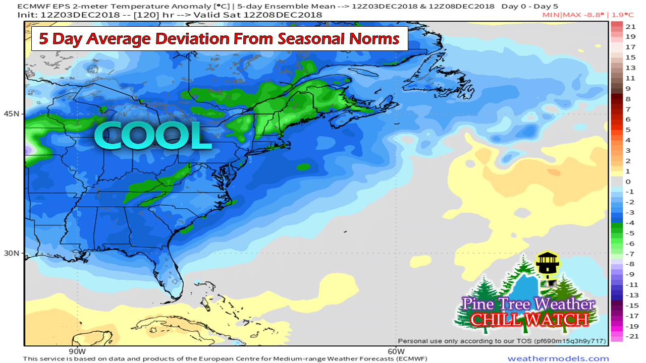
For the areas that were fortunate to warm up over the past weekend will see that short lived.  A cold front passing through Monday night will bring below normal temperatures on average for the remainder of the week. This chart is in Celsius which translates roughly 20° below normal Fahrenheit. 

Tuesday breezy and cold

Picture
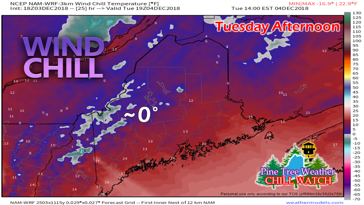
Folks headed for the ski hills should layer up accordingly as the wind chill values drop during the course of the day as northwest wind gusts to around 20-30 mph will add a bite to the air. Northern Maine sees values in the single digits above with teens expected across most of the coastal plain. 

High pressure to dominate the rest of the week

Picture
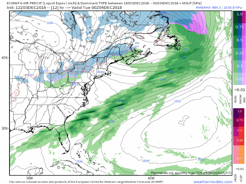
Outside of some clipper systems that reinforce the cold air as the week progresses, not much in the way of precipitation is expected for the state. A few up slope snow showers are possible on Tuesday along the international border with Quebec, and that is likely again Thursday night into Friday. High pressure over the northeast steers away a potential midweek threat well out to sea. We'll have to watch for a potential storm generating over the southeast over the weekend and see where that tracks once it hits the Atlantic seaboard. 

Outlook through Saturday

Picture
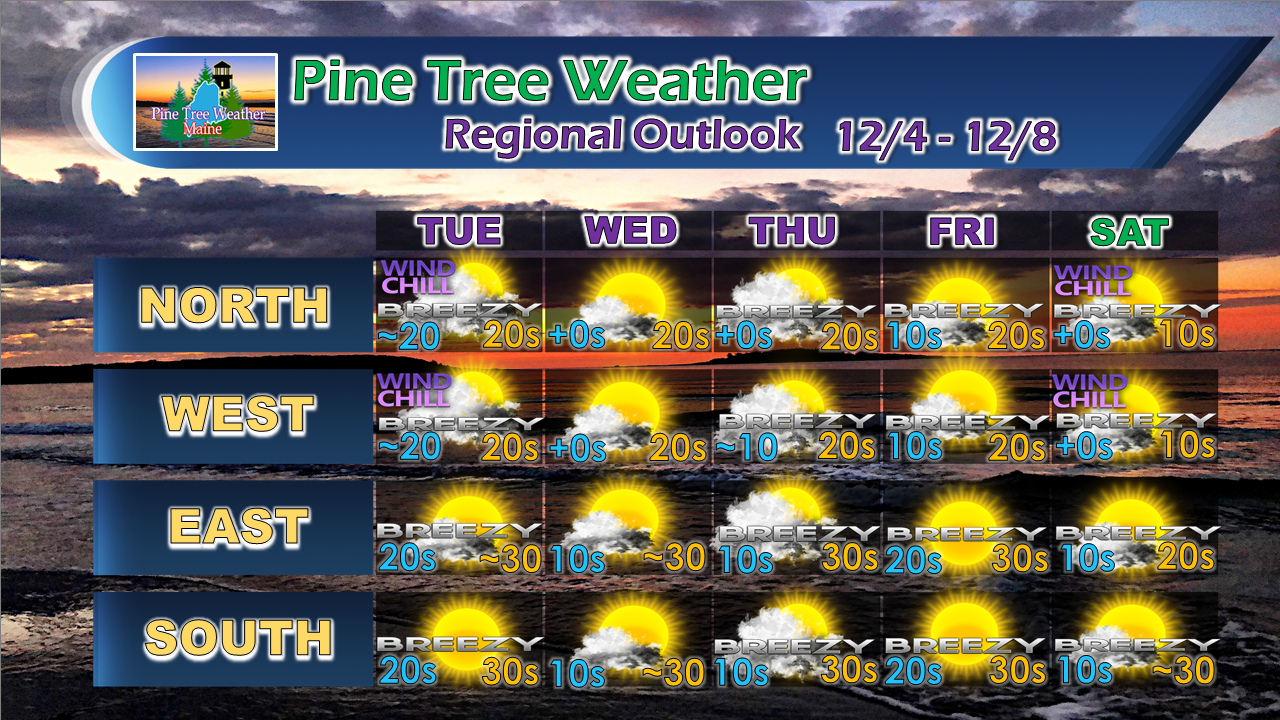
For the latest official forecasts, bulletins and advisories, please check in with the National Weather Service in Gray for western and southern areas, or Caribou for northern and eastern parts of Maine.

Please consider making a donation to keep Pine Tree Weather going through the year ahead. My data cost expense is increasing. The operation is 80% funded and needs your help to get through the winter. You can set up a monthly pledge on my Patreon page  or send me a message from the Facebook page or direct message on Twitter to get my address to mail a check.

For more information from me, please follow the Pine Tree Weather Facebook page and my Twitter feed.

Always stay weather aware, and thank you for your support! 

​- Mike
Comments
    Picture

    Mike Haggett
    Kennebunk, ME

    Certified Weather
    Forecaster
    Penn State '21

    American Meteorological Society

    National Weather Association

    Weather-Ready Nation 
    Ambassador
    ​
    ​SKYWARN-CWOP

    Matthew 19:26


    Support
    Pine Tree Weather

    DONATE

    Picture

    Picture

    Picture

    Picture

    Picture

    Picture

    Picture

    Picture

    Picture

    Picture

    Archives

    January 2023
    December 2022
    November 2022
    October 2022
    September 2022
    August 2022
    July 2022
    June 2022
    May 2022
    April 2022
    March 2022
    February 2022
    January 2022
    December 2021
    November 2021
    October 2021
    September 2021
    August 2021
    July 2021
    June 2021
    May 2021
    April 2021
    March 2021
    February 2021
    January 2021
    December 2020
    November 2020
    October 2020
    September 2020
    August 2020
    July 2020
    June 2020
    May 2020
    April 2020
    March 2020
    February 2020
    January 2020
    December 2019
    November 2019
    October 2019
    September 2019
    August 2019
    July 2019
    June 2019
    May 2019
    April 2019
    March 2019
    February 2019
    January 2019
    December 2018
    November 2018
    October 2018
    September 2018
    August 2018
    July 2018
    June 2018
    May 2018
    April 2018
    March 2018
    February 2018
    January 2018
    December 2017
    November 2017
    October 2017

    RSS Feed

Proudly powered by Weebly