
Power Recovery UpdateAs of 4:20 PM Monday, Central Maine Power reported 5,353 without power from the Late October Gale. Emera Maine reported outage were down in eastern areas to 253. I have seen several gripes about cable TV and internet issues. Unfortunately, those companies do not release information on outages or restoration times. High pressure in control midweek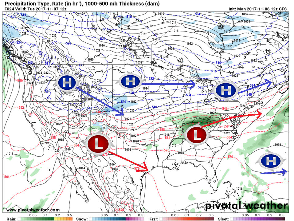 It appears pretty quiet through early Thursday for the state as high pressure takes over the region. A bit of a concern that low pressure over Tennessee may bring some light snow showers or flurries to far southern areas late Tuesday night / early Wednesday, but otherwise it appears dry with varying amounts of sun Tuesday and mainly clear for Wednesday. Light snow possible late week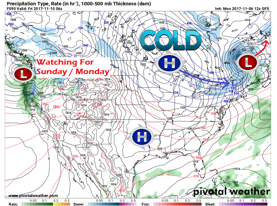 An area of low pressure drags an arctic frontal boundary into the region late Thursday into Friday. A long with it comes a chance for snow showers and flurries. The European model is in disagreement on the system entering the Pacific northwest having any effect on the region at this point for late weekend in today's 12z run, but the GFS and Canadian GGEM think it is possible. I am going with a chance for snow for now on Monday. More on that as the week unfolds. 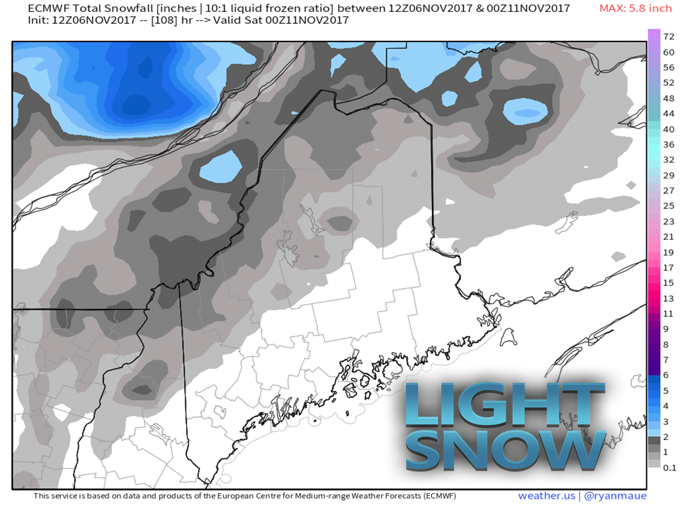 A bit early in the ballgame for accumulations, but it does appear that the mountains and north will see an inch or so from this frontal passage. 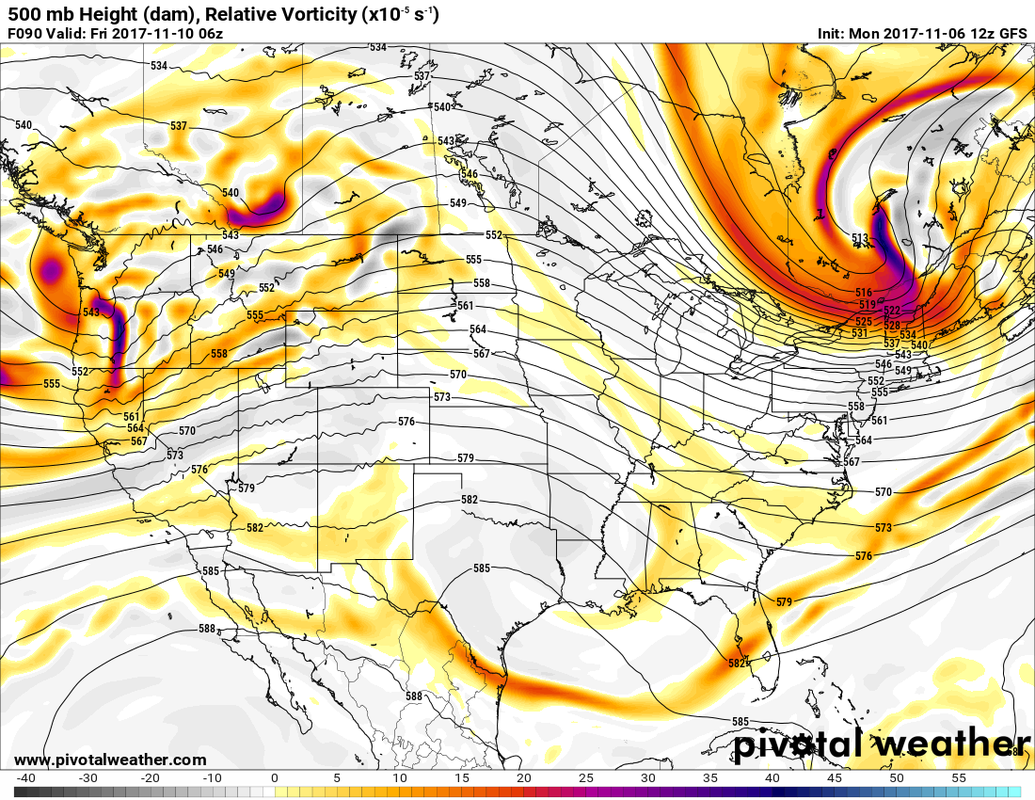 Looking at upper level energy, this causes me a bit of concern. Guidance has trickled up moisture output with this system over the past couple of days. If the energy can tap into the Great Lakes by dropping a bit further south on the sweep, it may turn into a bit more than what the models are selling at this point. For now, a dusting to an inch of snow is possible for the north country, and stay tuned. The first true arctic high of the season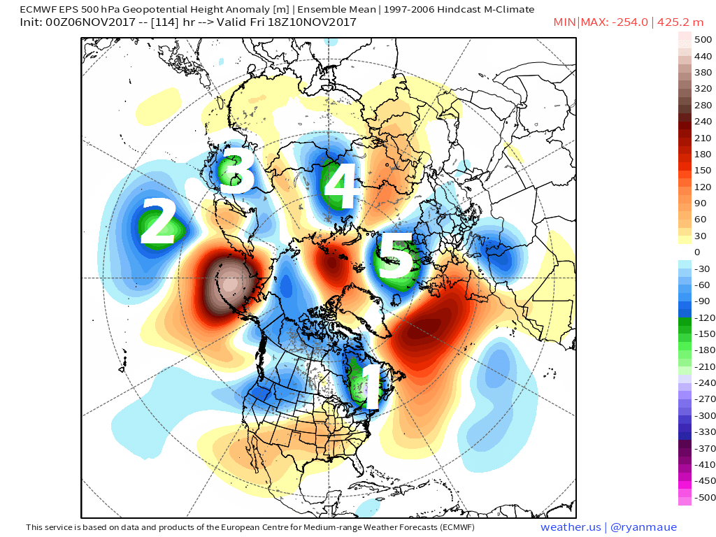 The arctic is cooling down. There are five areas of abnormally cool air swirling around the top end of the planet right now, with three blocking ridges. The ridge to the north and east of North America is one that will have to be watched. That ridge is partially responsible for cool summer the region experienced. When that weakens, the chances for heavier snow for Maine rises. It sets up a perfect blocking pattern that forces any developing storms to the south closer to the coast. For now, the pattern is back into the west to east zonal flow, which was the reason as to why the pattern was not only abnormally cool, but dry for most of the summer. 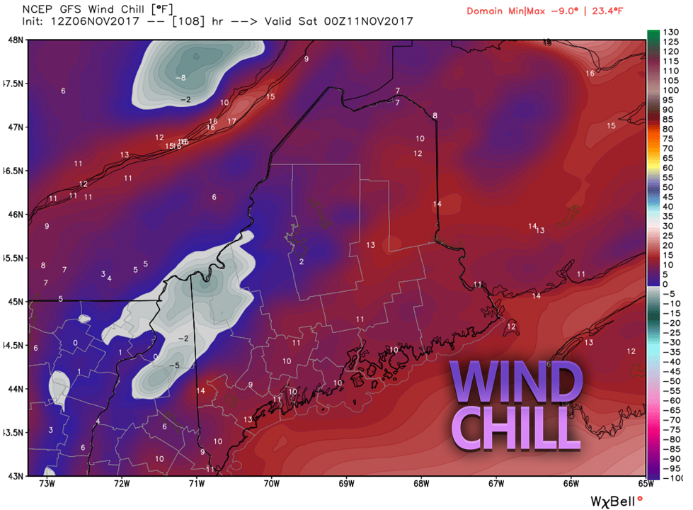 After the arctic front slides through, the northwest wind picks up delivering a sharp bite to the air the region has not had in months. The wind appears to settle roughly Saturday afternoon. Plan on bundling up for any outdoor related activity Friday morning through the weekend. Please click on the tab for the latest 7-Day Outlook for the forecast in your region. Website changesI am still tinkering with pages on the site. The "Maps" page will contain the surface forecasts from the Weather Prediction Center and the Ocean Prediction Center. I have added a "Precip Outlook" page that will contain both liquid and granular outlooks from the Weather Prediction Center. I will update each page daily, unless I am away.
Thanks for your support of Pine Tree Weather. You may not like the weather, but the idea is that you'll like the way it is presented to you, without hype, bias, or media influence. If you like what I do, consider sharing with your friends. I appreciate it! -Mike |

Mike Haggett
|


