
Enjoy the color while you can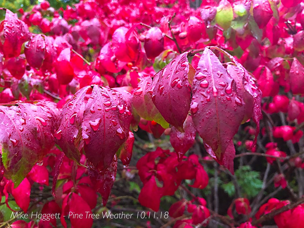 Seasonably cool, breezy and showery at times is the nutshell outlook over the next week or so. Hurricane Michael appears to be one of the factors that has brought a change to the pattern. The cold air in the Arctic has been looking for an area to drain, and this side of the northern hemisphere appears to be it. If you haven't done your foliage trip yet, do so soon. Leaves are likely to fall between the cooler air and the breezy conditions on the way. Temperatures below normal for a while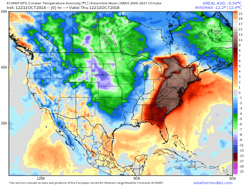 My humble suggestion is to continue to work on the stacking the wood, and to plan yard clean ups before too long for the folks in the mountains and north especially. This model loop of near surface temperatures departure from normal indicates a much cooler trend, and for this time of the year, nights where the mercury could fall below freezing for interior areas. 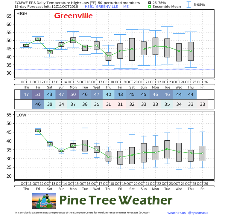 Using the European ensemble idea for Greenville as an example shows the details a bit more clearer. It appears 50s are going to be a rarity and many mornings around freezing. Just as a point of reference, the Euro tends to run a bit on the warm side, and actual results may vary a bit. I suspect some readings in the 20s as we head into the later part of the month. I tend to think the folks at NWS Caribou could be reporting some teens from places like Estcourt Station and Big Black River as we head towards November. Since the cold is on the way, you know what comes next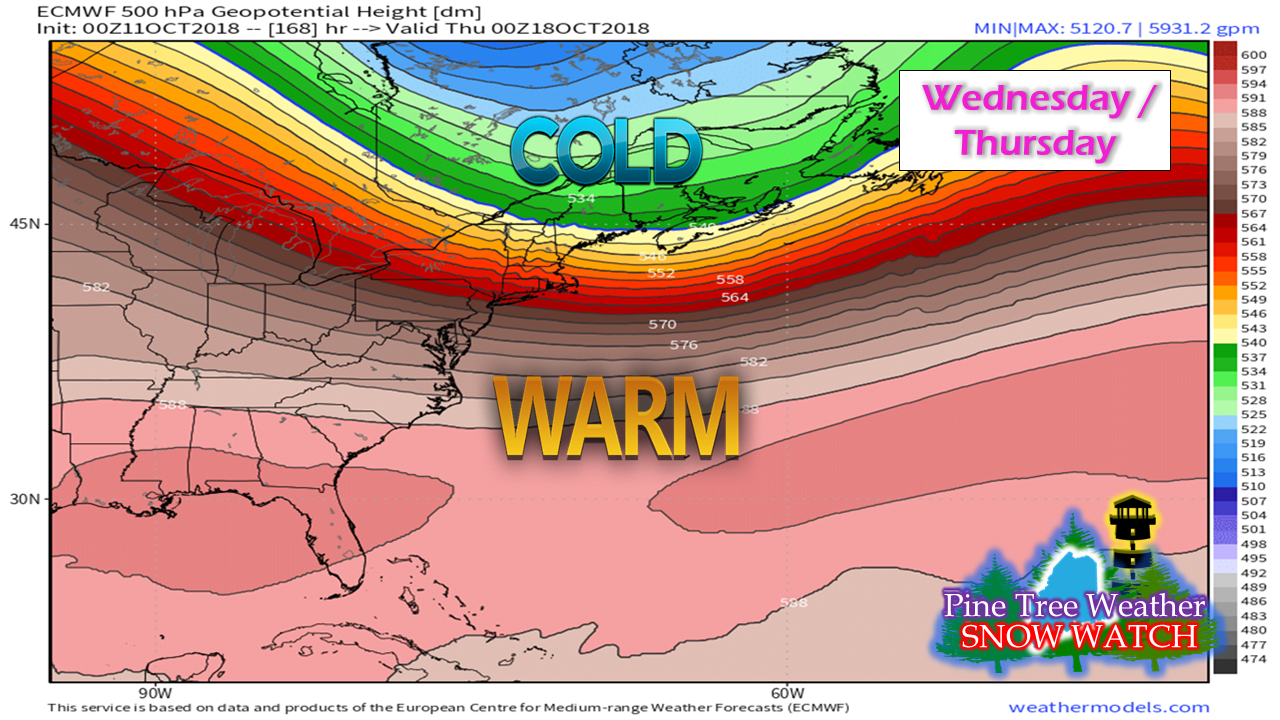 The ridge that has brought the region an incredibly humid summer continues to diminish over time. The trade off is cold air aloft gets closer to the surface. Where the greens on this 500 mb height map meets the yellows indicates the white flakes are possible under the right scenario. For the middle part of next week, there is that possibility. 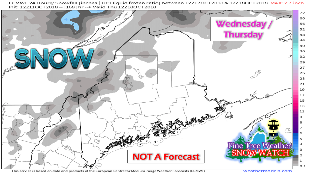 I am going to back track a tad here to Saturday as the hints have been showing for the past few days that Mount Washington could see a touch of snow, and that would mean Mount Katahdin could be in on a few flakes, too. Moving ahead to the middle part of next week. the higher elevations -may- see some light accumulations also. Time will tell, but the writing is on the meteorological wall for a winter tease in some form. It will be a while yet for lower elevations. To refer to my synopsis at the start of this post, plan on getting your fall chores done over the next couple of weeks. Outlook through Tuesday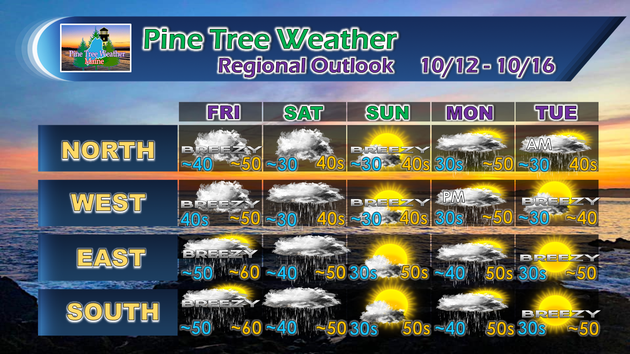 Any shower activity over the next few days will generally be light. I am still thinking the coastline may get brushed with some scattered showers in the morning on Friday as Michael slides to the southeast. Saturday appears to feature nuisance showers for most areas south of the Crown. Another weak front enters into the picture for Monday, with cooler temperatures and breezy conditions for Tuesday. Stay Weather Aware! For the latest official forecasts, bulletins and advisories, please check in with the National Weather Service in Gray for western and southern areas, or Caribou for northern and eastern parts of Maine.
For more information from me, please follow the Pine Tree Weather Facebook page and my Twitter feed. Thanks as always for your support! Please consider making a donation to keep Pine Tree Weather going through the year ahead. Check out the donate page on how to contribute. Always stay weather aware! - Mike |

Mike Haggett
|


