|
First off, thank you to those who have signed up for a monthly donation through Patreon, sent me donations through VENMO, or mailed checks. A big thanks to a donor in Carrabassett Valley who prefers to remain anonymous for his annual contribution to the cause, and to the others who have generously donated. As crazy as my world is at the moment, it's inspiring and motivating to see it. Pine Tree Weather continues because of you. As long as my bills get paid to operate this, I'll continue to do it. Anything you can do to help is much appreciated. About that CPC Winter Outlook...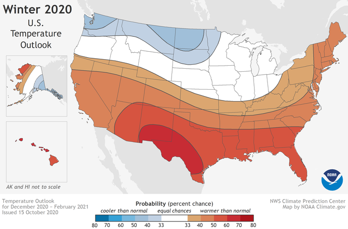 The Climate Prediction Center came out with its Winter Outlook for 2020-21 and it wasn't that much of a surprise to this forecaster. I mentioned a few weeks ago in a Lewiston Sun Journal FaceTime piece that I expected a mixed bag for Maine this winter, and this doesn't change my thinking. We've been dealing with warmer than normal winters for all but three seasons since 2000. As a result, we've seen more ice and sleet events. Lakes are slower to freeze and quicker to thaw since the ice pack is smaller. I am currently studying El Niño / La Niña, and while some may be quick to point that out, each of those is different in their own way given strength and impacts, and neither of those teleconnections are proven theory. Just because CPC thinks it will be above normal temperature wise does not mean winter gets cancelled. For those of us living and recreating around 45° north / 70° west point on the globe, winter is still going to happen. The question for me at this point is if municipalities and the Maine Department of Transportation have enough road salt / calcium chloride to treat the roads until spring. We're going to find out. Have your generators tuned up, and secondary heating sources ready for operation. (Editor's Note: For the record, my snow tires were put on my car last Friday)  Outlook for the first half of the week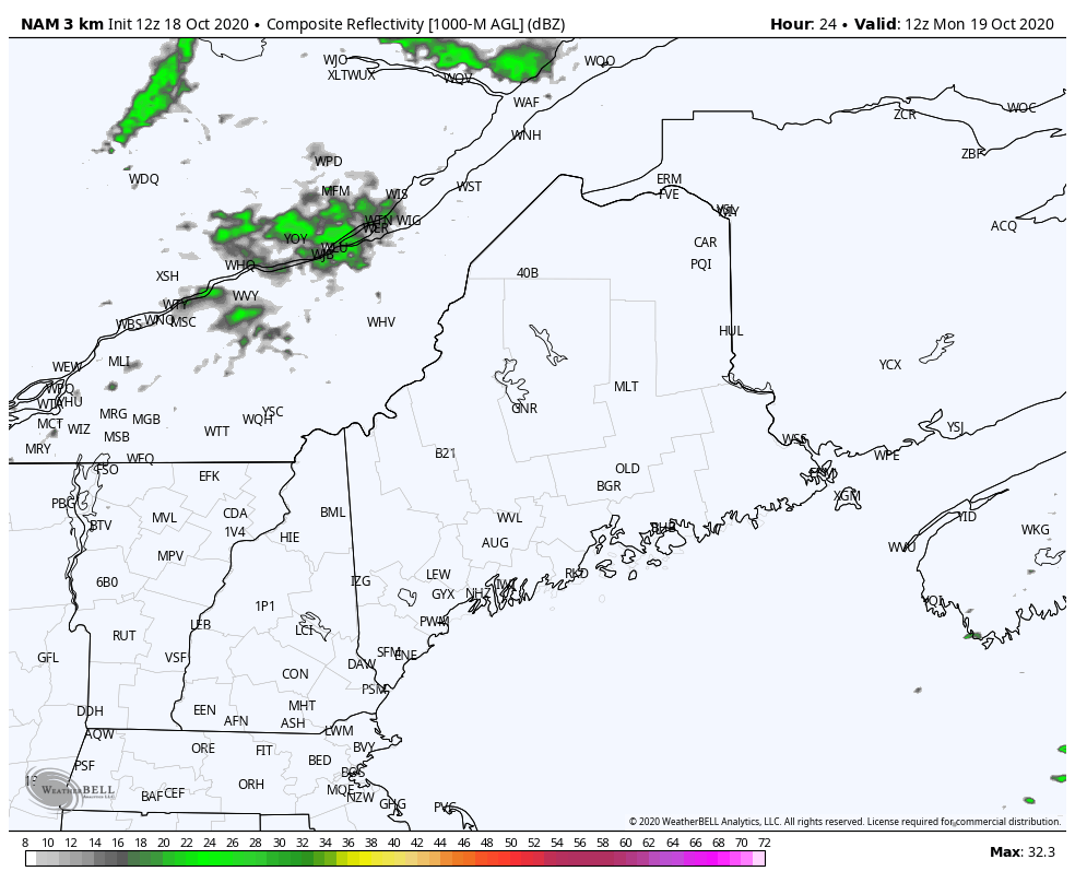 NAM model radar idea from 8 AM Monday to 8 PM Tuesday The western mountains and northern Aroostook may pick up a bit of rain Monday afternoon into the evening as a slow moving cold front advances toward the region. The front stalls out for a few hours overnight into Tuesday. By the time it works through the coastal plain Tuesday afternoon, it appears drained of any meaningful precipitation there. 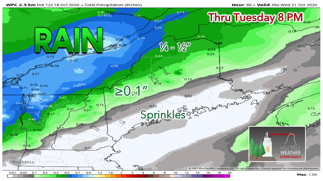 I can't rule out a couple hundreths of an inch for the coastal plain, but that is about it. Most of the rainfall from this one appears over the north country. We'll play it again Wednesday into Thursday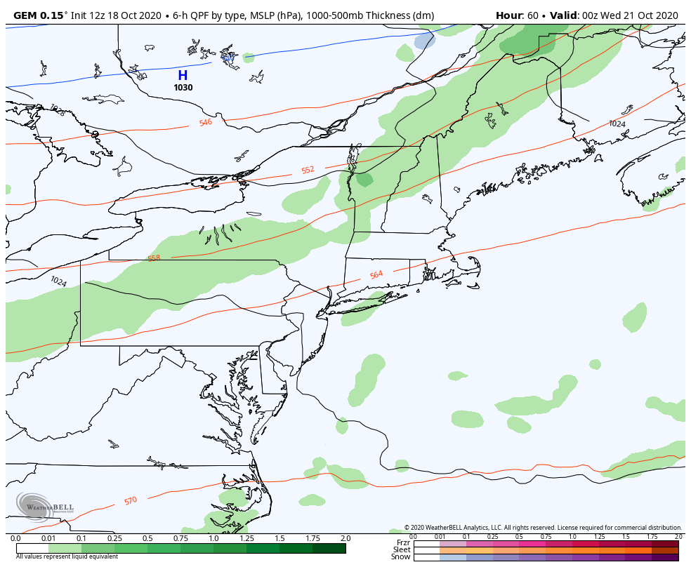 GGEM model idea of atmospheric thickness, mean sea level pressure and precipitation from 8 PM Tuesday to 8 PM Thursday High pressure passes quickly through the region Tuesday night into Wednesday morning. Another weak cold front is on tap to cross the state Wednesday afternoon, bringing more shower activity to the north and mountains, clouds with widely scattered showers for the south and east. A tropical cyclone is expected to form to the southeast of Bermuda. It appears to impact the island country Thursday into Friday before racing off to the north Atlantic over the weekend. Until guidance gets a handle on what is going to happen there, the forecast for Maine next weekend is low confidence on anything for now. Temperature outlook through SaturdayThe daily highs and lows don't appear to change a whole lot during the week. Temperatures will generally run above average through the period. 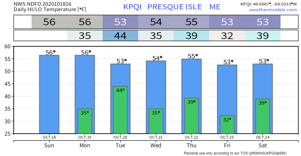 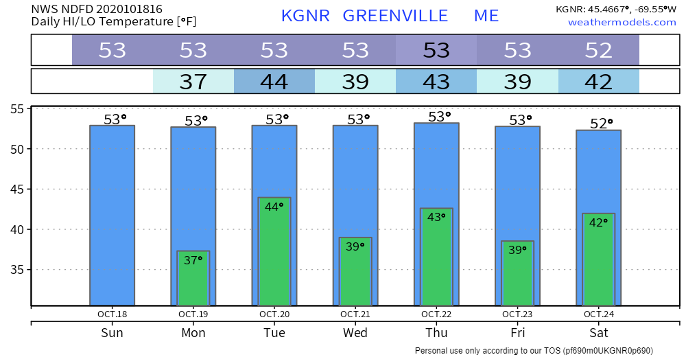 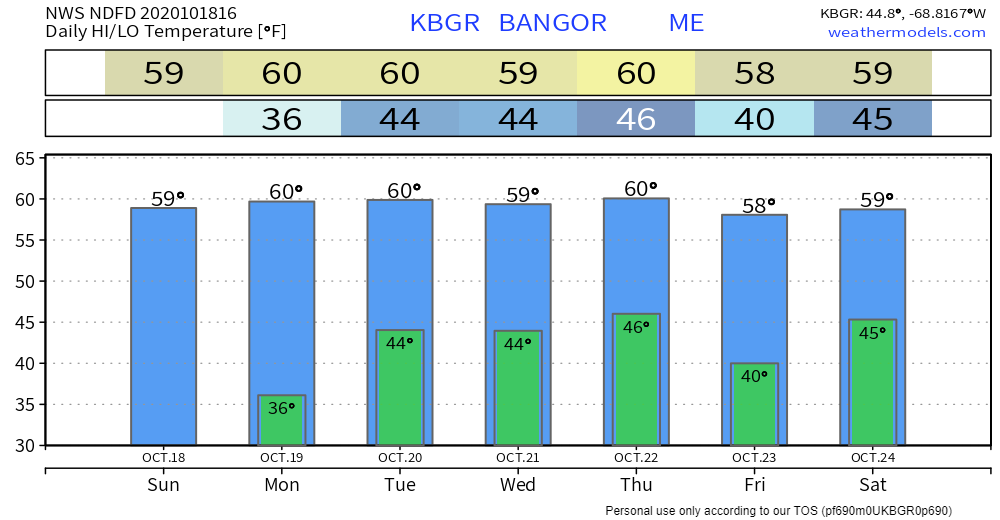 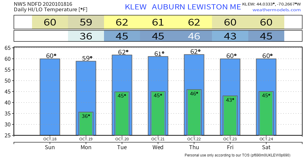 Winter SKYWARN Virtual Spotter Training in November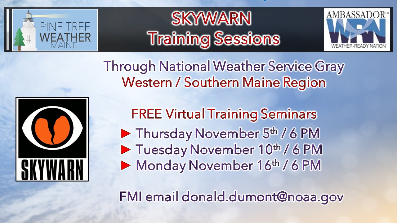 For those in Oxford, Franklin, Somerset, Kennebec, Lincoln, Knox, Waldo, Sagadahoc, Androscoggin, Cumberland and York Counties, here's your opportunity to get involved with the weather community. If you are interested in training for either of the above dates, please email Donald Dumont at the National Weather Service Gray office at [email protected] and tell him Mike at Pine Tree Weather sent you. He'll send you the Go To Webinar link to register for the time that works for you. No matter where you are, your reports are invaluable and helpful to the future of forecasting! All ages can participate! Be prepared to receive alerts and stay updated!
For more information, please follow Pine Tree Weather on Facebook and Twitter.
** FUNDING NEEDED FOR 2021 ** Thank you for supporting this community based weather information source that is funded by your financial contributions. Stay updated, stay on alert, and stay safe! - Mike |

Mike Haggett
|