
Northern areas escape Tuesday rain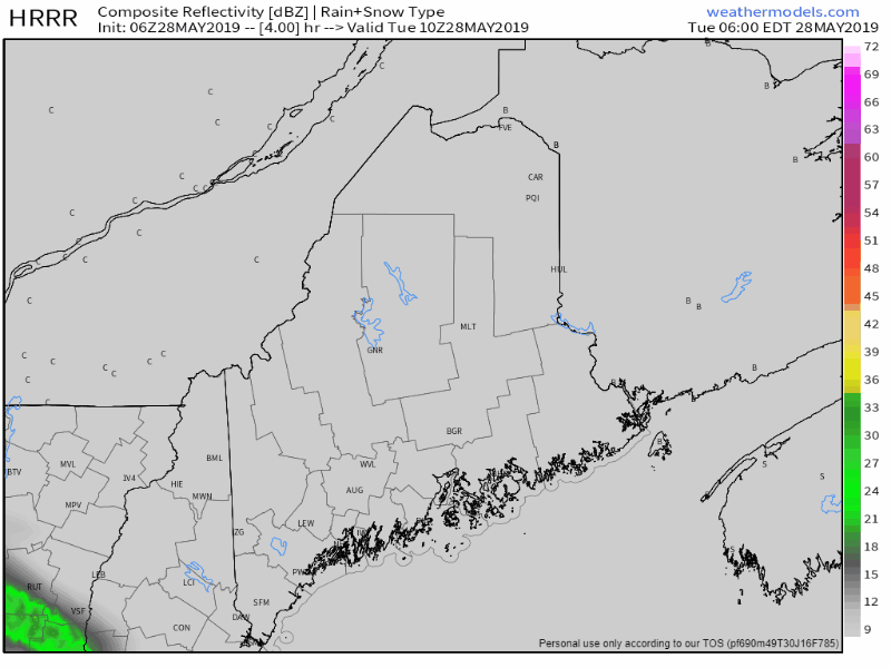 Drive north if you want to have some sun and dry conditions for the day. Otherwise, grab the rain jacket and the umbrella for areas south of The Crown. As the rain arrives, temperatures will fall, with 40s the dominant temperature in areas of raindrops. Northern areas will have a pleasant day over all, the highs around 60°. For areas that do get rain, it should be decent amount, anywhere between ½-1" of liquid from this event. Upper low stalled over Quebec to cause showers & rain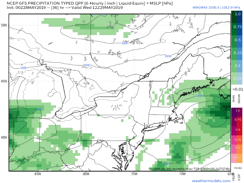 Cut off upper level lows that are jammed in road blocks ebb, flow, and meander until something gives to allow it to move on. It will that scenario that plays a factor in the weather for the region through the weekend. The results are some dry times, showers, and steady rain, along with the chance of thunderstorms as warm air tries to nose in. Due to the nature of the upper low, cooler than normal conditions will be a part of it. Thursday night into early Friday brings the next round of showers, and then Saturday into Sunday. Rain Outlook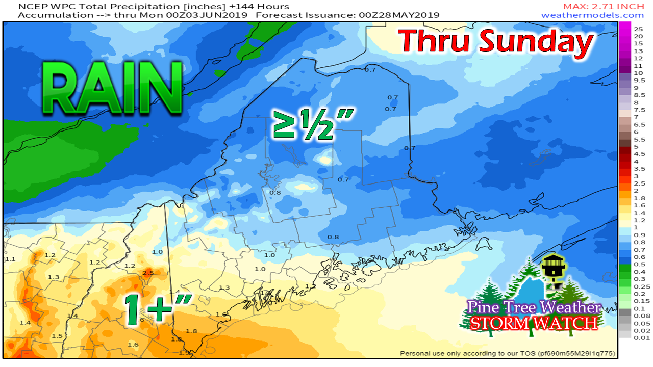 Rain prediction from the Weather Prediction Center indicates that southern areas are likely to see the most rain through Sunday evening, with nearly 2" possible for York County. The further north, the lesser amounts are expected as just over a ½". Outlook through Sunday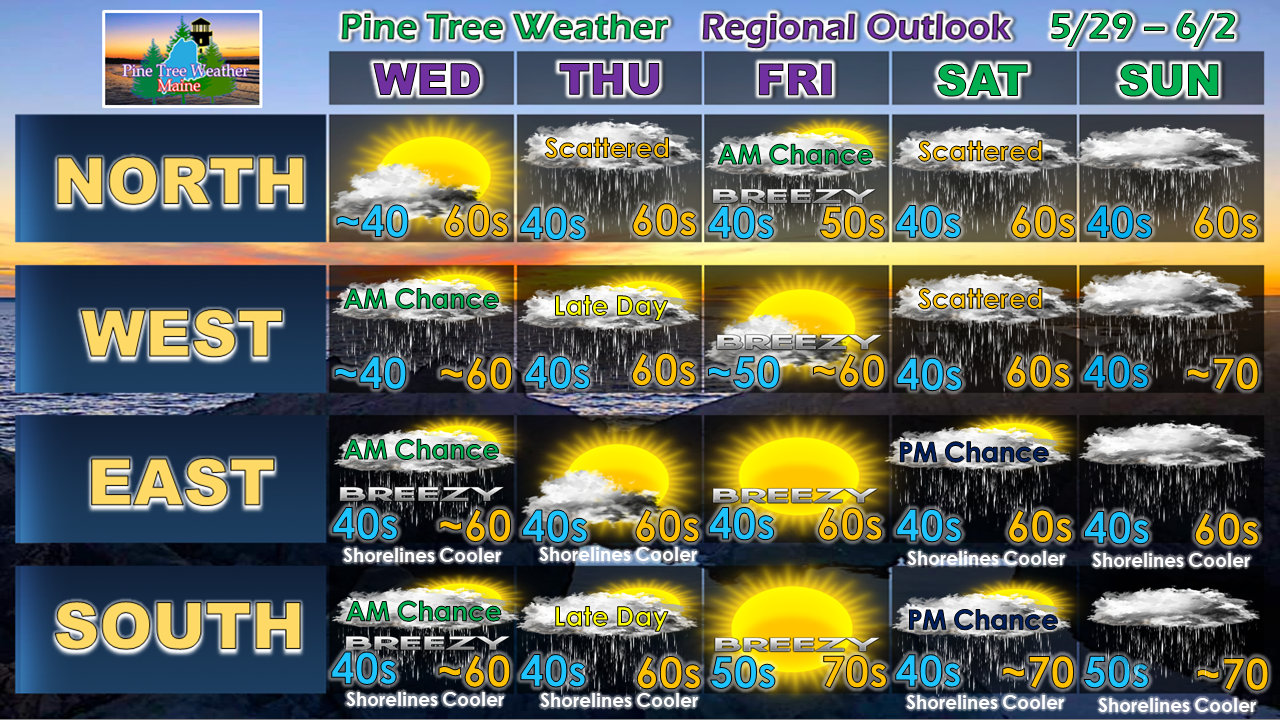 For the most part, the rain that comes after Tuesday will be in the evening or early hours of the day. The only potential washout day at this point appears to be Sunday. Stay tuned for updates through the rest of the week.
► ► For the latest official forecasts, bulletins and advisories, please check in with the National Weather Service in Gray for western and southern areas, or Caribou for northern and eastern parts of Maine. ► ► Your financial donations are much appreciated to keep this site funded and for further development. I sincerely appreciate your support not only financially, but also in sharing my efforts with others. For more information from me, please check the Pine Tree Weather Facebook page as well as my Twitter feed. Always stay weather aware! - Mike |

Mike Haggett
|


