Very warm on Wednesday, dew points reaching oppressive levels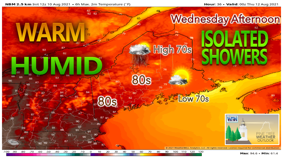 Wednesday will feature very warm temperatures in the southern half of the state, while the northern half avoids the extreme heat thanks to extra cloud cover. Regardless, it appears quite warm in most areas of the state, with the north reaching the upper 70s to around 80° for a high. Southern areas of the state will likely see the low to mid 80s with portions of the southwest interior potentially hitting the 90s. If you're looking to escape the heat, the Downeast coast will likely only reach the low 70s thanks to the sea breeze. There is a chance for some scattered showers and isolated thunderstorms on Wednesday afternoon as a disturbance aloft approaches. The very humid air mass that is in place will make for very uncomfortable conditions statewide. Temperatures will likely feel even warmer than they actually are, and this will only become more apparent on Thursday and Friday as the heat is expected to continue to increase. 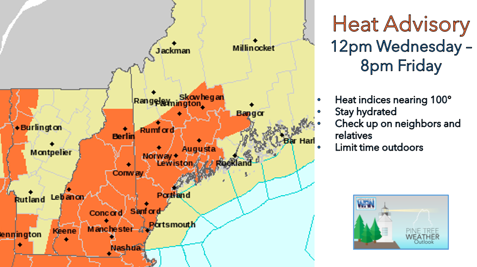 A HEAT ADVISORY will be in effect beginning at 12pm on Wednesday and lasting until 8pm Friday. While this is currently only affecting southwestern Maine, additional heat advisories may be needed to cover more regions of the state as the week unfolds. This means that dangerous heat indices of up to 100° F are possible. On days like this, it is best for everyone to limit time outdoors. Stay in an air-conditioned building and drink lots of fluids! Be extra cautious when outside, and if possible, reschedule activities to the early morning or late evening when the heat is less intense.  The big story for Wednesday and the rest of the work week is the extreme humidity. Certain areas of Maine could see dew points in the lower 70s, which does not occur very often. This moisture combined with warm temperatures are driving heat indices up into the 90s and even near 100° F. These levels of humidity can feel quite oppressive. Unfortunately, models are pointing to Saturday as being the earliest sign of cooler, drier air. Heat persists on Thursday and Friday, cold front offers relief Saturday Thursday appears to be the worst day in this stretch of heat and humidity. High temperatures in the south are projected to reach the low 90s, while the north should hover around the upper 80s. Factoring in dew points in the upper 60s and lower 70s, we are looking at heat indices around 95°-100°. The model above shows the "apparent" temperature - what it will really feel like on Thursday afternoon. Showers and thunderstorms are possible, especially across the north. Severe weather is unlikely, but given the very humid air mass, a few storms could contain some heavy downpours and gusty winds. Thursday night looks to be very mild and muggy with lows only falling to the 70s. There is a potential for Caribou to break the all-time record "high" minimum temperature of 71°F!  A cold front is expected to arrive somewhere around late Friday into early Saturday. This will likely provide a spark for some evening showers and thunderstorms on Friday lasting through Saturday depending on exact timing, as there is a lot of model disagreement. Fortunately, this front will allow for a cooler, refreshing air mass to be welcomed into the region once it passes through. Dew points are projected to drop to the upper 50s to lower 60s, finally providing a relief from the oppressive humidity. By Sunday, a noticeable chance should be felt statewide. Working Outside Outdoor workers can be at a higher risk from the effects of excessive heat. When working under hot conditions, OSHA recommends #WaterRestShade as well as allowing more frequent breaks for new workers or workers who have been away from the job for a week or more (acclimatization). Knowing symptoms, prevention and emergency response methods can help prevent heat-related illnesses and death. Check weather forecasts ahead of time to be better prepared. www.osha.gov/heat Temperature OutlookThursday and Friday appear to be the hottest days this week with most areas reaching the upper 80s to lower 90s. Northern regions are first to see relief on Saturday as a cold front passes through the state. Warm temperatures stick around for next week, but extreme heat does not appear likely. 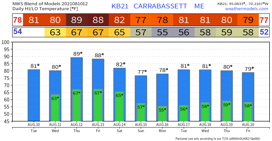 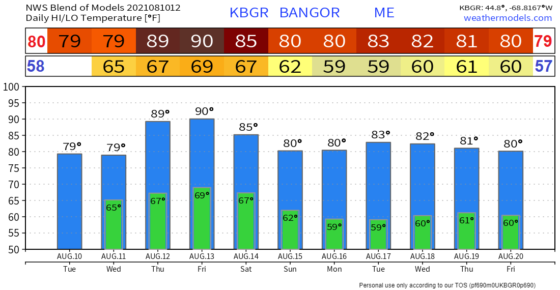 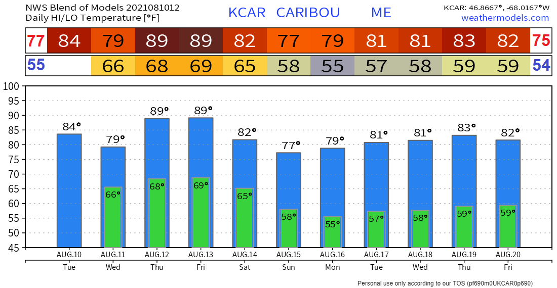 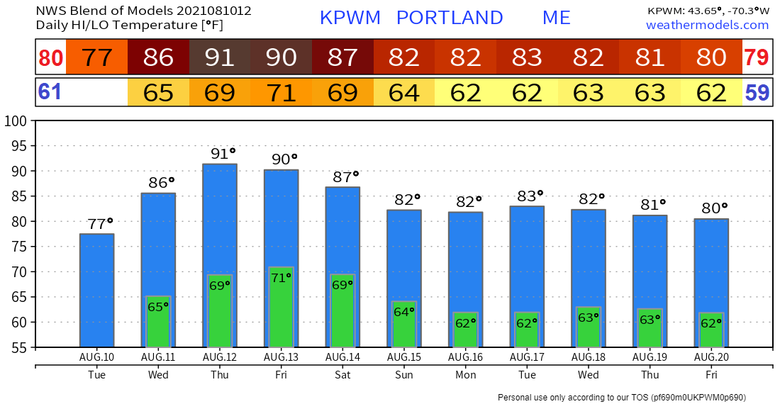 Be prepared to receive alerts and stay updated!
For more information in between posts, please follow Pine Tree Weather on Facebook and Twitter.
Thank you for supporting this community-based weather information source which operates by reader supported financial contributions. Stay updated, stay on alert, and stay safe! |

Mike Haggett
|