Tuesday Daytime Temperatures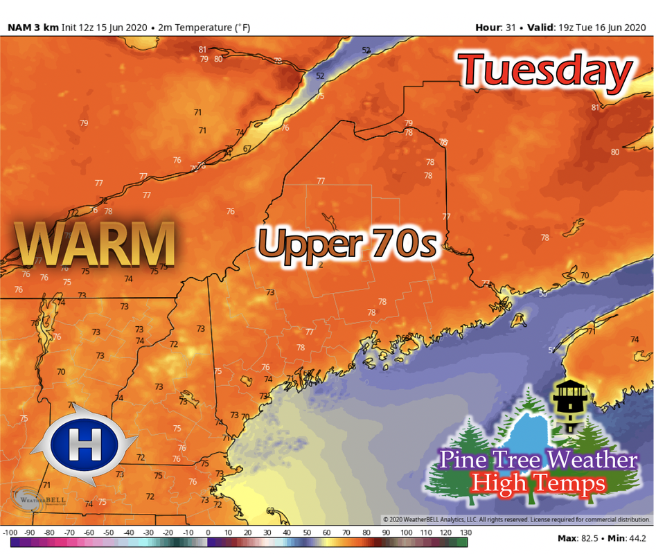 The high pressure begins to settle in the New England region on Tuesday. Southwest winds will help begin to warm up the state, and the high pressure will assist in bringing clear skies statewide. Statewide high temperatures will be in the mid to upper 70s, with some isolated areas having potential to hit in the low 80s in the Caribou area. Overnight temperatures are mild; Down East, Mid Coast, Portland, and higher elevated areas in the low to mid 50s, and the rest of the state in the mid to upper 50s. No precipitation is expected during the day and night. Wednesday Daytime Temperatures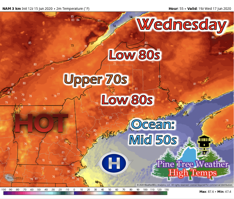 Wednesday warms up statewide as the high pressure system moves into the Gulf of Maine. Calm winds and clear skies statewide aid in the increase in temperatures. Higher elevated areas will experience a high temperature in the upper 70s, and elsewhere in the low 80s, with exception to areas directly on the coast. With onshore flow setting up in the afternoon, temperatures will feel more in the mid to upper 70s. Daytime Temperature Increase Through This Week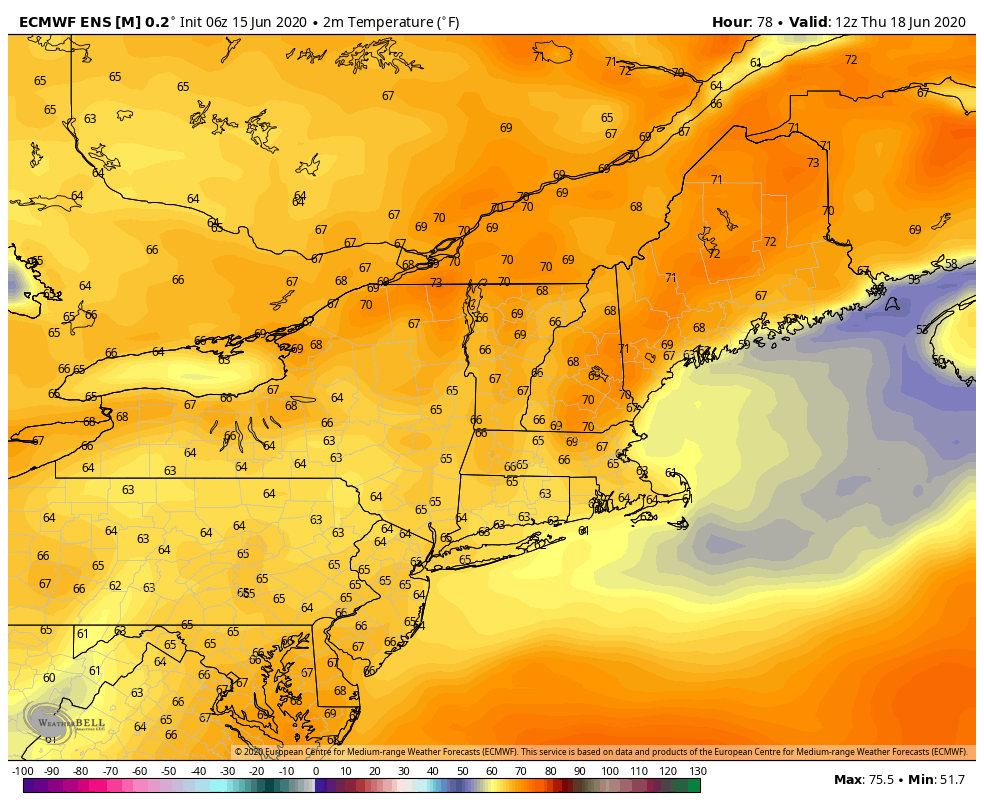 The GIF above runs from 7 AM Thursday to 1 AM Sunday. The high pressure system hangs around the state for most of the week, allowing daytime temperatures to increase into the mid 80s or higher for some parts of the state on Thursday. This model run is still a few days out, and a further look into current conditions in the area, confidence for some parts in the low 90s is medium. Once further information from the models is available, we'll keep you posted. Potential Rainfall Event for Next Week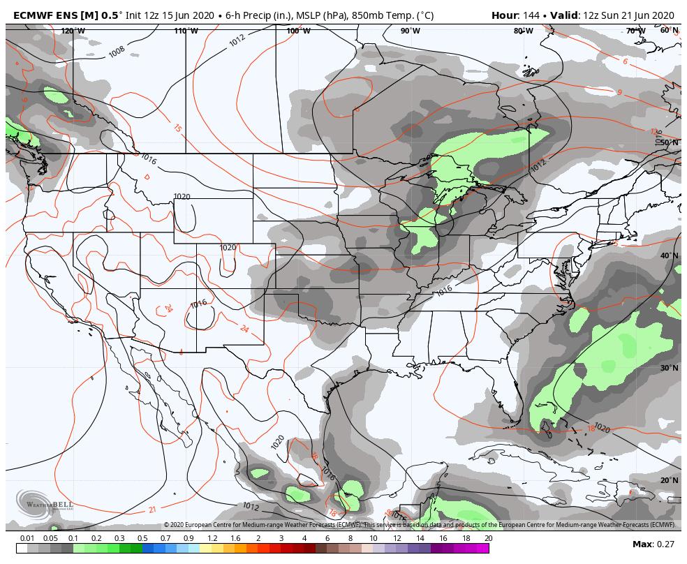 The GIF above runs from 7 AM Sunday, June 21st to 7 AM Wednesday, June 24th. More long-range model information shows the formation of a low pressure system in Canada, north of Montana, a few days prior to the beginning of this GIF. Past runs depicted Maine receiving precipitation over the weekend, but newer runs show Maine receiving precipitation the beginning of next week. In real time, the low pressure system has not fully formed, but models seem to suggest that the system will move easterly towards Maine slower than in previous runs. As more information becomes available, we'll keep you posted on when the rain may come next, and how intense it may be. Cold Water Safety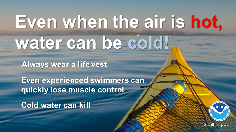 Ocean and lake temperatures for Maine are 50s and 60s respectively. Warm air temperatures doesn't necessarily mean warm water temperatures. Cold water drains body heat up to 25 times faster than cold air. When cold water makes contact with your skin, cold shock causes an immediate loss of breathing control. This dramatically increases the risk of sudden drowning even if the water is calm and you know how to swim. Practice cold water safety by staying out of waters below 70 degrees! Help forecast verification, and stay informed!
For more information, please follow Pine Tree Weather on Facebook and Twitter.
Thank you for supporting this community based weather information source that is funded by your financial contributions. Stay updated, stay on alert, and stay safe! Have a great week! - Kaitlyn |

Mike Haggett
|