Warm with scattered thunderstorms Saturday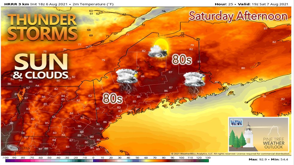 Saturday should start off mostly sunny with increasing clouds expected across the state ahead of an approaching cold front moving southeast into Maine from the St. Lawrence River Valley. During the early afternoon, we can expect isolated to scattered showers and thunderstorms to develop across the central portion of the state ahead of that cold front. There should be sufficient atmospheric instability to produce isolated damaging wind gusts. 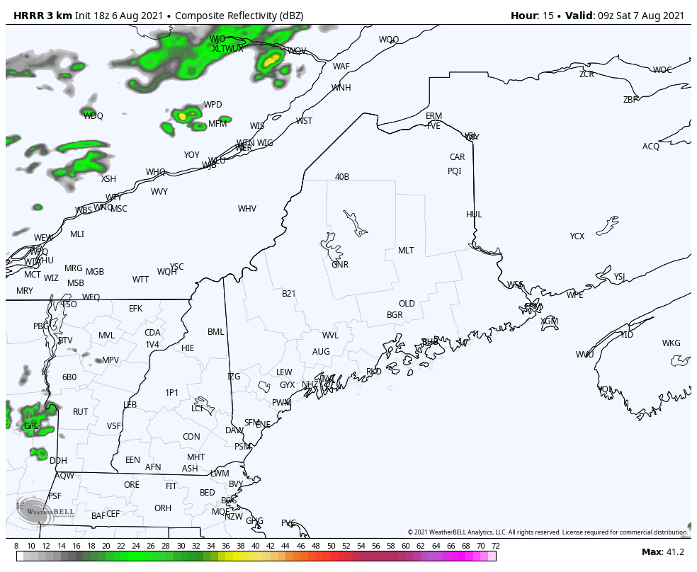 The cold front is expected to move southeastward through the state into Saturday evening pushing the thunderstorm activity into Downeast Maine. Expect high temperatures to range from the 70's for the coastal areas and higher terrain in western Maine to the mid 80's across the interior of the state on Saturday. We can expect skies to clear from north to south Saturday night as an area of high pressure builds into Maine from Quebec. It should be another muggy night across much of the state with overnight lows only dropping into the low to mid-60's. Muggy with thunderstorms possible Sunday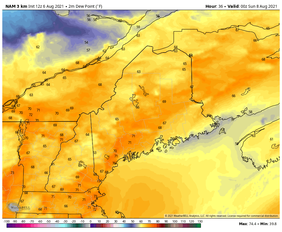 By Sunday, the cold front should have progressed through much of the state likely keeping the shower and thunderstorm chances contained to southern Maine. For the northern half of the state, we can expect partly to mostly sunny skies. Dewpoints on Sunday will be muggy or even tropical making it feel very uncomfortable when you walk out the door with dewpoints in the upper 60's to lower 70's for many locales. These high dewpoints look to stick around into next week so be prepared to plan the timing of outdoor activities you may have accordingly. High temperatures on Sunday will be slightly cooler than Saturday with low 80's expected for the interior and 70's elsewhere. Monday we will likely see the upper trough linger across the region providing ample cloud cover with chances for showers. High temperatures should be seasonable with 70's expected for much of the state. Warm and unsettled next week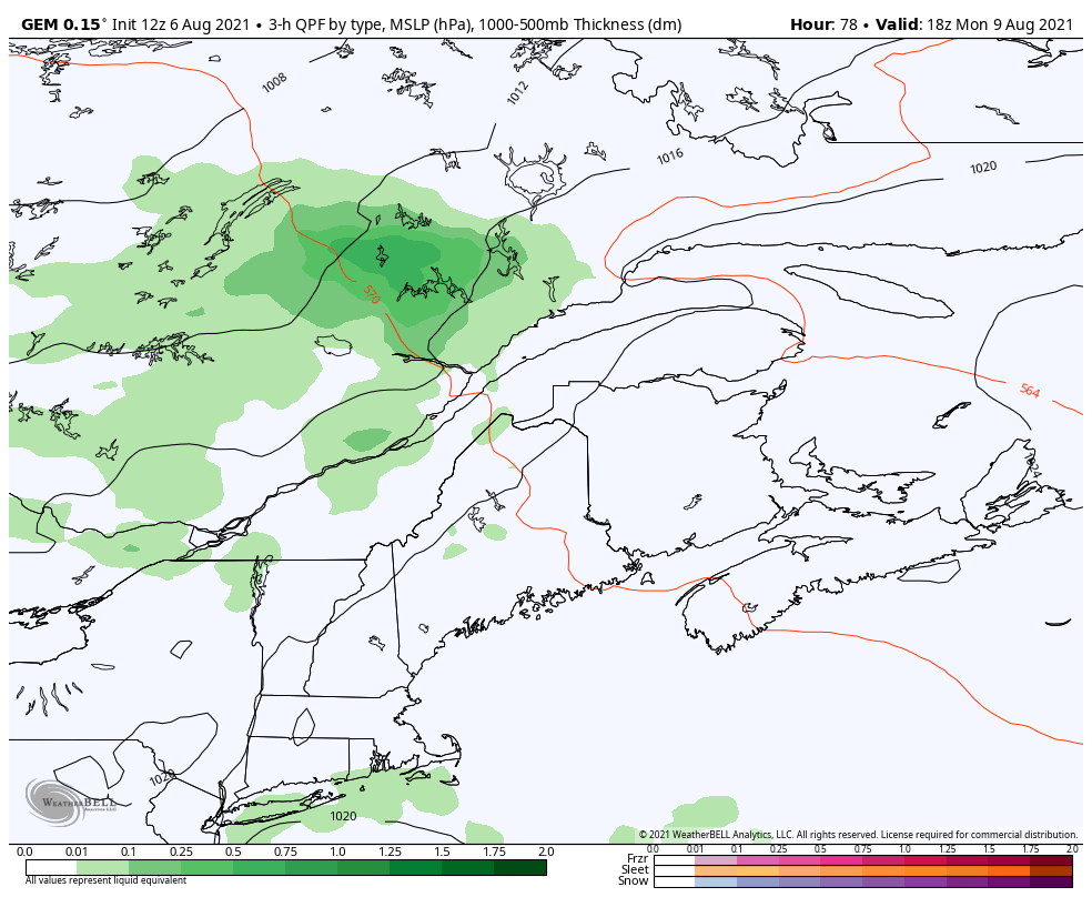 Tuesday we will likely see a warm front move into the state from the southwest. Behind the front, we will see increased humidity and a large scale southwesterly flow which will bring above average temperatures. A stalled frontal boundary projected to be just off the coast could keep coastal areas in a more easterly flow which would lower temperatures there. Tuesday and Wednesday we will see chances for isolated showers and thunderstorms with temperatures continuing to trend upward. Heading into late week, we should see above average temperatures with normal to slightly above average precipitation. Long range pattern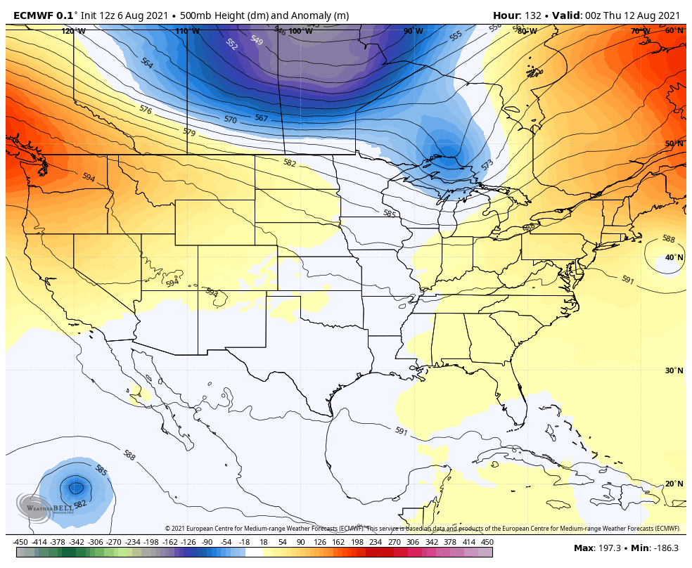 Heading into next weekend, we may see a series of shortwave troughs try to drop south into New England which would lower heights and also temperatures across New England. This could keep temperatures more seasonable rather than above average as was expected previously. We will continue to watch any changes in the long range and adjust temperature forecasts accordingly. Precipitation looks to trend normal to slightly above average through next weekend. Fog Safety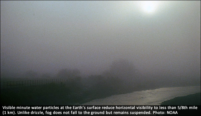 Dense fog is a common issue for drivers and boaters alike in the river valleys and along the coastlines here in the state of Maine. Dense fog is most likely to occur after a recent rainfall in low lying areas overnight. Fog contributes to numerous travel accidents every year. Restrictions in visibility resulting from fog can also impact takeoff and landing procedures and requirements for pilots, and can be the cause of weather-related aviation delays. To find out more regarding fog safety, https://www.weather.gov/safety/fog. Temperature outlook through mid-AugustThe plots below show the projected daily high/low temperatures for Carrabassett, Bangor, Caribou, and Portland for the next week and a half. Above average temperatures and increased humidity are expected heading into next week as the axis of the ridge becomes centered over the Eastern United States. A southerly flow will be common most days helping to boost temperatures as well as increase daily shower and thunderstorm chances for Maine. 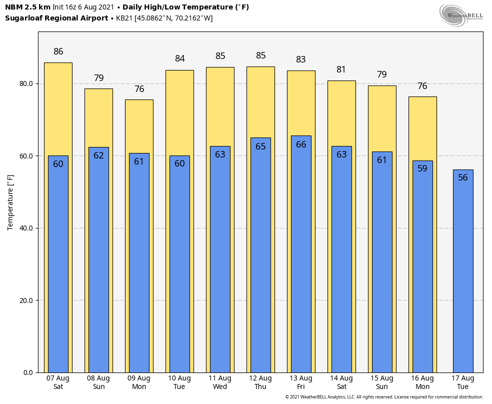 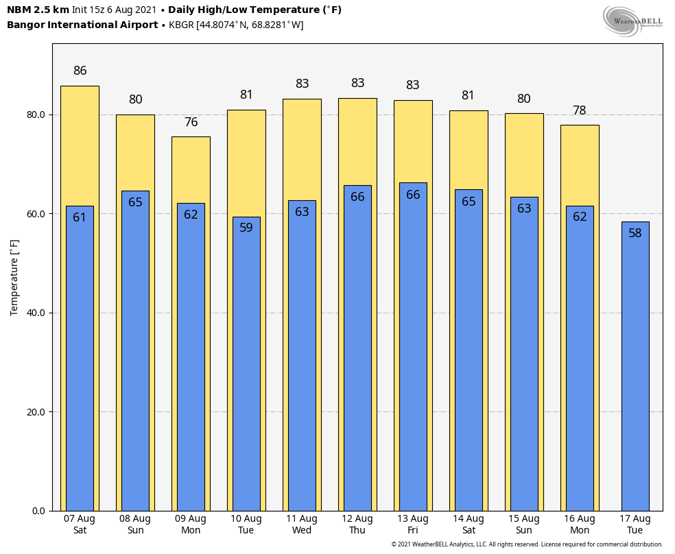 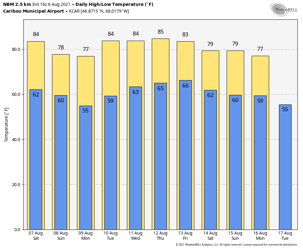 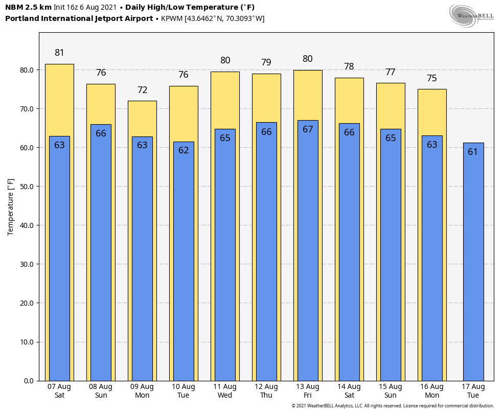 Be prepared to receive alerts and stay updated!
For more information in between posts, please follow Pine Tree Weather on Facebook and Twitter.
Thank you for supporting this community-based weather information source which operates by reader supported financial contributions. Stay updated, stay on alert, and stay safe! |

Mike Haggett
|