
Tropical Storm Watch for Cape Cod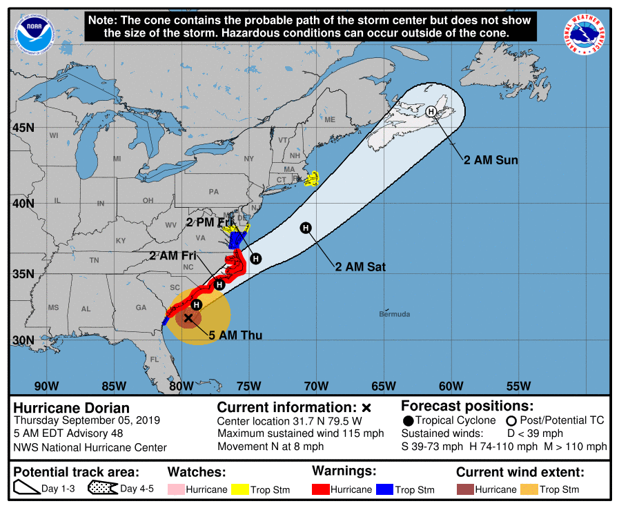 The storm track is more or less locked in at this point for Dorian. There may be some subtle deviations within 50 miles or later in the forecast, which would most definitely be a concern for Nova Scotia as the storm track is very close to the Halifax metropolitan area. I've mentioned here the thoughts that southeastern Massachusetts could see tropical storm conditions, and the National Hurricane Center made that idea official overnight by issuing a Tropical Storm Watch for Cape Cod, Martha's Vineyard, Nantucket, Buzzards Bay and area islands. 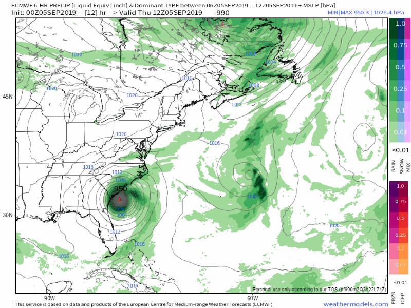 The storm will slowly work through the Carolinas Thursday and Friday. It appears to latch onto the cold front that passes through New England on Wednesday and ride along it as it heads to Atlantic Canada. The storm track also coincides with the warm gulf stream waters, which may help to keep the storm at hurricane level as it heads for Nova Scotia. 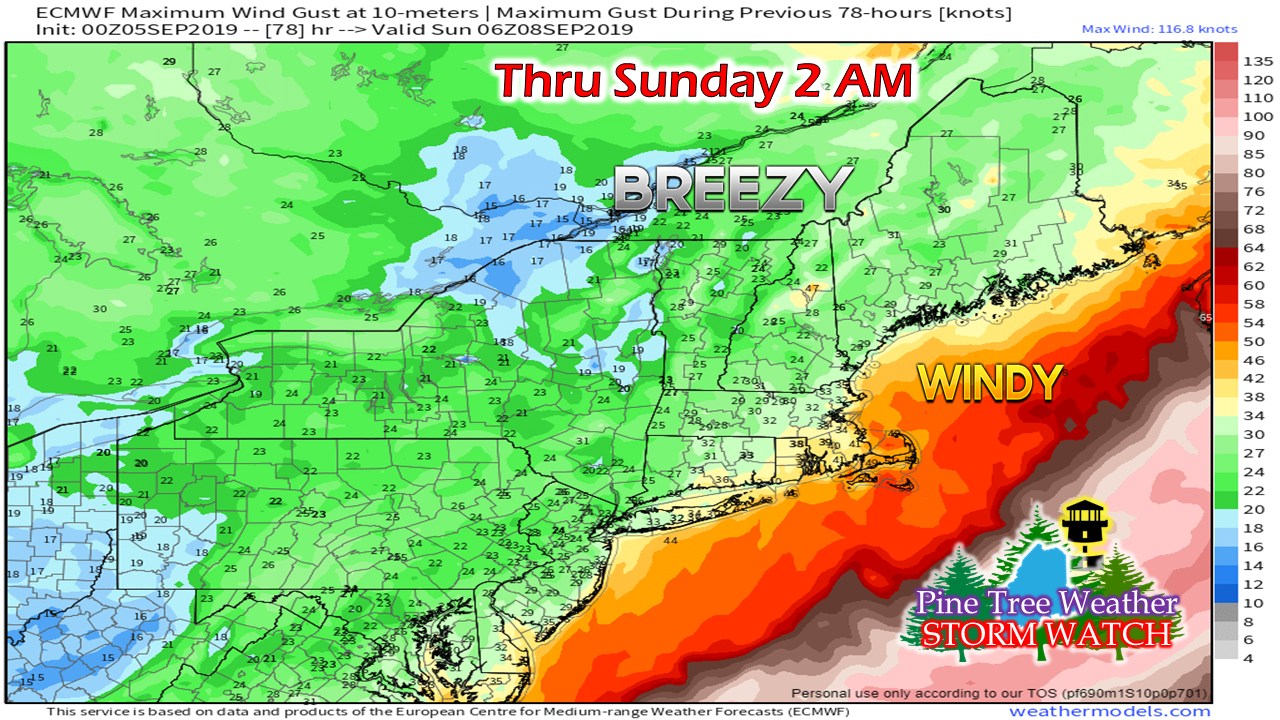 The track of this storm runs similarly to that of Hurricane Earl back in 2010. The storm brought tropical storm force winds to Cape Cod and Islands, dumped 6" of rain on Edgartown, and over 4" of rain to Machias. 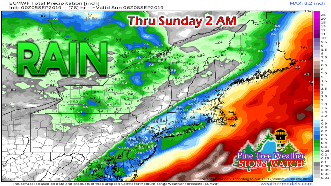 That is pretty much the scenario that is going on here. The heaviest rain will be for southeast Massachusetts and Washington County, Maine. Accumulations of 2-5" of rain is safe bet at this point. Wind speeds of 40-60 mph for Cape Cod, and 25-50 mph for Machias/Eastport/Lubec area certainly appear possible. 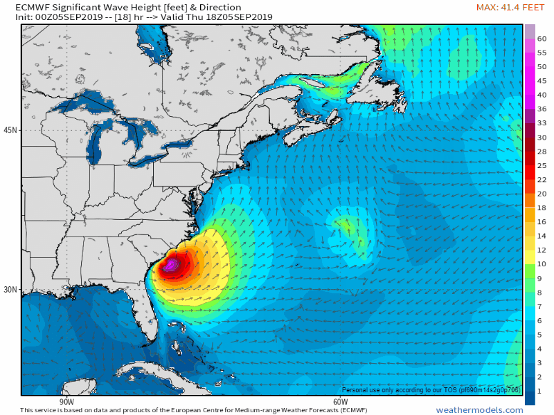 The ocean is going to be boiling. A Tropical Storm Warning has been issued for the Gulf of Maine. A gale watch is likely to come for the waters near land. Waves of 9-14' are possible for areas between Eastport and Schoodic Point. For the southwest coast, seas of 8-11' are predicted on Saturday. For those who head to the coast to watch the wave action, remember to watch from a safe distance as heights can be unpredictable. Please respect the power of the ocean. Donations needed to keep Pine Tree Weather going Many thanks to all of those who supported Pine Tree Weather in 2019, either through monthly donations through Patreon or sending checks to me in the mail. I have $3000 a year in operating costs to maintain the website and data subscriptions to keep everything going. I am looking for your help keep this going. I have paid out over $10,000 of my own money in the past, and I refuse to put another cent into this. I do this for you. If you see the value in what I do, I will ask you kindly to support it financially. I know some of you can't due to tight incomes, and I understand that. All I ask in that case is for you share my efforts with others on occasion, and tell your friends and family about what I do here.
You can make out a check to me, Mike Haggett, and mail it to 6 Lexington Drive, Kennebunk, ME 04043, or you can donate a few dollars every month on Patreon by using the link. Thank you for your support! ► ► For the latest official forecasts, bulletins and advisories, please check in with the National Weather Service in Gray for western and southern areas, or Caribou for northern and eastern parts of Maine. Please consider supporting Pine Tree Weather ► ► Your financial donations are much appreciated to keep this site funded and for further development. FUNDRAISING FOR 2020 PLEASE SUPPORT! I sincerely appreciate your support not only financially, but also in sharing my efforts with others. For more information from me, please check the Pine Tree Weather Facebook page as well as my Twitter feed. Always stay weather aware! - Mike |

Mike Haggett
|


