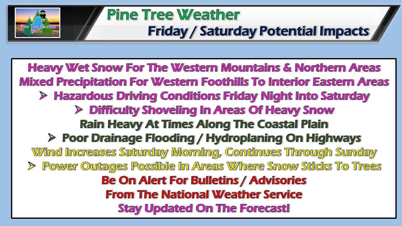
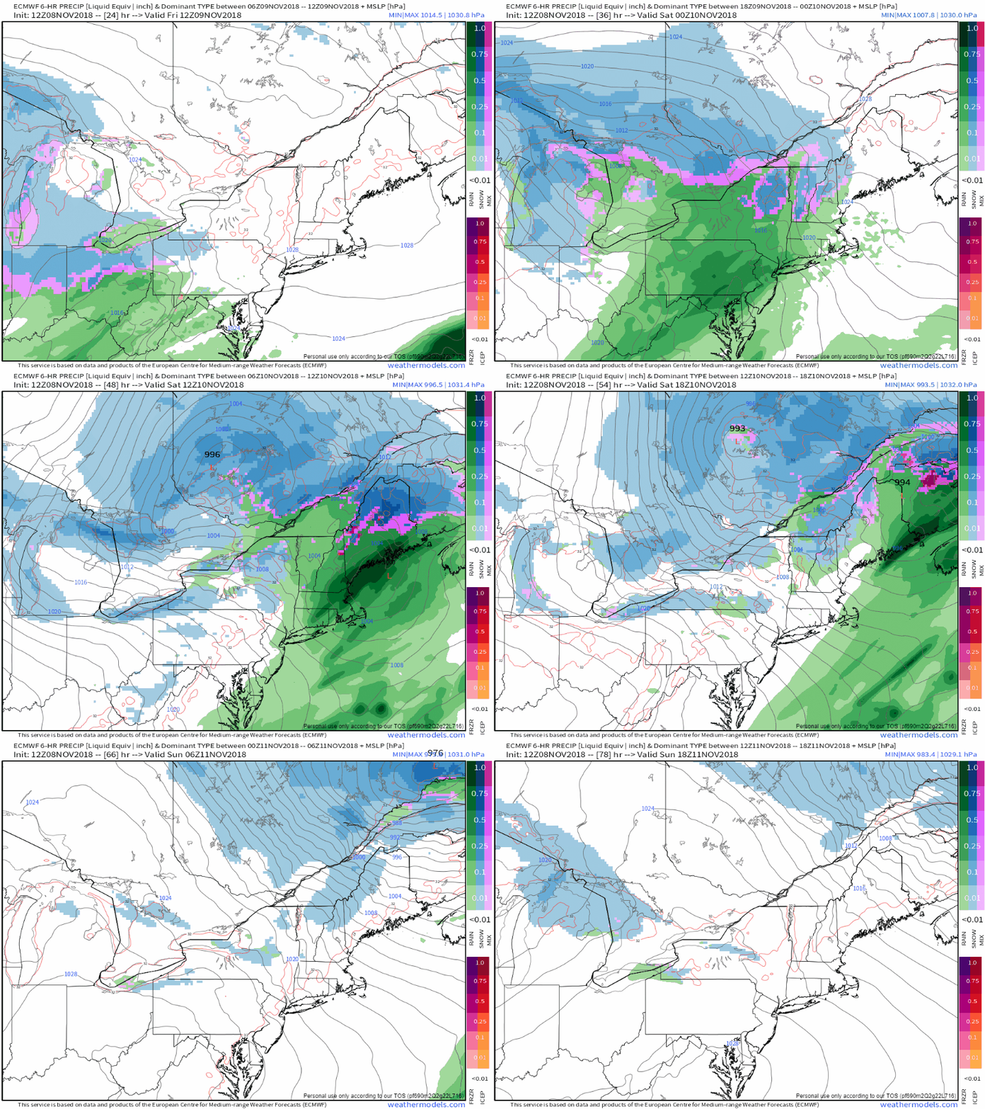
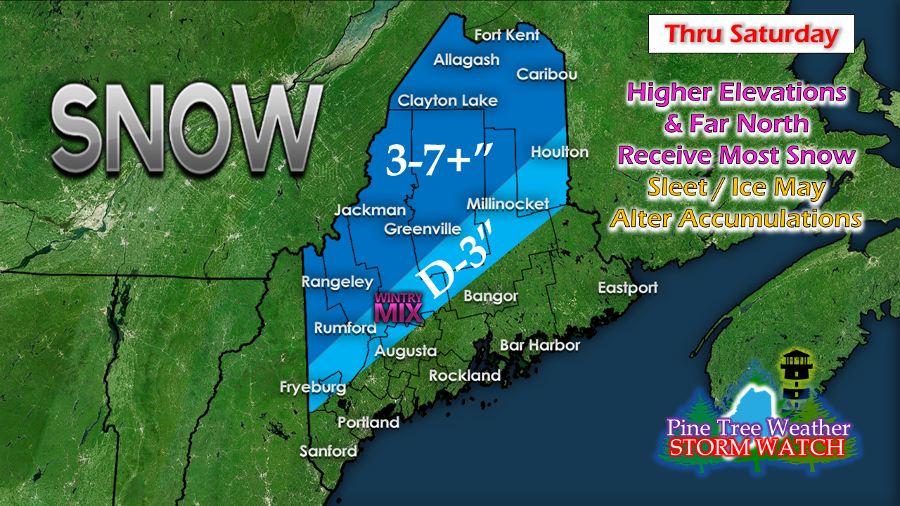
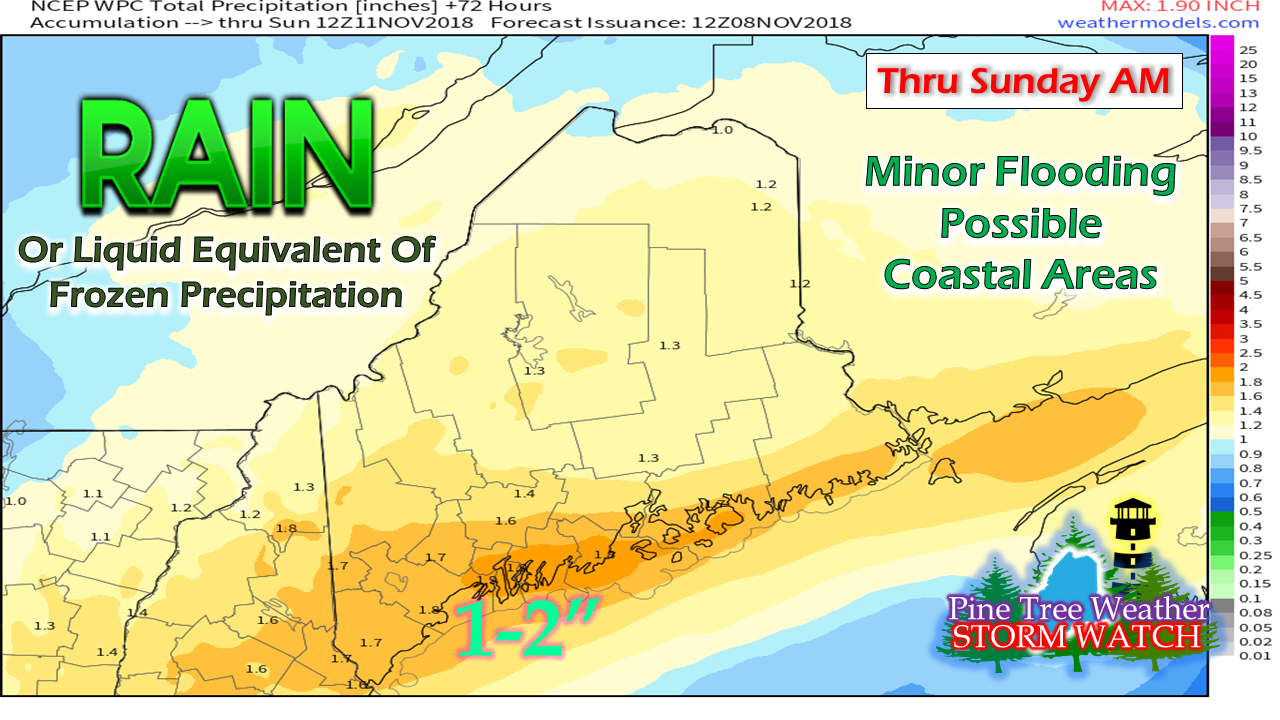
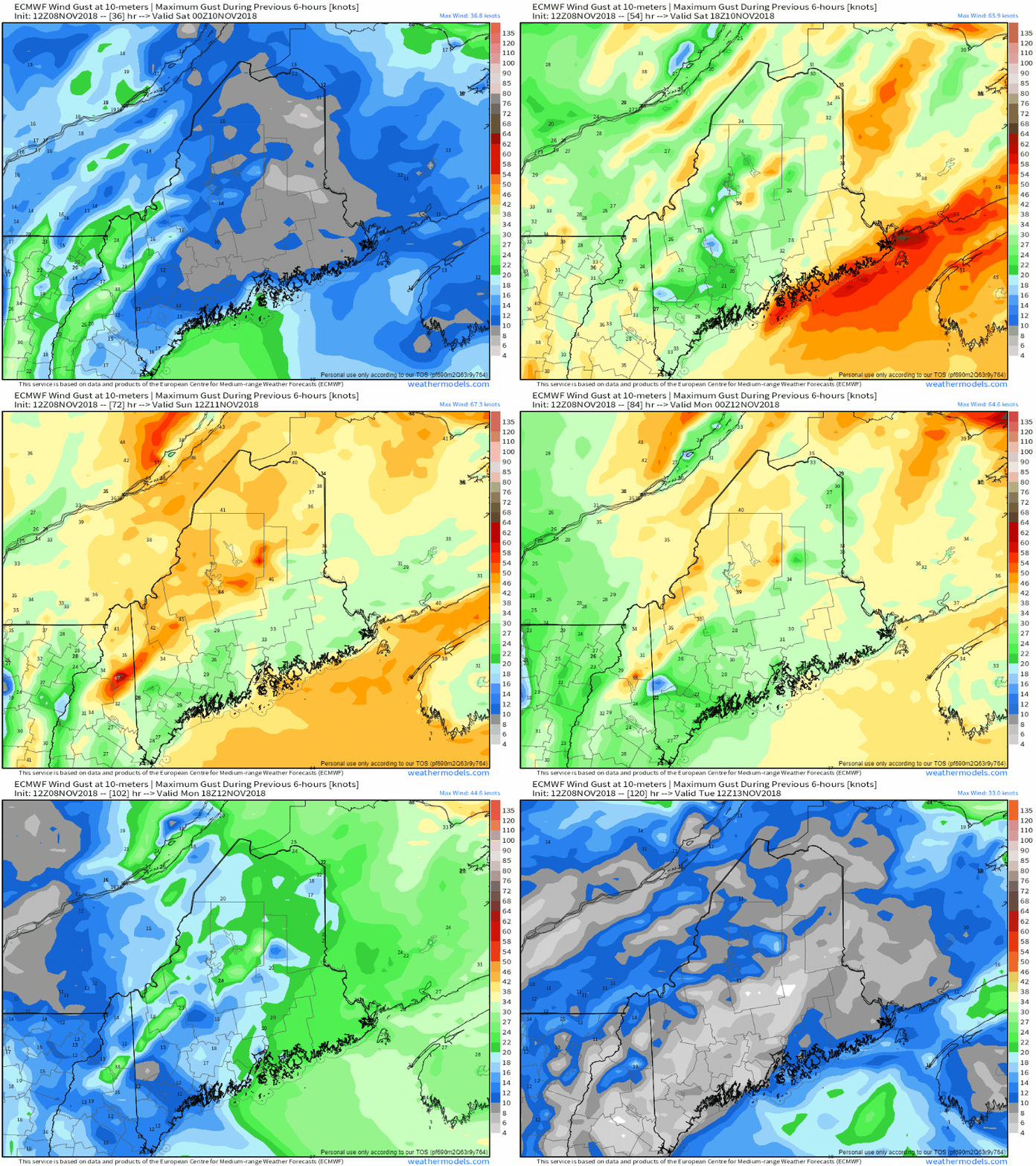
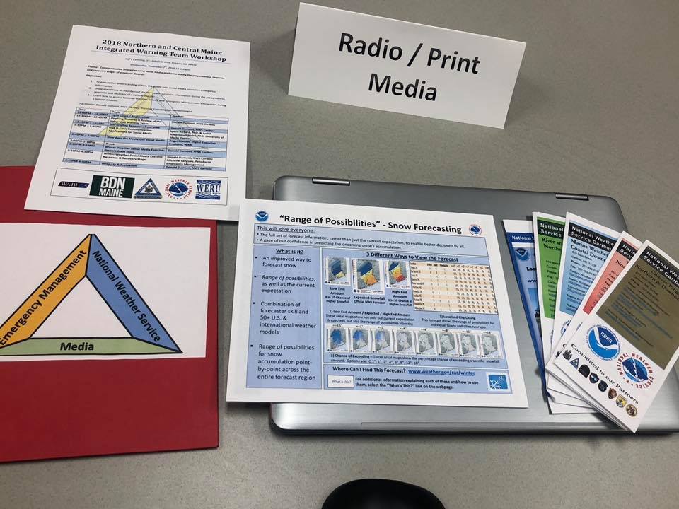
Winter Arrives For The North CountyIt's going to be a mess precipitation wise across the state. Where there isn't snow or mixed precipitation, there will be rain. In the aftermath comes gusty wind that could create problems in the form of power outages in areas in its wake. Timing of the stormFar western and southern areas will get in on the elements late afternoon / early evening on Friday. Precipitation overspreads the state from southwest to northeast, reaching the far north roughly around midnight. Precipitation ends from the same direction Saturday morning into Saturday evening. The western mountains are likely to see snow shower activity last into Sunday morning. As I stated in my previous update, this is a fast mover, thankfully. It has plenty of moisture, so in whatever form the precipitation falls, it will bring a good amount with it. As energy from the Great Lakes low transfers to the coastal low, the wind will pick up as the storm rapidly intensifies on its way in the Gulf of St. Lawrence by Sunday. Snow accumulations a bit trickyAny time we have these mixed bag events comes the threat for sleet and/or freezing rain to fool model output on snow. Add to that, this likely to be a sloppy, high water content snow, so that could knock totals down also. The fine folks at the National Weather Service in Caribou have winter storm watches posted for northern Somerset and the Clayton Lake / Allagash / Fort Kent regions for potential of 7" or more of snow. It will be that area that will see the least amount of liquid precipitation, outside of a trace of ice at the end. Further to the southwest, Rangeley / Jackman / Greenville may see a switch to rain in the valleys. For the higher elevations, expect to be on the high end for projected snow amounts. Then there is the rainThe National Weather Service in Gray has posted an areal flood watch for York County. Pending on guidance and how this unfolds, more areas may be added, or advisories and warnings may be issued as needed. Wind gusts in the aftermathWhile the coastal low forms Friday night into Saturday, the coastal areas are likely to deal with some rather stiff wind gusts, enough so gale watches are posted for the entire coast, and will likely go to warnings. As the storm intensifies as it departs Saturday, wind over the interior parts of the state will pick up and be gusty from the northwest, and last through most of the day Sunday. Pending on elevation and snow cover on trees will dictate potential for power loss in areas of the interior. Integrated Warning Team Workshop A SuccessMy travel day on Wednesday was a valid one. Thanks to the great folks at the National Weather Service, I was invited to be a part of their integrated warning team workshop in Bangor. Folks from northern and eastern Maine involved with emergency management, public health, transportation and media were asked to participate. The seminar was educational and informative, focusing on delivering a consistent message during storm events, and impacts associated with them.  It was great to meet up with a couple of friends from the TV side of the mission. Ryan Breton of NewsCenter Maine has been a good friend for a number of years. Long timers of my meteorological musings will remember his fill-in for me with Western Maine Weather while he was in college at PennState a few years ago. Jenny Brown from WABI-TV arrived in Bangor back in the spring after graduating from Embry-Riddle University in Florida. It's great to connect with these folks and others, to discuss forecasting, communication, struggles and celebrations, along with a few laughs. I would like to thank Donny Dumont and Priscilla Farrar from the Caribou office for a great event. I am already looking forward to attending next year. Pine Tree Weather is proud to be a Weather Ready Nation Ambassador that serves the state of Maine. Stay updated!For the latest official forecasts, bulletins and advisories, please check in with the National Weather Service in Gray for western and southern areas, or Caribou for northern and eastern parts of Maine.
For more information from me, please follow the Pine Tree Weather Facebook page and my Twitter feed. Please consider making a donation to keep Pine Tree Weather going through the year ahead. My data cost expense is increasing. The operation is 70% funded and needs your help to get through the winter. You can set up a monthly pledge on my Patreon page or send me a message from the Facebook page or direct message on Twitter to get my address to mail a check or set up bill pay. Always stay weather aware, and thank you for your support! - Mike |
Mike Haggett
|

