Drier air and cooler temperatures bring relief from the heat on Thursday, chance for showers Friday6/9/2021 Low temperatures dip into the 40s and 50s Thursday morning, windy to start with humidity falling throughout the day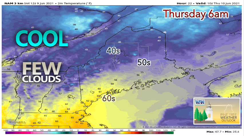 As cool, dry air is filtered into our region, many will be waking up to some refreshing temperatures Thursday morning. The western mountains and northern regions could see lows fall into the upper 40s, while much of the interior appears to drop to the 50s. This should be a pleasant change to those who did not enjoy the warm, sticky nights we have had for the past couple of days. Due to the dry air mass approaching the state, skies appear mostly clear with few clouds. Southwestern areas may see some increased cloud cover near sunrise Thursday. 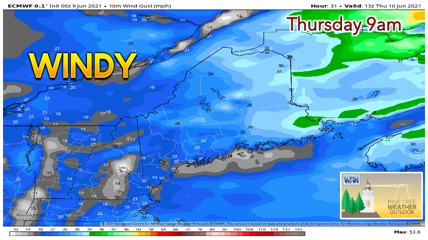 Expect some gusty winds Thursday morning as an upper-level shortwave passes to our northeast, interacting with the high-pressure system currently in place. The model above predicts gusts upwards of 30 mph in the eastern portion of the state, with 20-25 mph gusts possible elsewhere. Winds should gradually decrease throughout the day thanks to atmospheric mixing and the shortwave passing by us. 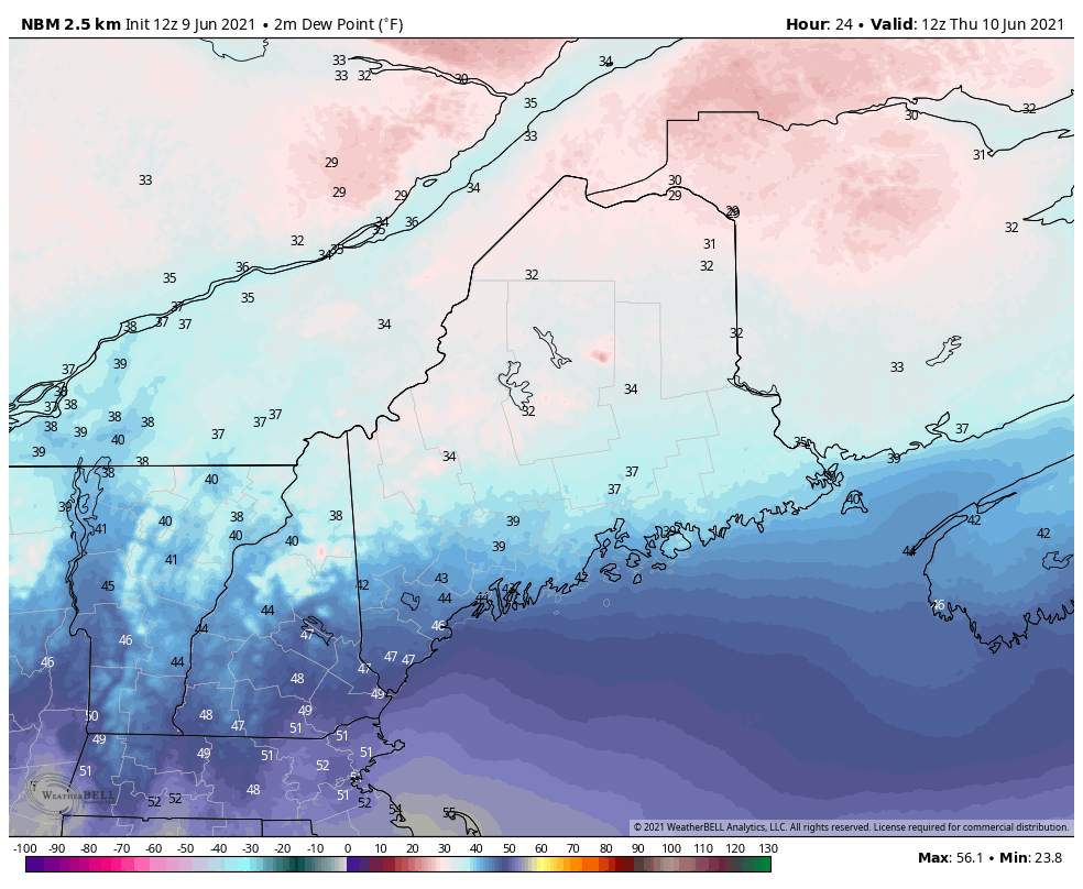 Thanks to a continental polar (cool and dry) air mass settling over the area, dew points are expected to be significantly lower on Thursday compared to earlier this week. In terms of human comfort, this will allow for conditions to improve considerably. Thursday is looking like a very pleasant day as dew points are projected to be in the 30s and 40s. Southwestern Maine will likely reach the 70s for a high, with temperatures likely reaching the 60s elsewhere. High pressure is expected to build throughout the day, resulting in partly sunny to mostly sunny skies with no rain expected. Intermittent showers possible Friday through Monday, but rainfall deficit persists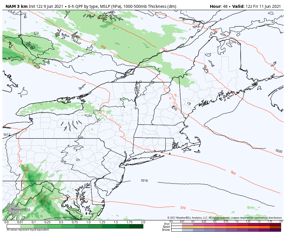 The next chance for precipitation comes on Friday as an upper-level trough approaches from our west. Showers are possible throughout the day, although heavy rainfall amounts do not appear favorable. There is some uncertainty in the exact track of the low, which will ultimately determine which areas of Maine receive precipitation. Check back for updates in Thursday's evening discussion and the Friday morning Facebook post as forecast confidence improves. 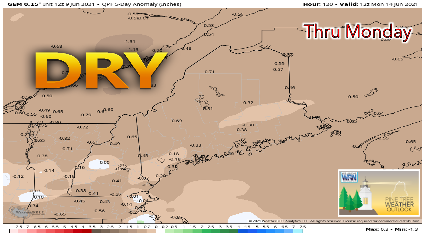 The potential for showers and thunderstorms remains through Monday morning has several shortwave troughs are projected to track towards our region. As it currently stands, any precipitation that comes with these systems does not appear to offer much relief from the prolonged dry spell. This model predicts that conditions will be drier-than-average through 8am Monday. However, a chance for more significant rainfall comes Monday afternoon, so stay tuned in for updates throughout the rest of the week! Temperature outlook through TuesdayAfter a cold front passes through on Wednesday, more seasonable temperatures arrive on Thursday and appear to last for the rest of the week. 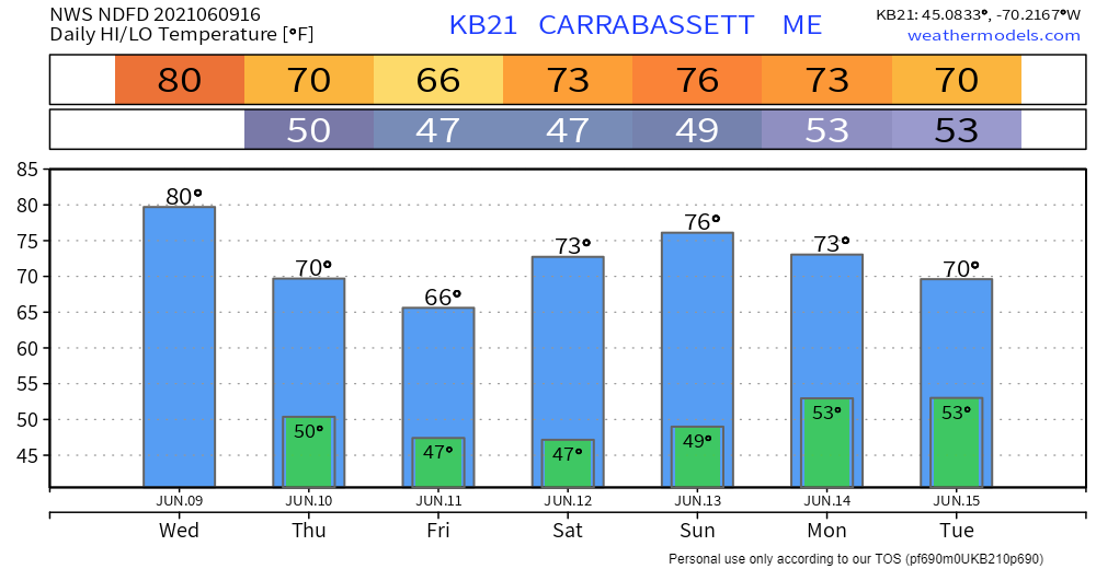 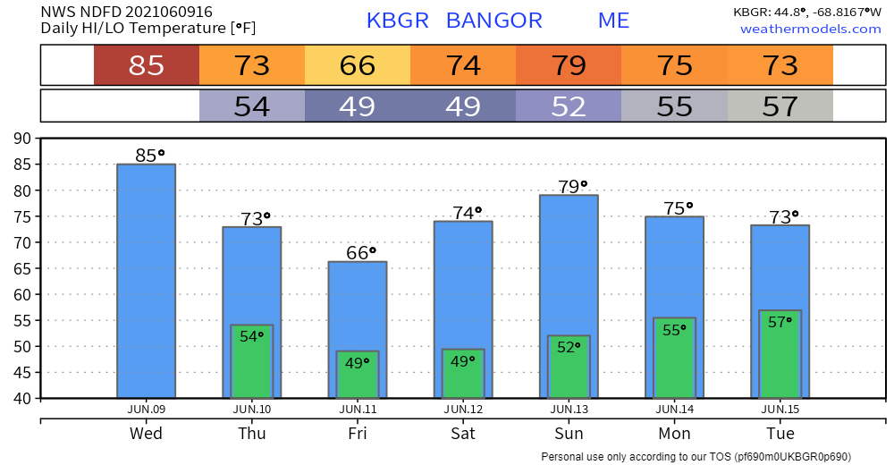 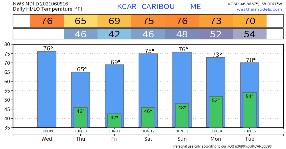 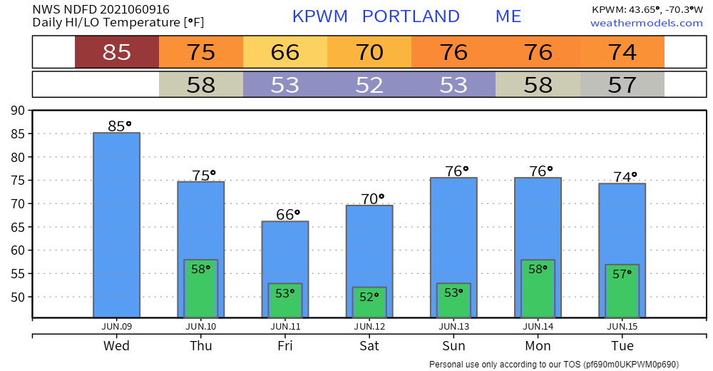 Cold Water and Life Jackets Most of the lakes and oceans in Maine are below 60F, which is a dangerous temperature for swimming. Even strong swimmers can lose muscle control in cold water, which may cause them to drown. The only difference between life and death in cold water may be your life jacket. Always wear one! weather.gov/safety/coldwater Be prepared to receive alerts and stay updated!
For more information in between posts, please follow Pine Tree Weather on Facebook and Twitter.
Thank you for supporting this community-based weather information source which operates by reader supported financial contributions. Stay updated, stay on alert, and stay safe! |

Mike Haggett
|