High pressure begins to dominate the region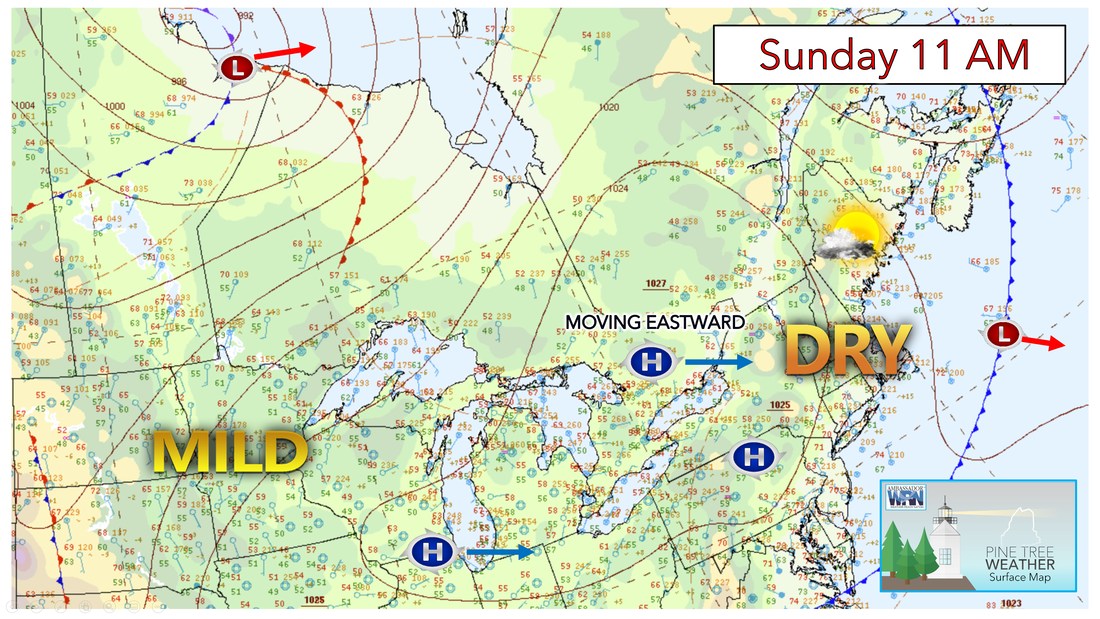 Surface high pressure rolls overhead tonight and into Monday with continued fair weather in place. Sunday night will likely be the coolest night in the forecast as well as the coolest night we’ve had in a couple of weeks. Overall, expect clear skies and a light wind. With clear skies and light winds, there should be strong radiational cooling overnight. Expect low temperatures to drop into the low-40s across the upper Androscoggin, Kennebec, and Mt. Katahdin on Northward. In the southern urban zones, temperatures will drop into the mid-50s. Patchy fog will once again develop in the typically cooler areas towards the west. 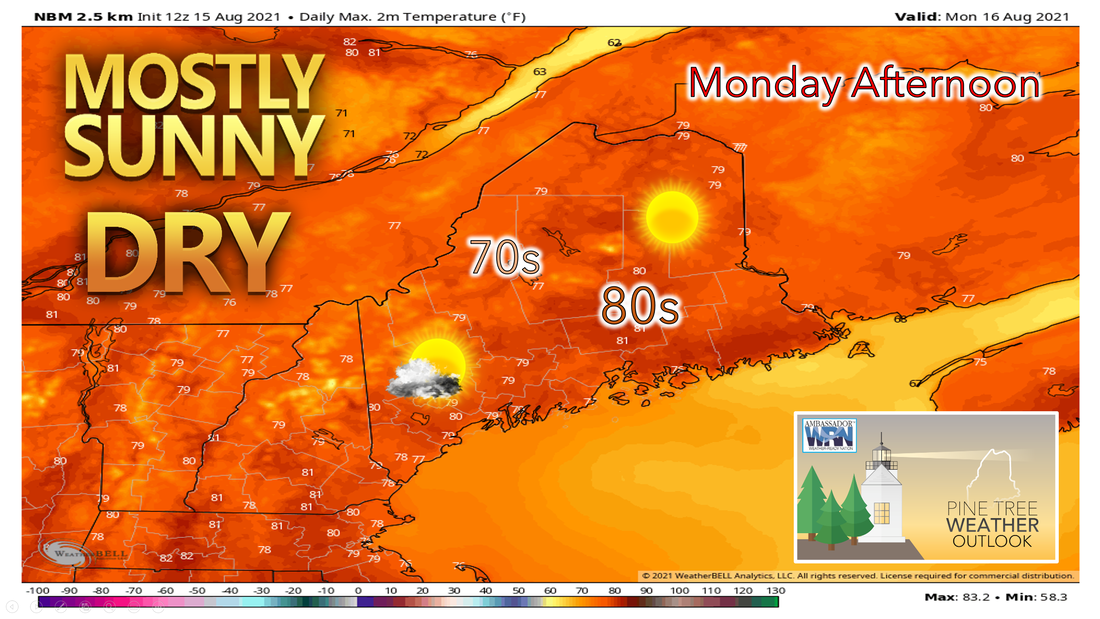 Monday looks to be a comfortable day with plenty of sunshine and low relative humidity values. High pressure will continue to sit overhead, but it begins to drift slightly out to sea. Overall, we can expect abundant sunshine with comfortable and seasonable temperatures. A few high clouds may work their way into the southern portion of the state during Monday evening. Temperatures are likely to top out in the upper 70s and possibly even the lower 80s in the south and east although a sea breeze is likely to keep the coast a bit on the cooler side. Towards the west and north, temperatures should remain in the low to mid-70s. The sea breeze will be enhanced by onshore flow as high-pressure crosses into the waters, which will knock back high temperatures early along the coast. The high will slide off the coast later Monday night. Clear skies remain in place heading into the day on Tuesday with overnight lows dropping into the 50s in most locations. Humidity slowly returns by the end of the week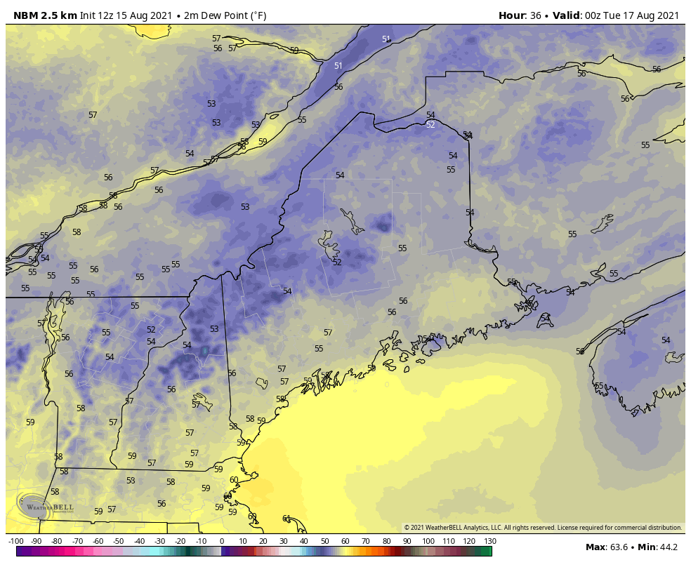 High pressure gradually shifts offshore providing for a mostly dry and sunny day once again for Tuesday. Return flow around the high will bring higher dew point values into the region along with increasing clouds across the south. Highs will be in the low 80s with onshore flow bringing cooler conditions along the coast. A sea breeze is likely to set up once again keeping coastal temperatures slightly below 80°F. Clouds look to increase from the SSW Tuesday night as guidance starts to show a trend of moisture from the tropical system moving into our area. The clouds will keep overnight temperatures from dropping too low. Low temperatures will be in the upper 50s across the Allagash and North Woods with lower 60s elsewhere. Dew points begin to creep up into the 70s by Wednesday bringing a return to the muggy air. Showers move in on Wednesday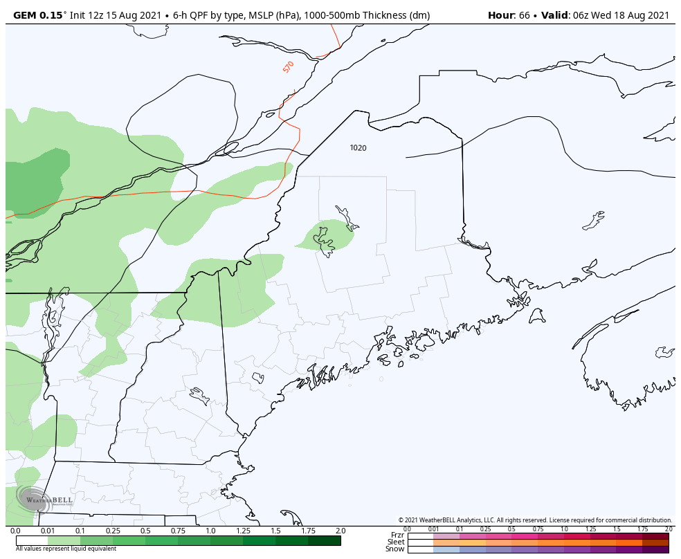 High pressure continues to slide offshore Wednesday as a weak wave approaches the St Lawrence Valley. Wednesday looks to feature more clouds than sun with dewpoints approaching 70°F and high temperatures will be in the upper 70s to low 80s. Some afternoon showers and possibly a thunderstorm will be possible Wednesday afternoon with the best chances across New Hampshire and the western Maine mountains. Temperatures will feel hot as increasing moisture will lead to some muggy conditions. By Thursday another mid-level wave/closed low will be progressing through the eastern Great Lakes. This feature along with ample moisture will bring better chances for showers and thunderstorms.  End of the week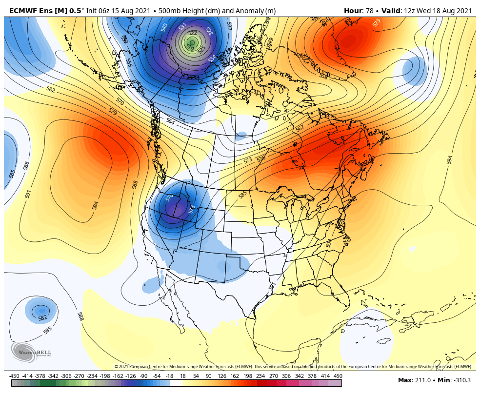 After a quiet and comfortable start to the week showers, heat, and humidity will make their return into the area by Wednesday. Models suggest some moisture from the remnants of Fred from the tropics may reach our latitude towards the end of the week. Heat and humidity will persist going into the weekend. mPING Check out mPING (Meteorological Phenomena Identification Near the Ground) project. Weird name, cool app! You can report the type of precipitation you see where you are. No need to measure! Use the free mobile app to send reports anonymously. Reports are automatically recorded into a database, which improves weather computer models. The information is even used by road maintenance operations and the aviation industry to diagnose areas of icing. mping.nssl.noaa.gov Temperature outlookThe plots below show the trend of the high and low temperatures for Carrabassett, Bangor, Caribou, and Portland over the next week and a half. Relief in temperatures remains Monday before temperatures begin to rise again beginning on Tuesday with the heat sticking around through the end of the week. Humidity increases each day as well. 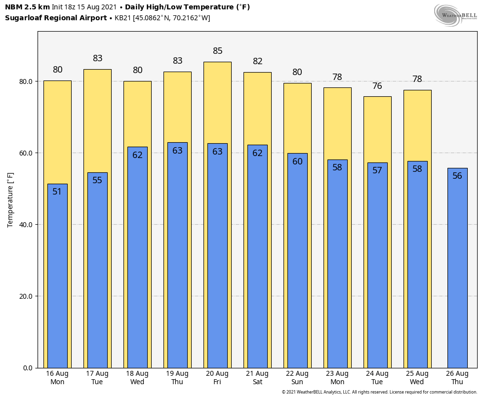 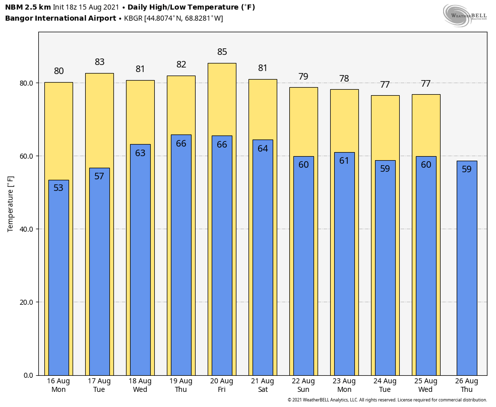  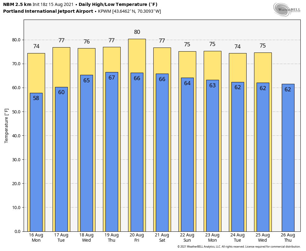 Be prepared to receive alerts and stay updated!
For more information in between posts, please follow Pine Tree Weather on Facebook and Twitter.
Thank you for supporting this community-based weather information source which operates by reader supported financial contributions. Stay updated, stay on alert, and stay safe! |

Mike Haggett
|