Dry and seasonably cool day expected Wednesday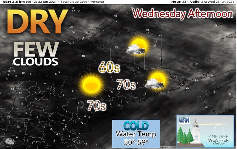 Through the remainder of Tuesday night, we should see any remaining shower and thunderstorm activity across East Central and Downeast Maine exit to the northeast towards Nova Scotia. This will occur as a result of a cold front passing offshore Tuesday night into Wednesday morning. Behind the cold front, skies should become mostly sunny with a cool day on tap for Wednesday. High temperatures will be in the lower 70's for SW Maine with 60's expected elsewhere like in the mountains and along the immediate shorelines. There will also be a noticeable drop in the dewpoints with dewpoints mainly in the 40's making the air feel comfortable as opposed to the muggy conditions we have seen the past several days. High pressure will move just south of the area Wednesday night setting the stage for a clear night with light winds. As a result, some patchy fog may form by early Thursday, especially near the coast and in the river valleys. Low temperatures are expected to drop into the 40's across the interior with 50's expected for the shoreline locations Wednesday night. Sunny and seasonable weather expected Thursday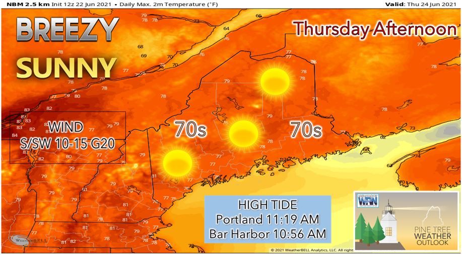 On Thursday, expect another sunny and comfortable day across Maine as an area of high pressure settles over Nova Scotia. We will likely see a southwesterly flow with winds of 10-15 mph and gusts to 20 mph possible. High temperatures should be a few degrees warmer statewide on Thursday with mid to upper 70's expected for the interior locations and upper 60's to lower 70's expected for the mountains and coastal locations. Thursday night expect another clear night with light winds across the region. Low temperatures should drop into the 50's statewide. Warmer with precipitation chances into the weekend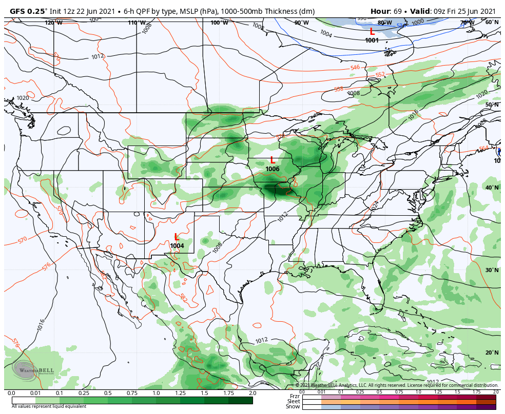 An area of high pressure off to our east should keep us in a warm southwesterly flow heading into the weekend. This southwesterly flow should funnel increasingly more humid air into our area heading into the weekend. Friday should be mostly sunny with temperatures in the 70's and 80's expected statewide. Saturday night we watch the approach our next front from the west which could touch off some showers and thunderstorms. Sunday we may see more showers and thunderstorms as the front is likely to be slow to push through the region. Heading into early next week, it looks like we stay in a dry weather pattern with above average temperatures expected as a possible omega block sets up over the Atlantic keeping the ridge parked over the Northeast US. Temperature outlook through late JuneBelow are temperature plots that show the projected high/low temperatures for each day over the next week for Carrabassett, Bangor, Caribou, and Portland. If you are a fan of summer weather, you will enjoy the weather this upcoming week! After a cool Wednesday for many locations across the state, temperatures will begin to trend upward as we head into the weekend and early next week with above average temperatures expected. We will also likely be below average in terms of precipitation as a ridge of high pressure settles over the Northeast US including Maine in the longer range. 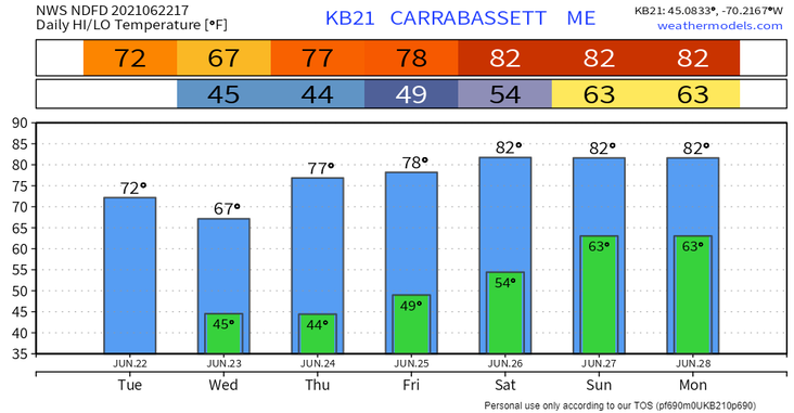 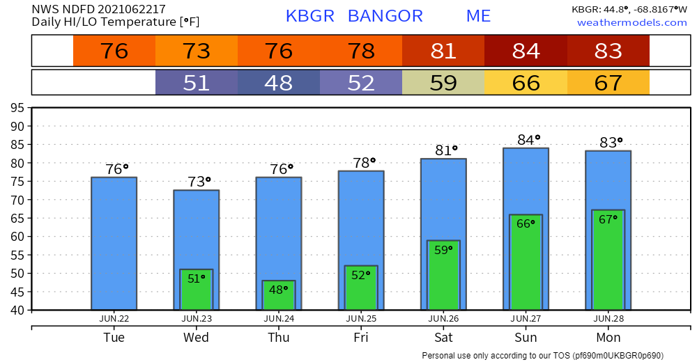 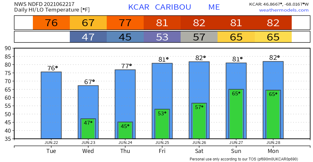 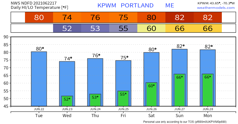 Lightning Safety Awareness Week for Maine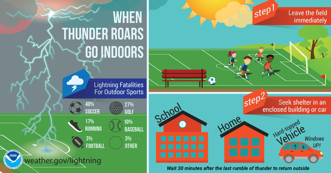 This week is Lightning Safety Awareness Week for Maine! Here are some tips regarding how to stay safe from lightning: 1. No place outside is safe when thunderstorms are in your area! If you hear thunder, lightning is close enough to strike you! 2. When you hear thunder, immediately move inside a safe shelter which includes a substantial building with electricity or plumbing or an enclosed metal topped vehicle with the windows up. 3. Stay in shelter for 30 minutes after you hear the last rumble of thunder! Almost 100% of lightning fatalities occur outside so remember when "thunder roars, head indoors!"
For more information in between posts, please follow Pine Tree Weather on Facebook and Twitter.
Thank you for supporting this community-based weather information source which operates by reader supported financial contributions. Stay updated, stay on alert, and stay safe! |

Mike Haggett
|