
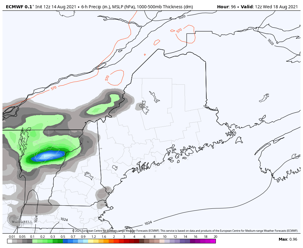
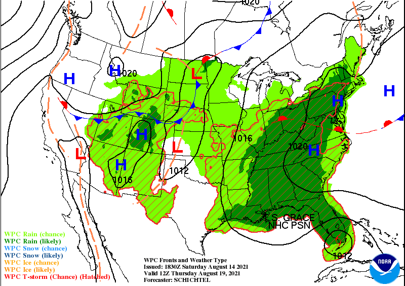
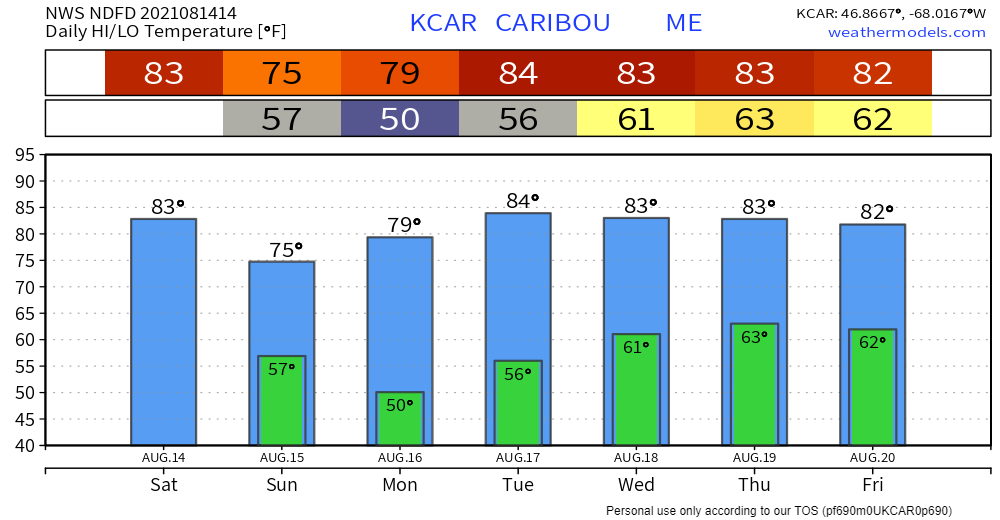
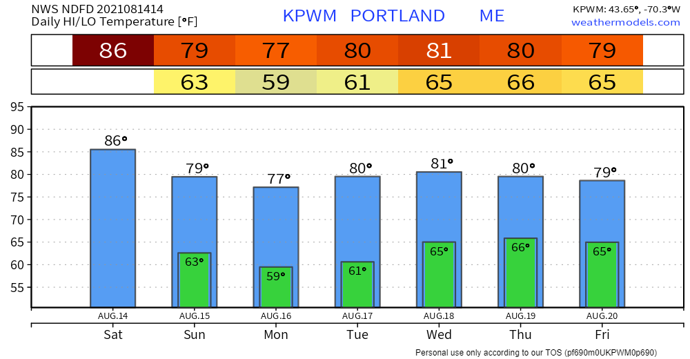
High pressure enters the region on Sunday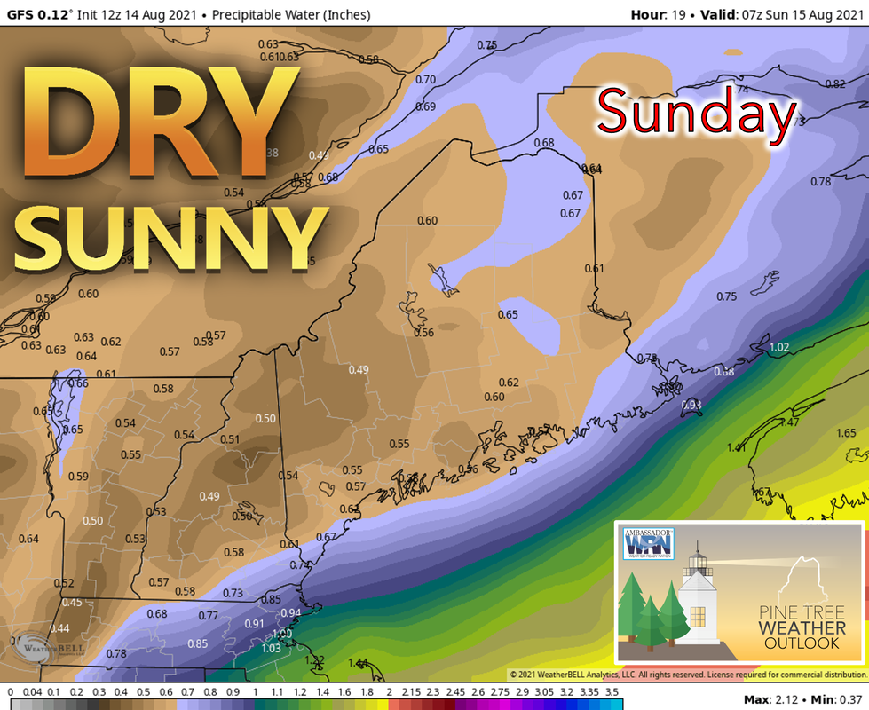 On Sunday, high pressure approaching from the west moves into Maine beginning a dry trend that is likely to last into the middle of next week. As the high brings cooler, drier air down from Canada, the humidity that has been lingering the past several days will also be leaving the region making for more comfortable conditions. Temperatures on Sunday are likely to be on the warmer side farther south and east, reaching the mid and upper 70’s, while areas towards the north and west stay in the upper 60’s and lower 70’s. The offshore flow should limit the strength of the sea breeze and allow the coast to stay in the 70's. Skies should otherwise be sunny with a few clouds possible over the mountains later in the day. There also exists a chance for some fog overnight. Another dry and clear day to start the week off on Monday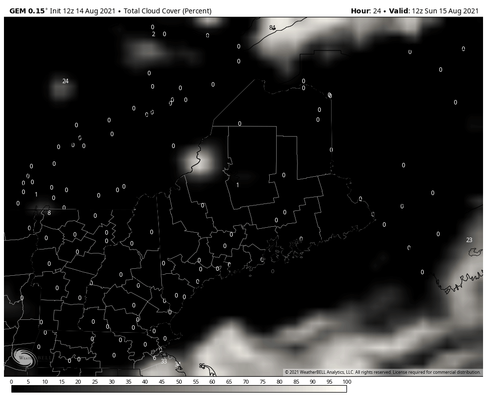 High pressure will continue to stick around on Monday allowing for another dry day. Humidity will also still be quite low. Skies should also remain sunny although a few clouds may work into the area during the late evening. Areas of fog may also develop. Temperatures are likely to reach the upper 70’s and possibly even the lower 80’s in the south and east although a sea breeze is likely to keep the coast a bit on the cooler side. Towards the west and north, temperatures should remain in the low to mid 70’s. The heat makes a return on Tuesday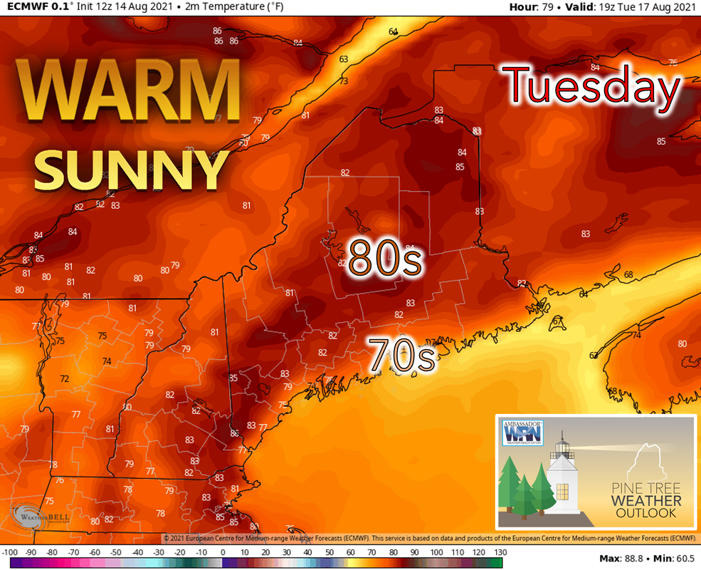 As the area of high pressure moves east on Tuesday, the wind direction will shift towards the southwest allowing warmer air to be transported into the region. Temperatures are likely to reach the 80’s across most of the state with some places east of the mountains reaching the upper 80’s. However, a sea breeze is likely to keep coastal temperatures below 80. An end to the dry trend on Wednesday as showers move in |

| | BE PREPARED WITH A NOAA Weather Radio. For $20-$40, it could provide vital information to you when you need it. The weather bands are standard on most public safety scanners, and newer scanner models. Weather radios can be programmed for auto alert. Click here for more information. |
| ► ► For the latest official forecasts, bulletins, and advisories, please check in with the National Weather Service in Gray for western and southern areas, or Caribou for northern and eastern parts of Maine. | |
 | Thank you for your support! Check on Facebook tomorrow for a morning update from Angelina! -Sean Find me on Twitter. |

Mike Haggett
Kennebunk, ME
Weather-Ready Nation
Ambassador
Certified Weather
Forecaster
Penn State '21
American Meteorological Society
National Weather Association
SKYWARN-CWOP
Matthew 19:26
Please
Support
Pine Tree Weather
In 2024


Archives
July 2024
June 2024
May 2024
April 2024
March 2024
February 2024
January 2024
December 2023
November 2023
October 2023
September 2023
August 2023
July 2023
June 2023
May 2023
April 2023
March 2023
February 2023
January 2023
December 2022
November 2022
October 2022
September 2022
August 2022
July 2022
June 2022
May 2022
April 2022
March 2022
February 2022
January 2022
December 2021
November 2021
October 2021
September 2021
August 2021
July 2021
June 2021
May 2021
April 2021
March 2021
February 2021
January 2021
December 2020
November 2020
October 2020
September 2020
August 2020
July 2020
June 2020
May 2020
April 2020
March 2020
February 2020
January 2020
December 2019
November 2019
October 2019
September 2019
August 2019
July 2019
June 2019
May 2019
April 2019
March 2019
February 2019
January 2019
December 2018
November 2018
October 2018
September 2018
August 2018
July 2018
June 2018
May 2018
April 2018
March 2018
February 2018
January 2018
December 2017
November 2017
October 2017