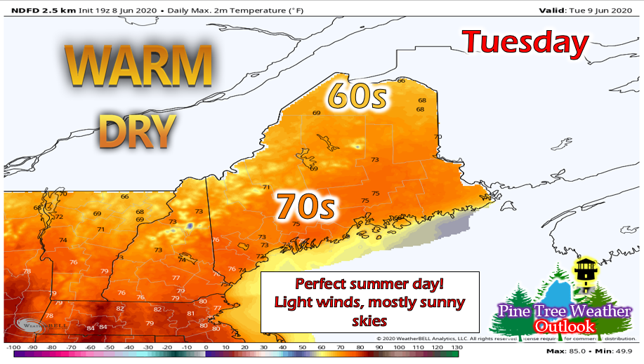
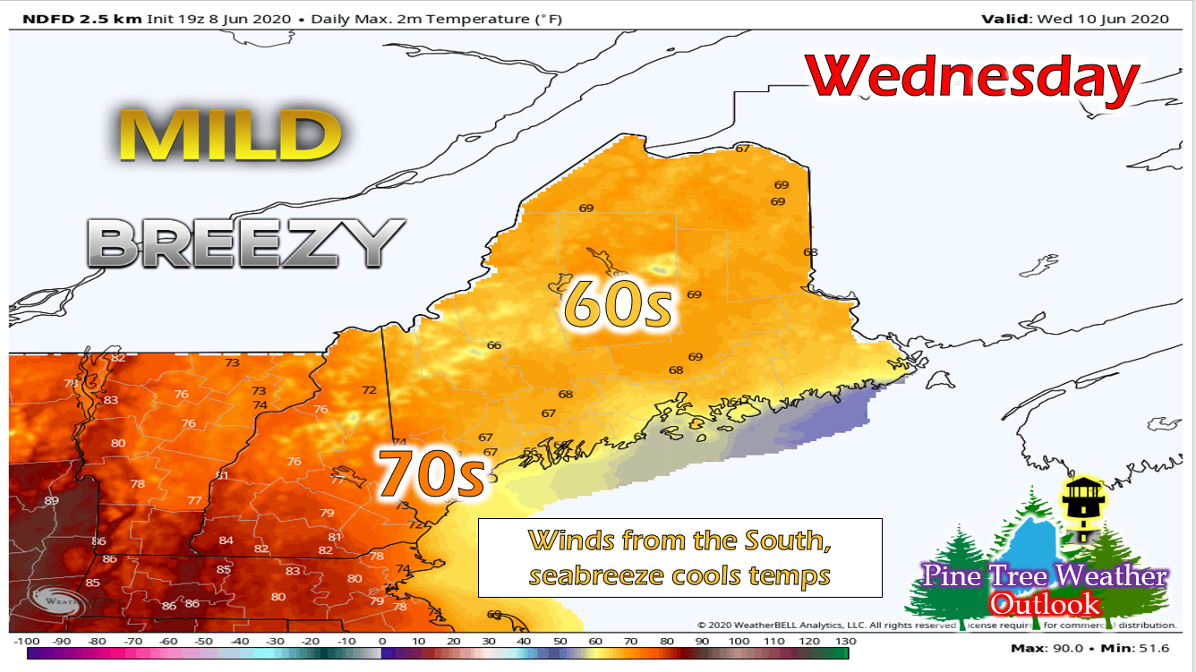
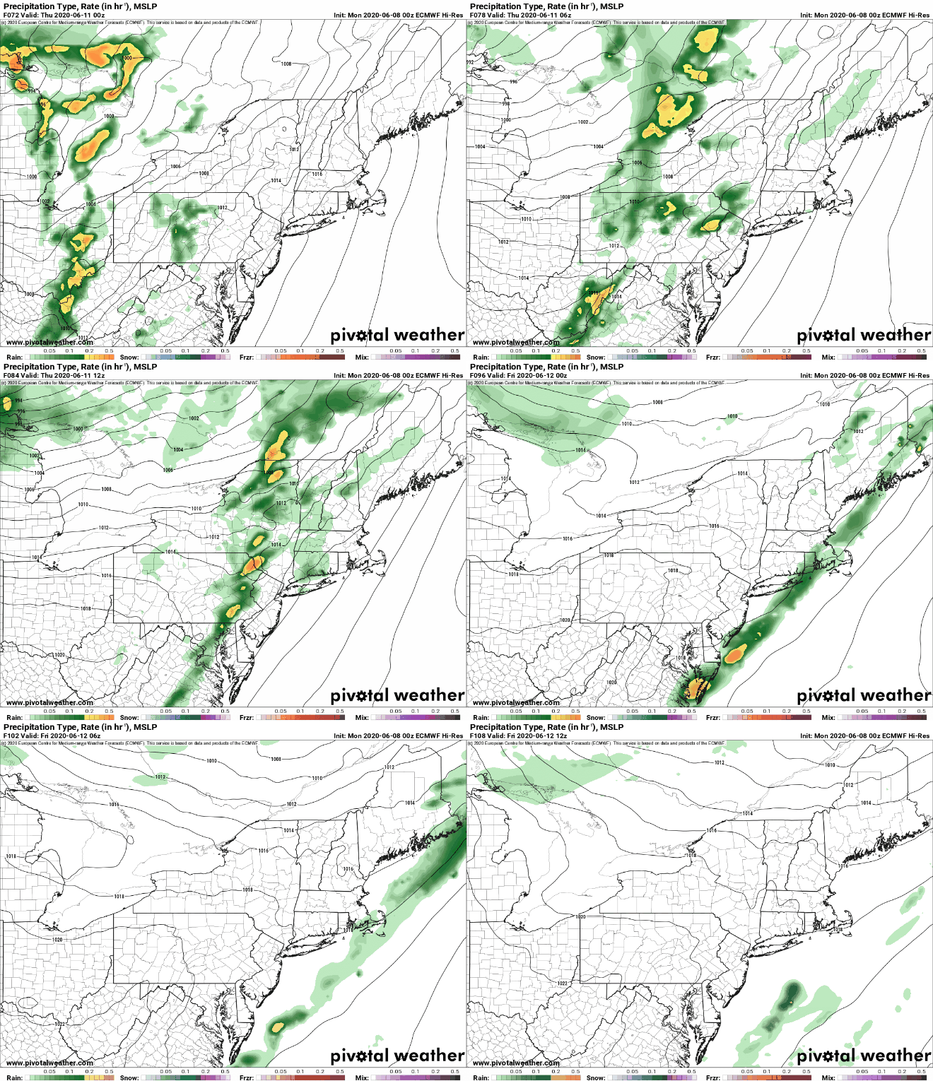
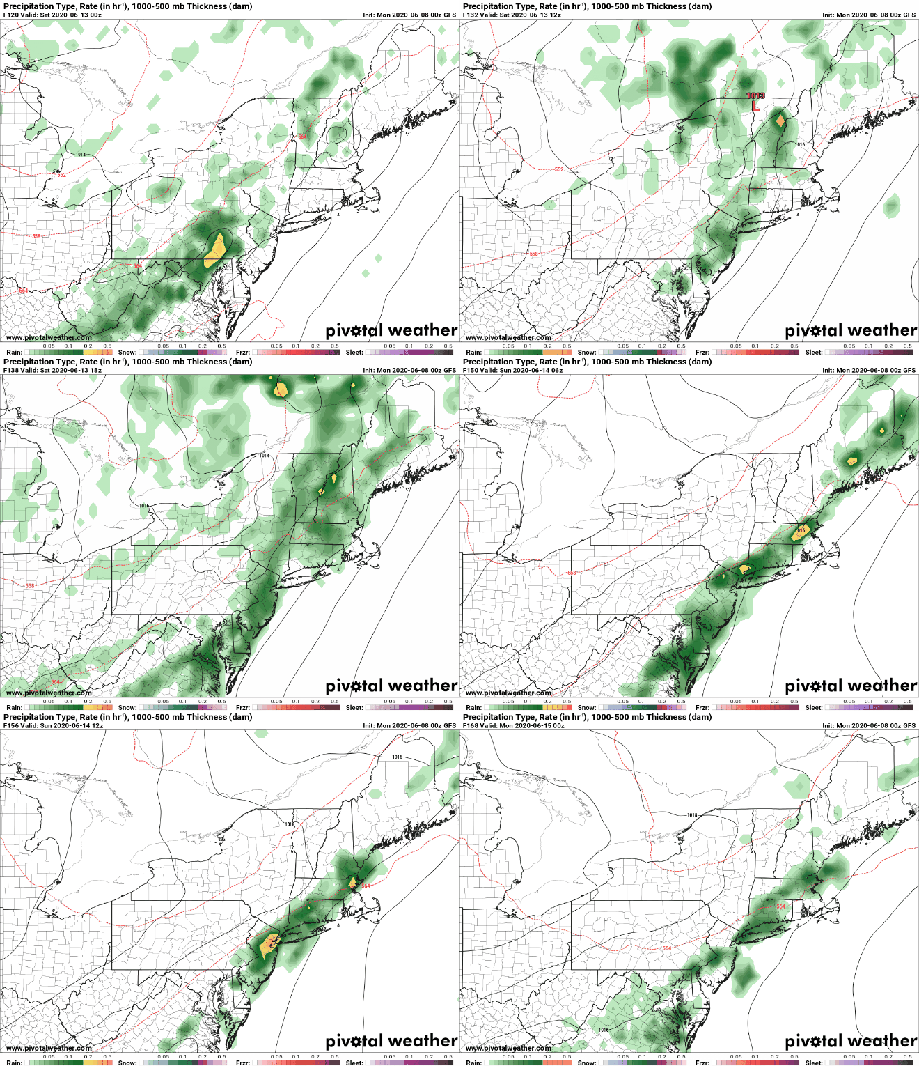
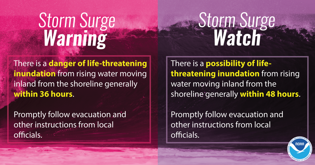
Beautiful TuesdayTuesday's looking like a beautiful one! Dewpoints will be low, winds will be light from the NW and skies will be mostly/partly sunny! Southwestern portions of the state may see more clouds than the rest of the state. Temperatures will be in the 60s and 70s and it won't be muggy, so it's the perfect day to get outside and do something fun! Overnight, most of the state will see 40s with southwestern areas only dropping into the low 50s. Wind shift brings cool downWind directions shift for Wednesday, bringing in air from the south at 10-15 mph. The ocean is only 52 degrees right now, so as winds come off the ocean, it will cause a statewide slight cool down. With the winds remaining out of the south overnight, temperatures will only drop into the 50s with some isolated low 60s in southwestern portions of the state. The initial precipitation bands from our next system begin to move in to the western and central portions of the state overnight as well. Patchy fog is also a possibility over downeast areas. Remnants of Tropical Storm Cristobal arrive for ThursdayAs the remnants of Tropical Storm Cristobal merge with an extra-tropical cyclone, it will begin to impact the region overnight on Wednesday and linger all the way into Thursday night. As the cold front passes, the threat for a few storms cannot be ruled out. Rainfall totals will be between a tenth and a quarter of an inch. Temperatures will be in the upper 60s to mid 70s throughout the day. Stationary front moves in, bringing showers for the weekendAfter the system passes, it's back to warm and partly cloudy for Friday. However, a front approaches the region and becomes stationary, bringing showers for Friday night and Saturday (and possibly into Sunday). Hurricane SafteyTropical Storm Cristobal brought storm surge, heavy rain/winds and flooding to the Gulf and southeastern U.S. Storm surge however is one of the most deadly hurricane hazards and causes the most damage to areas impacted. Even though Maine isn't as effected by this threat, if anyone visits areas impacted by tropical systems or has family members who live down in these areas, it's important to keep storm surge in mind. Not only that, but it's important to know the difference between a watch and a warning so you can properly prepare for what is coming. Stay informed!
For more information, please follow Pine Tree Weather on Facebook and Twitter.
Thank you for supporting this community based weather information source that is funded by your financial contributions. Make it a great week! - Alex |
Mike Haggett
|

