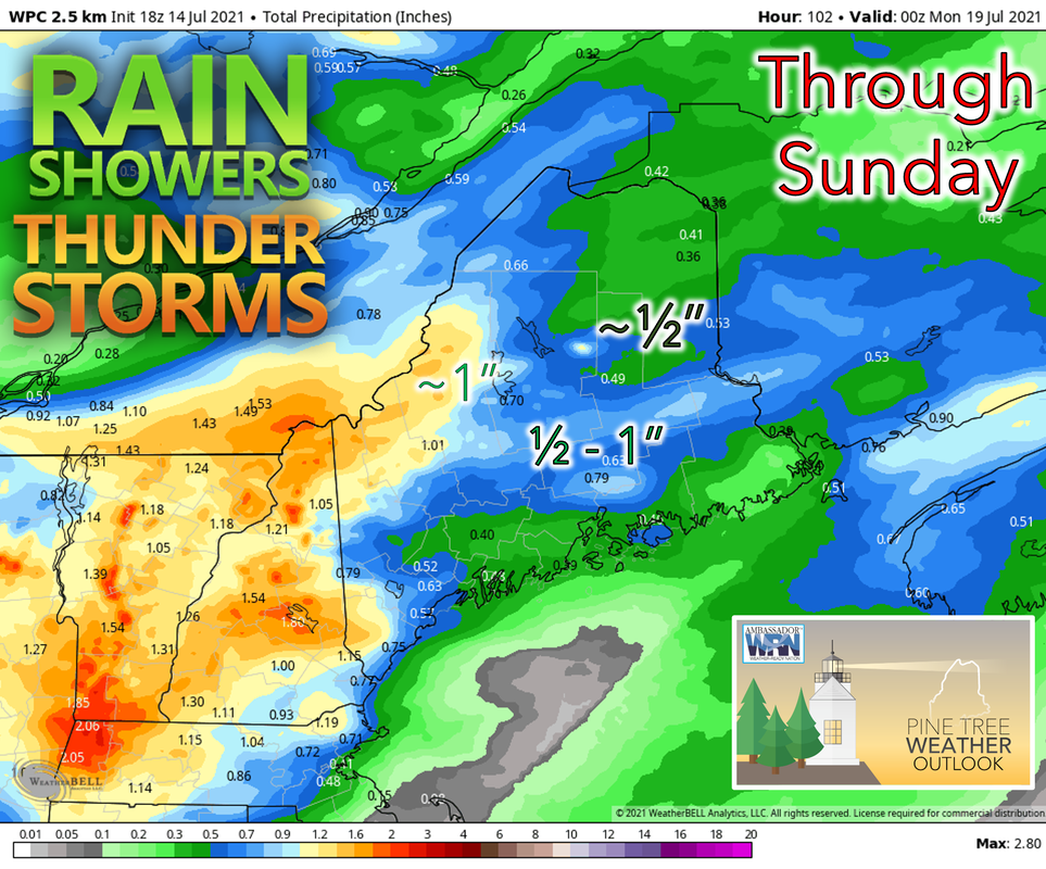
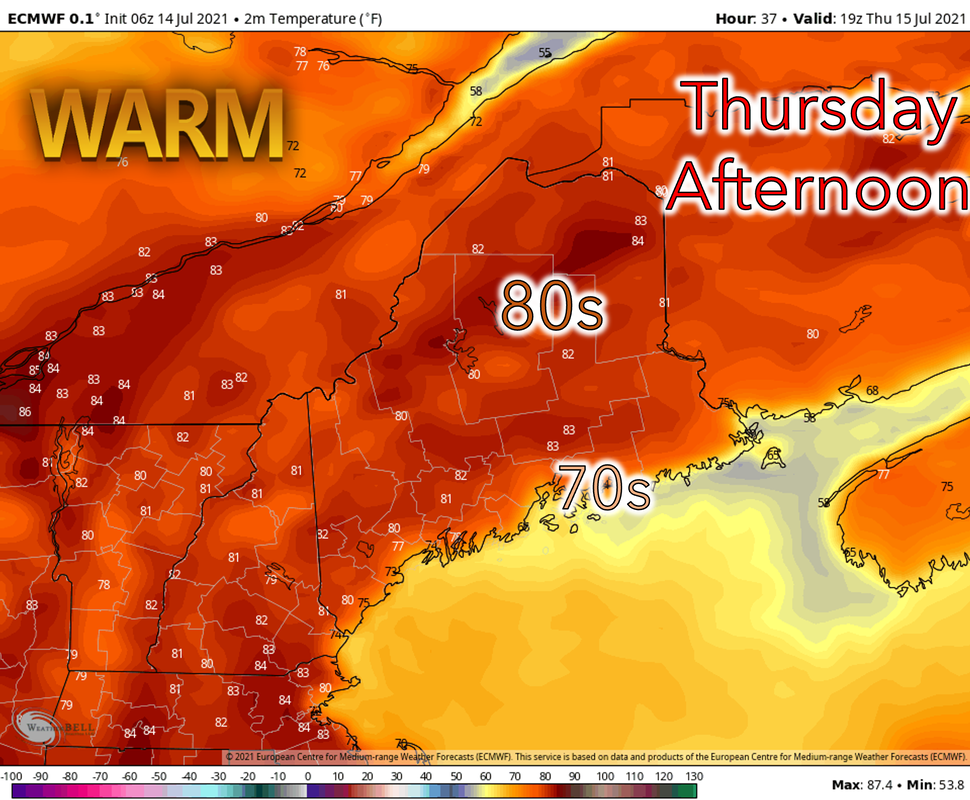
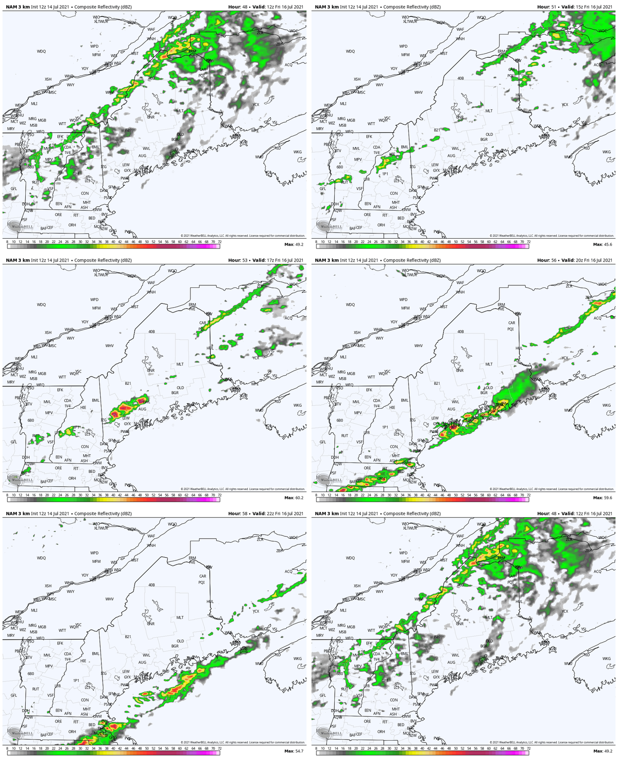
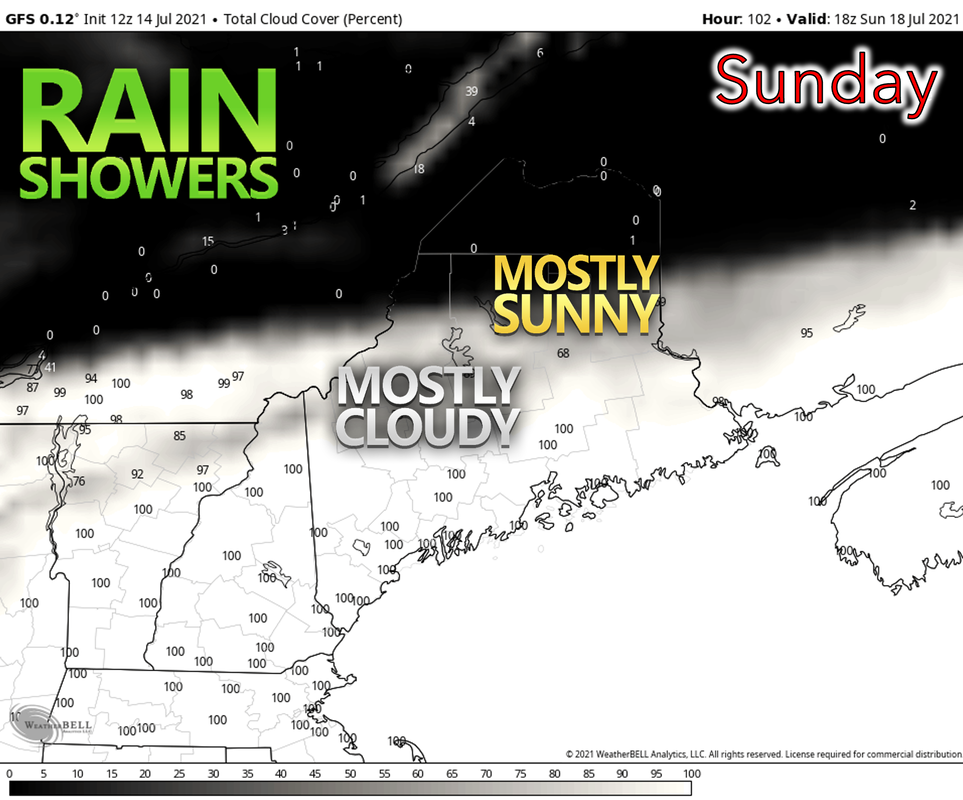
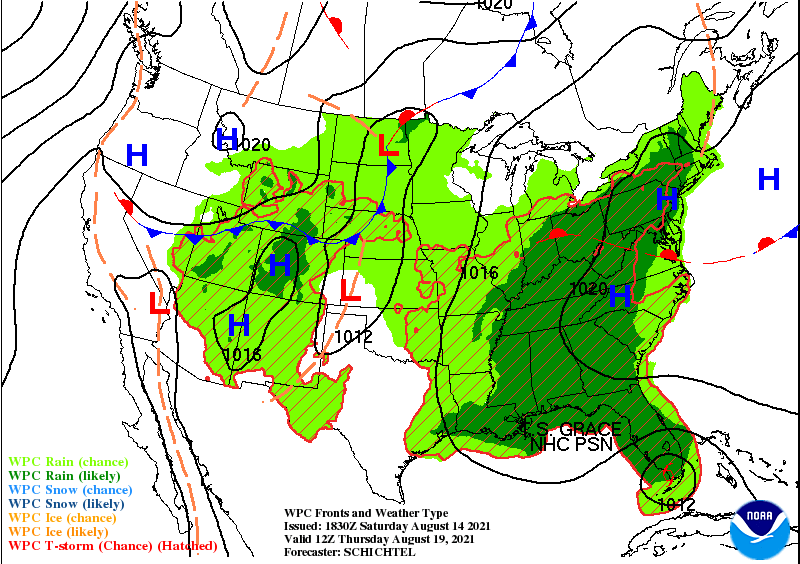
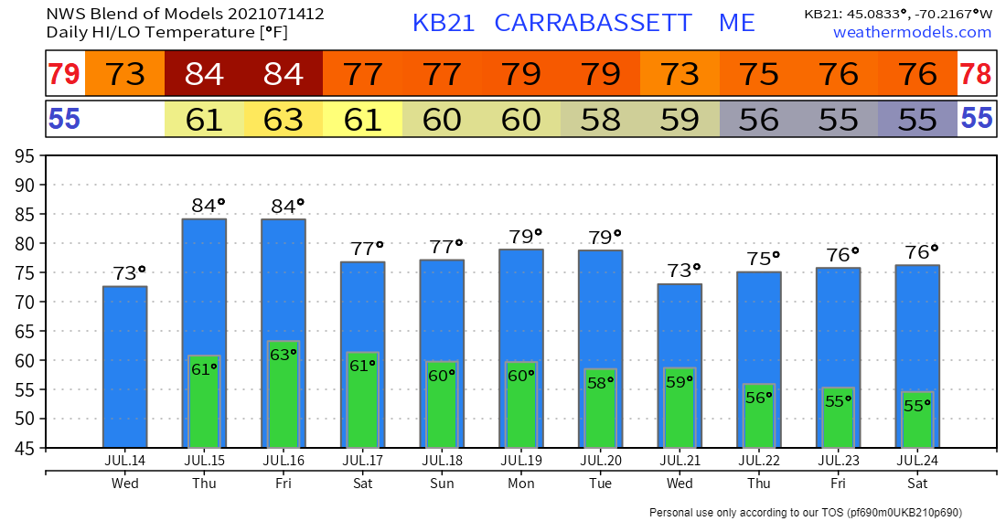
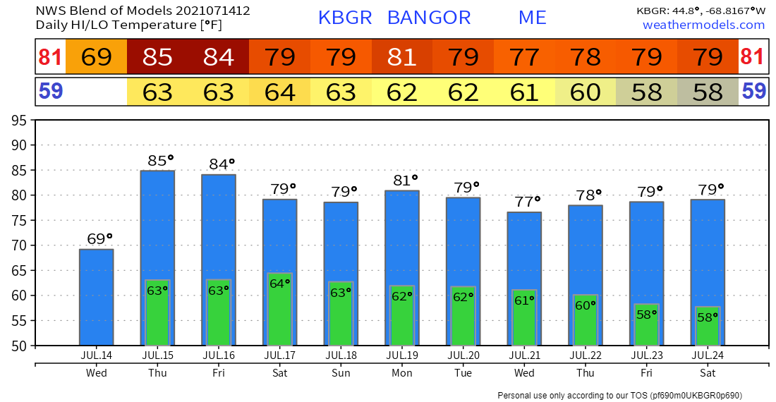
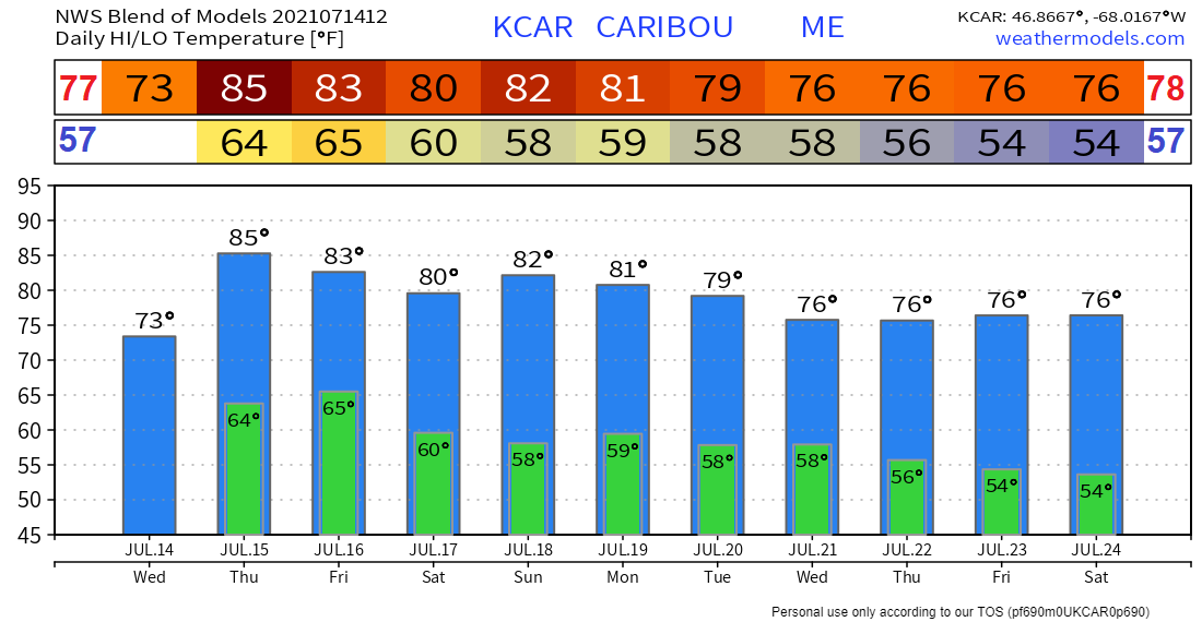
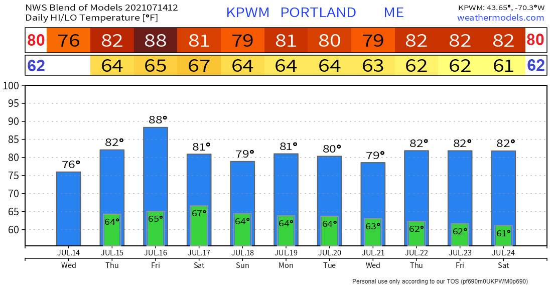
Storms ahead bring more rain to the area through SundaySome rain showers and thunderstorms are likely to impact Maine starting on Friday and continuing through the weekend. The most significant rainfall totals are likely to be in some of the hardest hit areas by recent drought conditions. A break from the storms on ThursdayThursday will bring a break from the showery and stormy weather. Along with a mix of sun and clouds, there exists only an isolated chance for a stray shower or thunderstorm across the region. Temperatures will be warm and likely to reach the lower 80’s across much of interior Maine while staying in the 70’s along the coast as a sea breeze sets up. The air may feel a bit sticky along the coast as dewpoints reach 65 and over making the air feel a bit uncomfortable. Thunderstorms return on FridayA trough ahead of a cold front will be moving through the area on Friday. Sufficient instability ahead of the trough will sustain ongoing convection as it crosses the border into western Maine Friday morning. As a result of the nearly parallel orientation of the mean wind along the trough, storms are likely to organize into lines. There is the possibility that some of the storms could become severe, especially towards the afternoon when storms are in southern and eastern Maine. Otherwise, expect a mix of sun and clouds. Temperatures should again be warm, reaching the mid and upper 80’s just inland of the coast and upper 70’s farther inland. Possibility for some more thunderstorms over the weekend |
| BE PREPARED WITH A NOAA Weather Radio. For $20-$40, it could provide vital information to you when you need it. The weather bands are standard on most public safety scanners, and newer scanner models. Weather radios can be programmed for auto alert. Click here for more information. |
| ► ► For the latest official forecasts, bulletins, and advisories, please check in with the National Weather Service in Gray for western and southern areas, or Caribou for northern and eastern parts of Maine. |
Thank you for supporting this community-based weather information source which operates by reader supported financial contributions.
Stay updated, stay on alert, and stay safe!
Mike Haggett
Kennebunk, ME
Weather-Ready Nation
Ambassador
Certified Weather
Forecaster
Penn State '21
American Meteorological Society
National Weather Association
SKYWARN-CWOP
Matthew 19:26
Please
Support
Pine Tree Weather
In 2024
Archives
July 2024
June 2024
May 2024
April 2024
March 2024
February 2024
January 2024
December 2023
November 2023
October 2023
September 2023
August 2023
July 2023
June 2023
May 2023
April 2023
March 2023
February 2023
January 2023
December 2022
November 2022
October 2022
September 2022
August 2022
July 2022
June 2022
May 2022
April 2022
March 2022
February 2022
January 2022
December 2021
November 2021
October 2021
September 2021
August 2021
July 2021
June 2021
May 2021
April 2021
March 2021
February 2021
January 2021
December 2020
November 2020
October 2020
September 2020
August 2020
July 2020
June 2020
May 2020
April 2020
March 2020
February 2020
January 2020
December 2019
November 2019
October 2019
September 2019
August 2019
July 2019
June 2019
May 2019
April 2019
March 2019
February 2019
January 2019
December 2018
November 2018
October 2018
September 2018
August 2018
July 2018
June 2018
May 2018
April 2018
March 2018
February 2018
January 2018
December 2017
November 2017
October 2017

