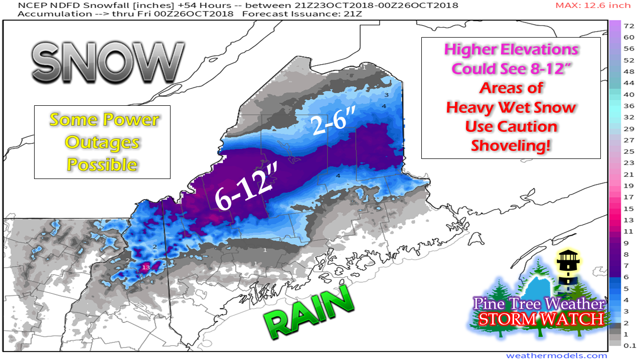
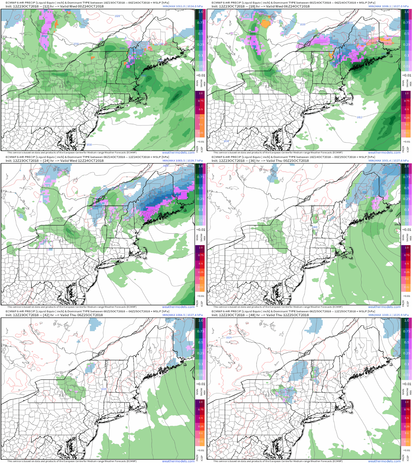
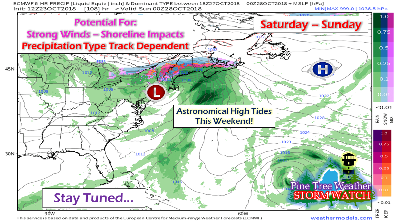
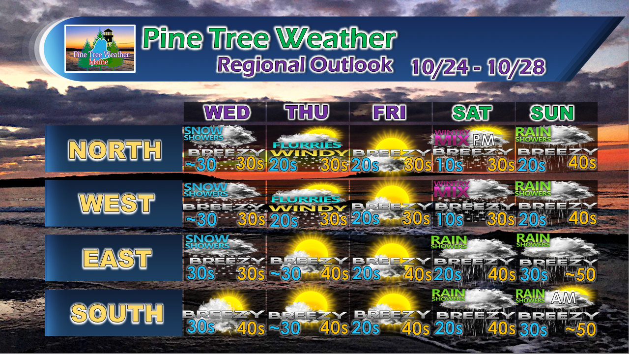
The latest snowfall ideaThis storm has been a modeling nightmare due to the origination of the source energy in Alaska. It's these clipper systems that once in awhile turn a low impact forecast into a surprise event. There is still and element of surprise with this one, especially for eastern and northern areas, so be advised of that. What changed? Storm track is further south. As a result, forecast ideas had to be adjusted. What you see here is the fine work of the Gray and Caribou National Weather Service offices. Winter Storm Warnings are posted for the north central part of the state. Roads will be a mess. Snow will vary in weight from lighter up in the north to heavier in the south. Much of the state will wake up to see some snow on the ground, even near the shorelines around the MidCoast. This short loop of the Euro model gives an idea on the time frame. Precipitation moves northward this evening. The storm intensifies and moves eastward on Wednesday. The bulk of the precipitation ends for western areas Wednesday afternoon, and eastern areas Wednesday night. In its wake, it hauls down cold air, which could bring some flurries and squalls to areas of the state Wednesday night into Thursday. Potential NorEaster for the weekendMy policy is usually one storm at a time but given the fact this could be an impactful event, I need to discuss it. I have mentioned this in my updates previously. The signals have been showing in various model ideas for roughly a week now about potential for a strong storm to develop. The one piece that is critical for this to happen is the southern energy that is crossing the eastern Pacific. It's going to be Wednesday before the picture comes into focus here. It's a bit too early to nail down timing, but early enough to consider potential impacts. Astronomical high tides won't need much assistance to cause flooding. NorEasters bring the chance for surf, beach erosion, and splash over. There is the potential for precipitation in various types, and wind is the greatest concern of all. One year ago, we dealt with a nasty gale that put half of the state in the dark and made a big mess of the coastline. Time will tell what the potential impacts will be with this one. Be prepared just in case. Outlook through the weekendPlease note that Saturday and Sunday are subject to change pending on the potential track, timing and intensity. We could be on the east side or west side of the storm, and which side changes the potential impacts and outcome. What you see is my best idea for now. This will be discussed further as we approach the weekend.
More updates to come. For the latest official forecasts, bulletins and advisories, please check in with the National Weather Service in Gray for western and southern areas, or Caribou for northern and eastern parts of Maine. For more information from me, please follow the Pine Tree Weather Facebook page and my Twitter feed. Thanks as always for your support! Please consider making a donation to keep Pine Tree Weather going through the year ahead. Check out the donate page on how to contribute. Always stay weather aware! - Mike |
Mike Haggett
|


