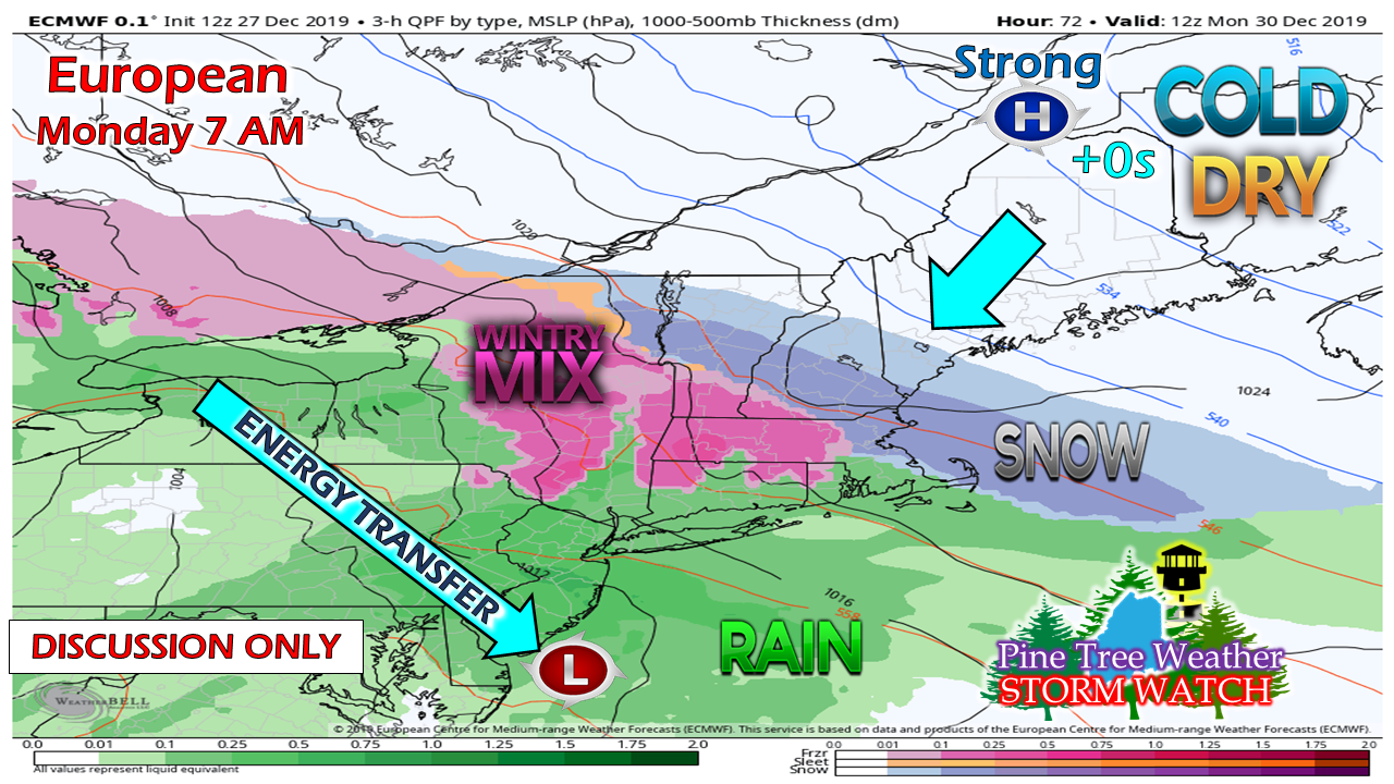
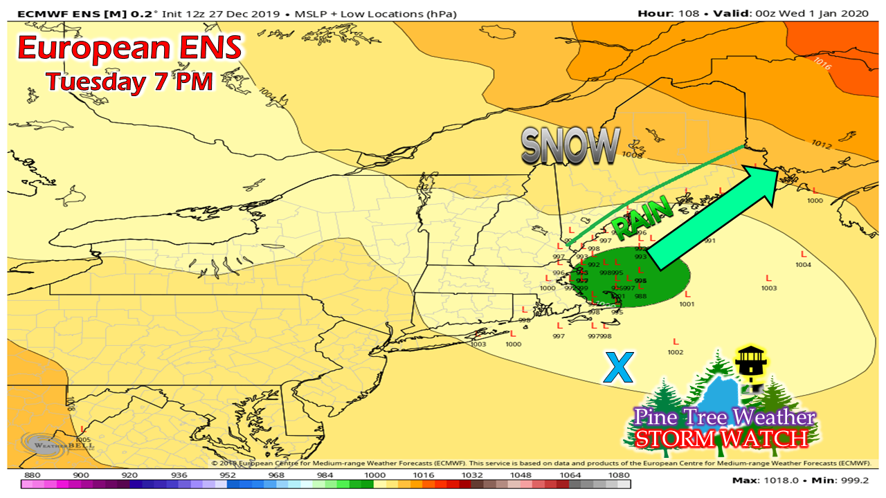
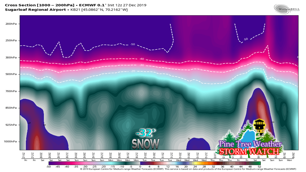
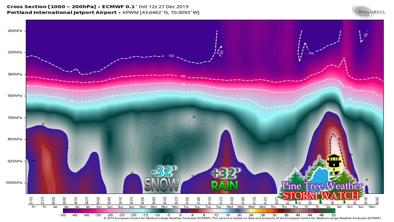
Cold will do what cold doesI mentioned here yesterday the things to consider with this storm: the cold air, the strength and position of high pressure to the north and east, and where the coastal low organizes, intensifies, and tracks. The confidence around those three pieces are increasing. In fact, Monday may not bring much in the way of snow for southern Maine, until later in the day. The wall of cold, dry air to the northeast, set up by high pressure moving into the region Saturday night into Sunday, stops the surge of warm air from the south. As I said yesterday, never underestimate the influence of cold air. Models are finally catching up to that idea. What was once a snowy Monday from Jackman / Rockland southwest, may only amount to light snow or flurries for Fryeburg / Portland south, and the best chance of accumulating snow for far southern areas of York County. Single digit cold up in Aroostook to start Monday does an excellent job suppressing the intrusion of snow to the south as it bleeds dry air at the mid and lower levels. That snow line may not move a whole lot until the coastal storm fires up and intensifies Tuesday. For coastal areas and most of New England to get an all snow event, the storm center needs to be in close proximity to the blue X on this chart, which is the benchmark 40° N -70°W location. The track brings the coastal storm into the Gulf of Maine. This sets up rain for the coast, and snow for the interior. For ski country, this is your best case scenario. If this storm was closer to benchmark, the mountains get little for snow, where the coast gets buried. Taking a look at the atmospheric temperatures from the stratosphere to the floor, this is a cold event with little threat for mixing. For Sugarloaf, this is likely an all snow event. For southwest coastal areas, in this case Portland, there is the chance for snow on Monday, but as the coastal storm develops and moves into the Gulf of Maine, the atmosphere warms and brings rain. There could be some freezing rain for a period, but for most of the steadier precipitation, this does appear to be a rain event on Tuesday, with some backside snow possible as the storm pulls away Tuesday night. Interior areas (Fryeburg / Lewiston / Farmington / Augusta) may see some mixing in this. Bangor, for now, appears on the warmer side for most of the event. I will update on this with more detail on Saturday. Rule of thumb: never underestimate the influence of cold air. ► ► For the latest official forecasts, bulletins and advisories, please check in with the National Weather Service in Gray for western and southern areas, or Caribou for northern and eastern parts of Maine. Please support Pine Tree Weather!► ► $300 shortfall for the year ahead! You can help keep Pine Tree Weather going with a donation of ANY amount now through VENMO @PineTreeWeather, a monthly donation on Patreon or messaging me on Facebook or Twitter to send a check in the mail. Thank you for your support!
For more information from me, please check the Pine Tree Weather Facebook page as well as my Twitter feed. Always stay weather aware! - Mike |
Mike Haggett
|


