
Looking for snow reports! Please send me any snow amounts you can pass along with the town you are reporting from, along with any photos you can pass along. It is very helpful for forecast verification purposes. Thank you in advance! Snow tapers from west to east through this evening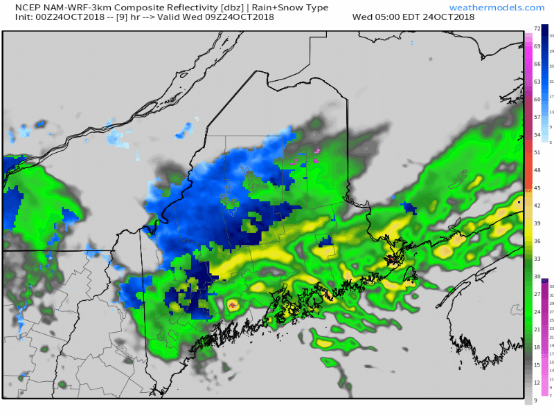 The storm is intensifying as is slowly moves eastward into the Canadian Maritimes today. Far northwestern areas of The County appear to get shut out of snowfall with this one. Snow will continue to accumulate in the mountains across the north central part of the state until it begins to taper from west to east this afternoon into tonight. MidCoast and DownEast areas appear to pick up a light amount of snow as temperatures crash on the west side of the system as it pulls away to the east. The snowfall idea posted here last night may come in a bit under, but 6-12" is the likely outcome in areas under winter storm warnings. Some areas of flurries and snow showers are expected in the mountains and north Thursday as high pressure works its way in. Expect breezy conditions with high temperatures in the 30s/40s through the remainder of the work week. More storms on the way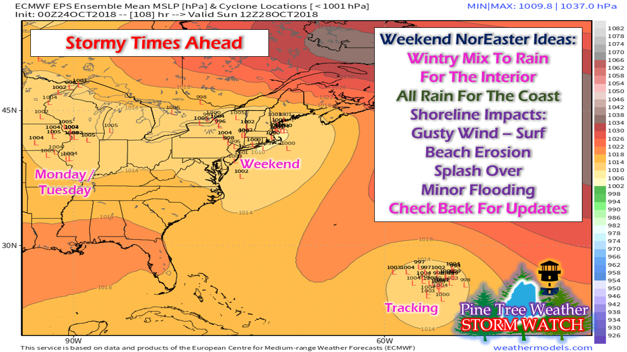 The lens on how the weekend plays out is coming into better focus, but not carved into stone just yet. As it appears for now it will be sloppy for the interior Saturday afternoon into the evening with a mix of snow, sleet and perhaps pockets of freezing rain and will eventually change over to all rain by Sunday. Coastal areas stay wet. Shorelines will have to deal with astronomical tides with may cause some minor flooding, along with wind, surf, splash over, beach erosion. The little L's on this ensemble chart indicate there is still some wiggle room on track, and a track shift changes potential impacts and outcomes. For now this is the main idea on what to expect and the finalizing of the timing and details will come as the weekend gets closer. On the heels of this storm comes another to start the week off as a surface low over the Midwest glides under a strong trough around the Great Lakes, hits the ocean and intensifies as it heads northeast toward New England. A tropical system brewing in the Atlantic will be tracked. Models are having a difficult time figuring out whether it will pick up the front with the Monday / Tuesday storm and stay out to sea, or miss the connection and potentially impact the region later next week. Welcome New Facebook Followers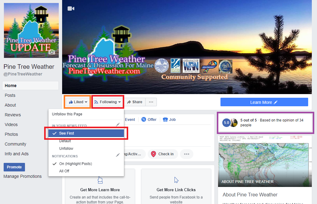 I see many folks have started to follow the page and I would like to welcome each of you. In order that my service to you has any value depends on two things. First, making sure that you get my updates. On the page, you need to click on Following, and then click on See First. Once that is done, the next thing to do is READ the updates. I don't post click bait just for the sake of boosting page views. When I make a post, there is something impactful that you may need to know about either short term or longer term.
I am not your sole source for weather information. I am an accompaniment to what you may see elsewhere. I don't profess to be right all the time. No forecaster ever is. My main mission is to alert you of potential so you can make plans and preparations needed to protect you, your family, property and business. This is a two way street here. If you like what I do, great. If you don't, you can unlike / unfollow and move on. No harm, no foul. I understand. I am not going to be a punching bag for forecast busts or weather that you may not like. I do hold myself accountable when forecasts go seriously sideways and I will give an explanation when that occurs. You won't see the TV folks or the public sector folks do that. I hope that you will find what I do to be of benefit. I put my heart and soul into this for that to be the case. More updates to come. For the latest official forecasts, bulletins and advisories, please check in with the National Weather Service in Gray for western and southern areas, or Caribou for northern and eastern parts of Maine. For more information from me, please follow the Pine Tree Weather Facebook page and my Twitter feed. Thanks as always for your support! Please consider making a donation to keep Pine Tree Weather going through the year ahead. Check out the donate page on how to contribute. Always stay weather aware! - Mike |

Mike Haggett
|


