A torcher on tap for MondayWhile the chance to establish new record high daytime temperatures is low for this round of heat, where the books are likely to be re-written for is the maximum low temperatures. What is affectionately known in forecasting circles as the "maxi-mins" (maximum minimum), we could see new values established at several long-term reporting stations around the state. It will be tough to cool down at night until the ridge responsible for this blast of heat breaks down later in the week. Do what you can to stay cool and comfortable in the meantime. 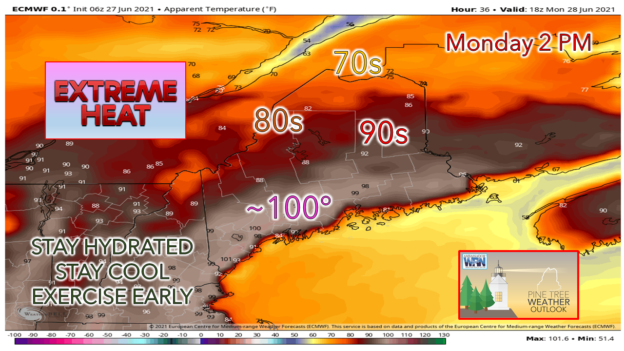 As discussed over the past couple of days, Monday will be the hottest day of this round of heat for the coastal plain as the apparent temperatures (feels like) indicate above. A quasi-stationary front lurks over the rooftop of the state which brings clouds and keeps temperatures down there. With the afternoon high tides peaking in the mid-afternoon, space availability at the beaches will be a minimum during the hottest time of the day. A south/southwesterly sea breeze will bring some relief for the MidCoast / Acadia / DownEast shorelines. I will be a good day to find an outdoor café or picnic table in one of the oceanside parks if the beaches are jammed. 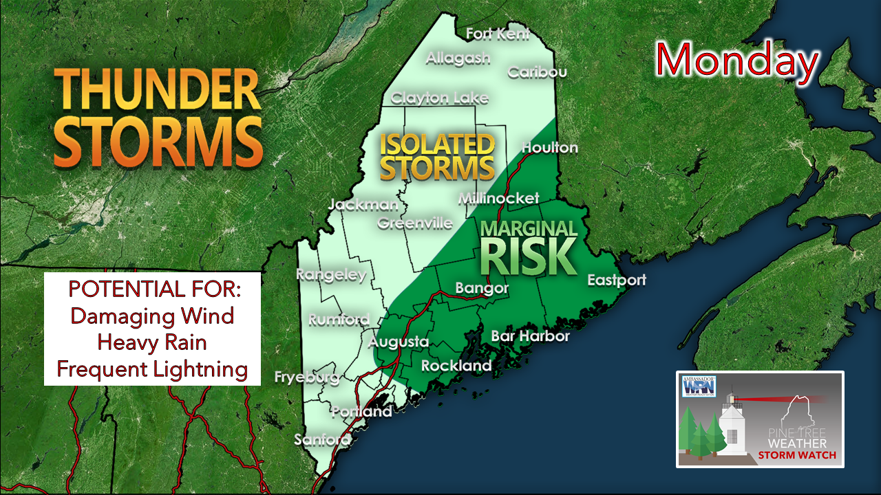 A weak area of low pressure passes through the region Monday afternoon. With the heat, this could initiate isolated strong to severe storms to fire up from noon through late evening. 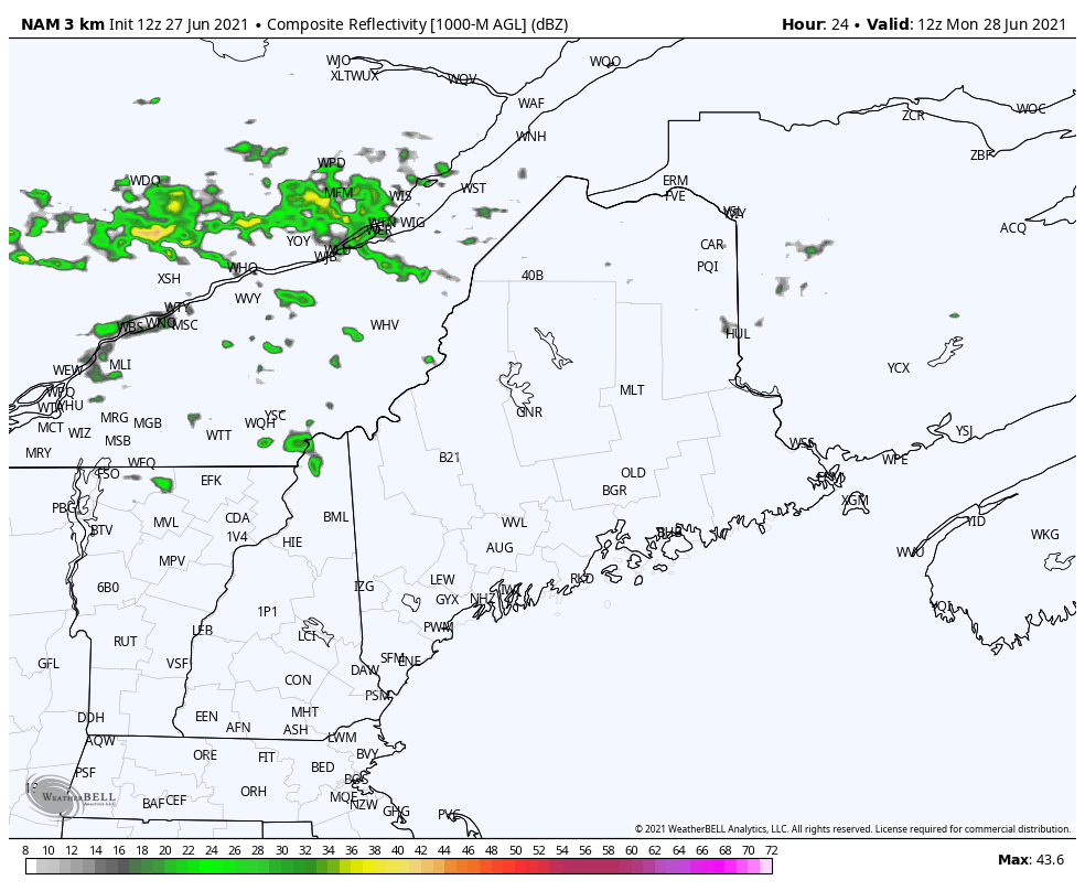 The NAM model idea from Sunday morning indicates the potential threat for isolated storms and shower activity through late Monday evening. Keep watch on the sky, make sure you can receive alerts and take action to find safe shelter and/or safe harbor once notifications have been sent out. Not quite as hot for Tuesday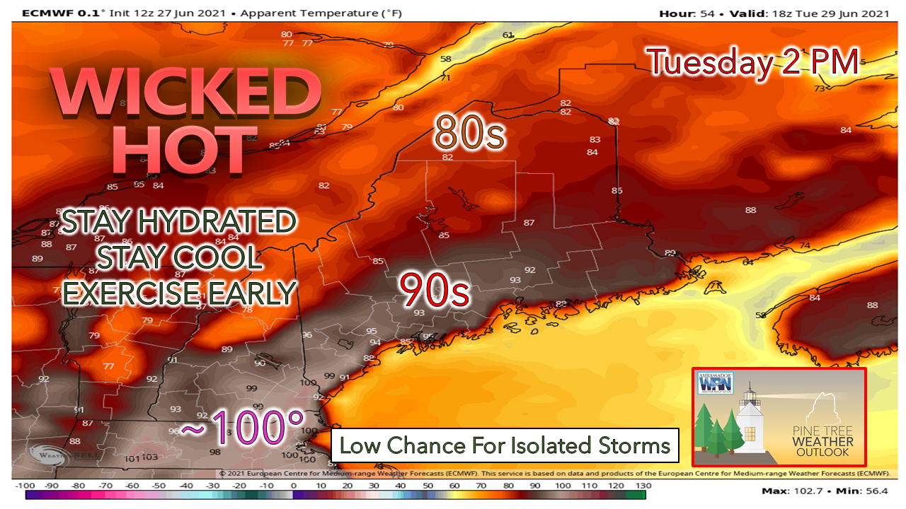 Tuesday appears to be another hot one. Far southwestern areas could see apparent (feels like) temperatures make a run for triple-digits for the second day in a row. The storm threat appears very limited at this point, but worth paying attention to sky in case convection initiates. Outlook through the rest of the week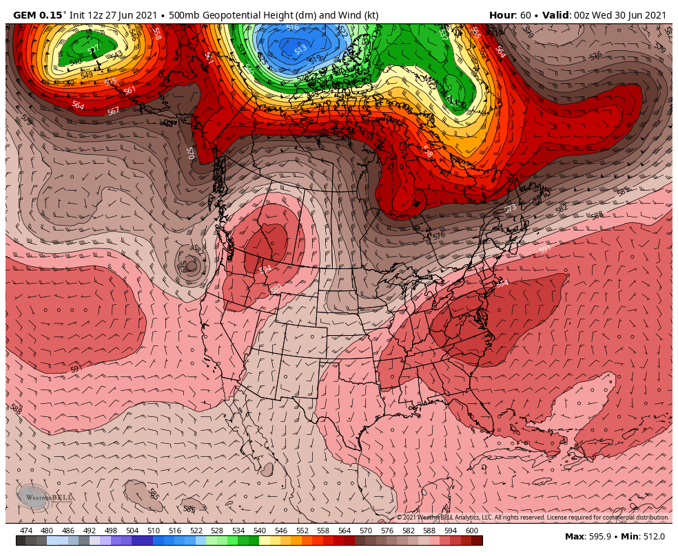 As we head into Wednesday, the ridge responsible for the heat begins to break down. It appears to be a rather slow process, which will bring the threat for showers and storms through the remainder of the work week and may continue to start the holiday weekend. Potential for an upper-level low and associated trough to the southwest may keep showers and storms in the forecast through the holiday and into early next week. 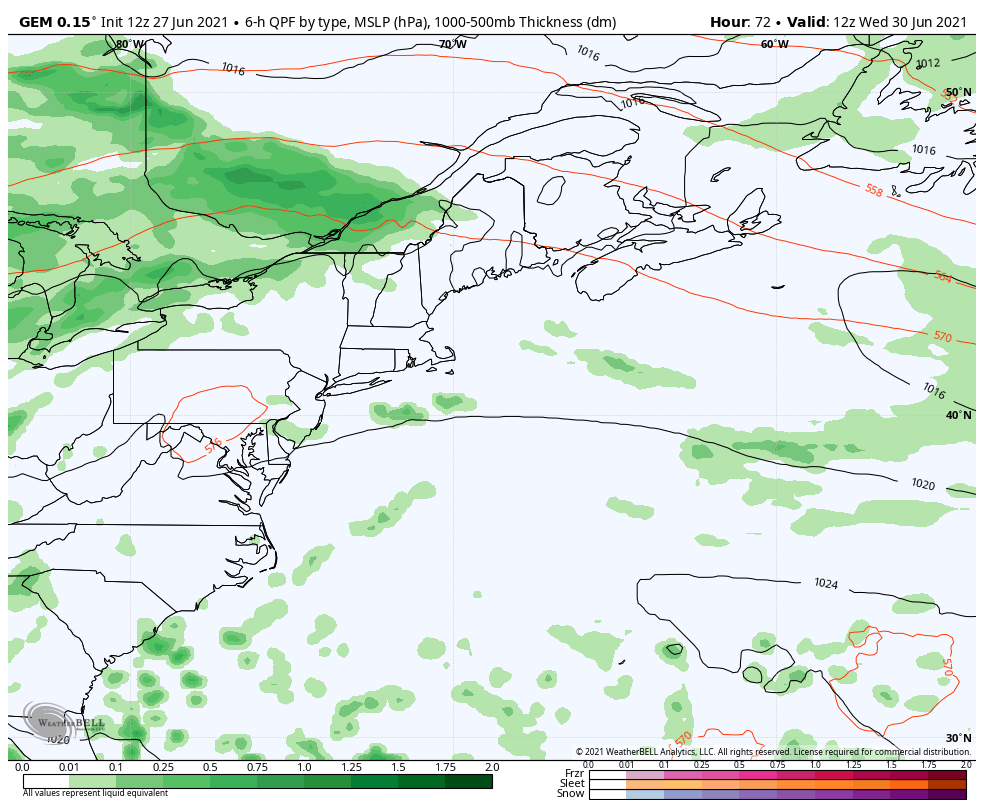 A look at one surface map idea from the Canadian GEM model shows the Bermuda High weakening on Wednesday. Cooler, drier air from the northwest slowly works to the southeast. The battle of the two airmasses bring the chance for showers and storms daily from Wednesday onward. Areas of low pressure traveling along the boundary may enhance showers and storms at times into the weekend. 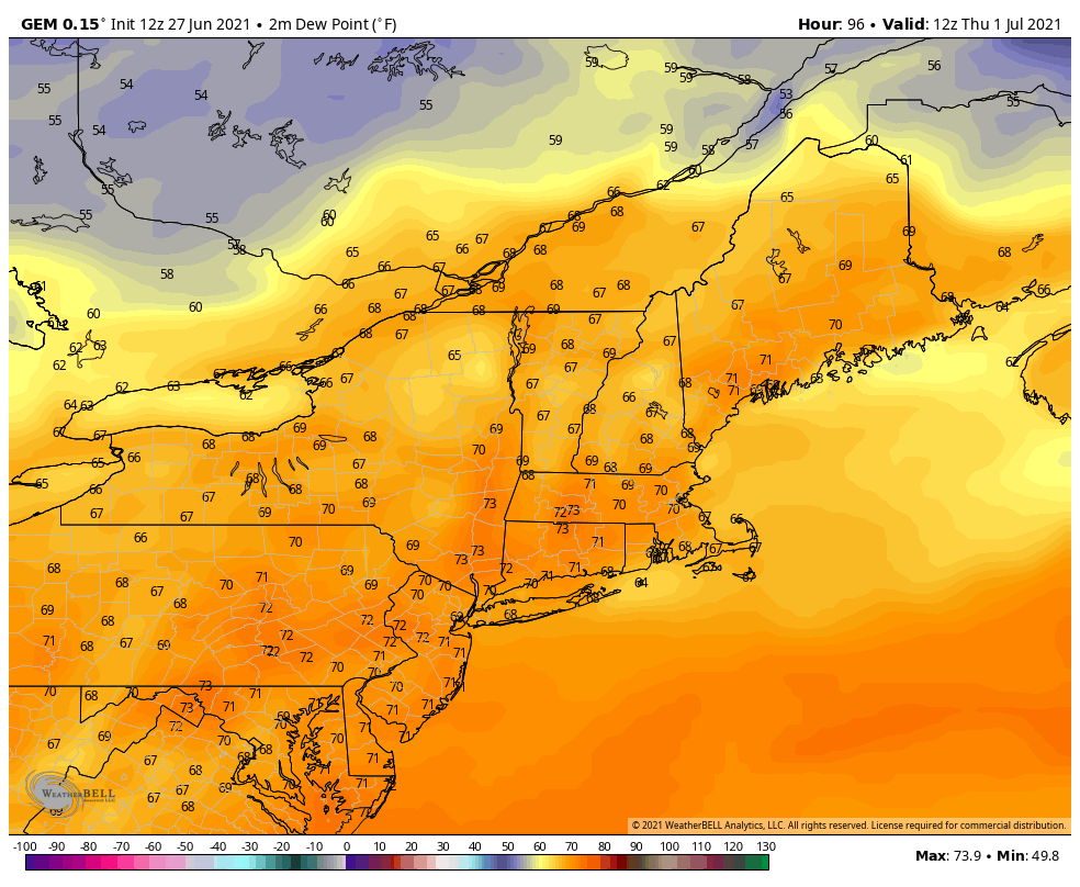 The humidity appears to hang on through midweek, then begins to fall over northern areas on Thursday, and southern areas on Friday. The entire region appears to wake up to more comfortable levels by Saturday morning. Heat Symptoms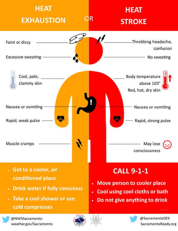 During hot and humid weather, your body's ability to cool itself is challenged. When your body heats too rapidly to cool itself properly, or when too much fluid or salt is lost through dehydration or sweating, you may experience a heat-related illness. Learn the symptoms of excessive heat exposure and the appropriate responses. weather.gov/safety/heat-illness Ten-day temperature outlookThe mercury runs above normal through Thursday for much of the region before cooling down to near seasonable averages. The holiday weekend appears comfortable overall, but with the potential for unsettled conditions may dampen it. 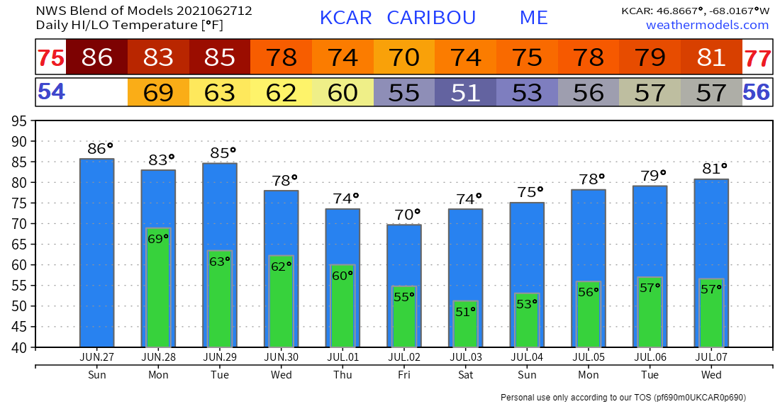 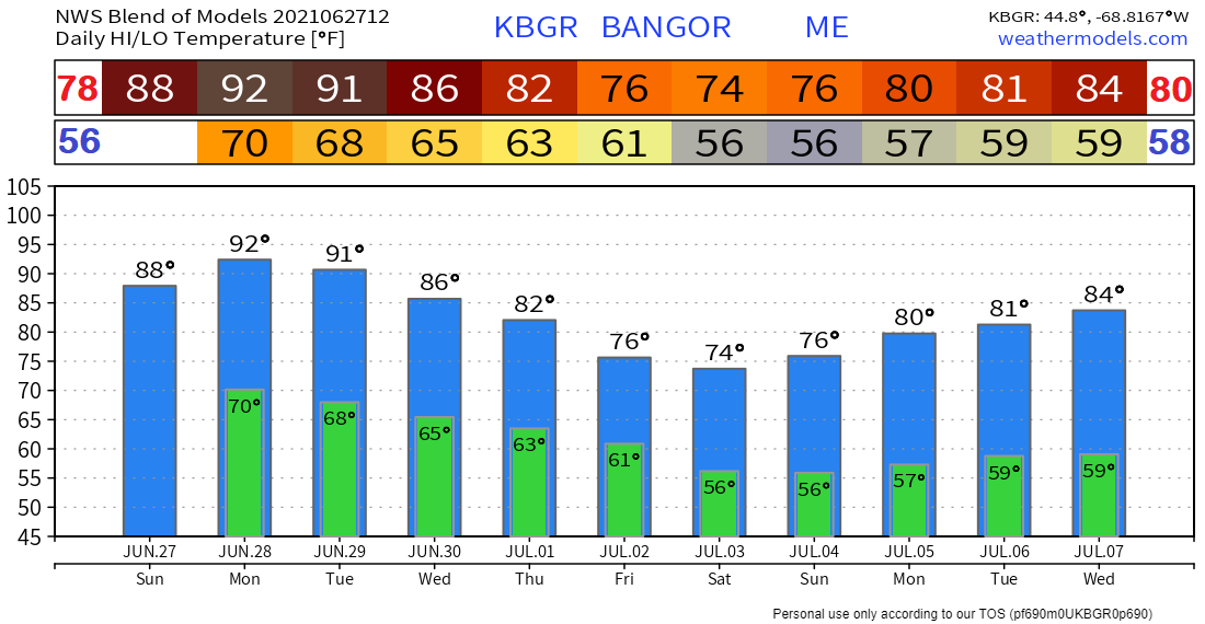 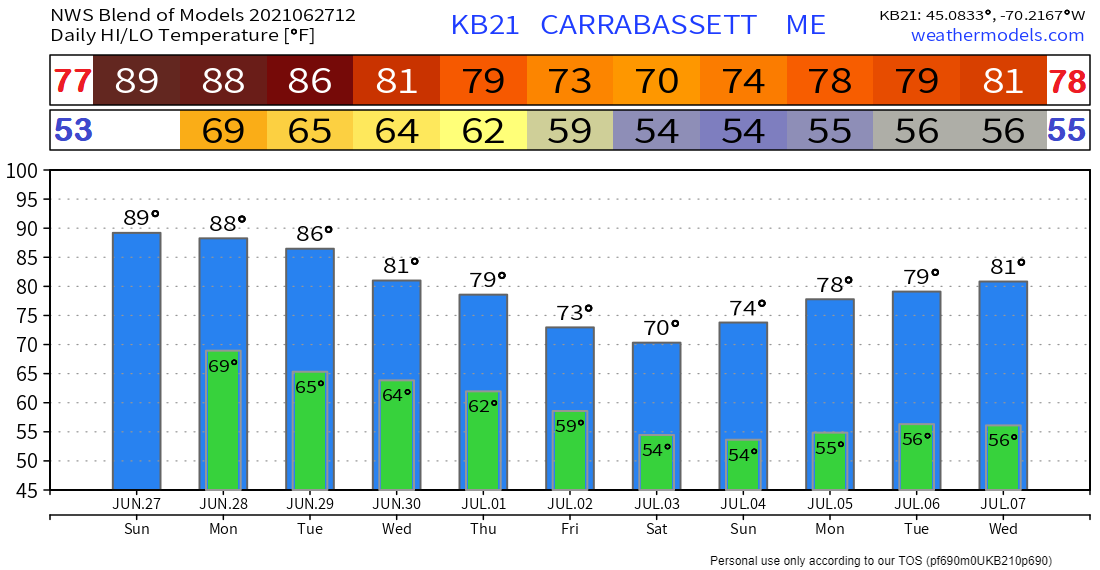 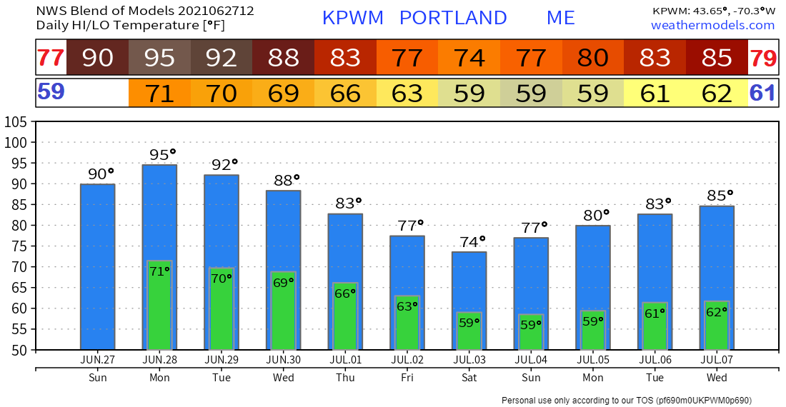 Be prepared to receive alerts and stay updated!
|

Mike Haggett
|