Storms could get nasty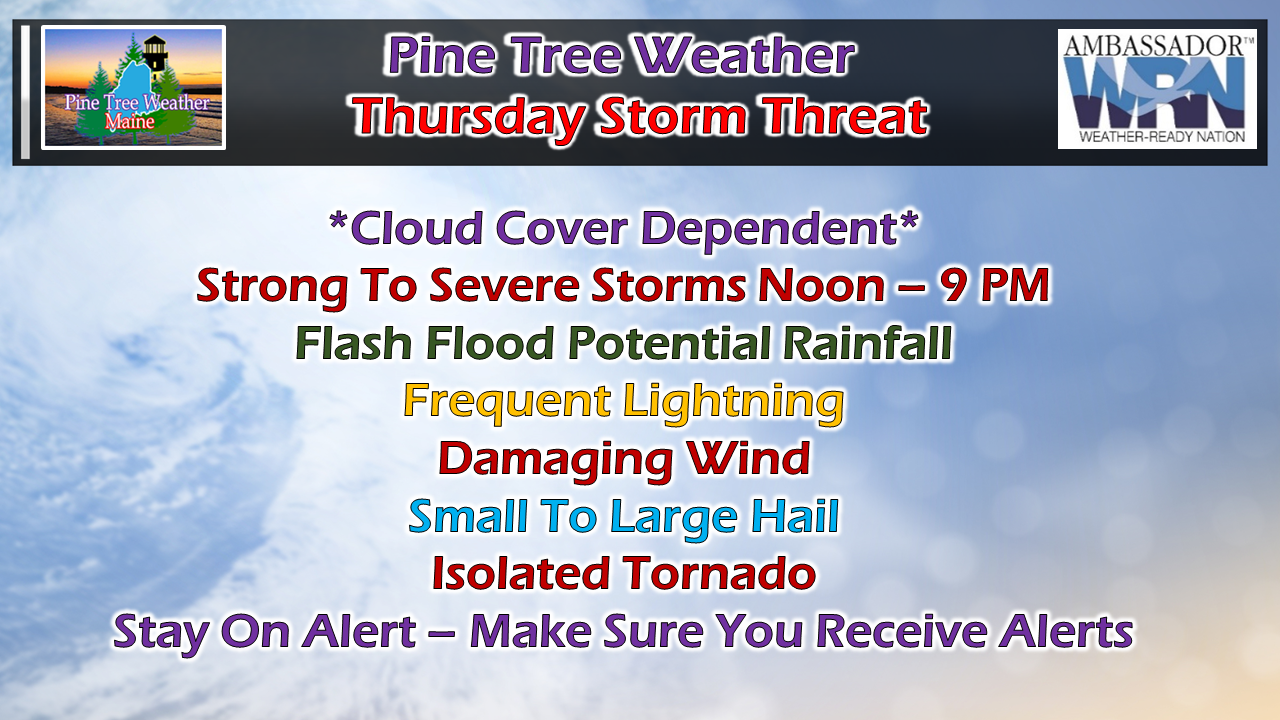 I am going to be right up front here from the beginning: the situation today has everything to do with cloud cover. There are two ways to spoil a severe threat, by cloud cover or by capping in the atmosphere. This past Monday the cap spoiled the threat. Thursday, it's cloud cover that could. Advancing warm fronts from the southwest ahead of cold fronts from the west/northwest have a way of busting forecasts due to cloud cover. That subject covered, if the sun gets out... look out. Storm threat potential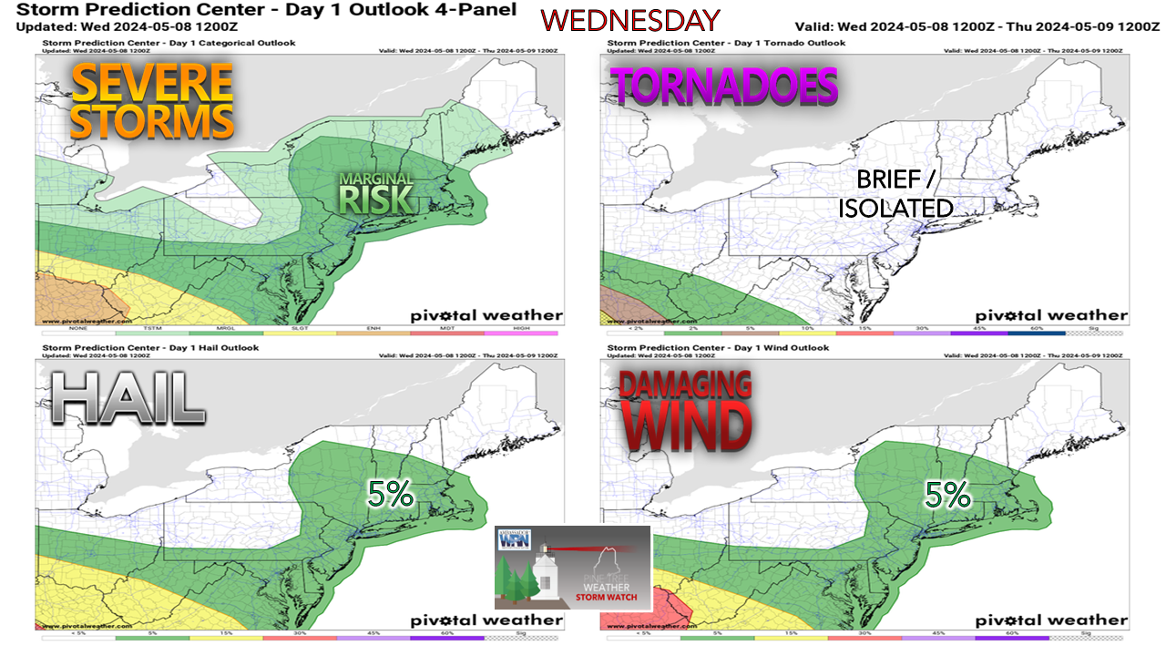 Southern New England had a busy severe day on Wednesday. Numerous reports of wind damage were reported, along with a suspected funnel cloud. Warm fronts have the tendency to to bring spin from wind shear to the atmosphere, One model idea from the NAM indicates shear velocity between 25-40 knots. That supports supercell structure. If the sun gets out, temperatures rise into the 80s with dew points in the upper 60s, that is plenty of convective available potential energy (CAPE) that could ignite storm activity. The main threat is for southwestern areas of the state, Bethel over to Skowhegan, south and west. This is where the projected temperatures will the warmest. The closer to southern New Hampshire, temperatures could reach the upper 80s. Shoreline temperatures appear cooler with the sea breeze. This may set up a boundary which could make things interesting as the afternoon turns to evening. Timing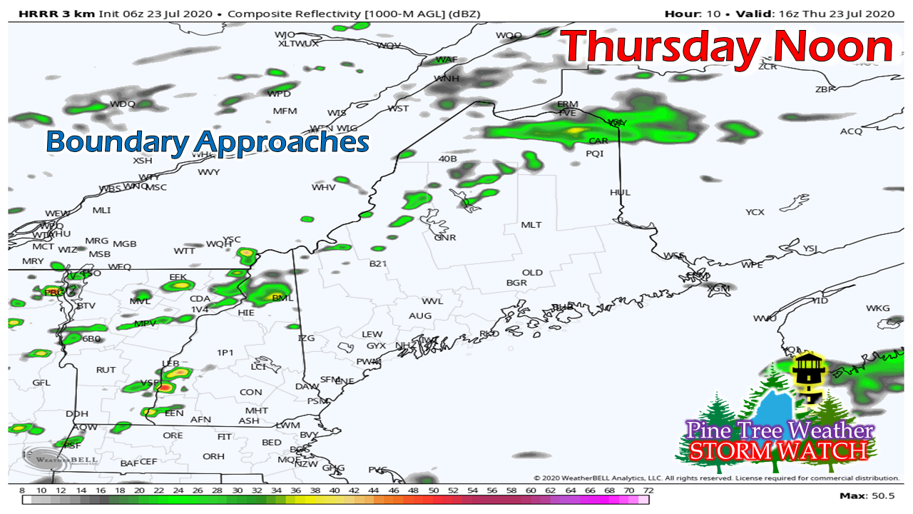 There is potential for an earlier initialization of storms as the warm front pushes northeast, so be aware of that. Again, this is cloud cover dependent. The region could see a few pop ups over interior areas around noon as the boundary from the cold front begins to ascend. 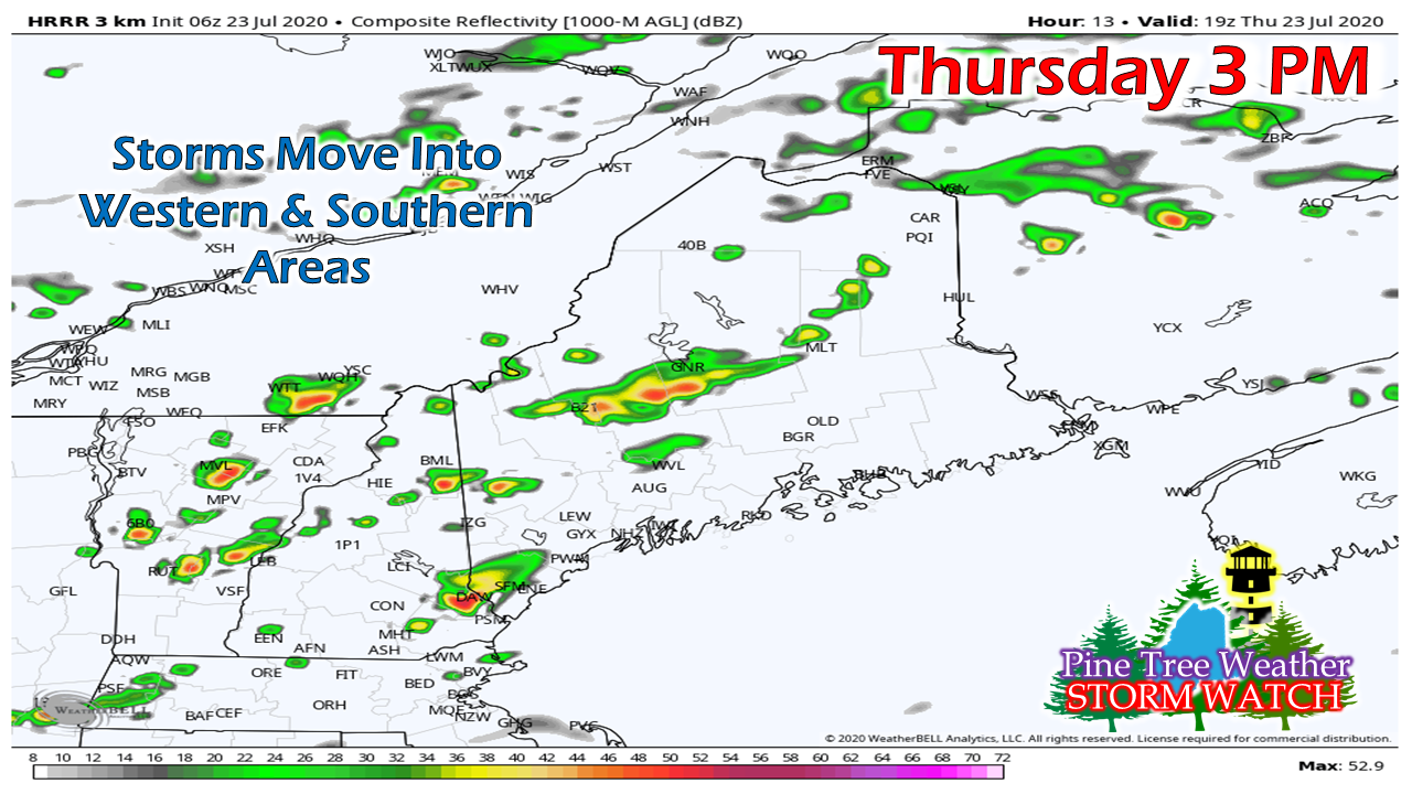 By mid-afternoon, storms begin to fire up. The linear structure of the storms is where the damaging wind and flash flooding threat begin to be a concern. With the heating of the day at the maximum and wind shear velocity increasing, this is the time to be concerned for potential tornado. 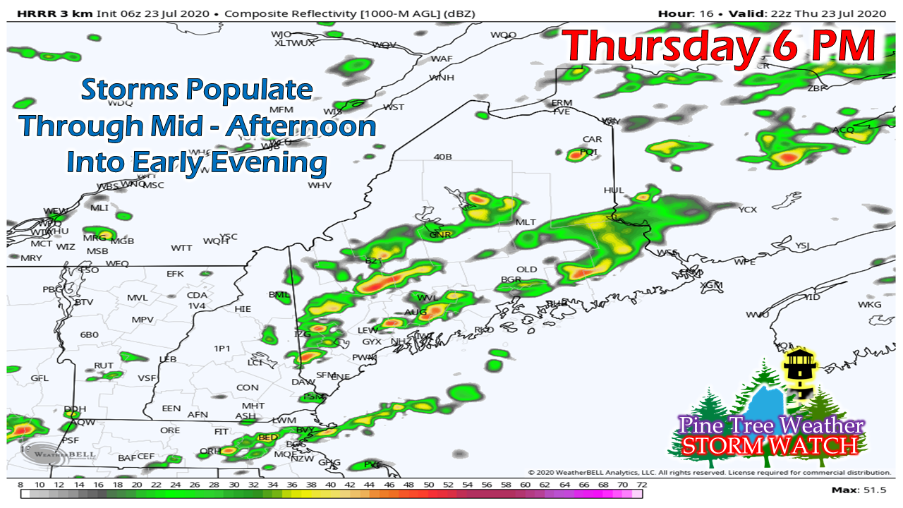 Staying true to the idea the clouds don't get in the way, the storm threat increases through late afternoon. With cold air moving in aloft, the hail threat increases on top of everything else as we head into early evening. 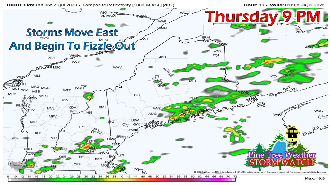 By mid-evening, the heat of the day escapes and what storm activity going on at that point will be fading as energy dissipates. 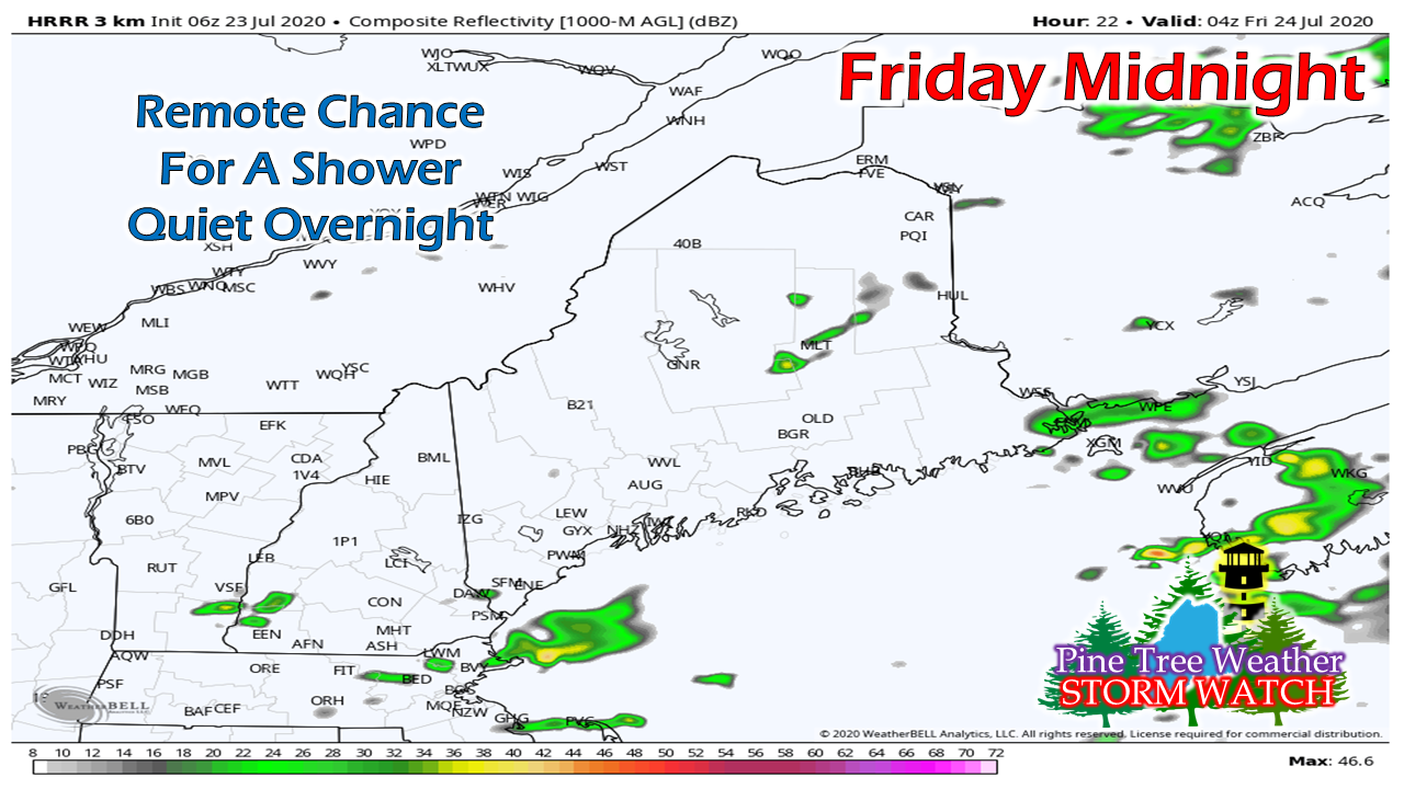 By midnight, most of the region has seen the threat pass, and a easy night to rest will be well underway. Stay aware of what is going on today. Keep an eye to the sky. Be on alert for severe storm watches and warnings. Stay tuned to NOAA Weather Radio, local media, and a reliable smartphone app (I recommend Weather Radio by WDT) to get the latest information. When thunder roars, head indoors... when you see a flash, make a dash for cover in a safe building. 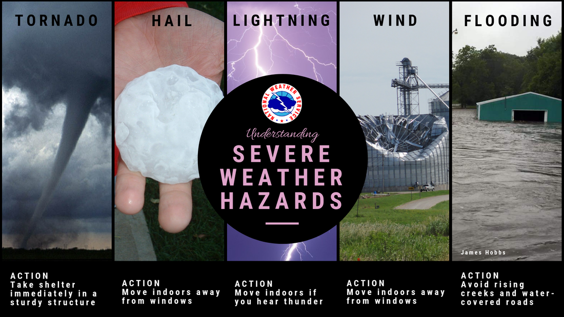 Help forecast verification, and stay informed!
For more information, please follow Pine Tree Weather on Facebook and Twitter.
Thank you for supporting this community based weather information source that is funded by your financial contributions. Stay updated, stay on alert, and stay safe! - Mike |

Mike Haggett
|