
It could be a rough afternoon in areas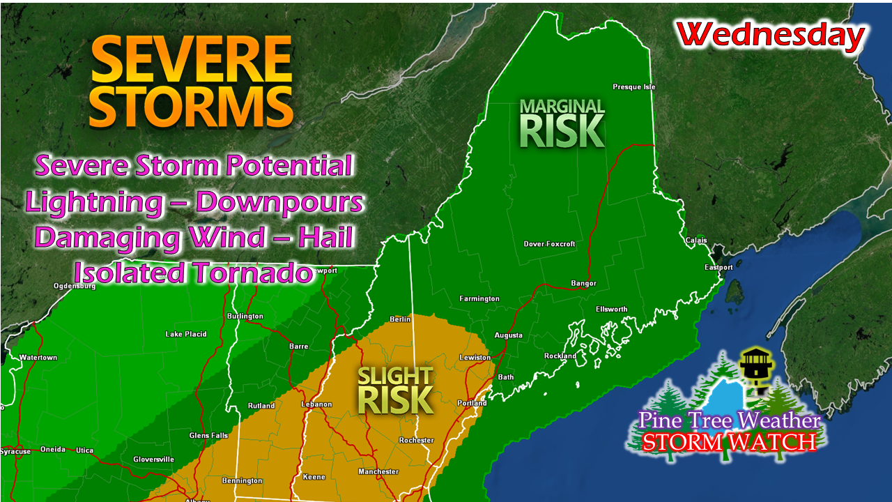 For those who read my thoughts posted here last night, I speculated if Storm Prediction Center would upgrade their outlook, and they did. A severe thunderstorm watch may be necessary for this afternoon as the cold front ascends through the area.  Timing remains on track for a few showers for the north country late morning. The main event works through the region this afternoon into early evening. Strong to severe storms are certainly possible, with damaging wind, downpours, frequent lightning and hail the main concerns. Their appears to be ample wind shear for the potential for isolated tornadoes. Once thunder is heard, inside shelter should be taken immediately. Make sure that you can receive alerts from the National Weather Service through NOAA Weather Radio or reliable smartphone apps to get bulletins and advisories from them through this evening. Dorian forecast track a bit closer for the weekend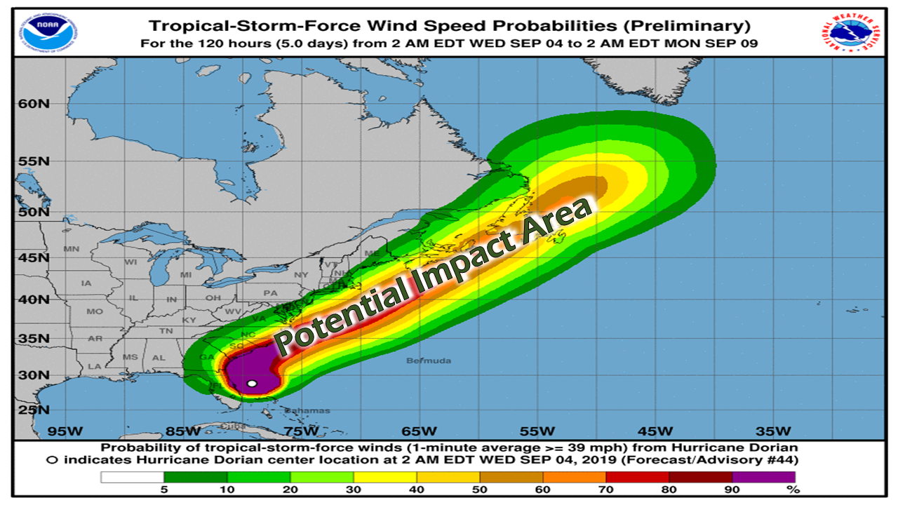 While the track has shifted a bit closer, it's certainly not close enough to cause any significant concern at this point. If there is any area of New England that needs to watch this storm very closely, it is Cape Cod, Martha's Vineyard and Nantucket as tropical storm conditions may exist there for a time Friday afternoon into early Saturday morning.  The area that could see the most impacts may be that of the DownEast coast, and Washington County, to be the most specific. That area will have the closest proximity to the storm. There is potential there for a period of heavy shower activity and some wind Saturday afternoon into Saturday night. An inverted trough may bring some showers over the mountains and north, but may not to amount to much accumulation. 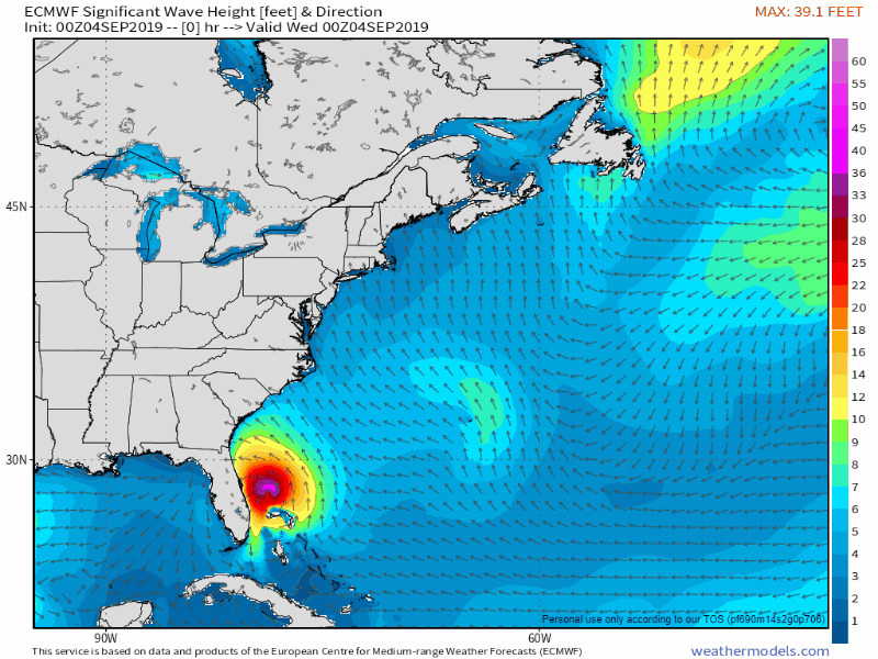 The main effect of the storm will be that of heavy surf. Seas in the 7-14' range appear possible along exposed shoreline of DownEast areas, perhaps a bit less to the southwest. The Gulf of Maine will deal with swells from the storm through Sunday, and then calm down on Monday. 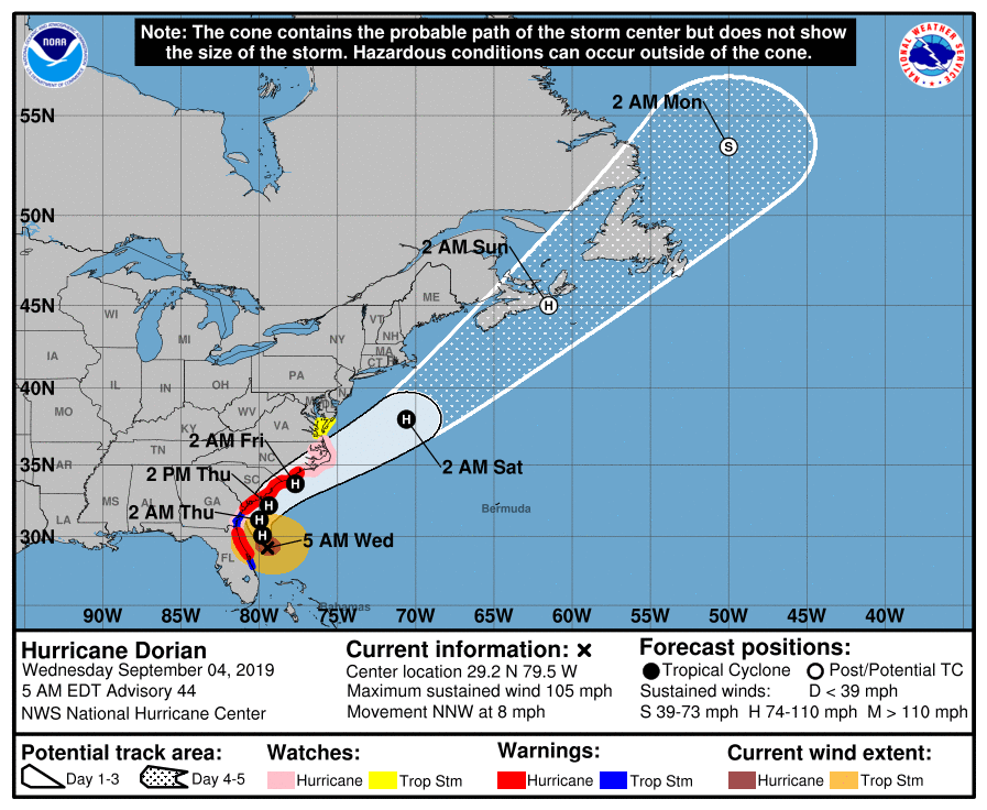 As always, stay in touch with the National Hurricane Center for the latest track and forecast information from them in regards to Dorian and other storms that are developing in the Atlantic. It's peak hurricane season, and it will be active for the next few weeks from what it appears now.
There is always the potential for a change in track and impacts. Stay updated! ► ► For the latest official forecasts, bulletins and advisories, please check in with the National Weather Service in Gray for western and southern areas, or Caribou for northern and eastern parts of Maine. Please consider supporting Pine Tree Weather ► ► Your financial donations are much appreciated to keep this site funded and for further development. FUNDRAISING FOR 2020 PLEASE SUPPORT! I sincerely appreciate your support not only financially, but also in sharing my efforts with others. For more information from me, please check the Pine Tree Weather Facebook page as well as my Twitter feed. Always stay weather aware! - Mike |

Mike Haggett
|


