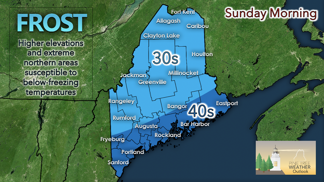
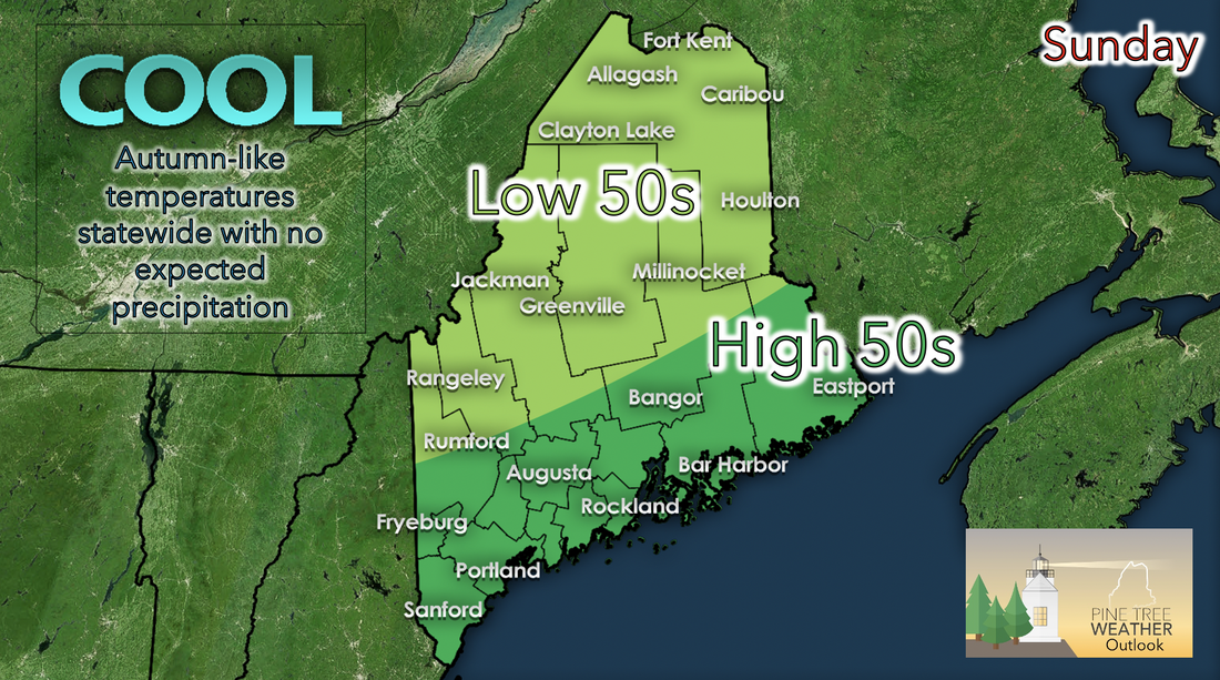
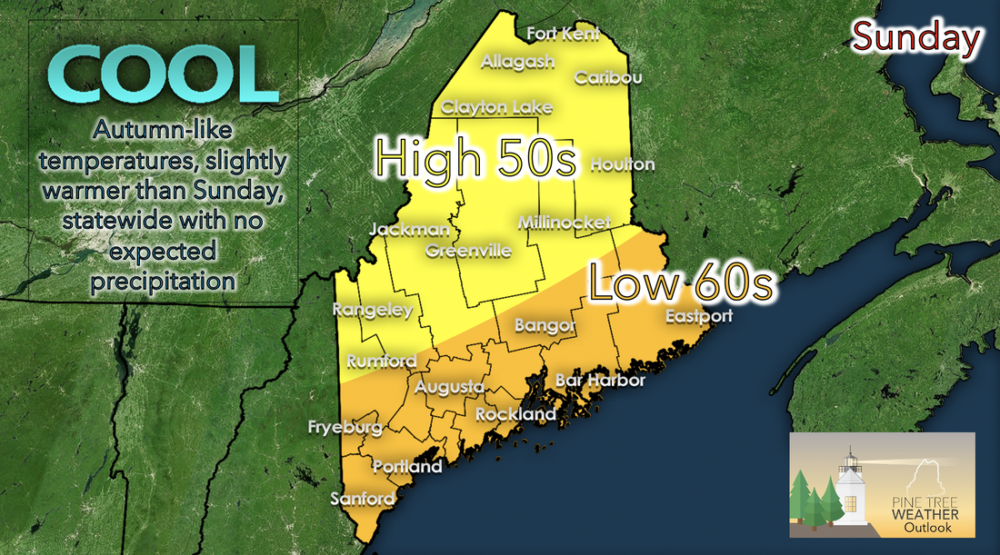
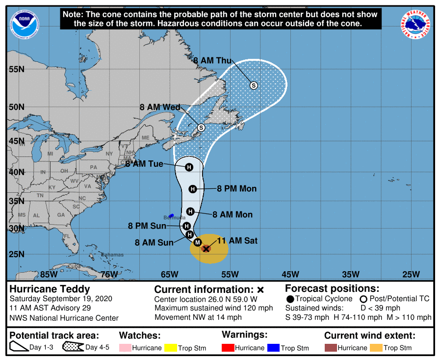
Early morning Sunday: 30s/40s temperatures with possible below-freezing pointsA high pressure systems sits over the New England region through the weekend and into next week. With the higher pressure comes northerly winds over Maine, bringing cooler and drier air that once resided in Canada. Sunday morning looks pretty chilly; coastal areas in the low to mid 40s and elsewhere in the 30s. Higher elevated and extreme northern areas are susceptible to getting low temperatures in the below-freezing range. Sunday: Autumn-like temperatures and more fair weatherThe overarching area of high pressure over the region also brings fair weather for the next few days. Temperatures are very autumn-like, ranging from low to high 50s as you move north to south in the state. Winds remain fairly calm and no precipitation is expected to occur. A perfect autumn day! Monday: Slightly warmer temperaturesMuch like Sunday, Monday looks to have fair weather. Slightly warmer temperatures than Sunday are also expected, with high 50s to the north and low 60s in the coastal regions and slightly inland. The are of high pressure begins to move down the coast slightly as Teddy's area of low pressure continues to move northward and heading for Nova Scotia. As it heads in that direction, winds begin to shift southerly and a reason for the slight increase in temperatures for the state. No precipitation is expected for the course of Monday. Updates on TeddyTeddy's path has remained similar for the past few days; northward trend towards Nova Scotia. If this path continues to be true, the eastern portions of Maine have potential to receive some rain and feel tropical storm-force winds by Tuesday. Coastal areas may be susceptible of high surf as Teddy draws closer. Updates on any changes regarding Teddy's path or strength will be posted as information is updated. Be prepared to receive alerts and stay updated!
For more information, please follow Pine Tree Weather on Facebook and Twitter.
** FUNDING NEEDED FOR 2021 ** Thank you for supporting this community based weather information source that is funded by your financial contributions. Stay updated, stay on alert, and stay safe! Have a great rest of your weekend! - Kaitlyn |
Mike Haggett
|

