
The dew points are falling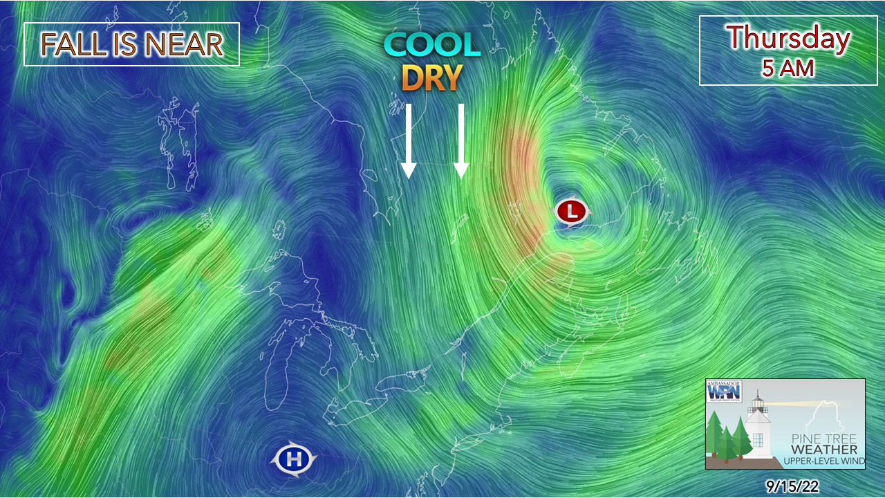 A look here at the upper-level wind at the 850mb (altimeter ~5,000 ft) level shows a strong area low pressure near Labrador dragging cooler and drier air into the region. Not only is this an example of the weather of the day. but the overall pattern through early next week. Dew points continue to fall over the region for the day, bringing the crisp feel to the morning air and introducing sweater weather back into the daily wardrobe. Another breezy day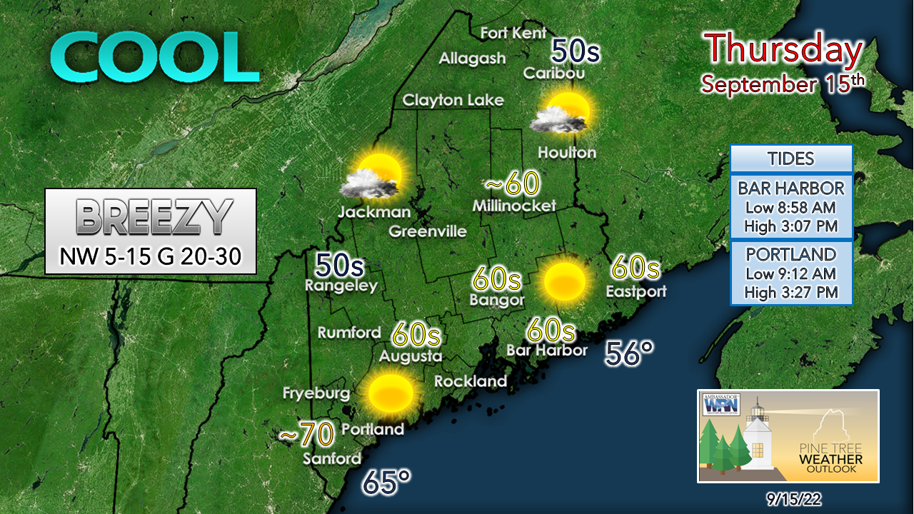 The north and mountain areas are likely to see the higher wind speeds of the day. Cold air advection does its thing and brings warmer temperatures to the coast. Folks hiking in the higher elevations could see wind chills in the teens and 20s. Yes, fall is near. The breeze slowly diminishes on Friday as high pressure settles in. Frost threat idea continues for Saturday morning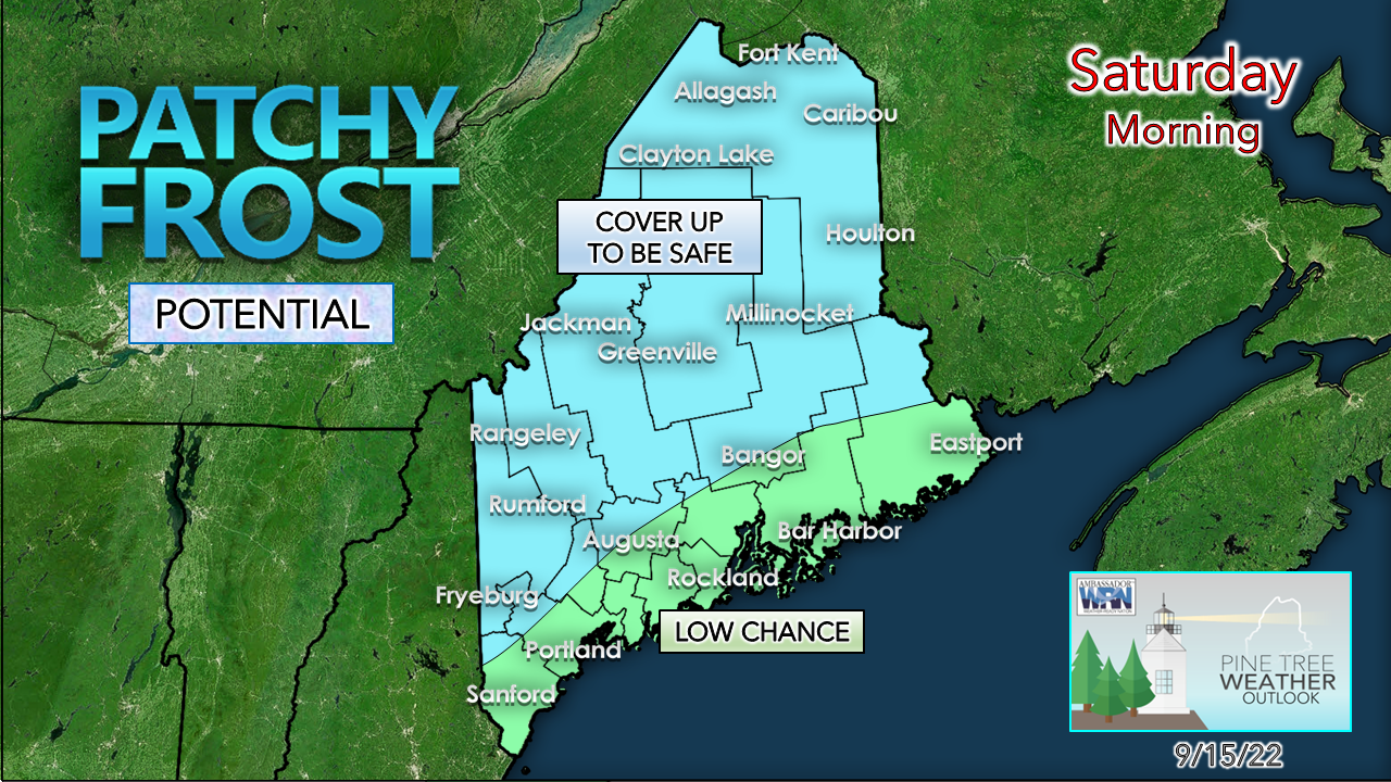 With high pressure settling in over the area, it sets up radiational cooling that brings the frost threat to the region Saturday morning. Folks that live in the valleys and well protected areas should expect frost to develop. While I've noted the areas along the coastal plain having a low chance for frost, it wouldn't surprise me to see a few readings flirting with 32° there. For the growers that have been bitten in the past by stealthy early season frost, here's your notification that it may happen again. Rain chances for all for Sunday into early next week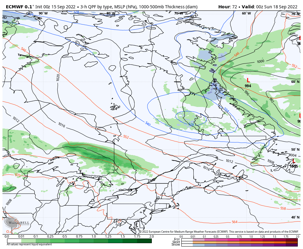 Saturday 8 PM to Tuesday 8 AM - In Wednesday's post I mentioned the atmospheric squeeze play set up for Sunday. A strong trough drops down over eastern Canada and blocks an advancing ridge from the west and puts the region in the middle of the sandwich. A back door cold front drops down over northern Maine while a warm front works in from the west. Given the cold air involved with the trough and how models typically mishandle it by being too progressive with it, I am leery about when rainfall begins. I am not expecting a washout, but at the same time I am not expecting a pleasant day with cooler temperatures in place. The best chance for showers continues to be for the mountains and north. Confidence will increase on timing by Saturday morning. A few words on Fiona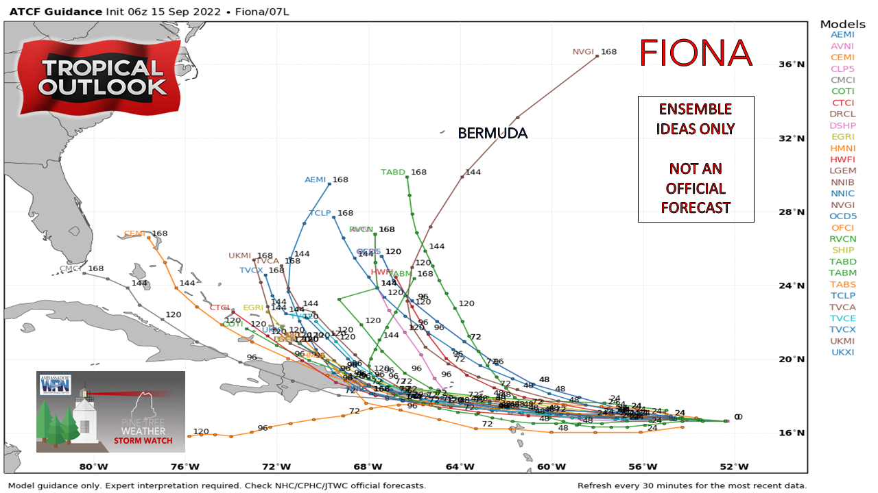 Tropical Storm Fiona has developed and is heading for the Leeward Islands and is expected to pass near or through Puerto Rico early Sunday. Two schools of thought here. An earlier intensification could cause an early turn to the north. which some ensembles indicate. If the storm can maintain its current forecast intensity and track, it may eventually become a concern for the southeast US so long as it survives interaction with the mountains of Hispaniola. This time of year, and tropical system that splits the uprights between Cape Hatteras and Bermuda is important to stay updated on, whether for potential remnants or more. Temperature outlook through Tuesday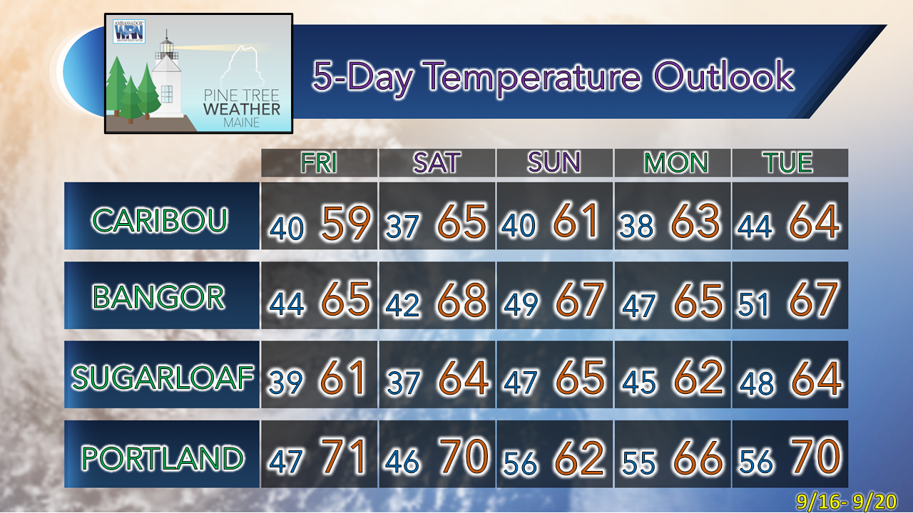 Thank you for supporting this community-based weather information source which operates by financial contributions from people like you. NEXT UPDATE: SATURDAY Stay updated, stay on alert, and stay safe! - Mike NOTE: The forecast information depicted on this platform is for general information purposes only for the public and is not designed or intended for commercial use. For those seeking pinpoint weather information for business operations, you should use a private sector source. For information about where to find commercial forecasters to assist your business, please message me and I will be happy to help you. |

Mike Haggett
|


