|
First off, I hope everyone has a great Easter holiday. While we continue to navigate through the pandemic and see hope for some sense of normalcy, we're not there yet. My family continues to take the necessary precautions. I've booked my appointment for the one-time vaccine in early May, just before graduation. On that note, I finished school this past Thursday, well ahead of schedule, and with my best semester GPA. I am going to hold off on the celebration for now until graduation over the first full weekend in May when it is made official. My next project is to prepare the operation for summer, interviewing and training interns, as well as website maintenance. Thank you for your continued support and patience. Fire concerns for Saturday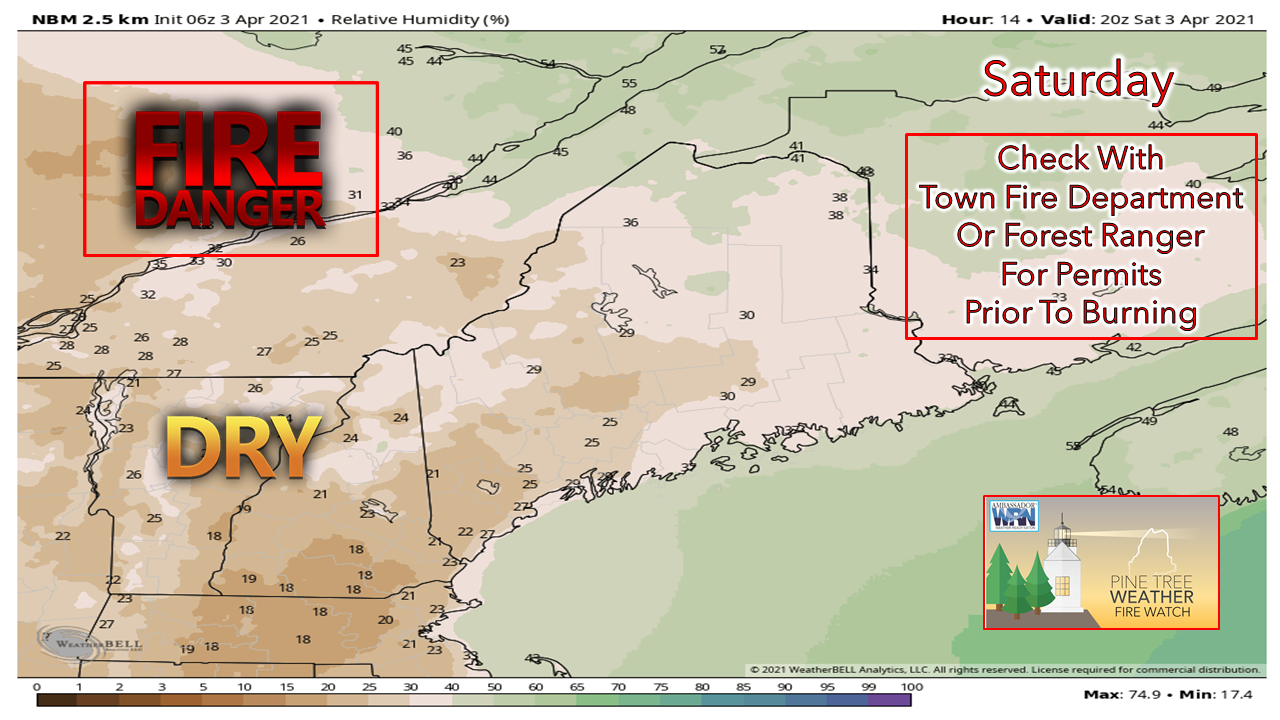 While we had a decent rainfall in the past week statewide, there is little foliage to speak of. With very dry air around and a bit of a breeze from the northwest, that is all it takes to elevate wildfire concerns. A Red Flag Warning has been issued for all but Coos County in New Hampshire due to the conditions. Folks in western and southern Maine should check with the local fire department or forest ranger BEFORE touching off the brush pile for burn permits. Sunday will be a better day, so if you can hold off for day, which would be best. Outlook for Easter into next week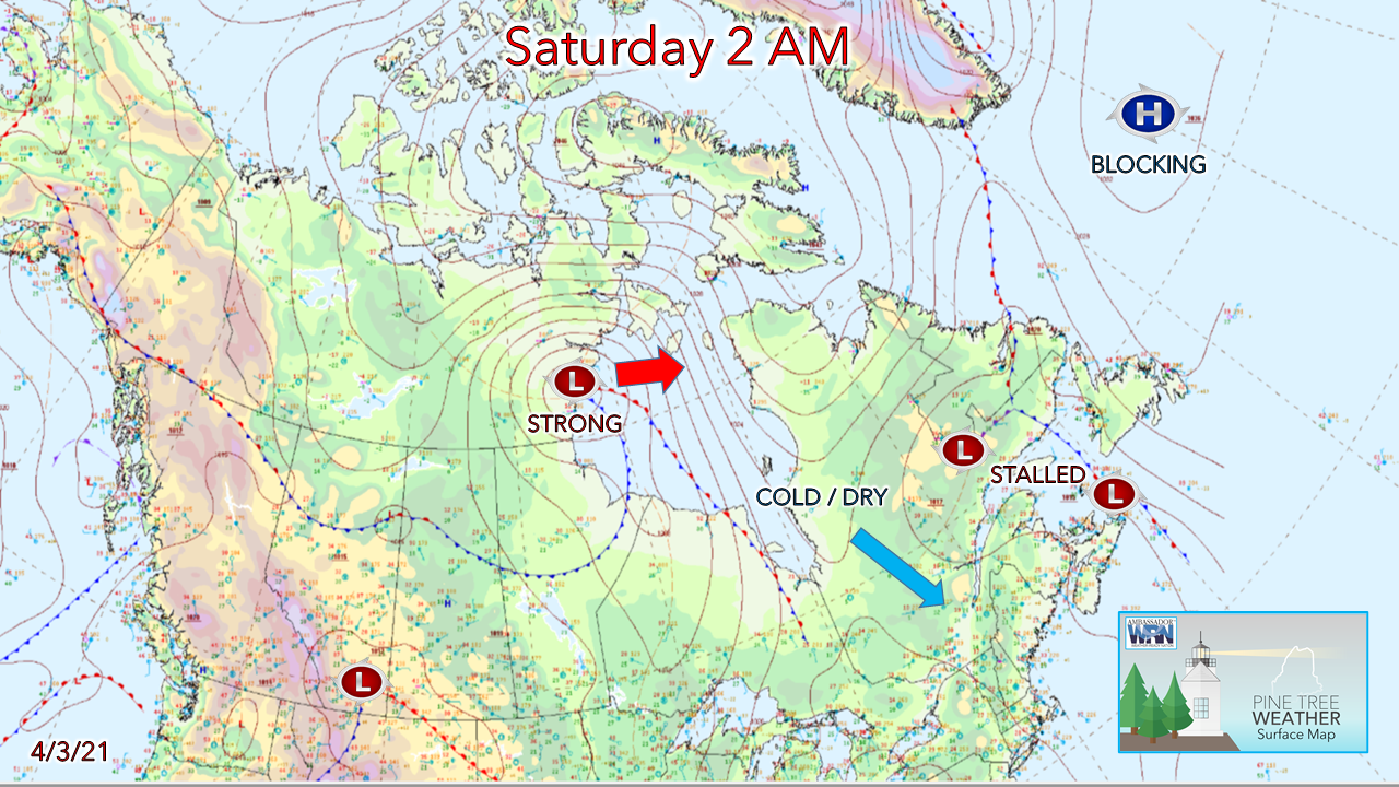 The key feature that will play a role in our weather pattern is the blocking high to the southeast of Greenland. This strong area of high pressure will weaken over the next few days, but it's not going to release enough for any real warmth or precipitation of any meaningful volume to work into the region. Cool and dry air appears to hang around through the first half of April. 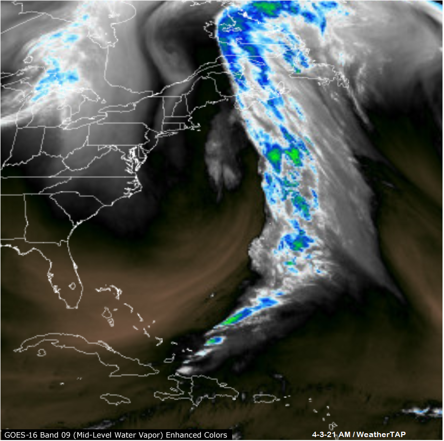 A look at water vapor here shows the stalled frontal boundary offshore, associated with an upper-level low which is caught in the roadblock of the strong ridge over Greenland. This will keep the Canadian Maritimes in a damp pattern, with Maine on the fringe. 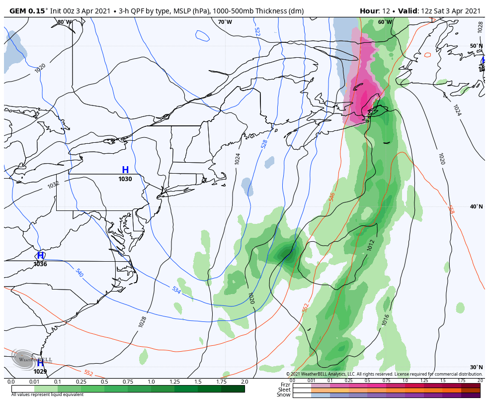 Low pressure is predicted to form along the stalled front Saturday and move north. As it gains intensity, it retrogrades to the northwest due to the blocking to the northeast. The result for our region is a chance for light rain and snow showers Sunday afternoon and keep clouds and chances for precipitation in the forecast through mid-week, with northern and eastern areas the likelier to get something out of it. As the blocking high and the storm weakens, conditions improve Wednesday into Thursday. A frontal boundary may bring some light rain as we approach next weekend. Pattern keeps Maine cool through mid-April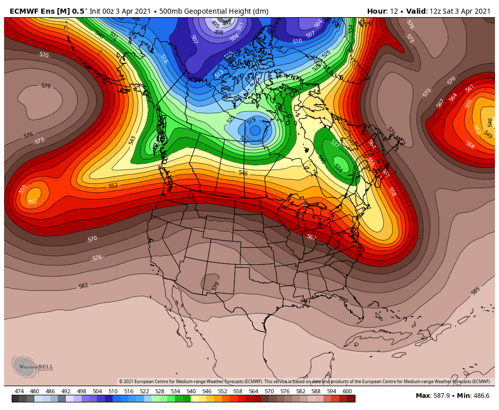 The blocking ridge over southeastern Greenland relaxes by mid-week but ridging over the North Atlantic stays consistent. Cut-off upper-level lows keep the warmth to the south and the region locked into a trough through late week. Temperatures appear generally above normal through the next ten days north and south. Southern areas may have a chance to flirt with the low 60s Tuesday and Wednesday, but 50s appear to be the rule from Sunday onward. Northern areas reach the 50s by midweek as the blocking high to the northeast loses its grip. 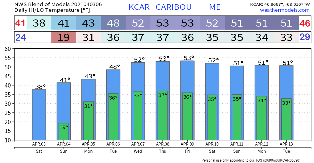 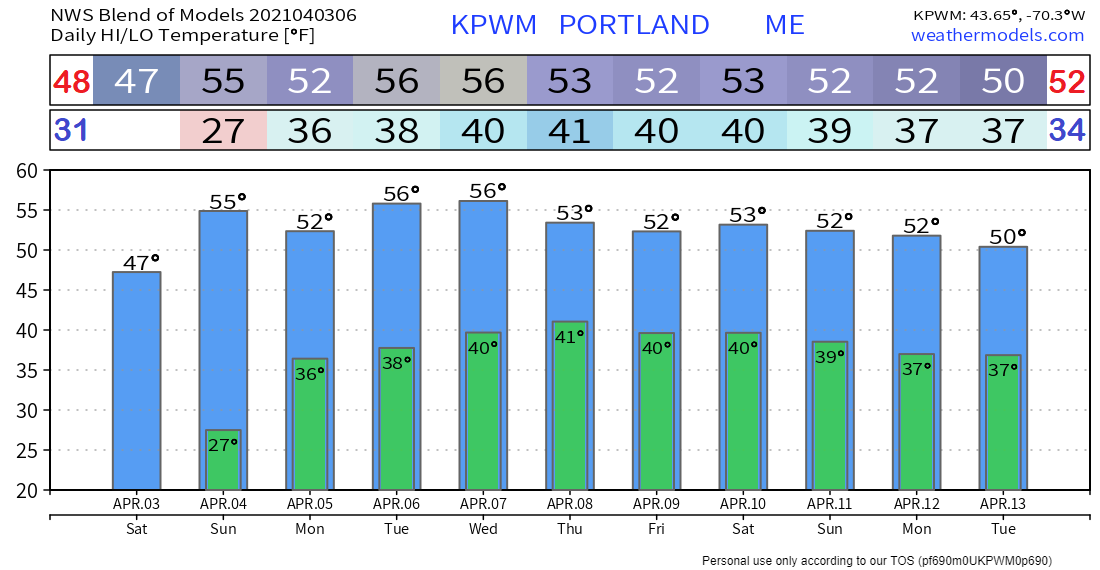 Red Flag Warning defined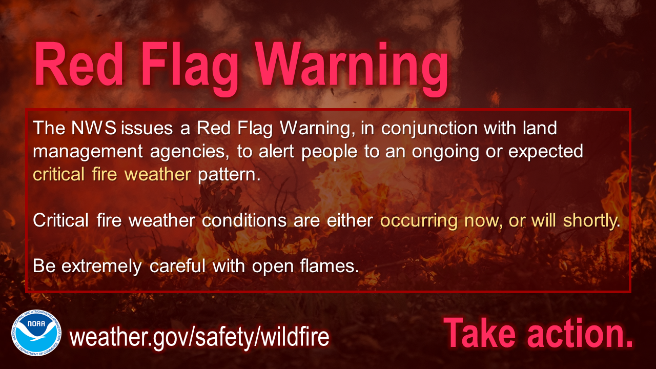 The NWS issues a Red Flag Warning, in conjunction with land management agencies, to alert land managers to an ongoing or imminent critical fire weather pattern. If a Red Flag Warning is issued, it means critical fire conditions are either occurring now, or will shortly. For more information, visit weather.gov/safety/wildfire-ww Be prepared to receive alerts and stay updated!
For more information in between posts, please follow Pine Tree Weather on Facebook and Twitter.
Thank you for supporting this community-based weather information source which operates by reader supported financial contributions. Stay updated, stay on alert, and stay safe! Thank you as always for your support! - Mike |

Mike Haggett
|