A blah Wednesday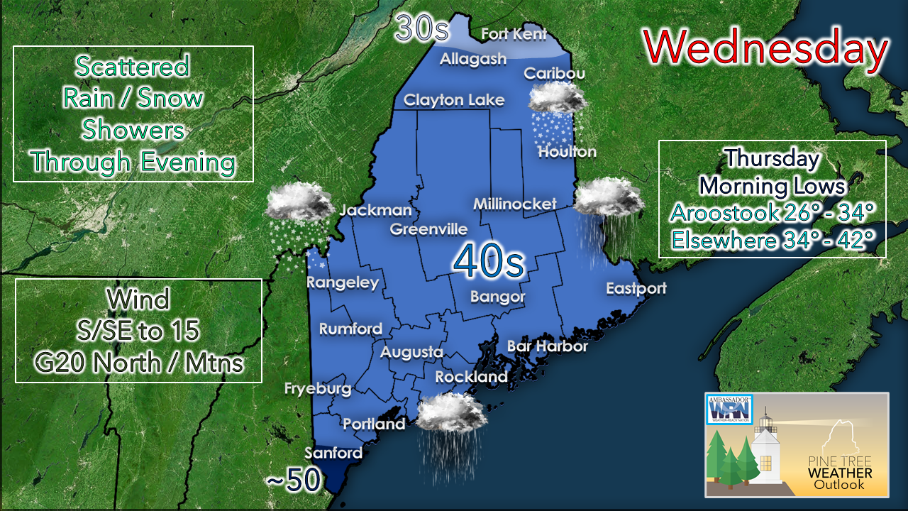 A weak area of high pressure moves eastward during the day Wednesday. A weak area of low pressure to the south taps in to an approaching cold front from the northwest. The end result is a mainly cloudy sky, spotty rain and snow showers, and a light breeze. Precipitation ends from west to east this evening, with the last of the shower activity departing northern and eastern areas early Thursday morning. Little to no accumulation of snow is expected. Temperatures for the day will be on the chilly side with 40s for most of the state. Pockets of clearing may occur late in the day for western and southern areas, but it may not last long. A moisture starved cold front passes through Wednesday night into early Thursday. First snow for coastal areas Friday appears light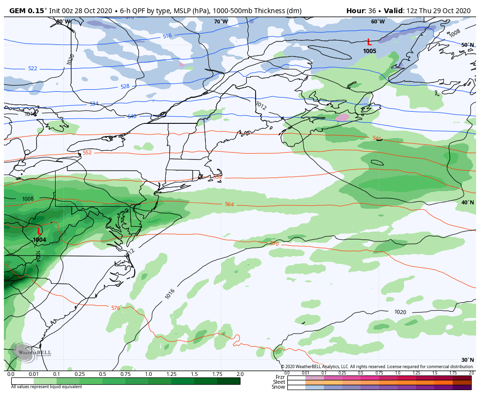 Guidance is coming into better agreement on track and intensity with the system on the way to end the work week. Much of the moisture associated with Zeta stays well out to sea, The phasing of the northern jet delivering the cold and the subtropical jet steering the moisture from the south does not appear to connect in time to turn this into a overly concerning event. Rain will be the key feature for southern areas Thursday afternoon with some snow shower activity in the western highlands heading into Thursday night. As the cold injects further south and the offshore storm tracks east-northeast, the air column cools and rain changes to snow. Timing of that changeover appears to be late Thursday night / early Friday morning for southern areas. Given the flat nature of the set up, accumulations of snow appear generally light for now. If there is a wrench that could get thrown into this would be an earlier arrival of cold air and/or a slightly northern adjustment of track which may add to the totals. 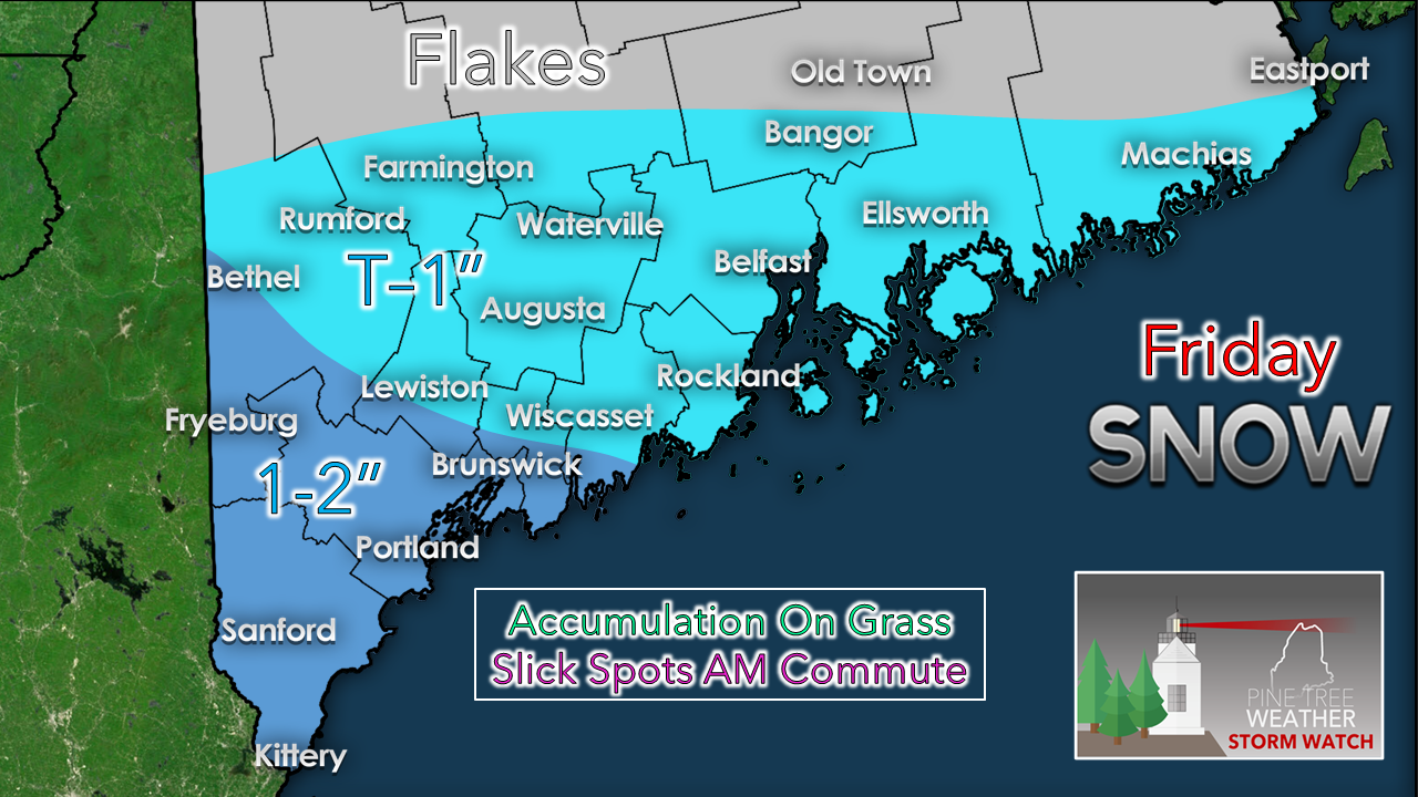 As it appears for now, southwestern areas could see some light accumulations, mainly on grass surfaces. Travel will be a concern given the first snow event of the season. Bridges could freeze up, and pending on how heavy the snow falls, could grease up some roadways. Snow ends by around noon on Friday. Any accumulation won't hang on for long as daytime temperatures progressively warm up into the weekend.  Outlook and temperatures through TuesdayThe weekend looks like a 50/50 split. High pressure moves in for Saturday and will bring cool but pleasant day to the region. The shifts east Saturday night, clouds increase and rain showers break out Sunday. A cold front passes through Sunday night in to early Monday. The mountains and north may see snow showers to start the work week. 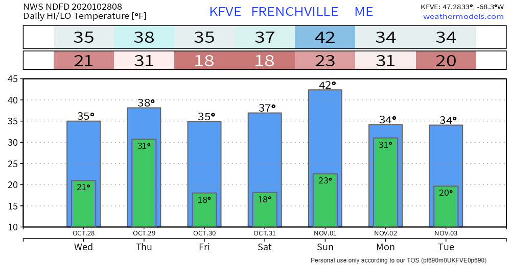 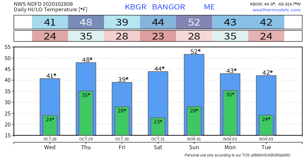 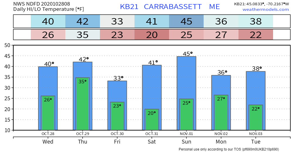 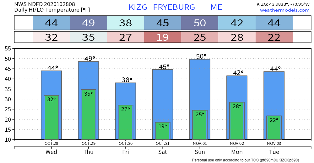 Be prepared to drive in the first snow of the season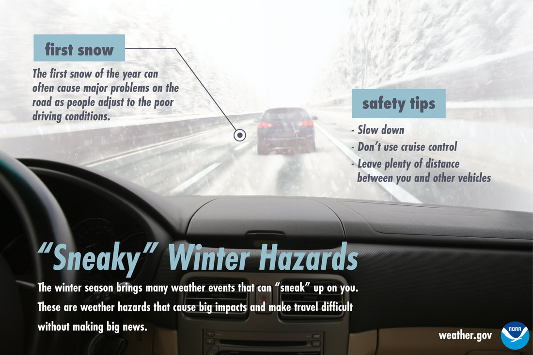 While lots of snow in the middle of winter can certainly cause dangerous travel conditions, many times it’s the first little bit of snow of the season that can cause accidents. Be extra careful as you and other drivers adjust to driving in poor conditions. Slow down, don’t use cruise control, and keep your distance from other vehicles. Don’t let the first snow sneak up on you! For more winter safety and preparation tips ► weather.gov/safety/winter Be prepared to receive alerts and stay updated!
For more information, please follow Pine Tree Weather on Facebook and Twitter.
** FUNDING NEEDED FOR 2021 ** Thank you for supporting this community based weather information source that is funded by your financial contributions. Stay updated, stay on alert, and stay safe! - Mike |

Mike Haggett
|