
Stay updated on the latest bulletins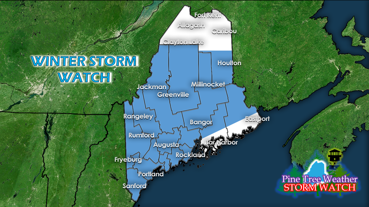 A Winter Storm Watch was placed into effect for much of the state Wednesday afternoon with the exception of the DownEast coast and the rooftop of the the state. Coastal areas who haven't seen any accumulations are going to get some, and the Friday morning commute is likely to be a messy one. If not for watches being posted along the coast, I would likely call for a Body Shop Special, because that is likely going to turn into. DownEast areas not under watch, take note. Friday will be a messy one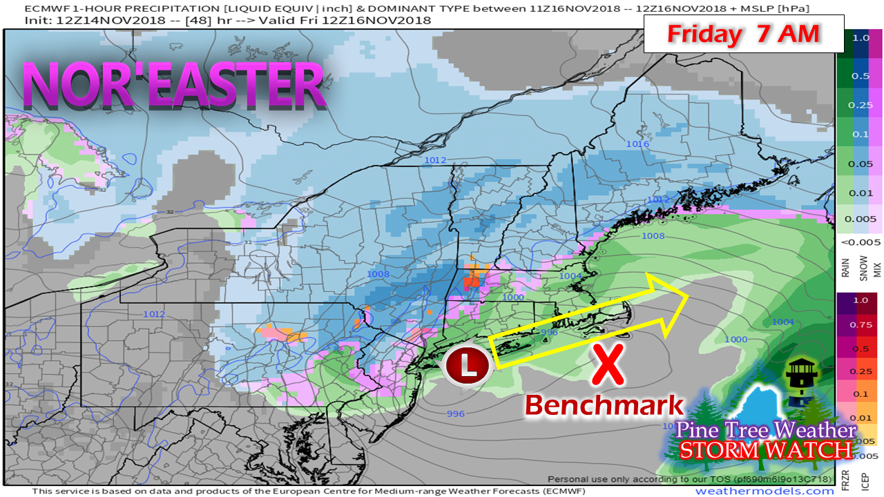 A couple things to note about this storm. For one, it's a quick mover. Second, the track is slightly north of the typical 40°N / 70°W "benchmark" point. The result of that is mixed precipitation for parts of Massachusetts, rain south of there, and potential for a coastal front to impact the Maine coastline. Snow gradually works into the region Thursday night and overspreads much of the state by Friday morning. Overnight or early bird travelers should be advised that road conditions will deteriorate as the night heads toward morning. By 7 AM, it will be a mess for much of the state as the morning commute commences. 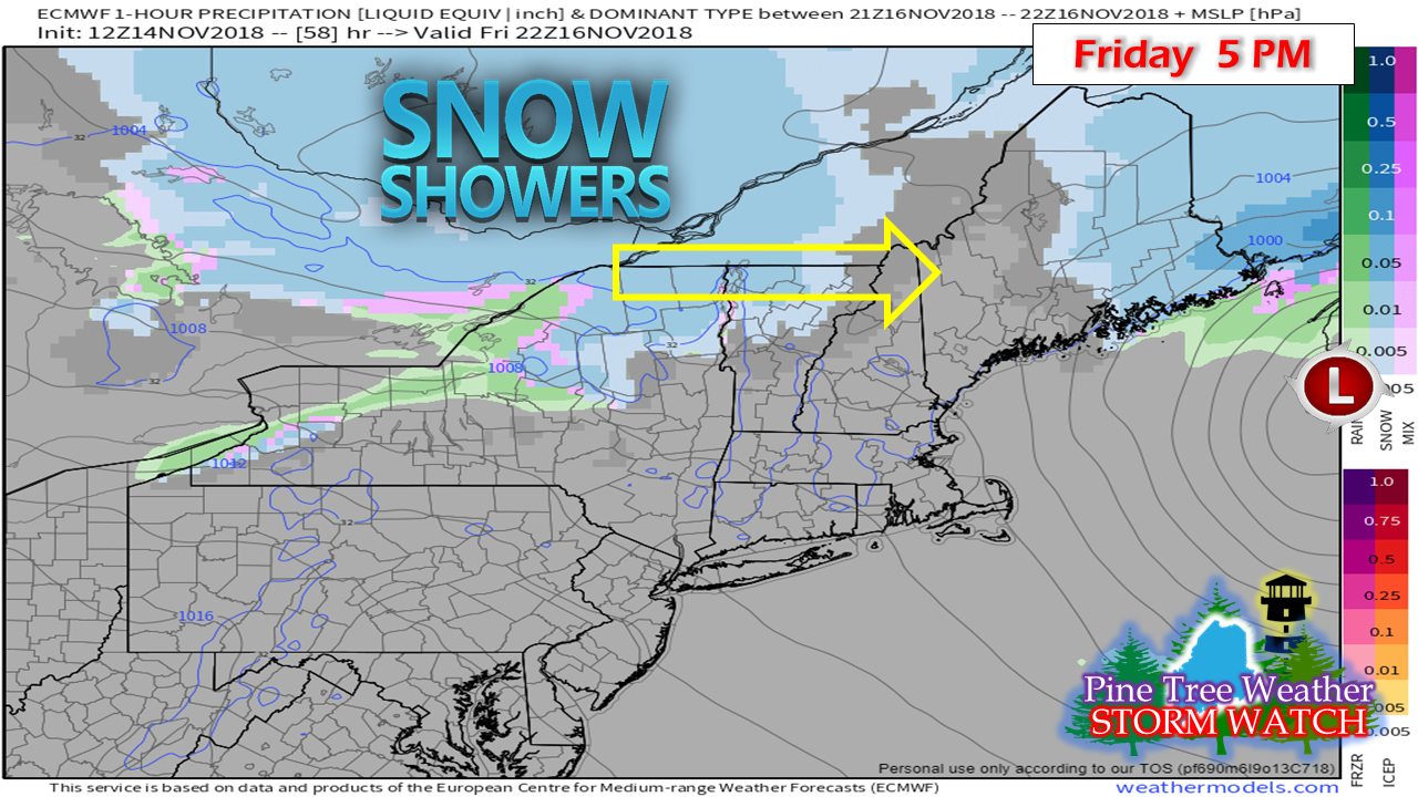 By Friday evening, southern and western areas are in a bit of a lull, while northern and eastern areas are wrapping up phase one. Phase two occurs Friday night as a trailing cold front brings another round of snow showers on the back side, which could bring another inch or two of accumulation pending on region. As far as intensity of wind with the storm, it does not appear to be as bad as previous storms. Outside of snowfall causing slick travel, and some 20-30 mph wind gusts along the coastal plain, the impacts of this event appear minimal. Snowfall idea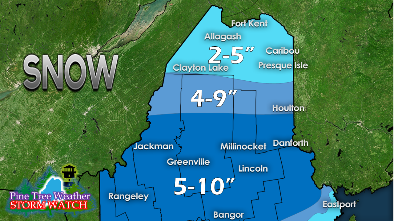 The rooftop of the state will be on the low end of snow totals. Folks around the Allagash are likely to be on the low end. This will be a fluffy snow by-in-large for areas away from the coast. 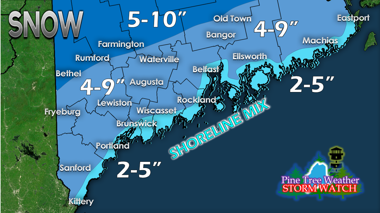 I totally expect a coastal front to impact snowfall amounts given the track of the storm. I also expect that this could bust on the low end along the immediate shorelines and the islands. A couple of miles could make all the difference between an inch or two, and a half a foot. This appears to be a solid event for the interior. I will fine tune this forecast on Thursday, but I don't expect any major changes. We've seen far worse storms. What will make this storm rough is this the first decent snowfall for the heavier populated areas of the south. For those of us who live in that area, we know how that works out. Winter Driving Retraining 101. Your support is valued and appreciated!Please consider making a donation to keep Pine Tree Weather going through the year ahead. My data cost expense is increasing. The operation is 70% funded and needs your help to get through the winter. You can set up a monthly pledge on my Patreon page or send me a message from the Facebook page or direct message on Twitter to get my address to mail a check or set up bill pay.
For the latest official forecasts, bulletins and advisories, please check in with the National Weather Service in Gray for western and southern areas, or Caribou for northern and eastern parts of Maine. For more information from me, please follow the Pine Tree Weather Facebook page and my Twitter feed. Always stay weather aware, and thank you for your support! - Mike |

Mike Haggett
|


