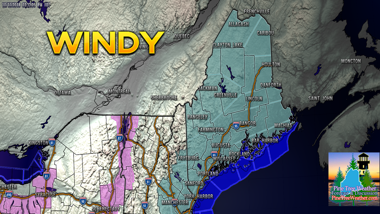
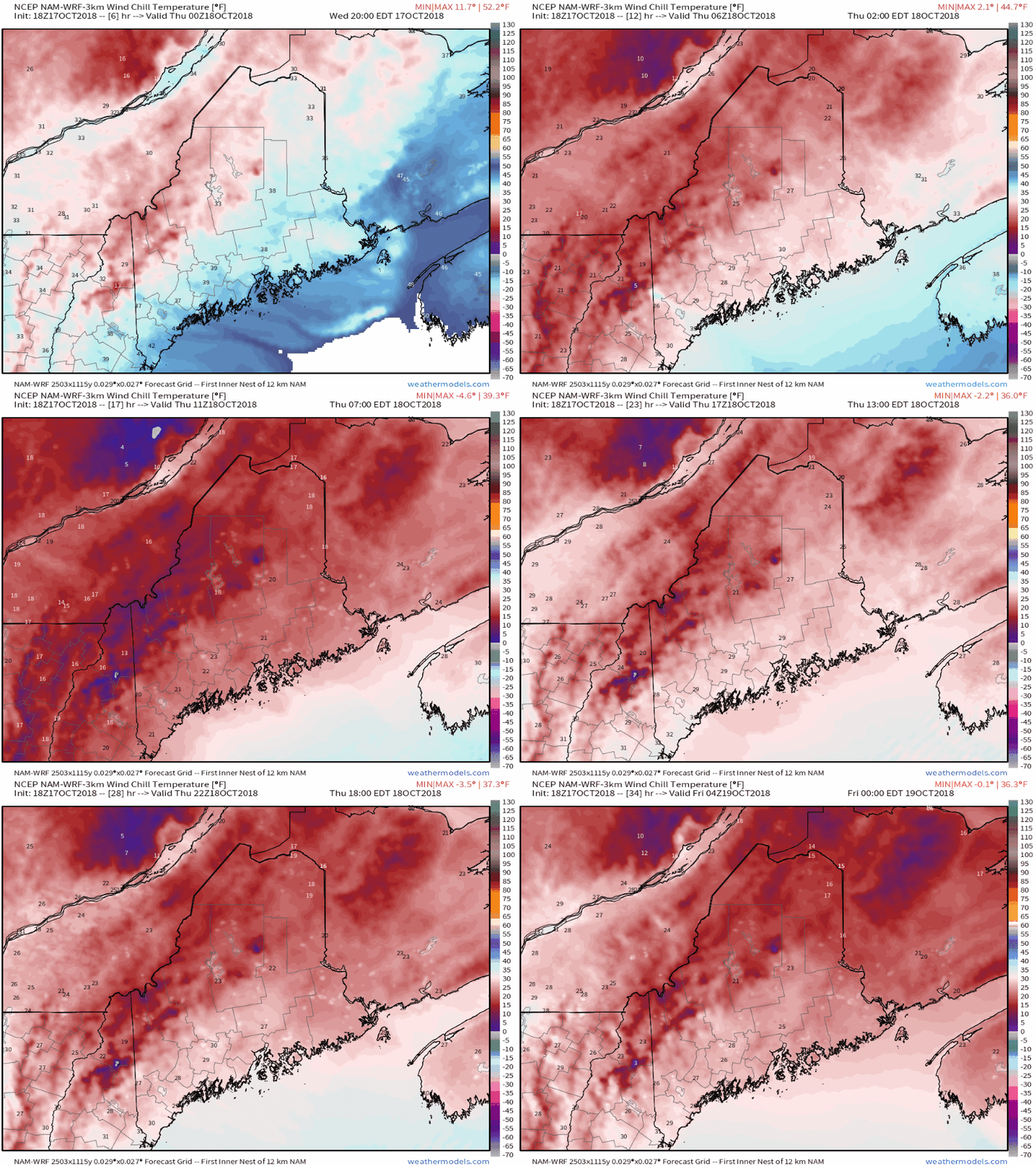
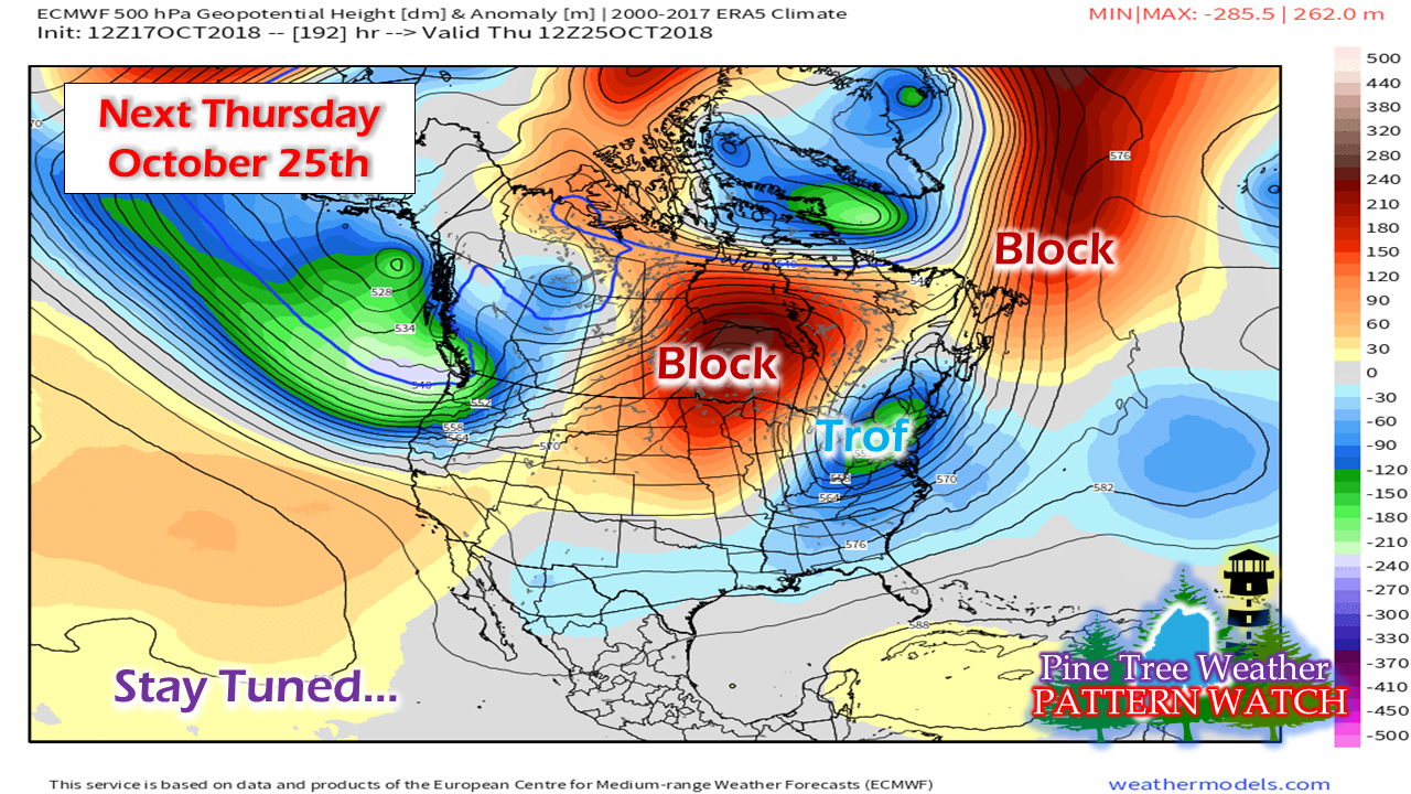
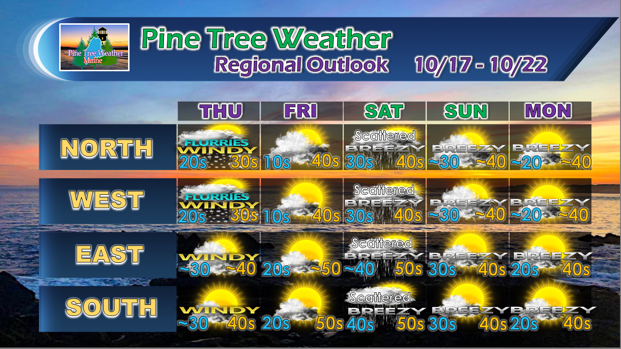
Breeze is the wordAs I mentioned in the previous updates this week on this very site, breeze is going to be with us for awhile. While it can be annoying and cold, it does serve a purpose. While the foliage is beautiful, the sooner the trees drop the leaves, the better. With the power outages earlier this week and a few more possible Thursday, the leaves are a liability at this juncture. As many of us witnessed late last October, they can cause serious problems if a strong storm develops. A Wind Advisory is posted statewide for Thursday with Gale Warnings up for the coast. Expect small objects to blow around, and trash bin obstacle courses in areas of the bigger towns. With the wind comes the chill... and some snow squallsAs mentioned here previously, it is going to be cold as folks head out the door Thursday morning with single digit wind chill indices for the mountains and teens to low 20s elsewhere. There will be some snow squalls around with some light accumulations possible for areas protected from northwest wind. I think most folks may see a chance flake or two in flurries or squalls all the way to the coast as the temperatures at the lower levels of the atmosphere appear to be chilly enough for that to occur. Concerning signal for next weekI don't like putting the cart ahead of the horse too far in advance as trends can change. That said, this idea has been showing over the past couple of days, and it is worth keeping an eye on. What you are seeing here is something that is rather typical in winter. A block to the northeast, a block to the west, and a trof stuck over the eastern half of the country. This is synonymous for breeding NorEasters. Buried in the trof is cold air... cold enough where solid precipitation (read: snow/sleet) could be a factor if a storm materializes. Models are starting to hint at that potential, and there is some support for that idea to occur. My suggestion is that you pay close attention to the forecast over the weekend and into early next week. We tend to get a strong storm in October. Last year, it was near the end of the month. Stay tuned. Outlook through MondayOutside of some light scattered showers Saturday and possibly some sprinkles Sunday in interior areas, the weekend appears dry. Breezy times continue for most of the forecast period.
For the latest official forecasts, bulletins and advisories, please check in with the National Weather Service in Gray for western and southern areas, or Caribou for northern and eastern parts of Maine. For more information from me, please follow the Pine Tree Weather Facebook page and my Twitter feed. Thanks as always for your support! Please consider making a donation to keep Pine Tree Weather going through the year ahead. Check out the donate page on how to contribute. Always stay weather aware! - Mike |
Mike Haggett
|


