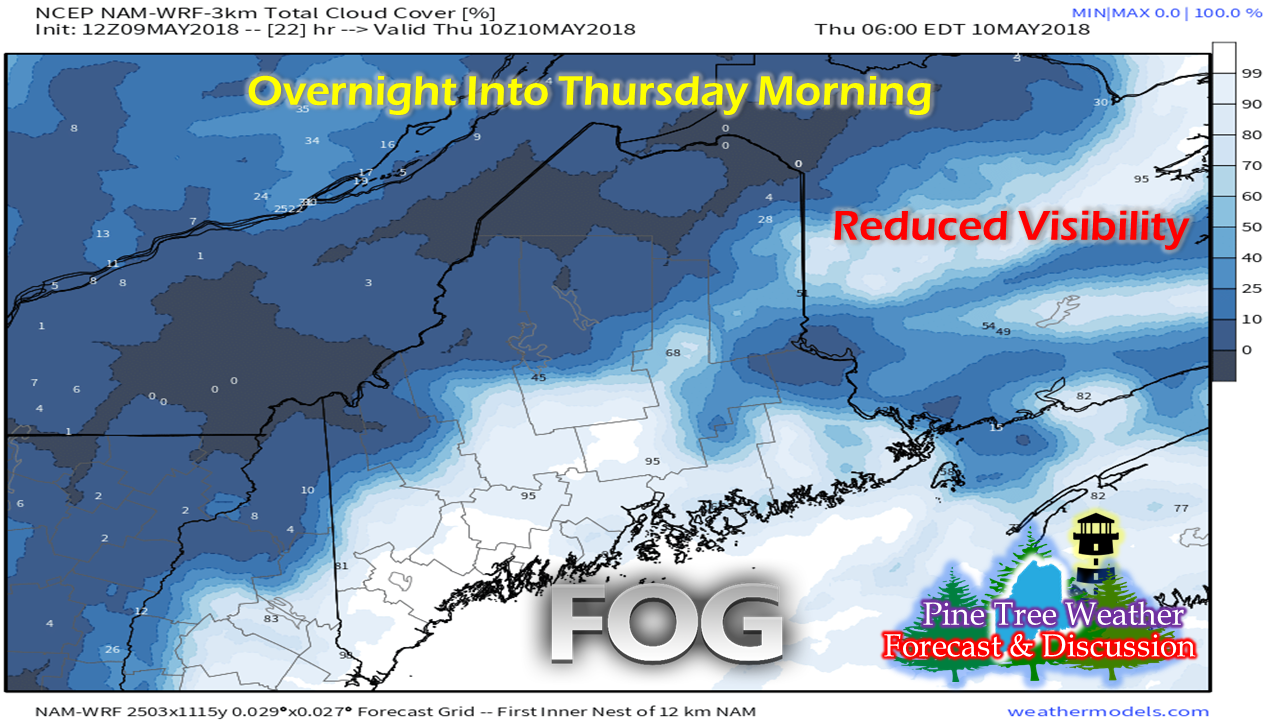
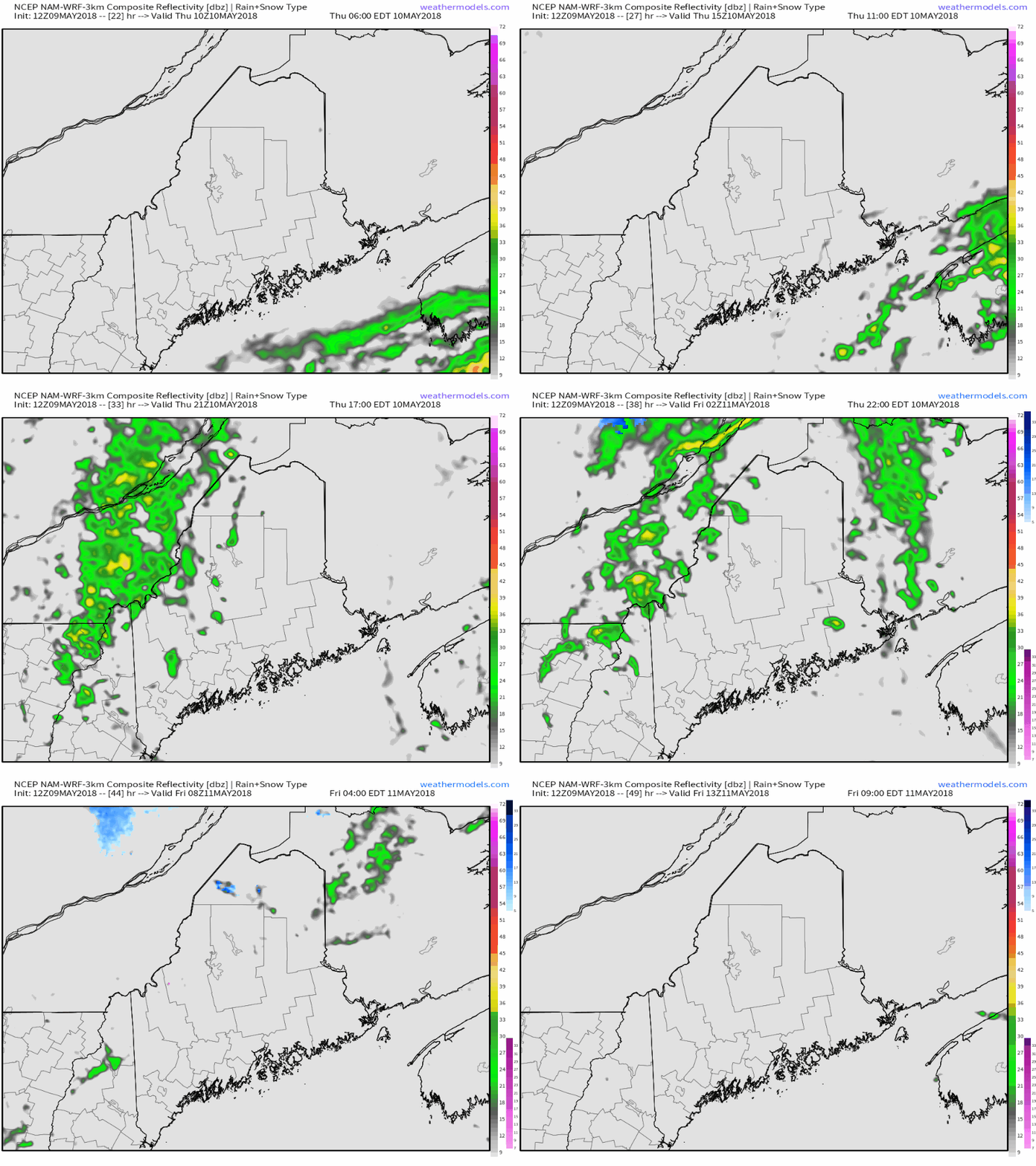
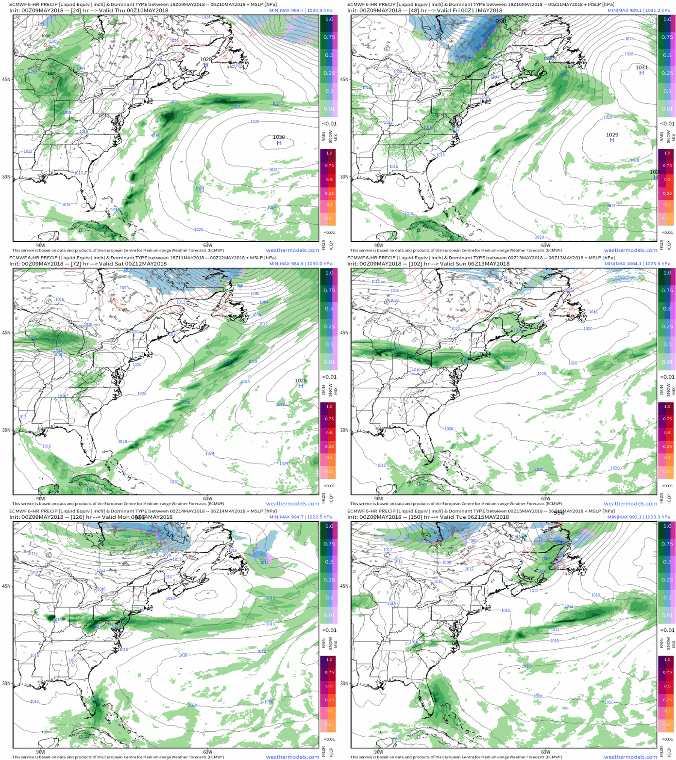
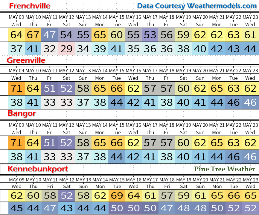
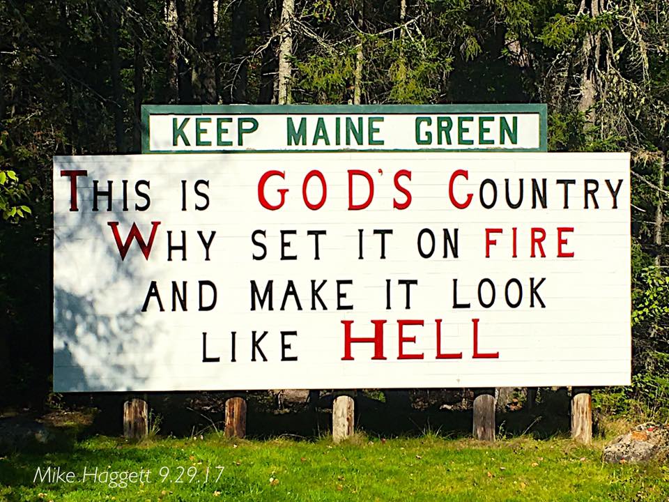
Returning to regular updates soonHello again, everyone! Most of the boxes are unpacked and life is settling down for myself and the family as we have completed our relocation to Kennebunk. I sincerely appreciate your patience during this process. I still have a few things to take care of, but updates here and on the Pine Tree Weather Facebook page will increase in the coming days. I should be back into a pseudo-normal updating pattern soon. Fog returns for one more overnight visitAs I can attest living close to the shoreline, the fog has been "chowder" thick Tuesday and Wednesday, and that appears to be the case again for Thursday morning. The wind direction and humidity off the cold ocean over warm air on land is just right for dense fog to form. Folks along the coastal plain should be advised of poor visibility for the early commuters. This fog may remain stubborn in areas through late morning once again. Clouds from two systems will approach the region, which will make it difficult for the sun to dissipate the low level cloud deck. A few showers around for ThursdayThere are two systems involved here. One is offshore heading to the Canadian Maritimes, the other is a cold front crossing central Quebec. There is a wedge of high pressure in between the two systems which will keep rain showers spotty and light as a result. Eastern areas may see some isolated showers in the morning as the coastal system skirts by well to the southeast. All areas have a chance to get in on the action with some scattered showers Thursday afternoon into the evening. Showers should taper off in the wee hours of Friday and the sky should clear out as the morning progresses. What rain comes will be lightBest chance for any measurable rainfall Thursday will be in the mountains and Crown of the state, along with the DownEast shorelines. The rest of the state may have to deal with some nuisance showers which may bring little to no measurable amounts of rainfall. Folks with outdoor activity in the southern and eastern areas of the state may want to bring along an umbrella or rain jacket in case of a brief spot shower, but chances are it won't be needed very long. Outlook for the weekendAfter a dry day for Friday, a weak trough drops down from the Canadian Prairies which is likely to produce some shower activity for Saturday. This also appears to be light in nature. A wedge forms between the northern and southern jet streams over the region Sunday, which keeps a bulk of the moisture to the north and south of the state. Northern Maine may get clipped with some shower activity from a system over northern Quebec late Monday. All in all, not a bad weekend overall, although it will be seasonably cool. Temperature OutlookThe weekend will definitely be on the cool side. Folks in areas away from the coast should be advised of frost potential Friday, Saturday, and Sunday evening. After that, temperatures begin to modify to a more seasonable to above seasonable levels over the next ten days for much of the state. Low rain means fire riskAs I have mentioned on Facebook and my Twitter feeds over the past couple of days, fire risk will be a concern until we the area gets a good soaker, which may be a week or longer. The Maine Forest Service Rangers have been very busy as of late with wildfires all around the state. Use common sense if you are planning any burning, whether it is burning brush, a camp fire, or using a grill to prepare a meal. For the latest information on the fire class level in your region, please consult with your local fire department or forest ranger. You can check in with the Maine Forest Service for more information.
For the latest official forecast information, please check in with NWS Gray for western and southern Maine and NWS Caribou for eastern and northern Maine. Thank you as always for your support! - Mike |
Mike Haggett
|

