|
If you read between the lines of the headline, we're full on into early fall weather mode. While summer is not officially over for another week, for us near the 45th parallel, we can expect seasonal changes happen early. The days are getting shorter, the cold air is forming to the north of us, and a La Niña watch is in effect. It's time to get the wood split and stacked, check the generators, and look over emergency supplies and plans. We know what is coming. Showers overnight Sunday into Monday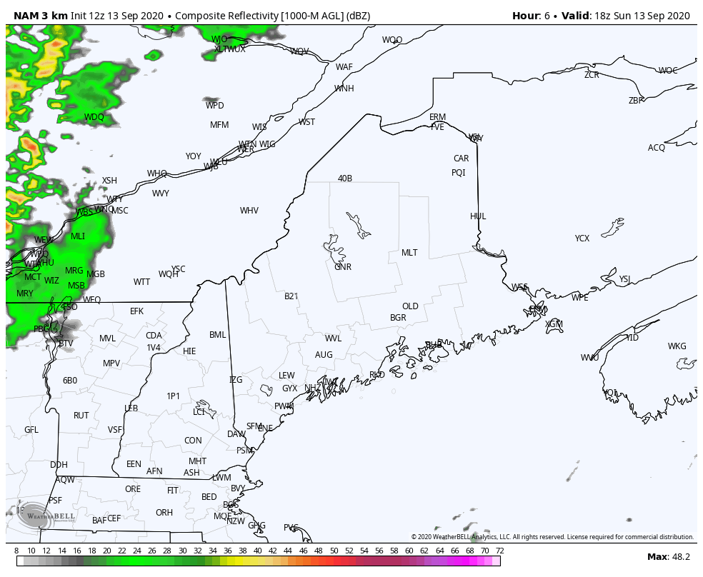 A cold front passes through the region Sunday evening and will bring some showers along with it. This may add a bit of rain to the collectors and tip the spoons on the weather stations a bit, but all in all, not much, if any liquid will come from this. Shower activity ends for most in the wee hours of Monday. Northern areas may get an isolated sprinkle around sunrise. This is all the rain we can expect until late week. Keep reading. Frost & freeze potential Monday night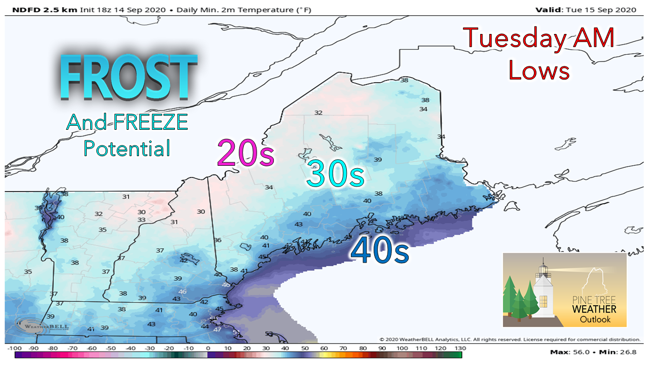 The cold front passing through Sunday brings Canadian high pressure into the area. Monday will be a breezy day as the high works in, but then will settle by Monday night. Radiational cooling kicks in, and that means there is good chance for frost for the mountains, north, and anywhere well protected from air flow, even near the shorelines. If you are growing, it would be safe to cover up what you have going on unless you can smell salt in the air from your door. Surf building from Paulette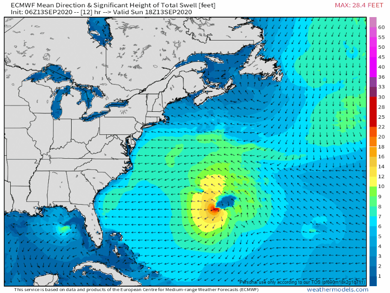 For those along the shorelines, it would be wise to pay attention the marine forecast and for flood statements through the middle part of the week. The new moon arrives Wednesday. Astronomical high tides will continue to build as we start the week. Long wave swell from Paulette appears to start having impacts on our region as soon as Sunday evening. Rip current threats are likely to increase. Splash-over is possible for high tides, along with minor flooding and some beach erosion through Wednesday. Ongoing drought and potential tropical relief late week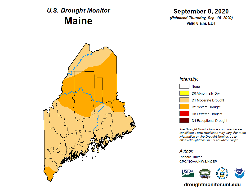 The whole state is either in moderate or severe drought according to the latest Drought Monitor. For more information on the impacts being felt around the state, NWS Caribou released an update this past Friday and NWS Gray issued an update earlier in the month. Given the pattern we are in, it appears that it will take something tropical to try to put a dent in the deficit. If there is a glimmer of hope at this point, it appears that it may be Sally currently in the Gulf of Mexico. 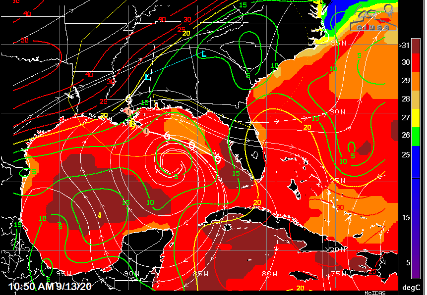 Sally is in a favorable environment for intensification. The Gulf of Mexico has recovered temperature from Laura and Marco. Wind shear is minimal around the system. The storm could reach Category 2 status by the time it makes landfall in eastern Louisiana Tuesday. 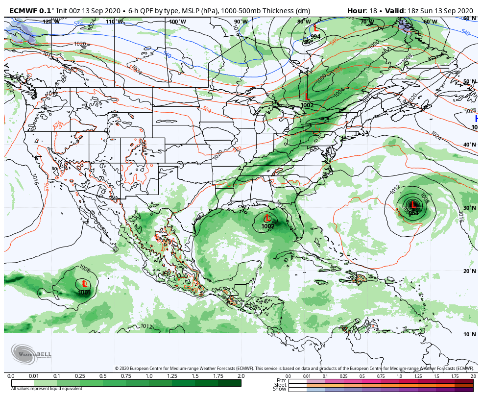 A busy wide angle forecast loop here. Paulette over the Atlantic heads out to sea. Sally makes landfall along the central Gulf coast and could move slow and dump big rain over Alabama until Thursday. A long wave frontal boundary picks up what is left of Sally and could bring rain to parts of New England as we head into Friday. As always, it's a timing game of whether or not it happens. We'll have to keep an eye on the potential storm crossing the Atlantic later in the week, also. Stay tuned. Temperature outlook through the weekFrost /freeze threat for areas away from the shorelines Monday night into Tuesday. Pending on what happens with Sally, we may be in a similar situation Friday night into Saturday.  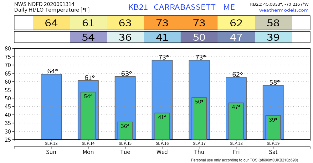 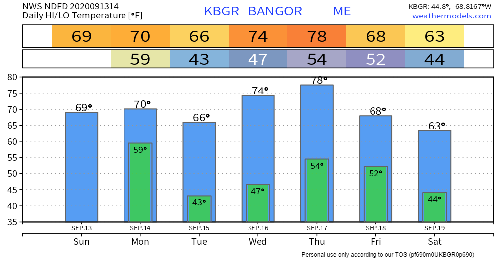  Know what the bulletins mean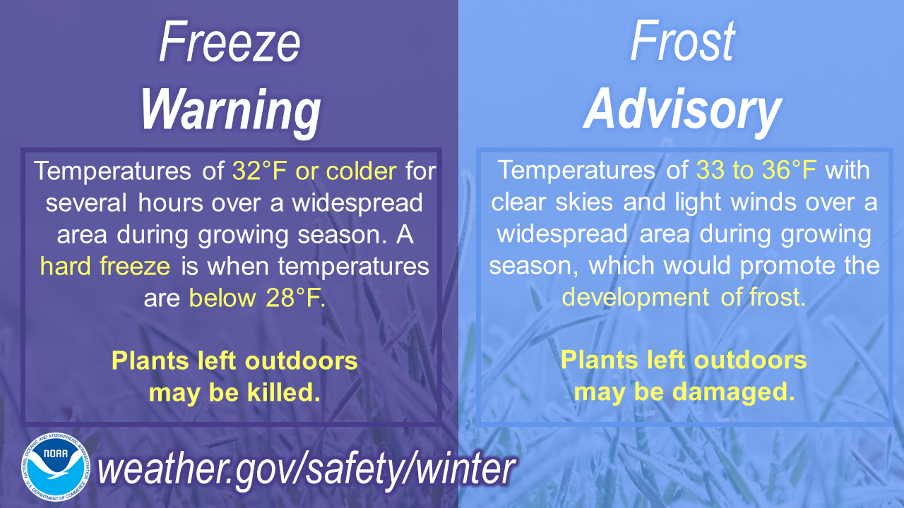 Frost can be annoying to scrape off your car, but did you ever think about how it got there? Watch this video for a little frost science: youtu.be/HBn1oSWu2nE Be prepared to receive alerts and stay updated!
For more information, please follow Pine Tree Weather on Facebook and Twitter.
** FUNDING NEEDED FOR 2021 ** Thank you for supporting this community based weather information source that is funded by your financial contributions. Stay updated, stay on alert, and stay safe! - Mike |

Mike Haggett
|