|
9-16-20 #MEwx WEDNESDAY Update - FREEZE WATCH posted for overnight Thursday into Friday; Watching #TEDDY - PLEASE READ
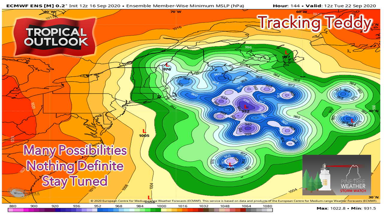
ProTip: Click on image to view in theater mode on PC First and foremost... overnight Thursday into Friday could be the end of growing season for many areas of the state. Both NWS Gray and NWS Caribou have issued freeze watches for areas away from the coast. Thursday sees some light shower activity around as a weak cold front passes through. This front will get the smoke out the the region temporarily. It could come back early next week. Now, onto Teddy. As I mentioned yesterday, it is something to keep watch on. What you see here is an ensemble spread of ideas from the European model. It's looks like the unpleasant aftermath of a long night out. In all seriousness, this shows multiple outcomes of where the storm may go. It's not by mistake I am studying tropical forecasting right now. When looking at long range forecasting, ensembles are a better indication of what -could- happen as they present a range of possibilities. In this case, there are many possible outcomes... 51 of them in fact. It is -WAY- too early to pinpoint what is going to happen here. For the record, the European model is the only model for now that even hints that the storm could reach Maine. This means it is an outlier. That said, it's presenting a case for itself, and it is not out of the realm of possibility at this point that Maine could see some effects from the storm. At the very least, high surf. We're NOT in panic mode here. I've seen big jumps in guidance happen from run to run over the years. Truth be known, the only data the European model is going off of is satellite data for the most part. A lot can change here. There are more questions than answers, as the chart provided here indicates. This is simply a courtesy notification that Teddy could be in the neighborhood. It's something to watch, it is something to stay updated on. There will be more clarification as to how this will play out. We're roughly a week out for now. Stay in touch with NOAA NWS National Hurricane Center as well as US National Weather Service Gray ME and US National Weather Service Caribou ME and updates will come here when time permits. At the very least, this would be a good time to look over storm supplies and think about what you need to do in order to prepare this weekend IF the region were to receive a storm out of this. If not for this storm, others will come soon enough. Stay updated! - Mike |
Mike Haggett
|


