|
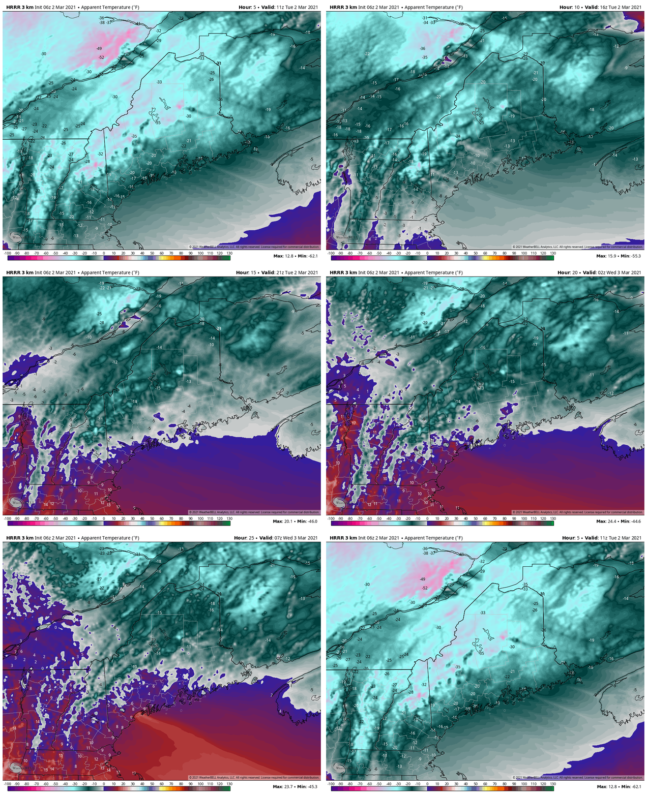
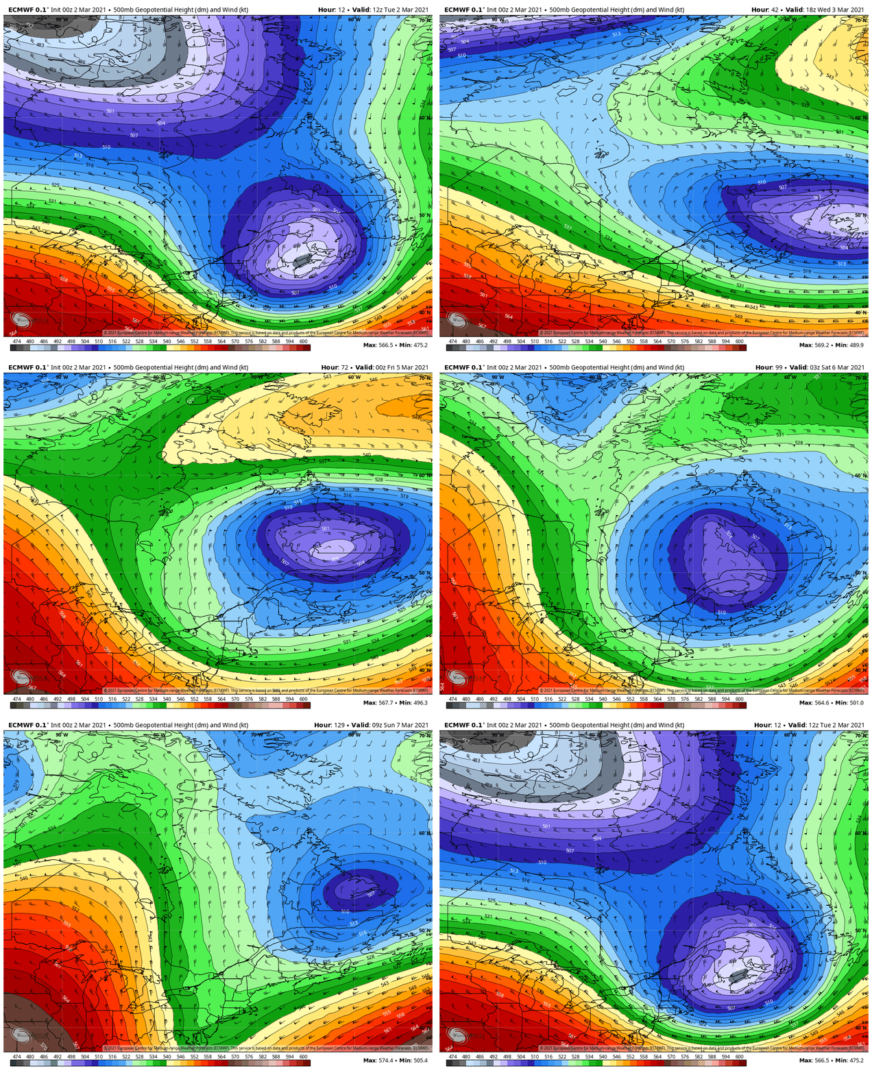
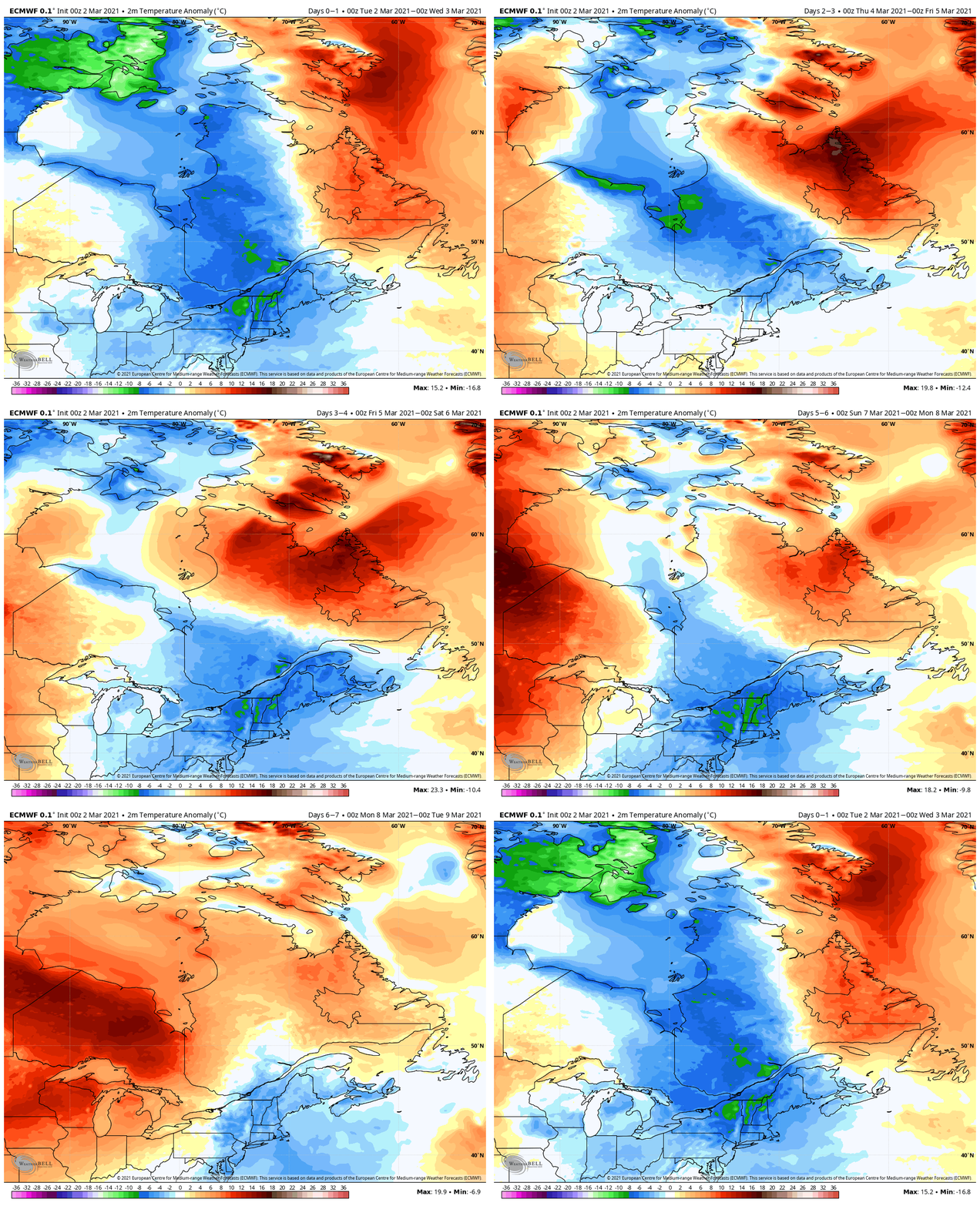
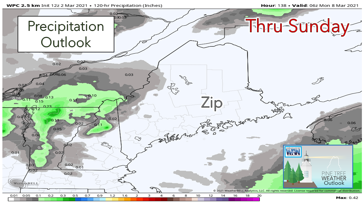
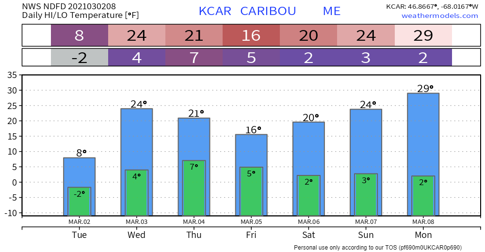
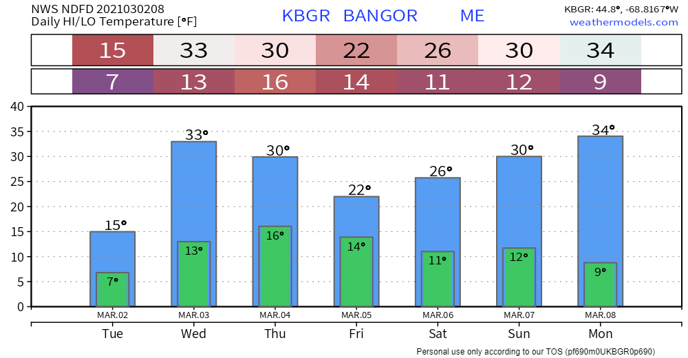
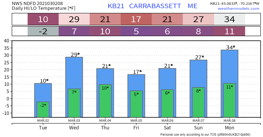
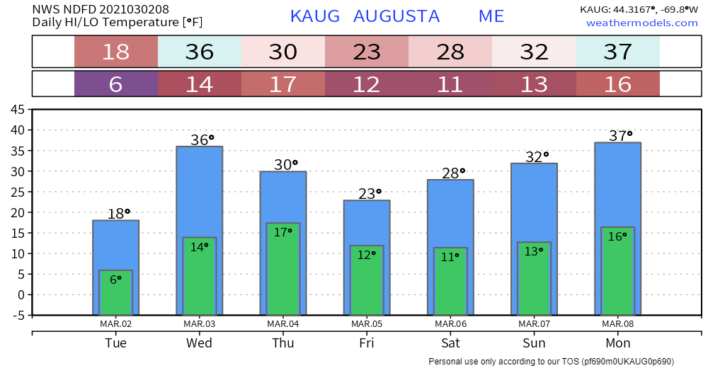
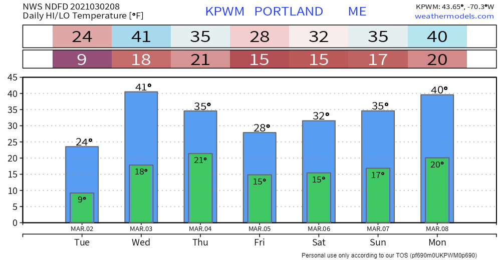
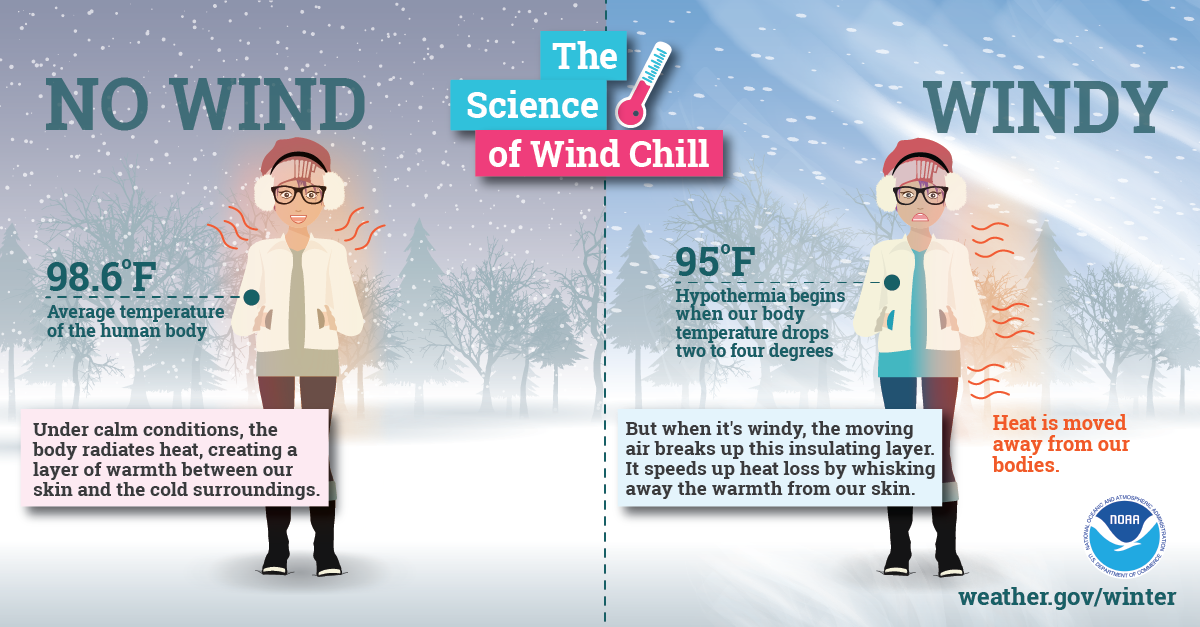
Before I get into the quick discussion here, I just want to say thank you again for hanging in there with me as I juggle multiple things. I am fighting off some serious mental fatigue as of late. I have my moments where I am ready to take the computer and the phone and throw it off a bridge. I am glad the pattern will be generally quiet for a stretch here which will allow me to unplug in spots. What this chap needs is sunshine, 70s for temps, and a golf course, but that will have to wait awhile. On top of everything else, I am working to set PTW up for summer. I have interest from several well qualified meteorology students who will be trained to update here, on Facebook and Twitter. The coverage is shaping up to be the best ever, and I am really looking forward to it. Thanks again for your patience and for your words of encouragement and financial support. It means the world to me. Bundle up for TuesdayWe've managed to get to March 2nd before I had to use my patented term "freezer burn" to describe double-digit below zero wind chills. This is the latest I have brought out the term in the 9+ years I have been publicly forecasting that I can recall. Frigid cold associated with late January will only make a brief visit, as temperatures head back up on Wednesday. High wind warnings for the western mountains and wind advisories continue until Tuesday evening. It will remain on the breezy side through the remainder of the week as an upper low stalls to the northeast and spins around overhead until late weekend. If you think it is cold and windy here, check out Mount Washington. So much pain. Outlook through the weekend dry and coolThe aforementioned upper low which has brought the arctic blast is caught in a traffic jam occurring over the north Atlantic. It will spin around and slowly weaken through the rest of the week. A strong ridge builds in from the south and helps to move traffic along by Sunday. Temperatures appear on the cool side through the first of next week. As the ridge sets up Monday, temperatures appear to head above normal by Tuesday. As the upper low pinwheels around the state, waves may pick up some moisture off the Great Lakes which may kick up snow showers in the mountains at times through Friday. There is a chance for a few flakes as disturbances pass through for the rest of the region which may bring a dusting, but for most the region it appears dry through the weekend and into the start of next week. Temperature outlook through MondayThe normal high and low for Caribou is 29° and 9°. For Portland, 38° and 20°. The upper low keeps northern areas below normal through Monday. Southern areas stay below normal at night but flirt with normal at times during the day. The science of wind chillWith little wind, your body is able to maintain a thin layer of warmer air between your skin and colder air surrounding you. However, higher winds can eliminate that thin layer, and your body can begin to cool at a dangerously fast rate. Visit weather.gov/safety/cold for more winter science! Be prepared to receive alerts and stay updated!
For more information in between posts, please follow Pine Tree Weather on Facebook and Twitter.
Thank you for supporting this community based weather information source which operates by reader supported financial contributions. Stay updated, stay on alert, and stay safe! Thank you as always for your support! - Mike |
Mike Haggett
|

