
Welcome to the convergence zone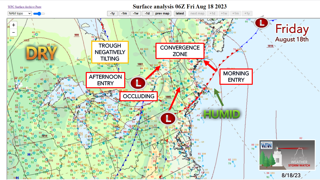 Many pieces in the atmosphere are approaching the region from southwest and southeast Friday and coming together over the state during the day. It's these dynamic systems with several moving features where models struggle due to bias, and it has raised an eyebrow for me a couple of times as I look over their ideas. The one piece that isn't anointed in this graphic is the upper-level jet that is bringing the low over Pennsylvania into the region. That is a key element in this as the exit streak of that over the region and the timing of its arrival could have implications. With the trough negative in the process, which intensifies low pressure along it, much like what we see in winter. Add in some tropical rich moisture, which is a heavy rain signal. Air-you-can-wear moving in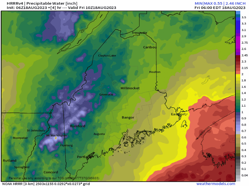 Friday 6 AM to Saturday Midnight - The first piece is the warm front moving into the region Friday morning which brings tropical moisture in. Precipitable water values could reach 2"+ which will drive dew points into the upper-60s and make the air feel like a water vapor gas chamber. While this will be short lived, this window is when the best chance for torrential downpours exists, along with dense fog. Heavy rain potential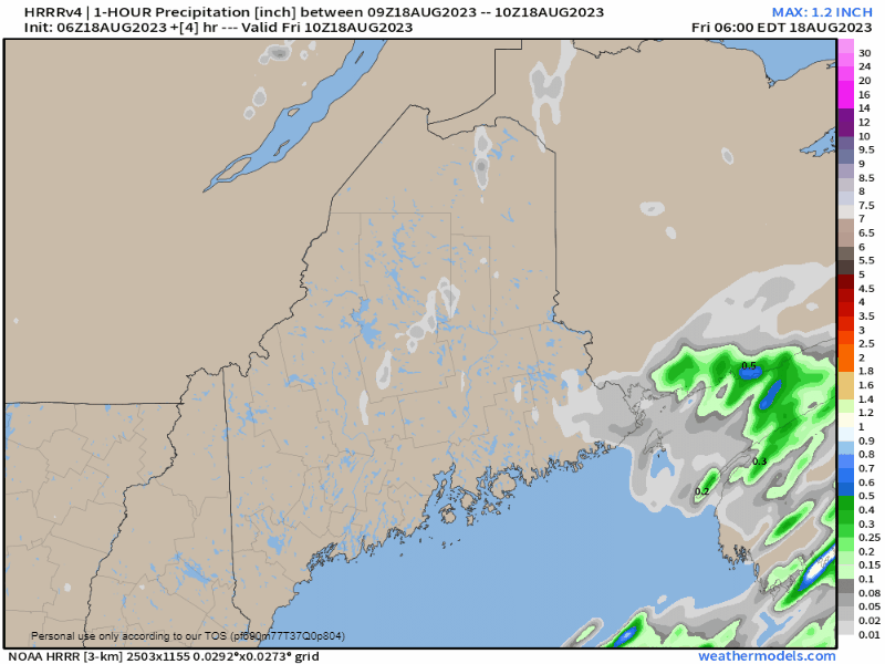 Friday 6 AM to Saturday Midnight - A look here at potential 1-hour rain amounts shows the idea of areas of the state getting hit with 1"+ within that time span and given what is going on here, that makes perfect sense. The difficulty here is pinpointing a specific area where the impacts are greatest. Other short-term models vary in ideas. Given the fact there are many moving parts going on, this is why flood watches haven't been issued as of the time of this post at 6 AM. I have confidence that there will be areas of flash flooding. I have confidence there will be areas of street flooding. I also think that with the speed of the systems involved that threat could be minimized to a more localized threat. I wouldn't look so much as to where the model is pointing to where, but to know that the threat exists for anywhere. Some areas may escape with little rainfall, other areas could get 1-2", perhaps more where storms and downpours repeat. Conditional severe thunderstorm threat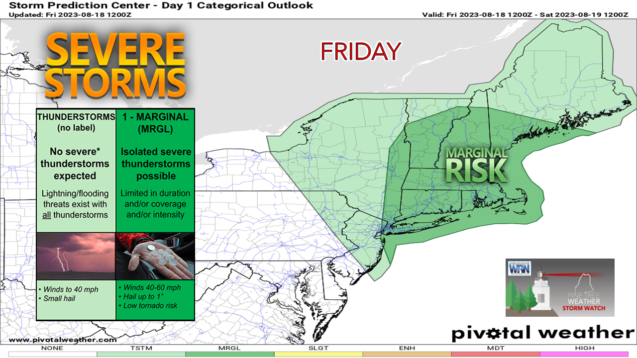 Anytime there is tropical moisture around, the threat of severe storms is on the discussion board. Given the strong warm front moving into the region from the southeast that drives the precipitable water values and dew points up, all it takes is the sun poking through long enough to heat the surface to touch off convection. Given all the pieces converging over the region, there is cause for concern IF that happens. 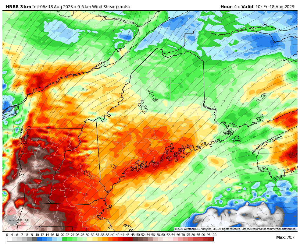 Friday 6 AM to Saturday 8 AM - With so many pieces coming together over the region, there is a lot of spin in the atmosphere likely to be produced. That is what this loop indicates. This idea indicates such a high level of spin that it could keep up with a blow dryer, which is too much. The main threat I see for damaging wind and perhaps an isolated brief tornado or two comes ahead of the front late morning into the early afternoon as the warm front moves in. The sky will roar overhead with all of this wind and surface gusts may reach 25-35 mph, higher in any thunderstorms that develop. 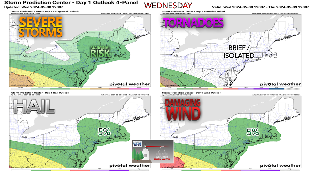 The main threat for strong to severe storms happens during the daylight hours and if the timing is correct, southwestern areas are over and done with the threat by evening and everywhere else by sundown. If the sun comes out, the thunder guns come out in the afternoon. If the clouds hold on, rumbles and downpours are possible, with gusty downdraft winds, but not much in the way of severe concerns. It will be important to stay updated through the day, have multiple ways to receive weather alerts, stay aware of what is going on in the sky, and stay on alert. I will update on my Twitter / X feed through the afternoon. Pine Tree Weather is funded from followers like you. I would appreciate your financial support. Click here for how you can contribute. You may not like the weather, but I hope you like what I do, and support my efforts. Thank you! Stay updated, stay on alert, and stay safe! - Mike NOTE: The forecast information depicted on this platform is for general information purposes only for the public and is not designed or intended for commercial use. For those seeking pinpoint weather information for business operations, you should use a private sector source. For information about where to find commercial forecasters to assist your business, please message me and I will be happy to help you |

Mike Haggett
|


