
Flood watch posted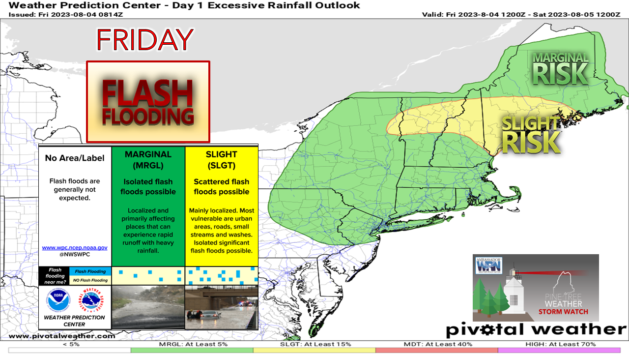 A bit more clarity as of early Friday morning on how this is going to play out. As of the time of this post, Oxford County is under a flood watch. The continuing theme is there is the risk of flash flood warnings that could be issued on demand in areas outside of a flood watch area. Given the complexity of what is known as a mesoscale convective system (MCS) that is falling apart as it moves eastward into Maine this morning and a sharp cold front passing through the area Friday night, the element of surprise is something to stay mindful of. I will continue to maintain that the region is under flood watch whether officially or not. It's been too wet for too long. With the hourly flash flood guidance generally in the 1½-2½" of rainfall across much of the state, the concern remains high. If the sun comes out, the thunder guns come out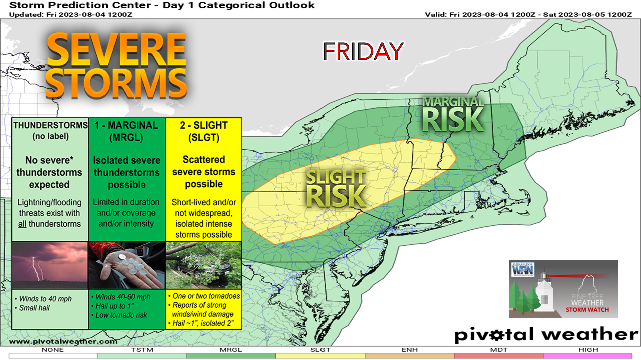 One element of surprise to stay mindful of is the afternoon thunderstorm threat. While the worst appears to the west of the state, southern and western Maine is certainly at risk for isolated mayhem. The severe threat is likely to be sun dependent. The amount of cloud debris around from the morning showers and rumbles, along with what pops up downstream and funnels into our region will dictate the risk of the storm threat. 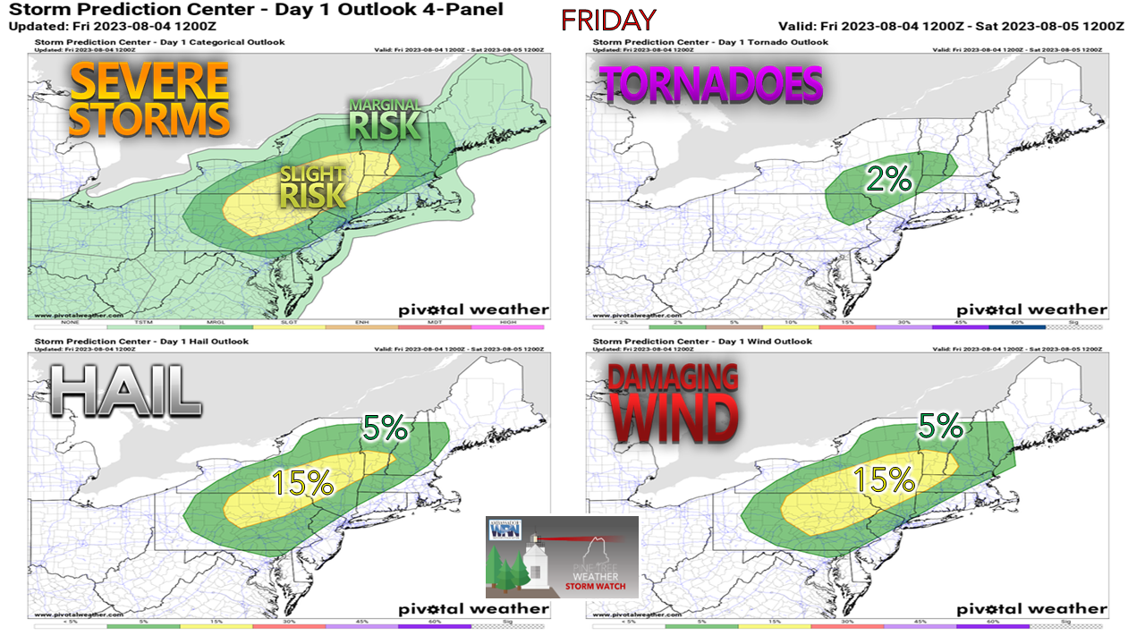 The folks to the west could have a rough time with this. With the sharp temperature lapse rates, there could be some large hail over southern Vermont, central New York and north / central Pennsylvania. While western and southern areas of Maine are at risk for damaging wind and hail, I can't eliminate the outside risk of an isolated tornado. There is quite a bit of spin in the atmosphere given all that is going on. Will we get a severe thunderstorm watch? Time will tell as the day evolves. Regardless of if a watch gets issued or not, the threat could be there if the sun comes out in the afternoon. Timing and rainfall amounts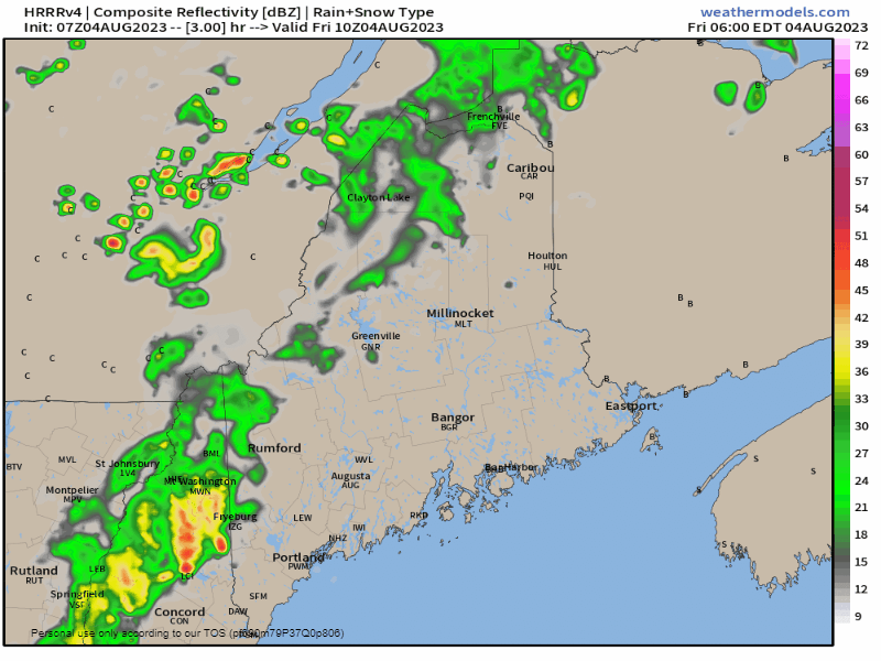 Friday 6 AM to 9 PM - Two waves moving through here. The first is what is left over from the decaying MCS over western New England. The lull that is presented here from mid-morning into the early afternoon is where the potential for the sun to emerge, and if it does, it's game on for strong to severe storms. The threat for training storms is clearly depicted in this 15-minute step loop. That is where it will dump. After sunset, the atmosphere will cool down and as the frontal boundary passes through overnight, showers taper off from west to east early Saturday morning. For those followers who are planning to come to the region for the weekend, my suggestion is to get on the road as early as you can. The timing is not good for the Turnpike around the time for the evening commute. With the ongoing construction in the Portland area, I can see the potential for gridlock, or slow travel. 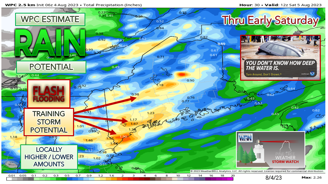 Rainfall amounts for southern areas up into the mountains still have the over/under at an inch of rainfall, with lesser amounts to the north and east as a general rule. Where training occurs and where storms develop could get a lot more than that. I've seen ideas that reach the 4-6" range, and while that would be isolated, it could happen given the dynamics here. After this we will have a quiet and dry weekend with temperatures slightly below normal through the period. Our next system of concern for potential heavy rain and storms comes Tuesday. I will be updating observations on my Twitter feed through the day.  Pine Tree Weather is funded from followers like you. I would appreciate your financial support. Click here for how you can contribute. You may not like the weather, but I hope you like what I do, and support my efforts. Thank you! Stay updated, stay on alert, and stay safe! - Mike NOTE: The forecast information depicted on this platform is for general information purposes only for the public and is not designed or intended for commercial use. For those seeking pinpoint weather information for business operations, you should use a private sector source. For information about where to find commercial forecasters to assist your business, please message me and I will be happy to help you. |

Mike Haggett
|


