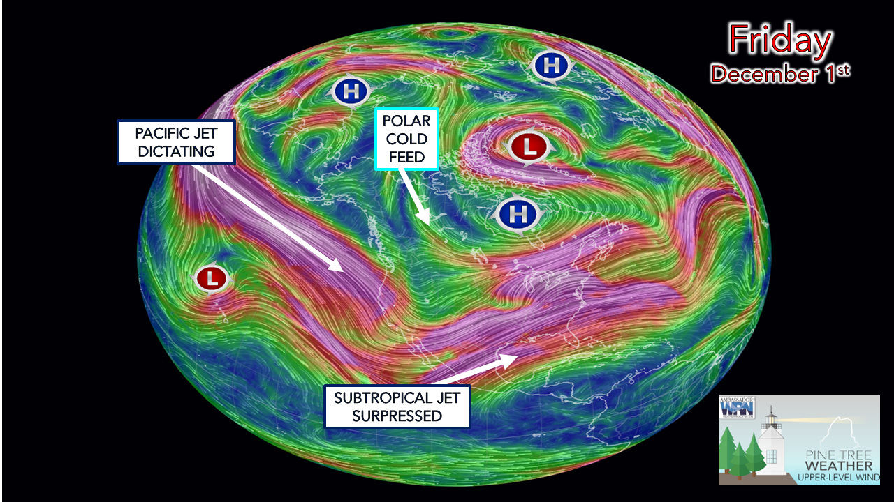
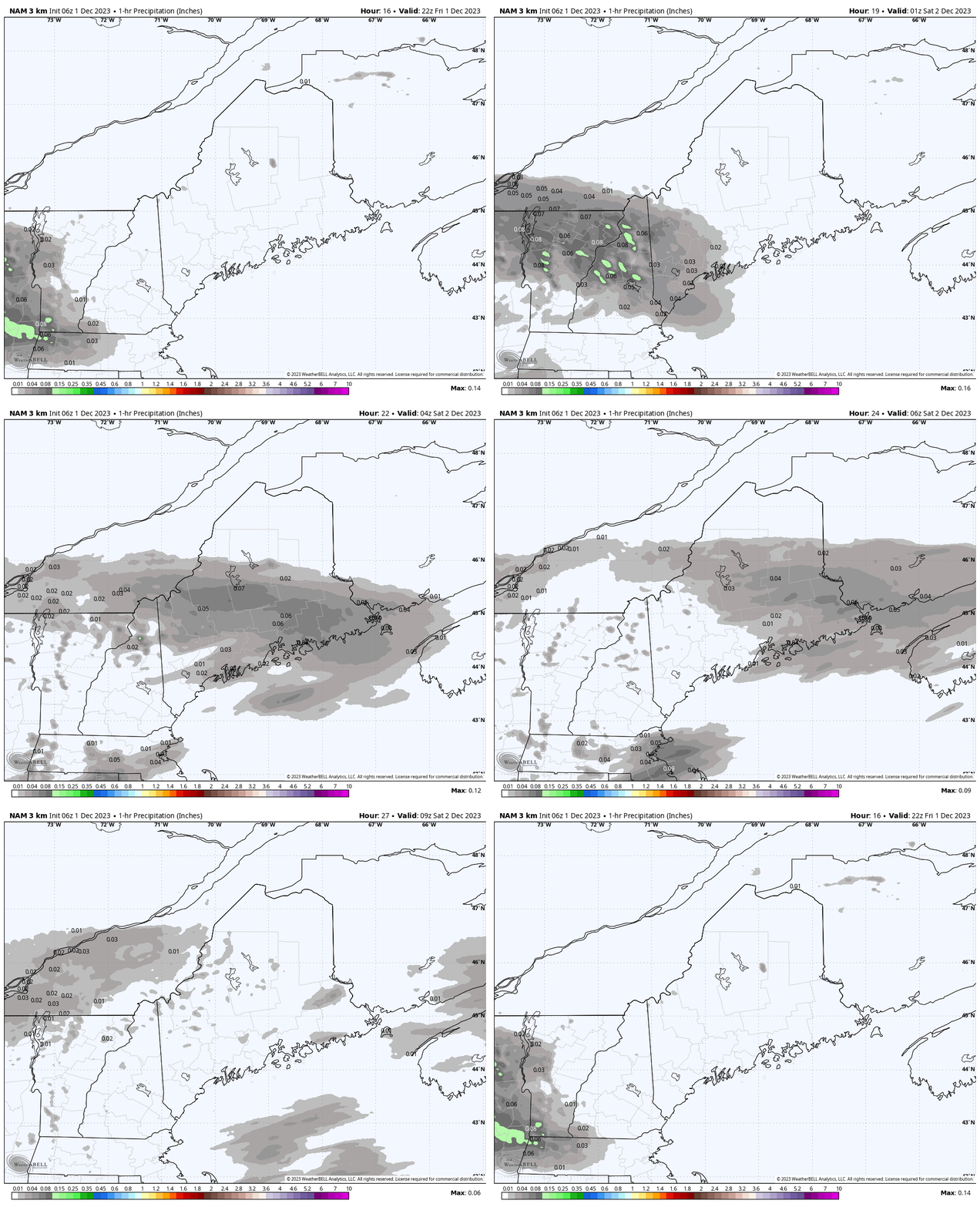
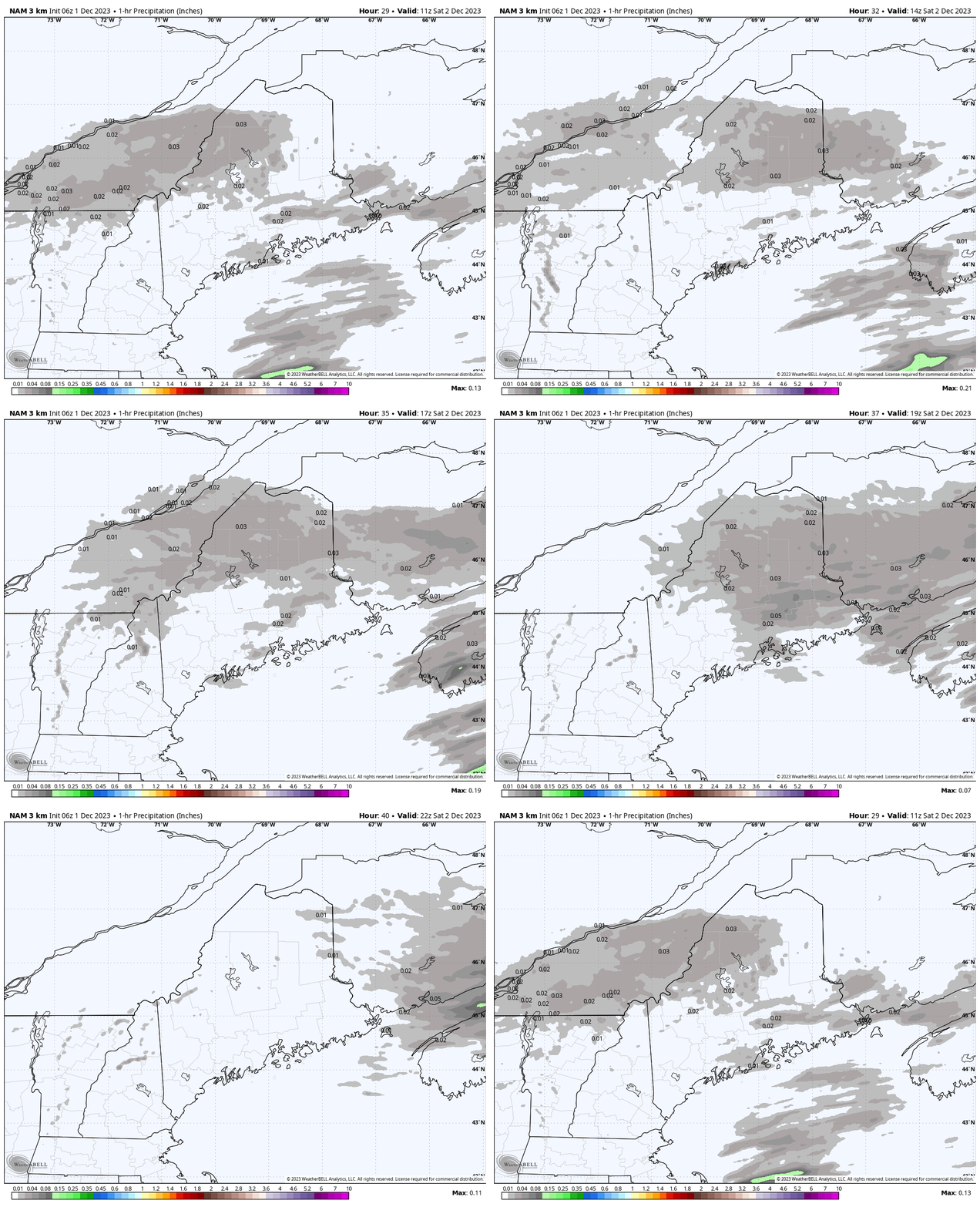
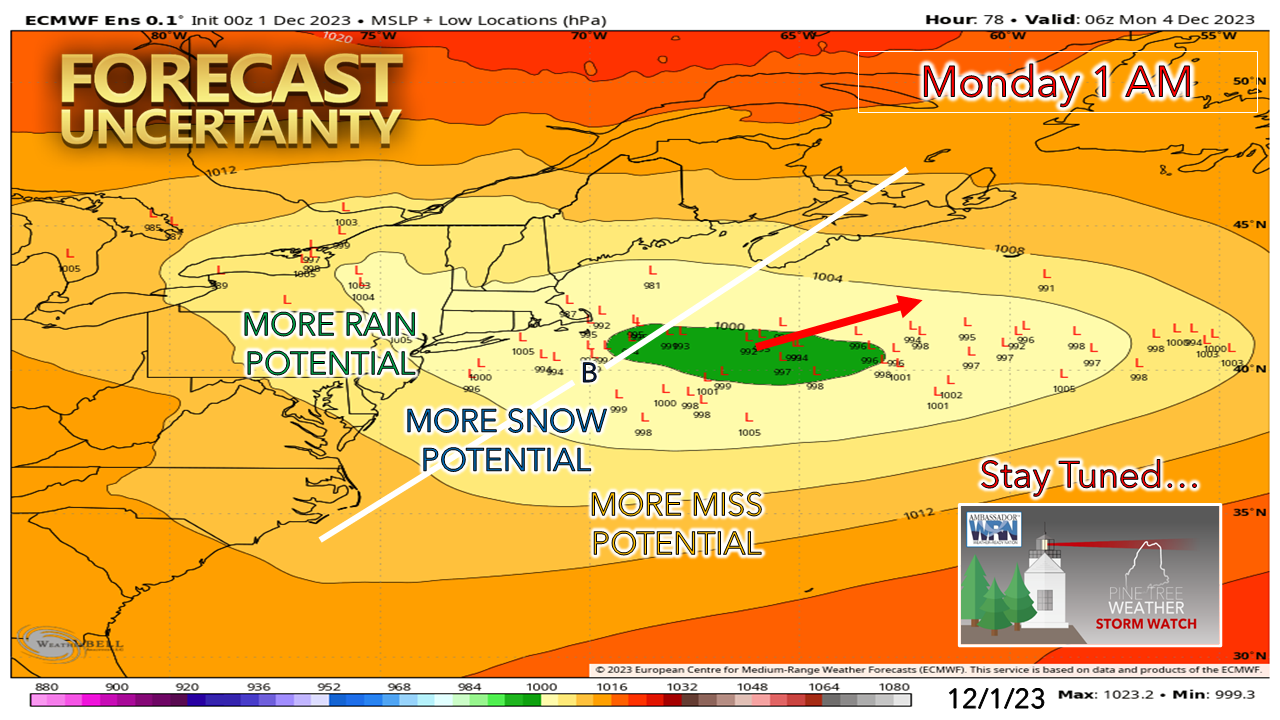
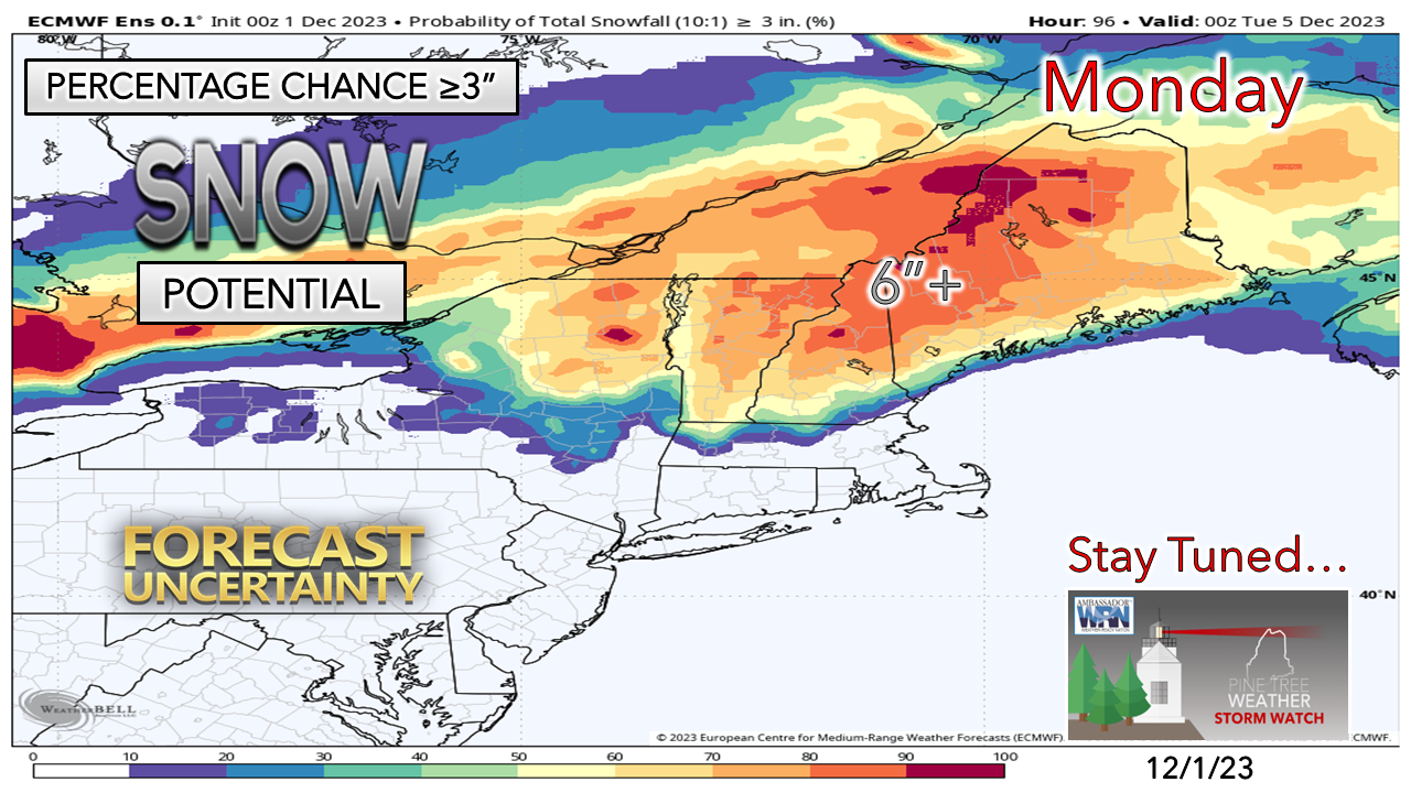
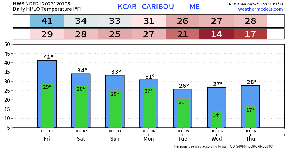
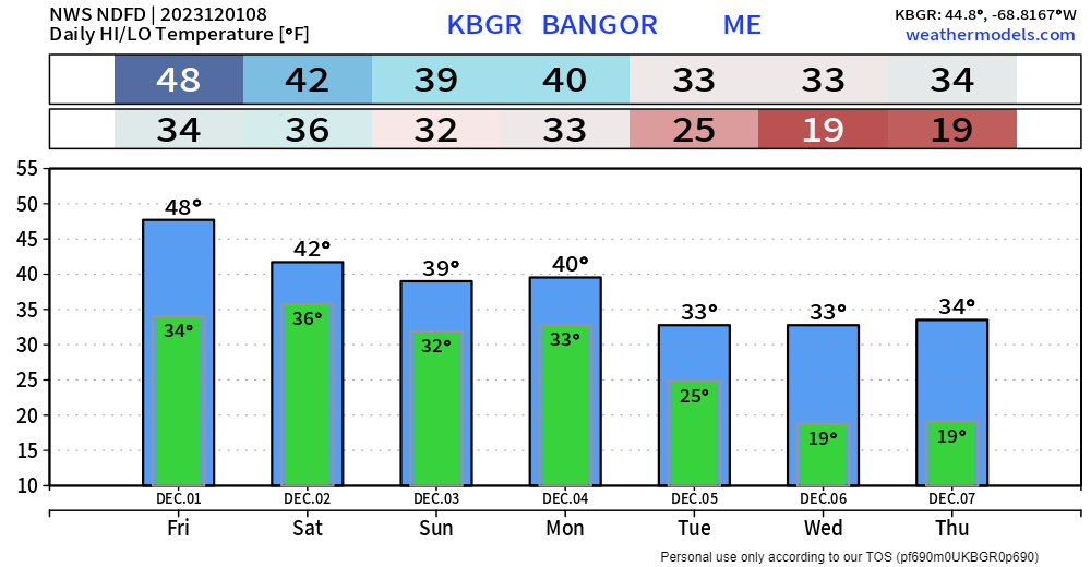
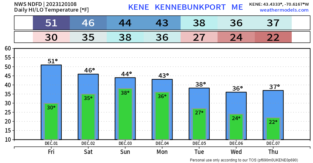
Upper wind pattern tells the tale through early next weekI mentioned on Facebook Thursday morning about the Pacific jet stretching from Saudi Arabia to North America. When it is that long and that strong, it handles the weather pattern like a cranky judge in a courtroom. Polar highs and lows spinning around aren't quite strong enough to bend it a whole lot. Suffice it to say the progressive pattern of storm flow continues. Ridging wants to move north, and deeper cold wants to move south, and that is setting up a standoff over Maine into next week. Boundary stalls out over the weekendFriday 5 PM to Saturday 6 AM - A weak warm front tries to nose its way into the region into the evening. Showers are expected to break out in frozen form over the interior and liquid form along the coastal plain Friday evening and continue into Saturday morning. Snow accumulations are expected to be light and enough so that it may require a salting on the roadways over the interior. There may be a bit of a mix in the lower elevations north of Route 2, with rain south of that to the coast. For those heading to Kennebunkport for the kickoff to Christmas Prelude, wear rain gear. It won't be heavy rain, but steady enough where you'll appreciate having it. Saturday 6 AM to 8 PM - As one weak disturbance departs, another one enters during the day. Some light snow is expected over the interior with showers, sprinkles, and perhaps pockets of drizzle over the southern half of the state. Southern areas may see the sun try to poke through in the afternoon, but it appears to be a mainly cloud day. Monday storm beginning to piece togetherSome better consensus is forming on the next storm on Monday, but there are plenty of questions that continue. Much of the ensemble envelope is east of the benchmark point "B" which is an indicator that snow has a chance to make it to the coast. High pressure over east central Quebec keeps the cold in place. The raw idea on track is to the east northeast. It becomes a timing game as when the storm gets its act together and how quickly it intensifies as to what the precipitation type and amounts. If the general idea on timing and development holds, Monday morning will be a slick start for much of the region, with the southwest coast a question mark. It could be another beneficial snow for the ski hills that are off to their best start since 2018. It's still a bit early to get into specifics as there are plenty of ways the idea depicted for now can change but the potential is there for a plowable snow that could close schools and daycares. Stay tuned! Please make my 2 AM wake up calls worth itTemperature outlook through midweekIf you appreciate independent, unbiased weather information, please support my efforts. I can't do this without you! Stay updated, stay on alert, and stay safe! - Mike NOTE: The forecast information depicted on this platform is for general information purposes only for the public and is not designed or intended for commercial use. For those seeking pinpoint weather information for business operations, you should use a private sector source. For information about where to find commercial forecasters to assist your business, please message me and I will be happy to help you. |
Mike Haggett
|

