Pine Tree Weather
  • DISCUSSIONS
  • DONATE
  • WEATHER WALL
  • MAPS
  • RAIN OUTLOOK
  • SEVERE
  • MARINE
  • CPC OUTLOOK
  • Kennebunk
  • MY BIO
  • PTW IN MEDIA
  • OBSERVING WEATHER
  • INTERNSHIPS
  • INTERN ALUMNI
  • DISCUSSIONS
  • DONATE
  • WEATHER WALL
  • MAPS
  • RAIN OUTLOOK
  • SEVERE
  • MARINE
  • CPC OUTLOOK
  • Kennebunk
  • MY BIO
  • PTW IN MEDIA
  • OBSERVING WEATHER
  • INTERNSHIPS
  • INTERN ALUMNI

Friday July 14, 2023

7/14/2023

Comments

 
Before I get into the forecast, I wanted to say thanks to those who financially contribute to the cause here. Whether it is by Patreon, Venmo, or by simply sending a check, you folks are the ones that keep the lights on here for me. Truth be known, I make very little to no money out of this. I've poured roughly $20,000 of my own money into this between forecast data and college over the years because I wanted to do this the right way. I knew back years ago that the state of Maine lacked weather coverage, and there was a serious gap between the TV outlets and NOAA, and I have tried to fill that. It has all come with great personal sacrifice at times in the amount of time this requires and the physical toll on my arthritic hands that I have mustered through here recently, not to mention sacrifice in time with my wife, daughters, and friends. If you like what I do, please support what I do, and thank you to those that do. 

We are under a constant state of flash flood watch

Picture
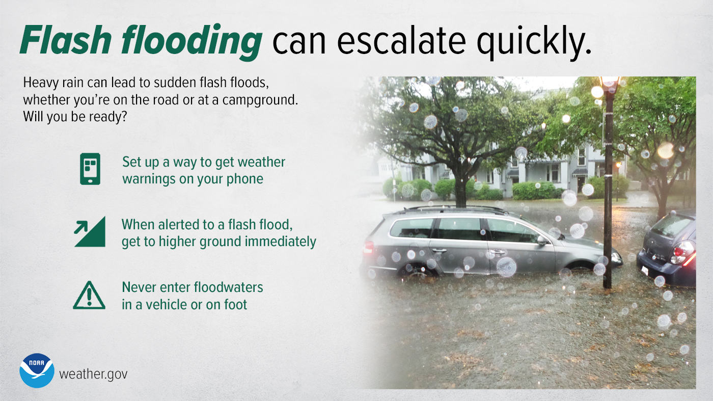
I hate beating on a dead horse here, but this is the reality, and it will be until further notice. There may not be official bulletins from the National Weather Service, but that doesn't matter. Torrential rain is going to happen. I've posted 1-hour flash flood guidance charts periodically over the past week to help drive the point home that the ground cannot absorb water anymore. It will want to run off, whether by road, brook, stream, river, or your basement. Where there is heavy rain, the threat of flash flooding is going to be there. By the time a bulletin is broadcast, impacts will already be occurring. When heavy rain happens, expect flash flooding. 

Shower and storm threat Friday afternoon into the overnight

Picture
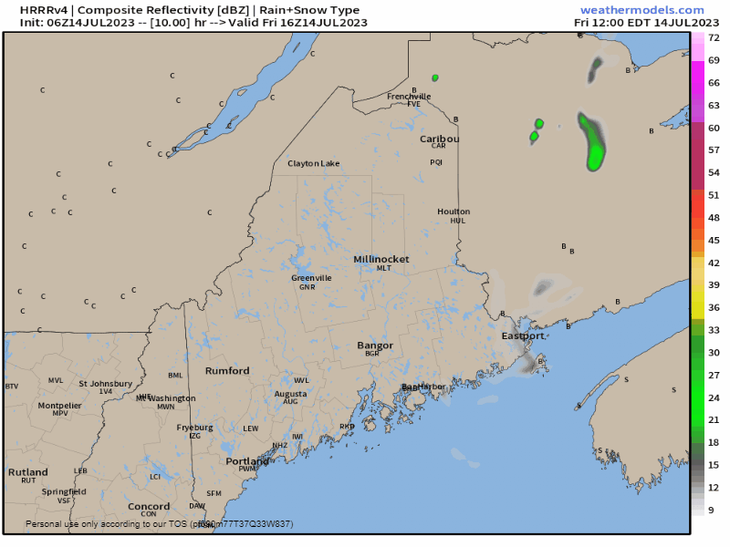
Friday Noon to Saturday 6 AM - I will be right out front here and mention the short-term convection allowing models (CAMs) have been a bit jumpy with their ideas. The reason being is how they are treating the ongoing convection downstream, which ironically enough is causing convective feedback issues. The bottom line here is that showers and storms are expected in the afternoon into the evening. There is a fair chance for strong to severe storms where the sun comes out, with damaging wind a concern. The influx of dew points into the 70s over southern areas and precipitable water values in the 2"+ range mean rainfall rates 1-3"+ per hour. I had a situation here in Kennebunk a year ago in similar conditions where my weather station recorded a rainfall rate as high as 11" per hour. Granted, I didn't get 11" of rain in an hour, but the point here is the velocity of it. For southern areas, heavy rain is expected to hit during the evening drive. Stay on alert and plan accordingly. 

Picture
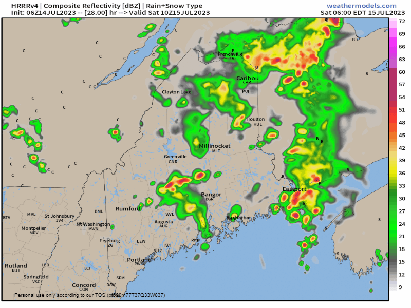
Saturday 6 AM to Sunday Midnight - I don't expect the day to be a complete washout, but there will be some showers and storms around. With the dew points high and the amount of convective available potential energy (CAPE) around, the sun is poison in this situation. If the sun comes out, expect the thunder guns to come out, as storm development could happen quickly. Storms could be strong to severe and bring damaging wind along with a boatload of rain. 

Sunday likely to be a washout for most of the state
and a greater flood concern

Picture
Sunday Midnight to Monday 6 AM - The Weather Prediction Center in their day three outlook has most of the state in slight risk (level 2 of 4) for flash flooding, and for a good portion of southwestern areas under moderate risk (level 3 of 4). This is where it gets worrisome for roads to wash out as brooks and streams rise fast due to the torrential rainfall. I am using the European model here since this time period is just outside that of the reputable short-term CAMs, so there is some fine tuning to come with this.  The heaviest rain is expected overnight into Monday morning, which for the overnight travelers is a concern for unmarked and unattended road washouts. The standard "turn around and don't drown" approach is required. 

Expect next week to continue to be unsettled, with showers and storms a regular feature, some days more widespread than others.

​Pine Tree Weather is funded from followers like you.
I would appreciate your financial support. 
Click here for how you can contribute.


You may not like the weather, but I hope you like what I do,
and support my efforts.

​
Thank you!

Stay updated, stay on alert, and stay safe!

- Mike

​NOTE: The forecast information depicted on this platform is for general information purposes only for the public and is not designed or intended for commercial use. For those seeking pinpoint weather information for business operations, you should use a private sector source. For information about where to find commercial forecasters to assist your business, please message me and I will be happy to help you.

Comments
    Picture

    Mike Haggett
    Kennebunk, ME

    Weather-Ready Nation
    Ambassador

    Certified Weather
    Forecaster
    Penn State '21

    American Meteorological Society

    National Weather Association
    ​
    ​SKYWARN-CWOP

    Matthew 19:26


    DONATE

    Picture
    Picture
    Picture
    Picture
    Picture

    Picture

    Picture

    Picture

    Picture

    Picture

    Picture

    Picture

    Picture

    Picture

    Picture

    Picture

    Picture


    Archives

    April 2025
    March 2025
    February 2025
    January 2025
    December 2024
    November 2024
    October 2024
    September 2024
    August 2024
    July 2024
    June 2024
    May 2024
    April 2024
    March 2024
    February 2024
    January 2024
    December 2023
    November 2023
    October 2023
    September 2023
    August 2023
    July 2023
    June 2023
    May 2023
    April 2023
    March 2023
    February 2023
    January 2023
    December 2022
    November 2022
    October 2022
    September 2022
    August 2022
    July 2022
    June 2022
    May 2022
    April 2022
    March 2022
    February 2022
    January 2022
    December 2021
    November 2021
    October 2021
    September 2021
    August 2021
    July 2021
    June 2021
    May 2021
    April 2021
    March 2021
    February 2021
    January 2021
    December 2020
    November 2020
    October 2020
    September 2020
    August 2020
    July 2020
    June 2020
    May 2020
    April 2020
    March 2020
    February 2020
    January 2020
    December 2019
    November 2019
    October 2019
    September 2019
    August 2019
    July 2019
    June 2019
    May 2019
    April 2019
    March 2019
    February 2019
    January 2019
    December 2018
    November 2018
    October 2018
    September 2018
    August 2018
    July 2018
    June 2018
    May 2018
    April 2018
    March 2018
    February 2018
    January 2018
    December 2017
    November 2017
    October 2017

Proudly powered by Weebly