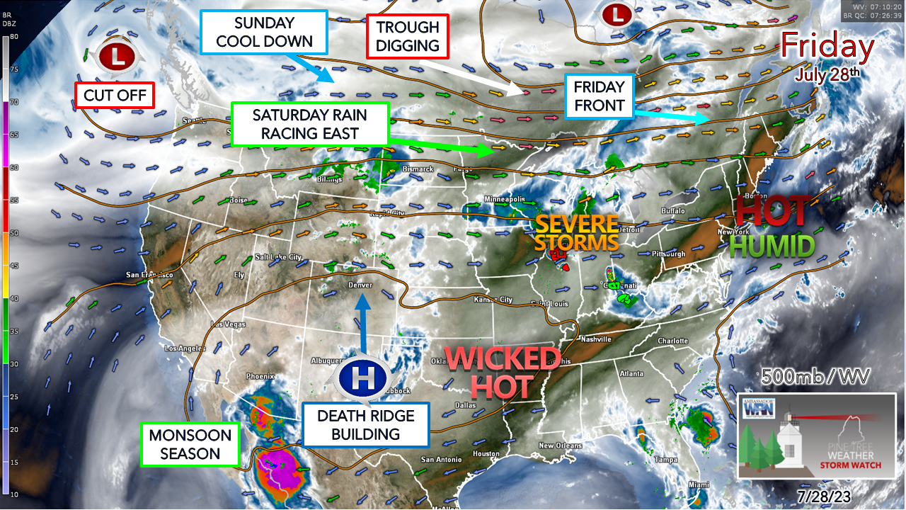
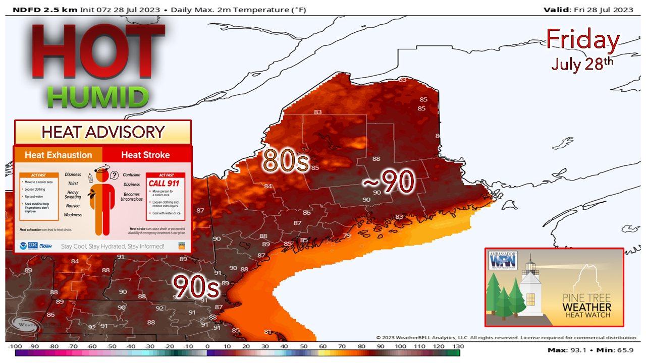
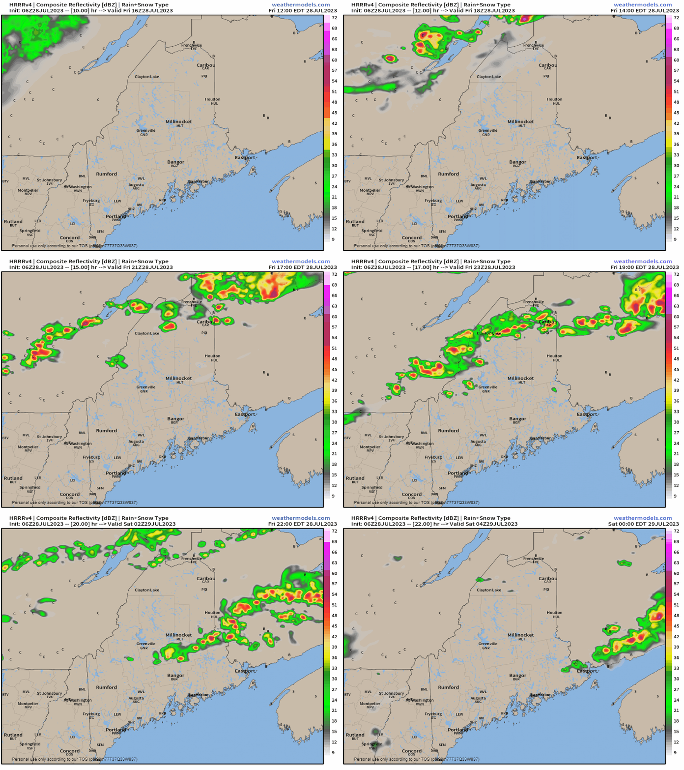
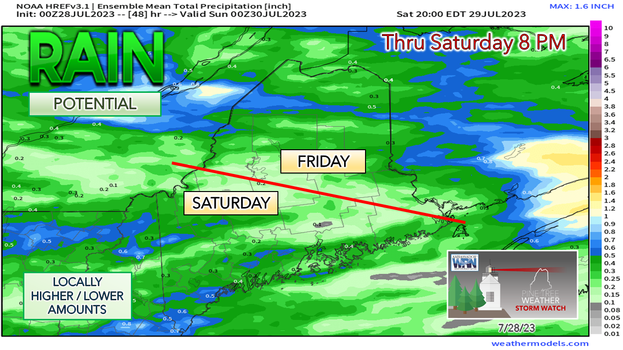
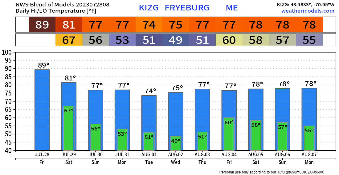
Overview of the weekend patternA look at the steering level shows the building ridge over the south agitating the upper low to the north that spins a trough to the east. A frontal boundary passes through That trough brings rain and the chance of a couple of storms on Saturday. Behind that comes the cool down with dry, refreshing dew points for Sunday and into next week. Expect well below normal temperatures by midweek with some morning starts in the 40s in the mountains. The heat is ... onFor those that love the heat, this is your day. We haven't had many of these and seeing the pattern, we may not get too many more of them. Low tide is during the 1 PM hour which will make for an epic beach day for those headed for the ocean. For those sensitive to the heat and humidity, this is a good day to find a cool place to hang out. If you are without air conditioning, the good folks at the Maine Emergency Management Agency have a list of cooling centers that you can get to. Showers and storms for the north FridayFriday Noon to Saturday Midnight - While the coastal plain roasts, a weak cold front passes through the north during the afternoon and will touch off some showers and storms. There is the risk of some strong to severe activity with damaging wind and hail. Since the front is moving along at a good clip, I don't expect much in the way of flash flooding concerns. Rain outlook through SaturdayI am not impressed with the short-term model ideas as far as how they are handling Saturday's system given their extremes from high to low due to how they are interpreting the system over the northern Plains. Northern areas have the best chance for rain on Friday, southern areas for Saturday. This idea puts the over/under at roughly ½" for a general idea and I think that is fair. The case can be made that southern areas may pick up more than that, but time will tell. I do expect a few rumbles around, but the best chance for severe storms is for southern New England. Temperatures and outlook through early AugustHeading into next week, the humidity is cut off to the south thanks to the upper low to the north. While the upper low battles with the death ridge over the south, the region is on the cooler side of being caught in between. The upper low is expected to spin waves through the region which may bring clipper-like systems that could bring hit or miss showers and perhaps a rumble of thunder, with the north and mountains seeing the better chance. Have a great weekend! Pine Tree Weather is funded from followers like you. I would appreciate your financial support. Click here for how you can contribute. You may not like the weather, but I hope you like what I do, and support my efforts. Thank you! Stay updated, stay on alert, and stay safe! - Mike NOTE: The forecast information depicted on this platform is for general information purposes only for the public and is not designed or intended for commercial use. For those seeking pinpoint weather information for business operations, you should use a private sector source. For information about where to find commercial forecasters to assist your business, please message me and I will be happy to help you. |
Mike Haggett
|

