
Storm chances and one more day of high heat for Friday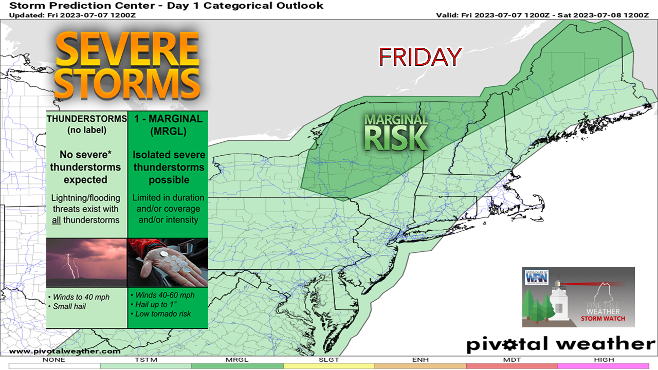 A slow moving cold front approaches from the northwest for Friday. With high pressure to the east strengthening, which sets up a stronger south/southwest inflow of moisture that will be thrown out ahead it. The potential for severe weather is isolated, with torrential rain and damaging wind the main concerns, along with small hail. 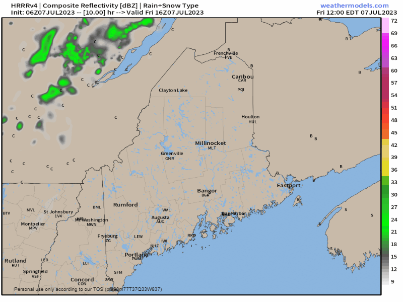 Friday Noon to Saturday 4 AM - Showers and storms are expected to fire up over the mountains and north in the afternoon and continue into the evening. After sunset, the storm threat diminishes overnight as the atmosphere cools down. Far northern areas have the best chance of getting clipped with a shower overnight. 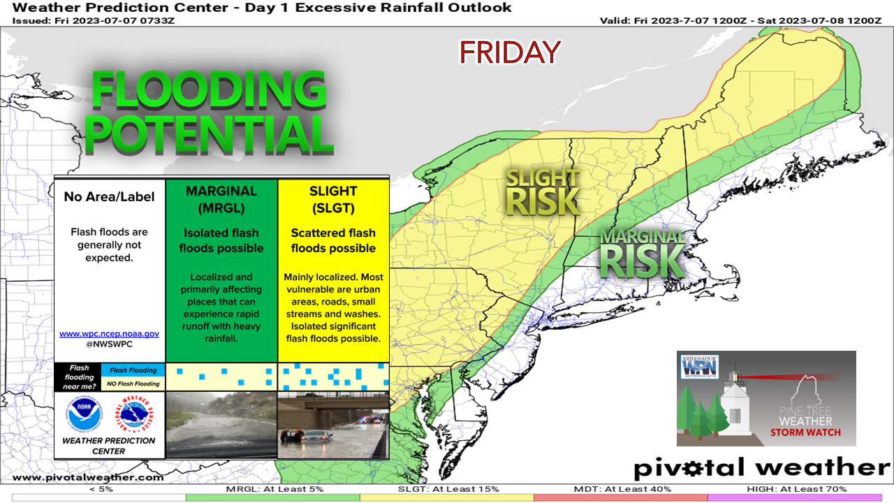 The risk of flash flooding over the north and mountains is expected to be scattered as the showers and storms dump heavy rain. For those camping out, it would be wise to stay away from brooks, streams, and rivers as water levels could rise rapidly. Current flash flooding guidance has most of the state in the 1-2" per hour level with the recent rain, and these storms could produce localized amounts of 2-5"+ rainfall. Please make sure that you have several ways to receive weather alerts and seek shelter from storms and flooding immediately. 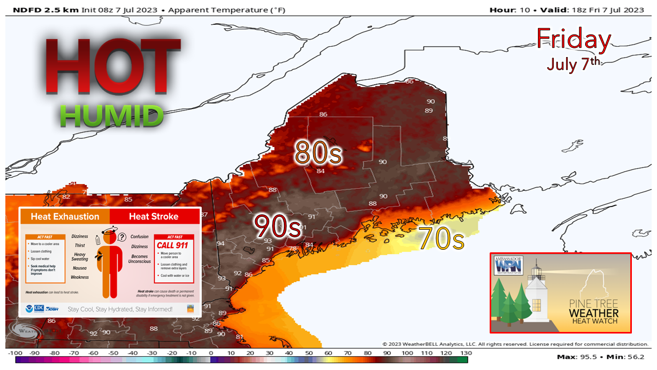 Apparent "feels-like" temperatures will once again climb into the 90s for much of the interior areas of the state for the day. The sea breeze will be more efficient with high pressure to the east keeping the shorelines cooler. Fog may be stubborn for MidCoast and DownEast areas, which if so, it may only keep the temperatures in the 60s. 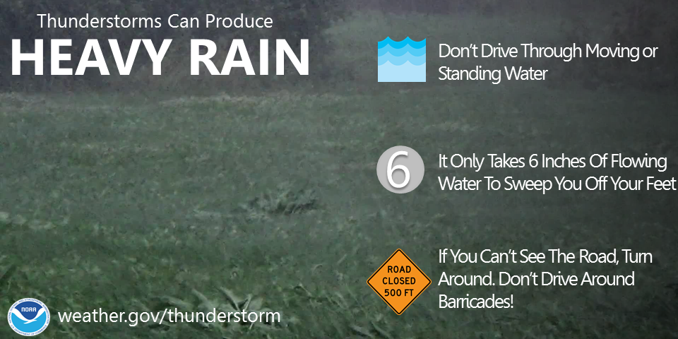 A few storms and a bit cooler for Saturday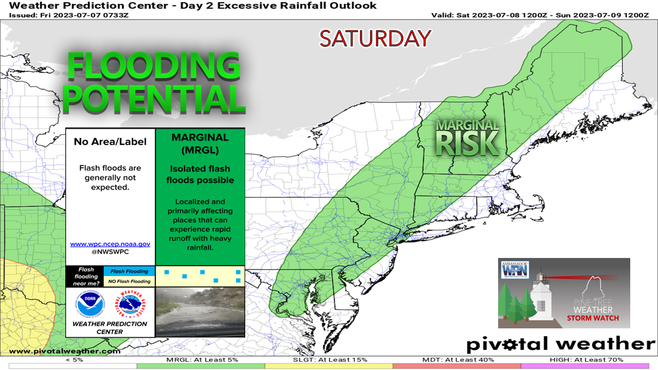 The slow-moving frontal boundary nudges a bit closer to the region. With more in the way of cloud cover, this will lessen the chance for showers and storms, but the threat is still there for the interior. Flash flooding concerns in areas where heavy rain and storms occur will continue.  Saturday 11 AM to Sunday 2 AM - The rule of thumb I keep mentioning is where the sun comes out, the thunder and heavy shower guns come out. If you are located over the interior, the sun should be a telltale indicator that storms, and heavy rain could come. The more clouds, the less of the chance. 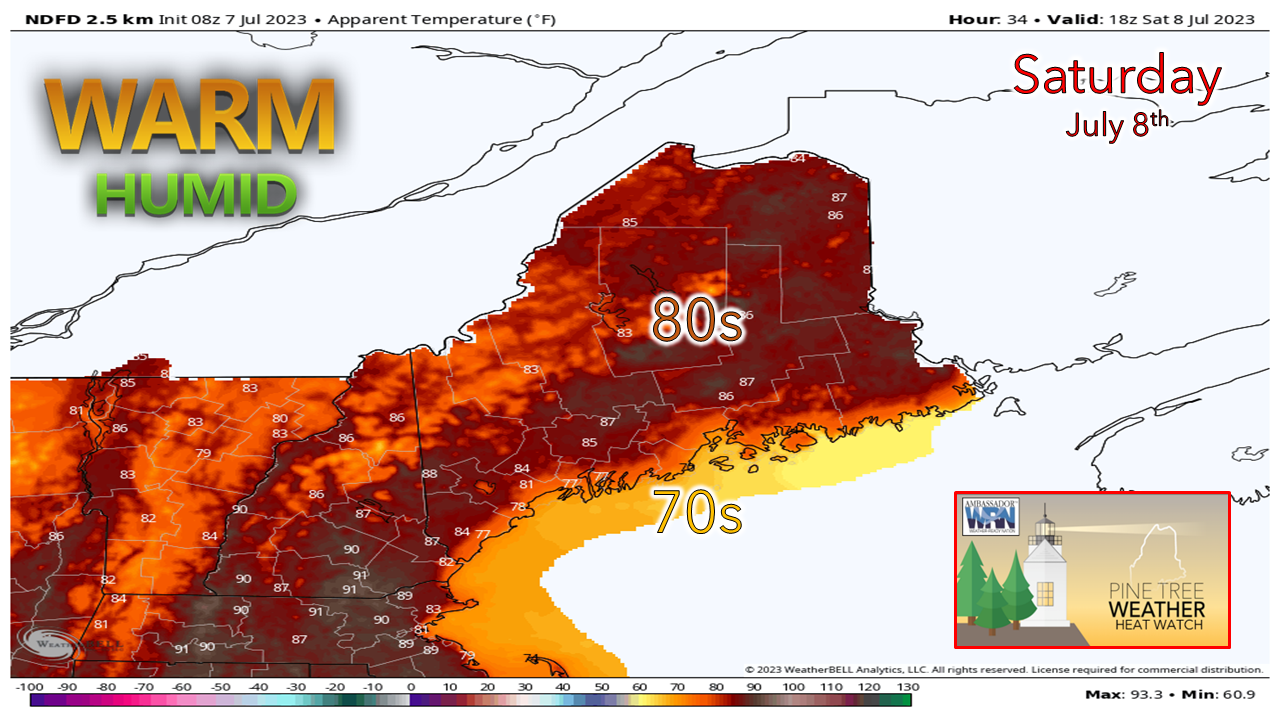 Saturday's apparent temperatures will be cooler by 5-10° over much of the interior areas of the state. Coastal areas get relief from the sea breeze. MidCoast and DownEast areas may be dealing with stubborn fog again. Outlook through midweek: heavy rain potential Monday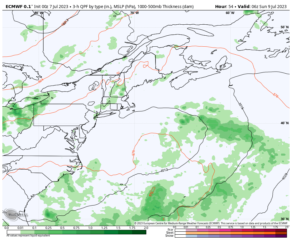 Temperatures are expected to cool off more on Sunday and into the first of next week. The humidity levels will continue to be juicy with dew points in the mid to upper 60s with a few low 70s possible. Scattered showers and storms are possible for Sunday. As the frontal boundary inches closer to the region and disturbances form along it, the risk for heavy rain and showers increases Sunday night and continues through Monday. Scattered showers and storms are possible for Tuesday as the front slowly exits the region. Expect temperatures to spike back up by Wednesday. Click here for the old school Weather Channel Local ForecastScroll to the bottom and click on Hazardous Weather, scroll back up, enter your town, then click go! Pine Tree Weather is funded from followers like you. I would appreciate your financial support. Click here for how you can contribute. You may not like the weather, but I hope you like what I do, and support my efforts. Thank you! Stay updated, stay on alert, and stay safe! - Mike NOTE: The forecast information depicted on this platform is for general information purposes only for the public and is not designed or intended for commercial use. For those seeking pinpoint weather information for business operations, you should use a private sector source. For information about where to find commercial forecasters to assist your business, please message me and I will be happy to help you. |

Mike Haggett
|


