
Showers with a chance for embedded thunder likely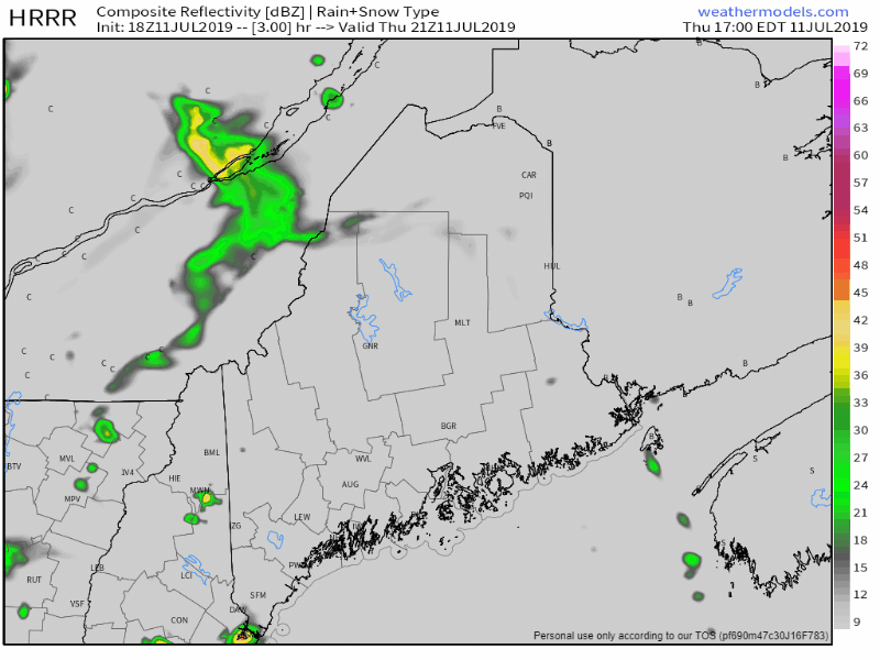 Rain showers with some embedded thunderstorms are possible Thursday night into Friday morning. Severe chances at this point appear remote over that period. Expect areas of fog along the coast, with pockets over interior areas for the morning commute. After the main front passes through Friday morning, a trailing weak frontal boundary may pop a shower or thunderstorm later in the afternoon. With the dew points in the upper 60s to low 70s, that upper air trigger may bring a strong to severe storm for areas away from the coast as we head into Friday night. Showers end for most by around midnight Saturday morning. A weak front slides through late Saturday into Sunday I've been watching this all week and for the most part, the idea has held together. Northern areas have the best chance for showers on Sunday. Eastern Aroostook south to Washington County may get a thunderstorm Sunday afternoon. Western areas may get a spot shower or two Sunday. Skies should clear out from west to east Sunday afternoon into Sunday evening. Regional outlook through Tuesday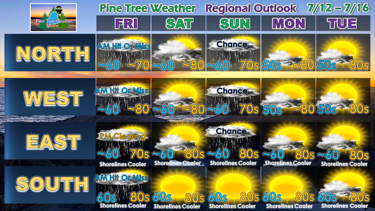 Temperatures will begin to increase as we head into the work week. We could be dealing with Triple-H (hazy, hot, humid) conditions as we head into the middle to latter part of the week. Remnant moisture from Barry may impact the area in some form Thursday, either with rain and/or thunderstorms, or may at more moisture to an already humid air mass on the way.
► ► For the latest official forecasts, bulletins and advisories, please check in with the National Weather Service in Gray for western and southern areas, or Caribou for northern and eastern parts of Maine. Please consider supporting Pine Tree Weather ► ► Your financial donations are much appreciated to keep this site funded and for further development. I sincerely appreciate your support not only financially, but also in sharing my efforts with others. For more information from me, please check the Pine Tree Weather Facebook page as well as my Twitter feed. Always stay weather aware! - Mike |

Mike Haggett
|


