
Cold front passing through Friday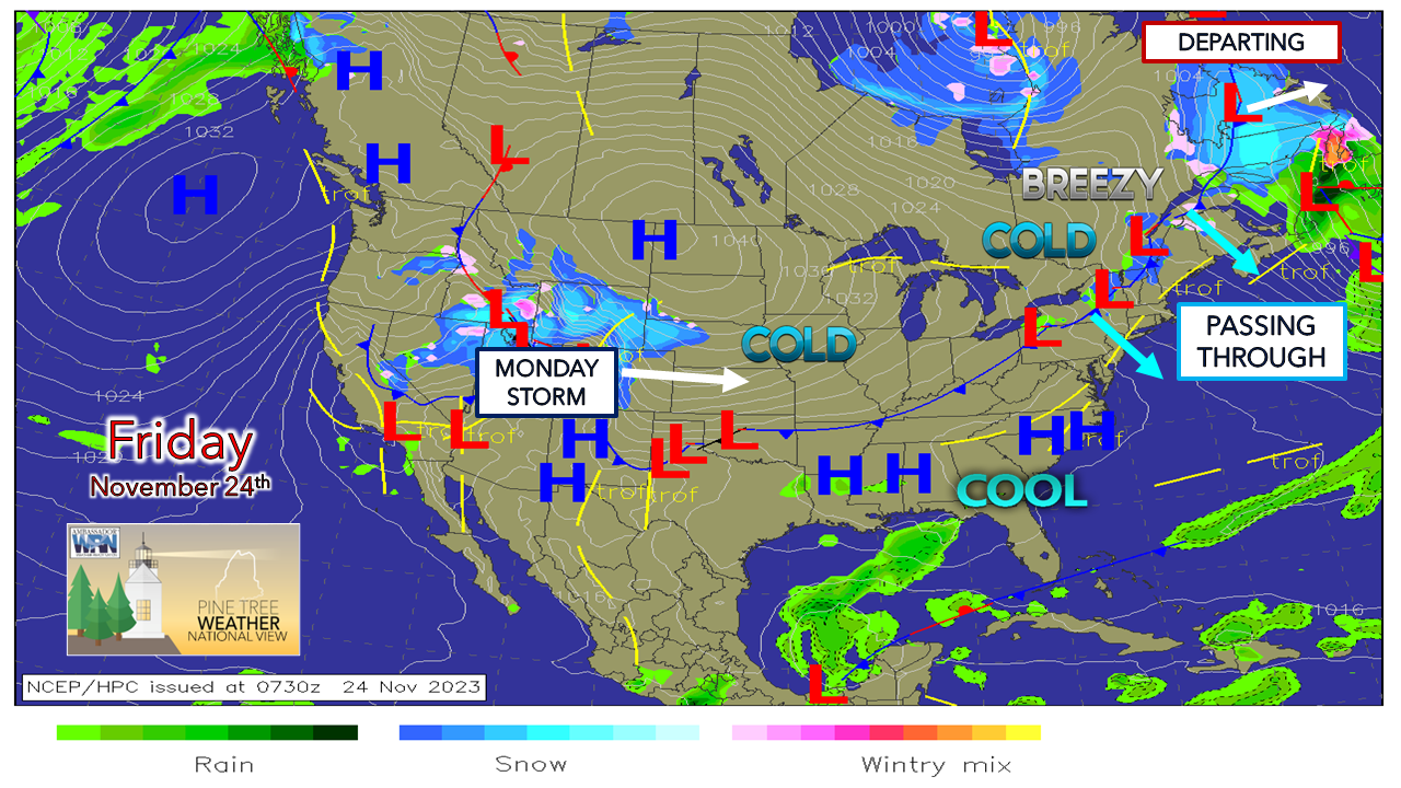 The weather pattern through Saturday for the region is cool to cold. Temperatures across the state are generally 5° to 10° below Thursday morning's start, and it could be 10° to 20° cooler to start from that come by Saturday morning. As the cold front passes through the state today, wind speeds pick up from the northwest and temperatures fall during the afternoon. The mountains stay mainly cloudy for the day with snow showers possible that may bring an inch of fluff for the taller hills. High pressure settles in during the day on Saturday, passing just to the east of the region by Sunday morning. 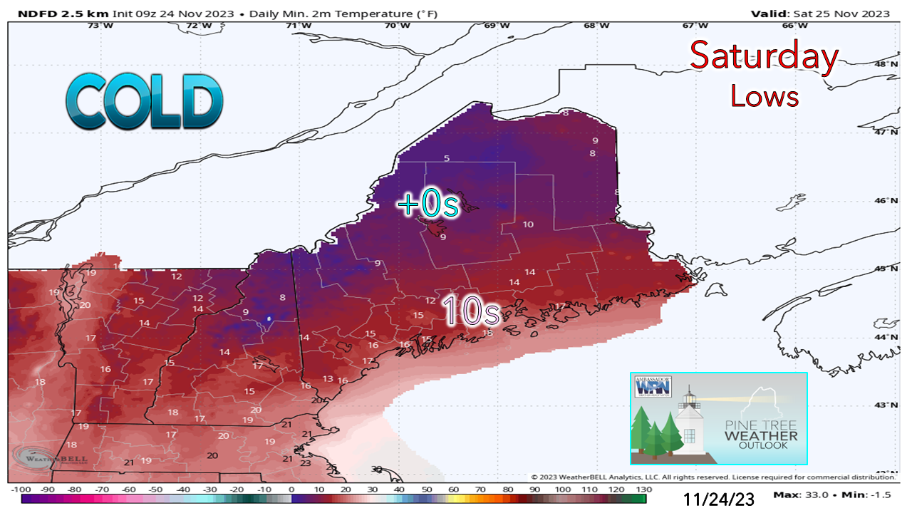 Saturday's start could be one of the coolest for the coastal plain for the season thus far. A bit of a lingering breeze over the interior could bring wind chill temperatures below zero to start the day. As the high moves to the east, a southerly flow sets up which will trend temperatures 5° to 10° warmer to start on Sunday, with most areas climbing above freezing for the daily high.  A few thoughts on Monday's stormLow pressure over the Rockies slides eastward over the weekend. Kicker energy over northern Alaska races southeast to meet up with the system to amplify it. High pressure to the east slows down and is expected to strengthen as the storm moves into the area. The storm is similar to what the region experienced on Wednesday, but at this point does not appear as juicy or as cold.  Sunday 7 PM to Tuesday 7 AM - As the kicker energy arrives in a negatively tilted fashion up against the departing high, the storm intensifies. There is a fair chance southern and western areas start the day with precipitation falling, with snow / mix over the interior and rain for the coast. A weak low associated with the kicker begins to siphon off moisture from the ocean low and draws it to the north over the region in an inverted trough like scenario. 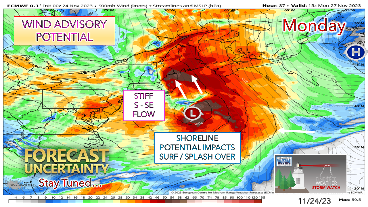 With the subtropical jet interacting with the polar jet and a strengthening high near the Avalon peninsula of Newfoundland, the idea is out there for a stout low-level jet to amplify in the 50-70 knot level. This could bring wind gusts in the 35-50 mph range along the coast, and for the higher elevations. This could bring the potential for power outages. There is also concern for shoreline issues that could bring surf, splash-over, and minor beach erosion. The high tide during the 10 AM hour on Monday is one to monitor pending on how this plays out as we are in a full moon phase. PTW is 68% funded for 2024 Temperatures and outlook through next weekAfter the storm passes Monday, the mountains may see snow showers on Tuesday. It appears dry for the rest of the week. The next potential storm comes for the first weekend in December. 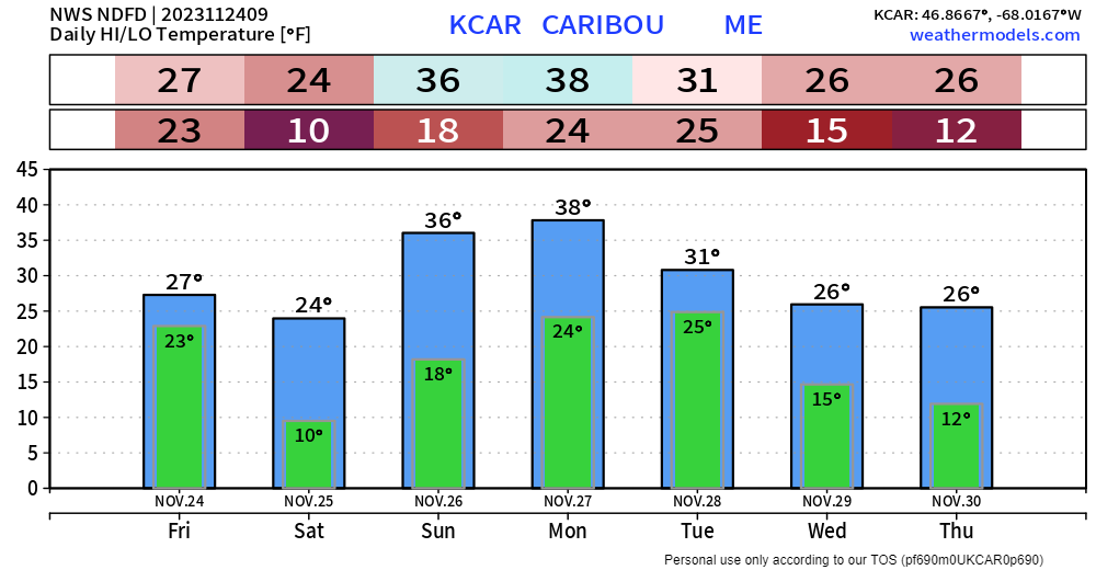   Thank you for your years of following and for your financial support. It is because of your funding that this operation continues. God bless and stay strong. Be good to yourself. Stay updated, stay on alert, and stay safe! - Mike NOTE: The forecast information depicted on this platform is for general information purposes only for the public and is not designed or intended for commercial use. For those seeking pinpoint weather information for business operations, you should use a private sector source. For information about where to find commercial forecasters to assist your business, please message me and I will be happy to help you. |

Mike Haggett
|


