
Lee is massive in size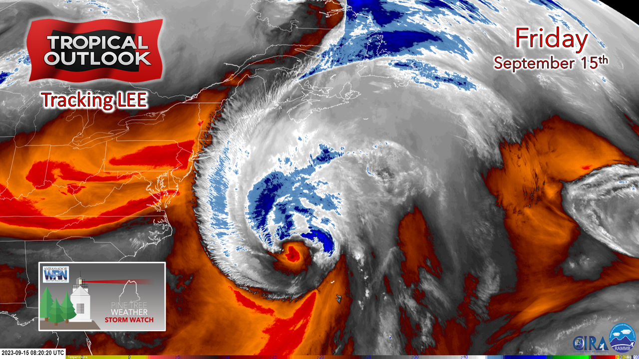 Lee looks like he had a few too many drinks overnight. The storm is getting sheared out and is looking like Mr. T with a mohawk freshly spiked up from the barber shop. For a mid-latitude storm in transition from tropical to extratropical, it's super-sized. This is a massive storm and continues to get larger as it heads north. 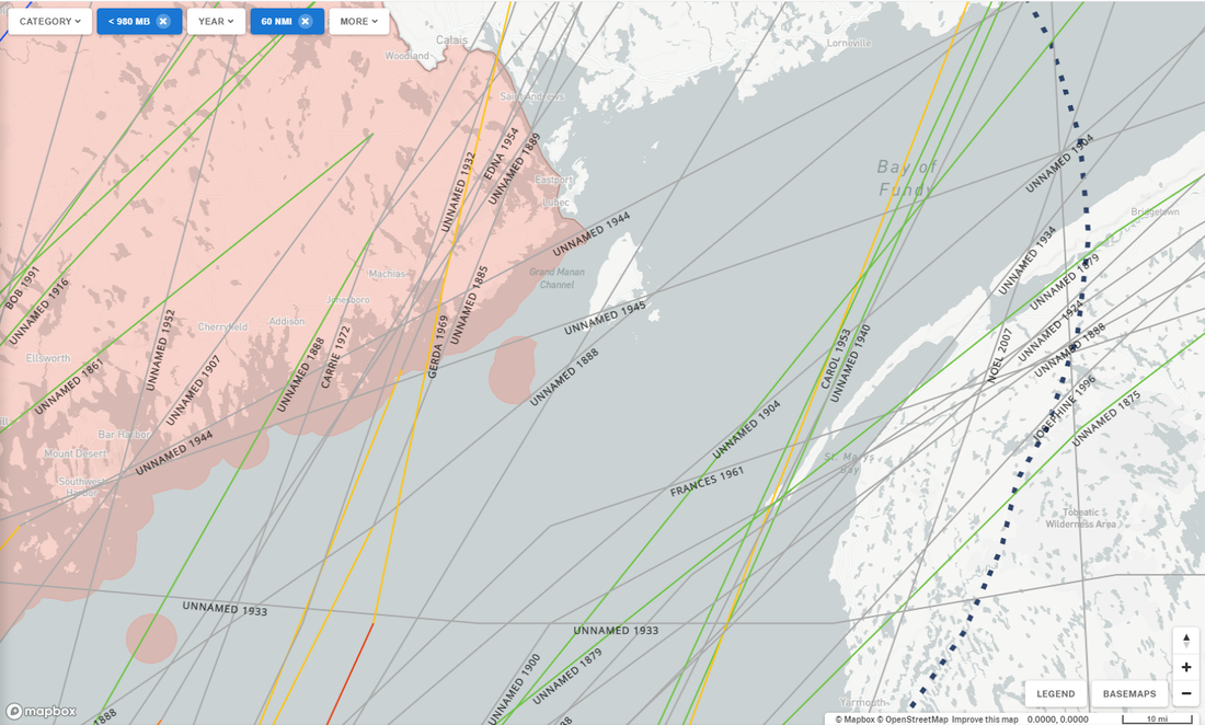 The Bay of Fundy has seen a few tropical and extratropical systems over the years of recorded history. Gerda in 1969 made landfall near Roque Bluffs which still to this day is the last official hurricane to make landfall. Lee is heading for the Grand Manan Island region plus or minus a few miles west or east. Track doesn't matter at this point as that is simply for scientific research and analysis. It's all about impacts that are on the way. It's the wind, stupid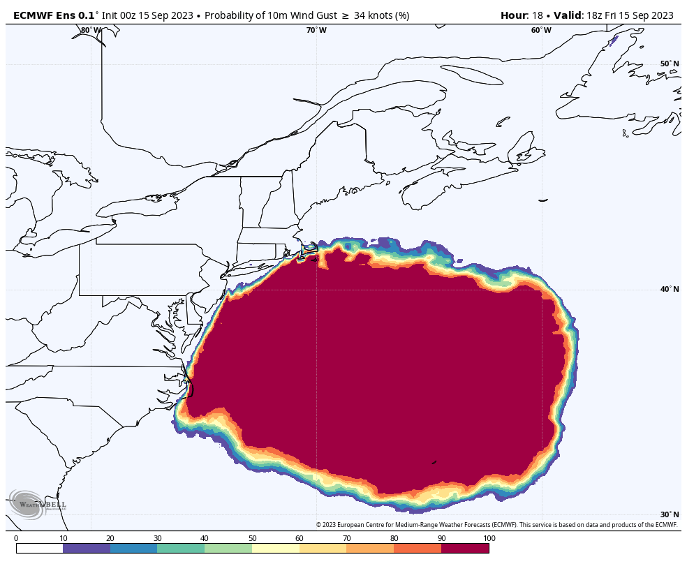 The looped chart of the European ensemble mean for the percentage chance of tropical storm wind gusts shows a 100% chance that most of the state sees gusts that high. This also is a great indicator of just how big the wind field is on Lee. This has 500,000+ power outages written all over it, with that figure including the Canadian Maritimes. That may be conservative. 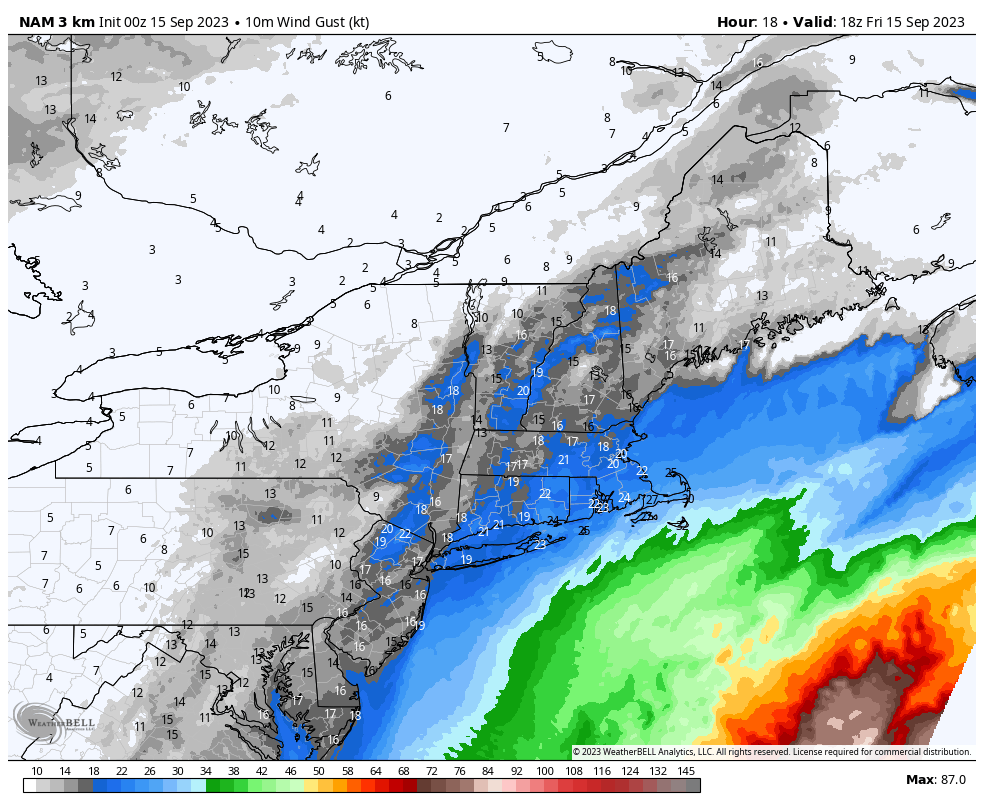 Using the NAM3 model idea simply for timing purposes, speeds pick up over the region Friday afternoon. The wind will be howling along the coastal plain by morning. The strongest gusts are over for most by mid-afternoon, but the stiff gusts continue through the evening, settling down overnight. Sunday will be a breezy one as Lee heads for Newfoundland. 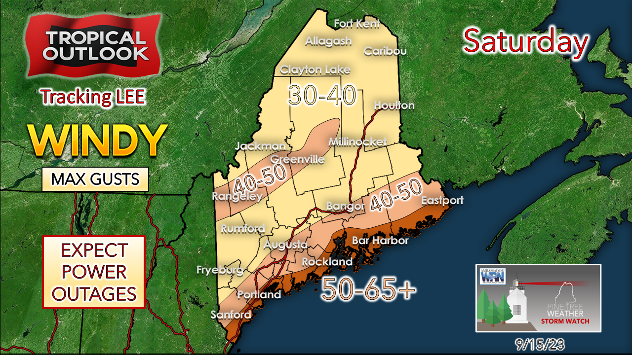 No changes in my thoughts on maximum wind gusts here. The shorelines are going to get smoked. The higher hills could see gusts at the same level and higher. Tree damage is likely going to be widespread. If we can keep power outages under 250,000, it will be a win. Some folks will be without power for days, if not over a week. The bottom line here is the whole region is going to get smoked. Heaviest rainfall to the east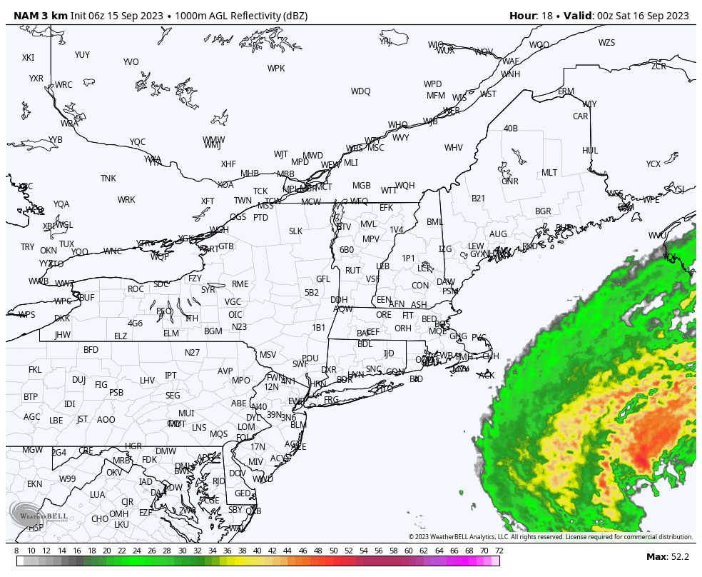 Chances are good that rain from Lee will be falling across much of the region by Saturday morning and will pick up with intensity as the storm moves into the Gulf of Maine in the afternoon. If you watch this loop around 18-20z (2 PM - 4 PM) there is a bit of a slow down with the storm before the incoming trough catches and drives it northeast. This is where I am concerned for the impacts over DownEast and the eastern interior might start to get out of hand. with torrential rainfall and strong wind. The precipitable water values are predicted to be sky high (2-2½") and with that amount of moisture, this is where the road and driveway washouts and other forms of flooding occur. In areas of torrential rain comes the threat of downdraft wind gusts, which makes the wind threat both horizontal and vertical. 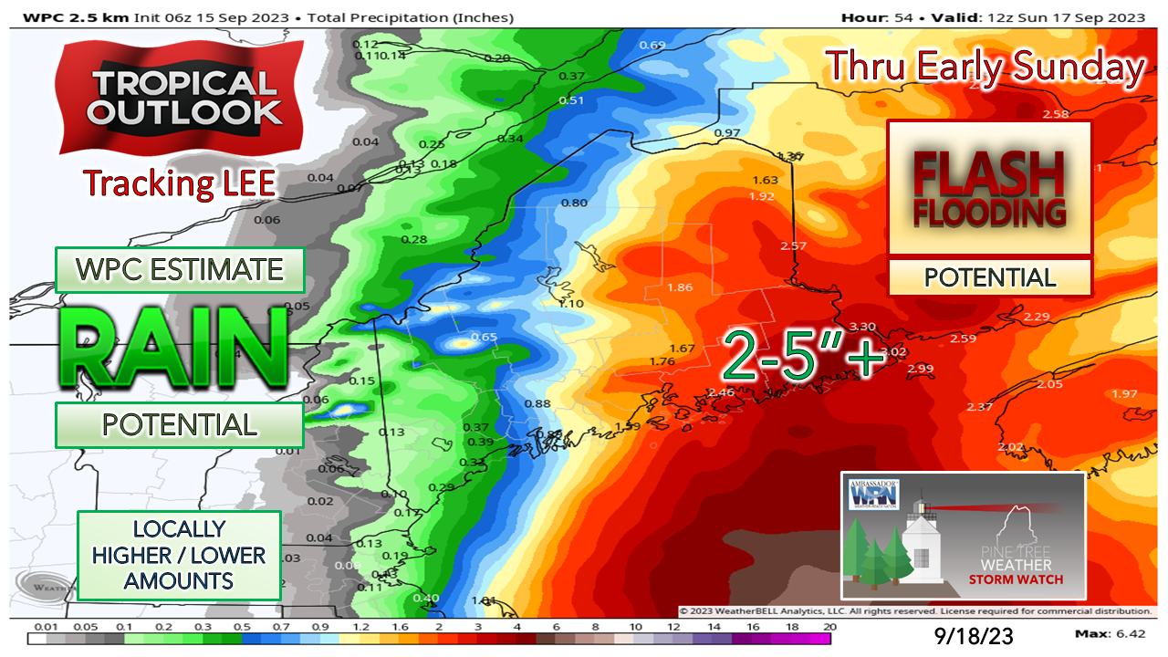 The general idea of heavy rainfall has shifted to the east, but localized dumpers over southwestern areas are certainly a possibility. Ideas on shoreline battering remain consistent The links to the hurricane local statements below cover the situation along the coastline well and since they will be continuously updated, they should be checked in on as they will be updated as needed until the storm leaves the region. The coastline is going to get pounded. There could be some geographical rearrangement in places. The beaches could be seriously eroded, and it will be interesting to see if any ancient artifacts are unearthed with this round of abuse. HURRICANE LOCAL STATEMENT LINKS: NWS Caribou for northern and eastern Maine NWS Gray for southern and western Maine Batten down the hatches and buckle up, we're in for a ride. 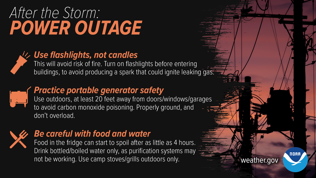 Even after the storm passes, power outages have their own set of hazards. Be especially careful with generators — never use them inside or in garages to avoid carbon monoxide poisoning. Use flashlights, not candles, to avoid the risk of fire. weather.gov/safety/hurricane-after FUNDING NEEDED FOR 2024 Pine Tree Weather is funded from followers like you. I would appreciate your financial support. Click here for how you can contribute. You may not like the weather, but I hope you like what I do, and support my efforts. Thank you! Stay updated, stay on alert, and stay safe! - Mike NOTE: The forecast information depicted on this platform is for general information purposes only for the public and is not designed or intended for commercial use. For those seeking pinpoint weather information for business operations, you should use a private sector source. For information about where to find commercial forecasters to assist your business, please message me and I will be happy to help you. |

Mike Haggett
|


