
Livin' on the edge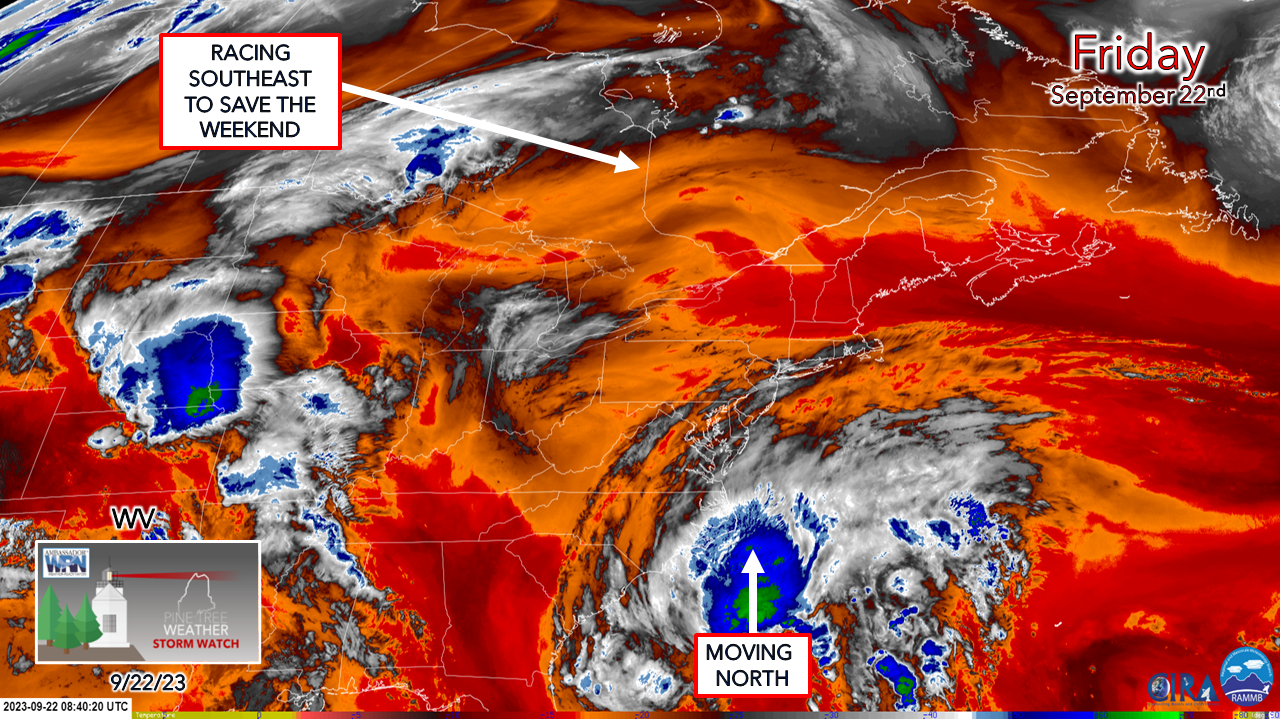 As I have been tracking what is now known as Potential Tropical Cyclone Sixteen all week, that classic Aerosmith song has been the music bed in my mind. Southern Maine is on the edge with this one. North of a line from Fryeburg / Poland / Richmond / Rockland appears likely to sit this one out. This is not a major event, if anything may be a nuisance with any showers that form south of that area, and even that is circumspect as of Friday morning. A frontal boundary passing through Hudson Bay is on its way to cut off Sixteen and keep the worst of what that has to offer to the south. The 5 AM Update from NHC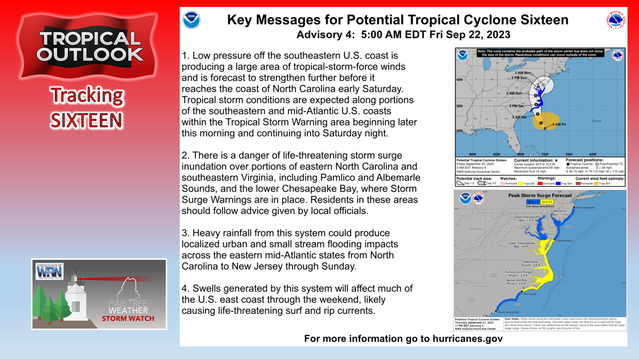 This is going to be a mess for the Carolina's, Virginia, DC, Maryland and Delaware with issues affecting New Jersey and southern Pennsylvania. The threat Southern New England has diminished outside of the shorelines and islands where the rain and the wind affect things there. If you are travelling by plane, you may want to be on alert for any flight cancellations or delays. If you are driving, expect a slow go of it the further south you are headed to. The fine line of rainfall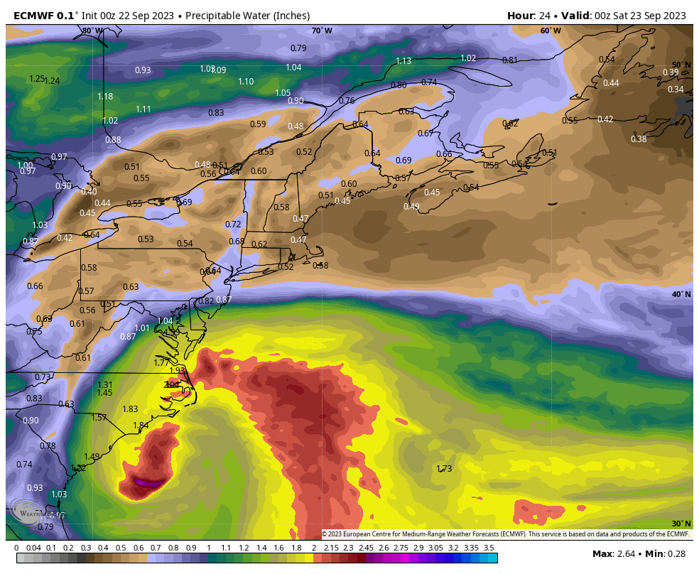 The precipitable water vapor loop from 8 PM Friday to 8 PM Sunday does an excellent job showing all the players involved here. The frontal boundary to the north is racing south to cut the storm off. The tropical, southern jet branches off to pick up the northern jet that is bringing the cold front south and as that happens, it takes the fire hose away from Sixteen and leaves the system for dead as a decaying upper-level low. What is left of Sixteen may bring some showers to the coast on Monday as its upper low remnants get absorbed by another frontal boundary and is driven to the east. 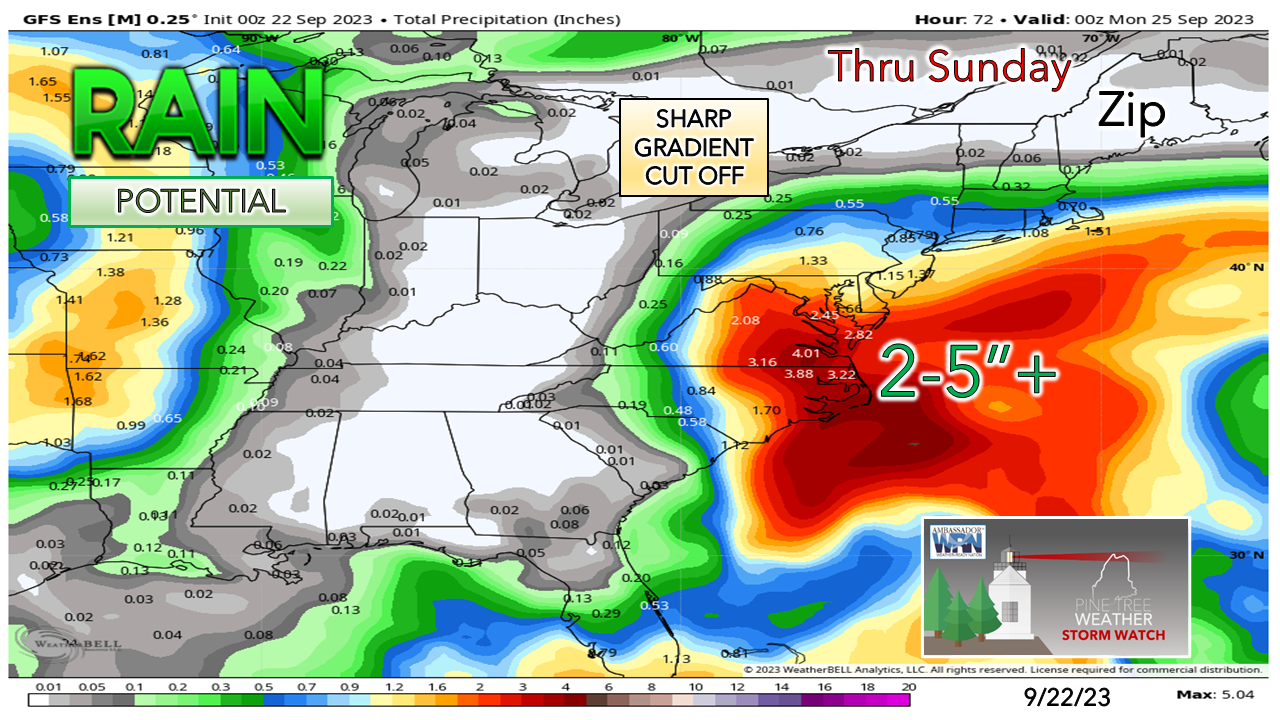 While the forecast rainfall amounts for Maine are not carved in stone given the fact the risk is there for a hiccup or a slowdown in the frontal boundary arrival from the north, most of the state isn't going see much out of this. High clouds around from the storm are expected to be prevalent on Saturday. The day stays dry. The best chance for rain showers for the south will come Saturday night into Sunday morning. As the frontal boundary continues south, cloud cover decreases over the north and mountains Sunday afternoon making for a pleasant day there. The closer to the coast, more clouds, but there is the chance that southern areas may see a sunset Sunday evening. Gardeners beware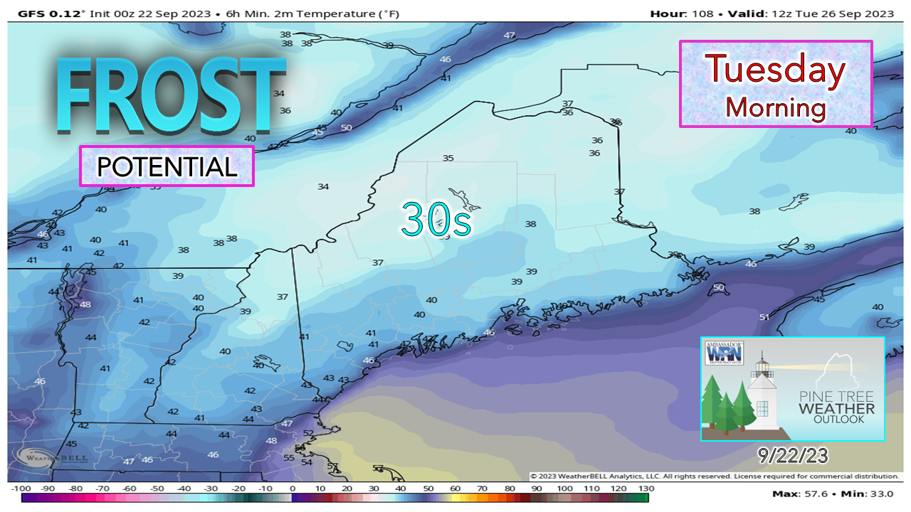 The Caribou office has ended the frost/ freeze program for the North Woods with a bulletin that went out Thursday. With bone dry air moving in after the pieces of Sixteen clear out, there is potential for frost Monday night into Tuesday morning across much of the state. This would be a good weekend to harvest and/or plan to cover up what you have going on just in case frost does come early next week. Your financial help is needed for PTW to continue You may not like the weather, but I hope you like what I do, and support my efforts. Thank you! Stay updated, stay on alert, and stay safe! - Mike NOTE: The forecast information depicted on this platform is for general information purposes only for the public and is not designed or intended for commercial use. For those seeking pinpoint weather information for business operations, you should use a private sector source. For information about where to find commercial forecasters to assist your business, please message me and I will be happy to help you. |

Mike Haggett
|


