
The view from the steering level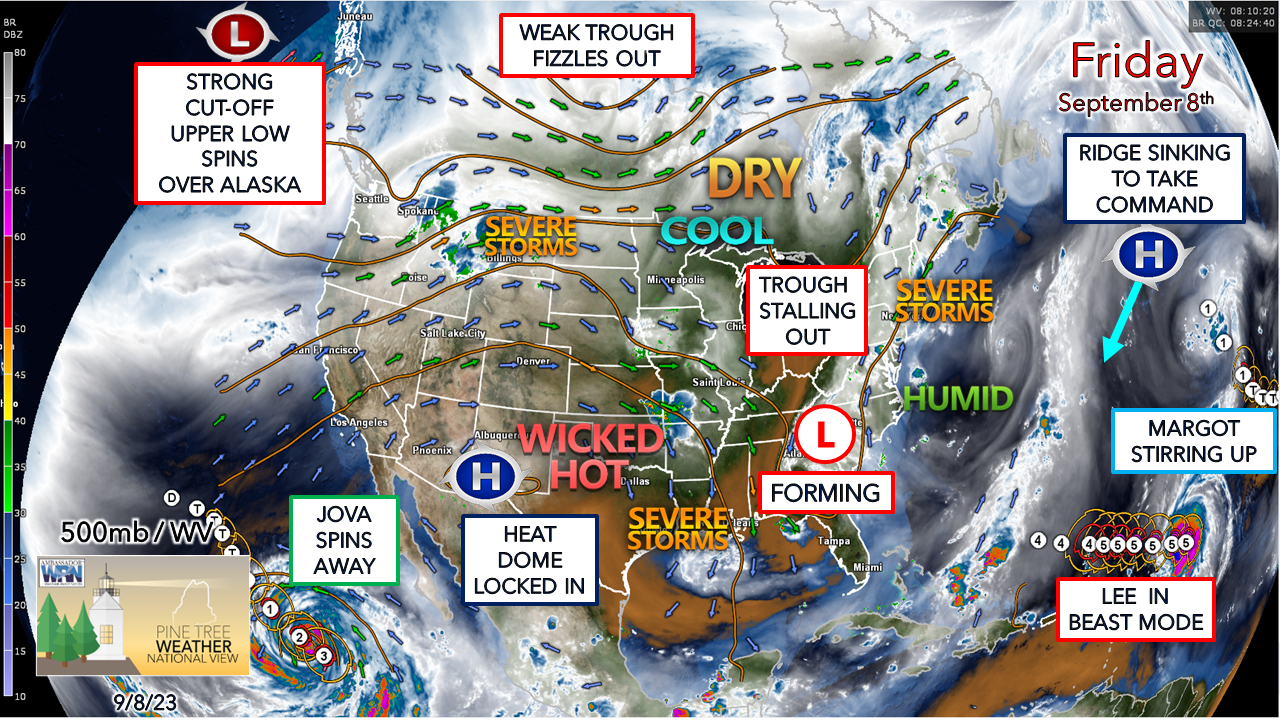 The steering level of the atmosphere is showing a typical September-like in nature with three tropical systems on the screen, along with blocking taking shape. The battle between the upper-low over Alaska and the heat dome to the south indicates fall is getting into high gear. Closer to home, a trough with an associated longwave frontal boundary is on approach and is about to become quasi-stationary (read: meanders around but doesn't move much) as a strong ridge over the Atlantic southeast of Newfoundland dips to the southwest and strengthens. This ridge is what keeps Margot out with the fish and keeps Lee in check until early next week. 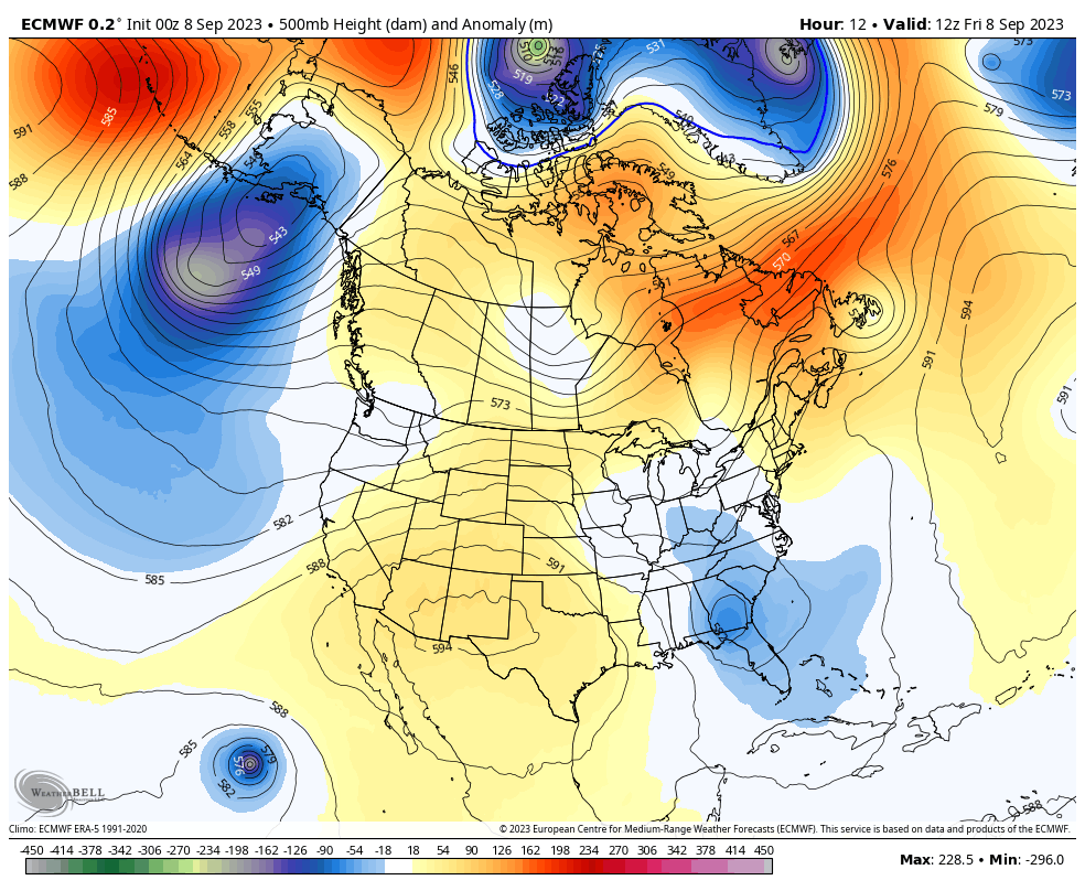 Friday 8 AM to Tuesday 8 PM - A look at the steering level height anomalies shows the ridge over the Atlantic strengthening over the weekend and then weakening heading into next week. Lee is expected to be south of Bermuda by Tuesday night. A trough is expected to develop over the Great Lakes on Monday, and that is one of the key factors in what direction Lee takes as it turns to the northeast heading into the middle part of next week. If you watch this loop a couple times focused over Maine, the heights don't move a whole lot, which indicates the frontal boundary working in won't be moving all that much over the next several days. Pending on the developing trough, if strong enough, and its interaction with the boundary may act as shield to deflect Lee to the east. If the trough over the Great Lakes is slow in development and further west, the region may see Lee move closer and ride along the stalled boundary. Too many questions, not enough answers, which is why it is important to think about preparations this weekend as the storm is expected to pass by next weekend. Some snarky storms around Friday With the frontal boundary crawling into the region Friday comes the best chance of strong to severe storms over the region, with southwestern areas having the best chance. Reports of downpours, gusty and hail up to 1¼" were reported by SKYWARN spotters overnight in New Hampshire from the storms that passed through. Damaging wind is the main concern from scattered storm development in the afternoon into early evening, along with small to medium size hail, and heavy downpours. Expect areas of fog to be part of the morning weather picture through the weekend.  Friday 6 AM to Saturday 6 AM - The westerly progression of the crawling boundary will be the key player in how much shower and storm activity occurs during the day. While predictive radar indicates widely scattered activity, it's not gospel, so an eye to the sky watch is in effect given the amount of humidity around with the juicy dew points. Where the sun comes out, the thunder guns can come out. The weekend does not appear to be washout, but there will be showers and storms around over both days. Monday appears to have the best chance for widespread rainfall. I see the risk of showers and potentially storms continuing in some capacity through next week as the boundary stays in the neighborhood. The time to prepare for storms is ahead of time The first step of preparing for hurricanes is to know your risk. Find out today what types of water and wind hazards could happen where you live. Hurricanes are not just a coastal problem. Impacts from wind and water can be felt hundreds of miles inland, and significant impacts can occur regardless of the storm’s strength. Know if you live in an area prone to flooding, if you live in an evacuation zone, and identify any structural weaknesses in your home. noaa.gov/know-your-risk-water-wind Pine Tree Weather is funded from followers like you. I would appreciate your financial support. Click here for how you can contribute. You may not like the weather, but I hope you like what I do, and support my efforts. Thank you! Stay updated, stay on alert, and stay safe! - Mike NOTE: The forecast information depicted on this platform is for general information purposes only for the public and is not designed or intended for commercial use. For those seeking pinpoint weather information for business operations, you should use a private sector source. For information about where to find commercial forecasters to assist your business, please message me and I will be happy to help you. |

Mike Haggett
|


