
Eye to the sky through the evening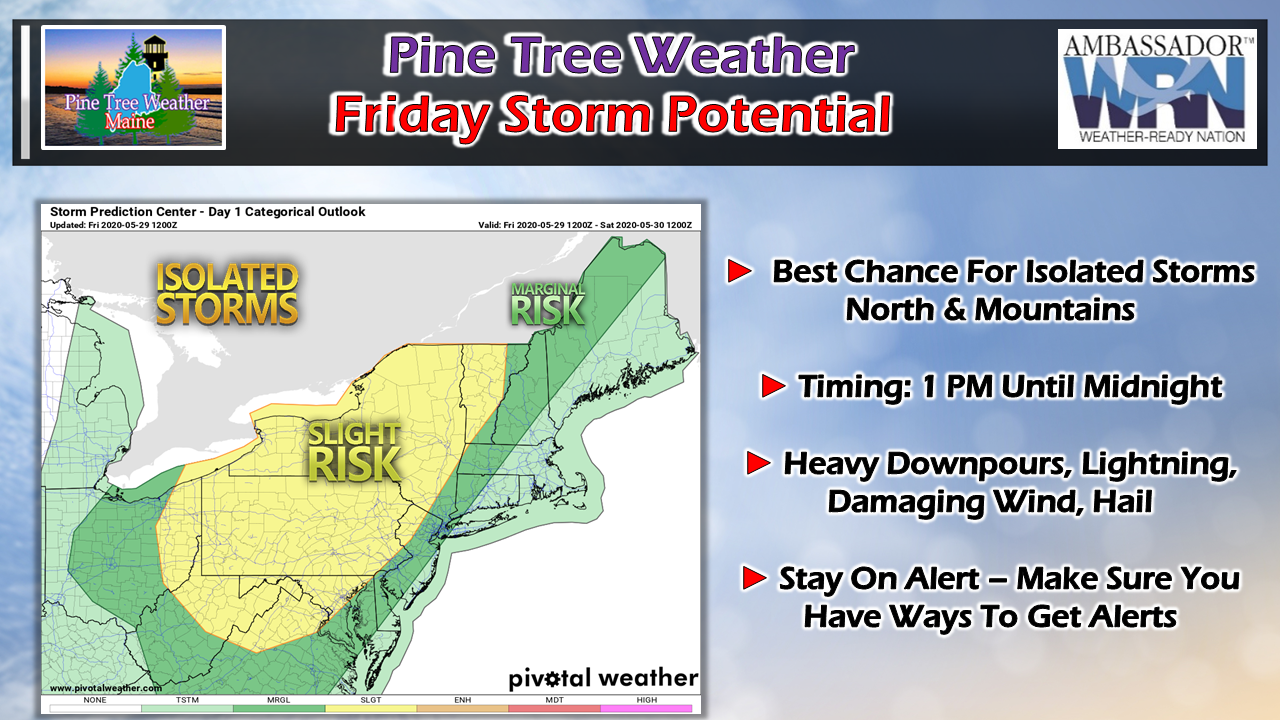 While the better chance for stronger storms is to the west, the risk for strong to severe storms is definitely on the table for Maine Friday afternoon into the evening. As a cold front slowly moves eastward, instability will be on the increase. With the heat and humidity around, some storms could bring damaging winds in excess of 60 mph, and perhaps some hail. 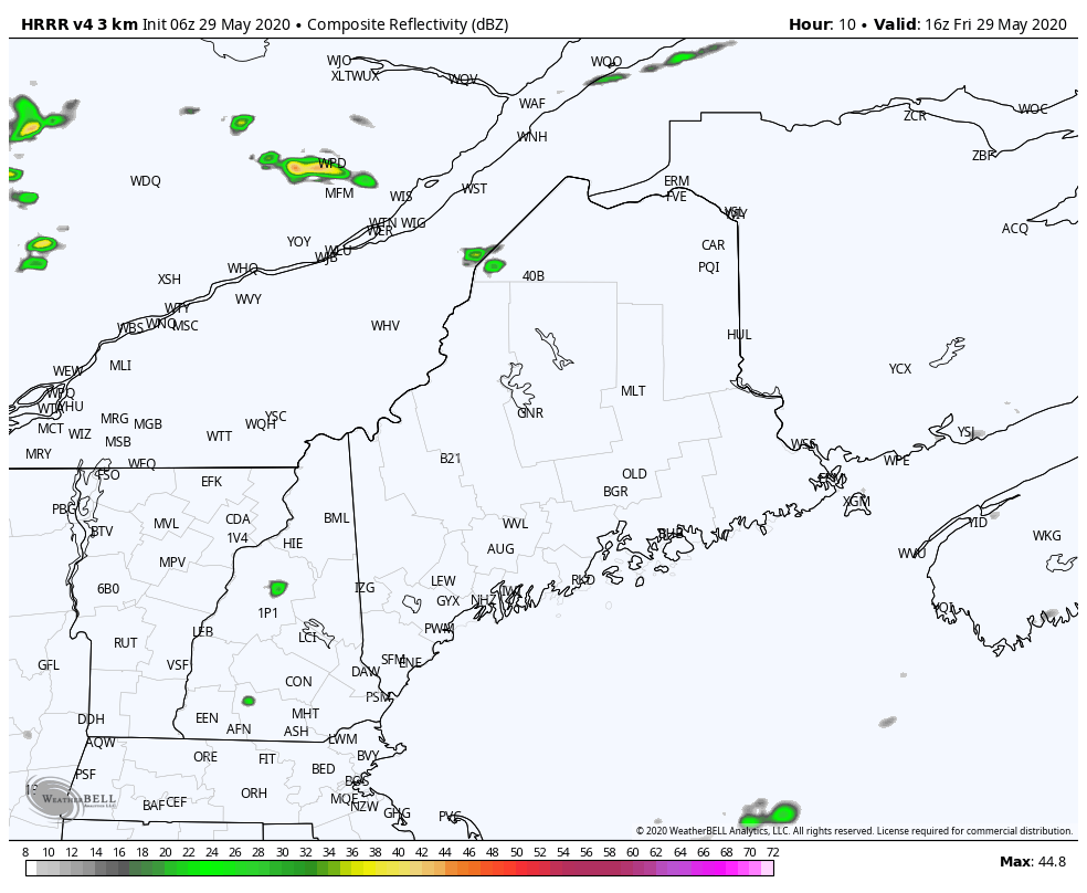 HRRRv4 radar idea from 12 PM Friday to 6 AM Saturday Expect isolated pop up outflow storms early this afternoon. At this point, the main action does not appear to gear up until late afternoon into the early evening. It could be a fairly impressive light show in the mountains and north into Friday night. Campers should be on alert for fast changing conditions. If located near a creek, brook or stream that could flood, it would be wise to move to higher ground in case of localized flooding from training storms. 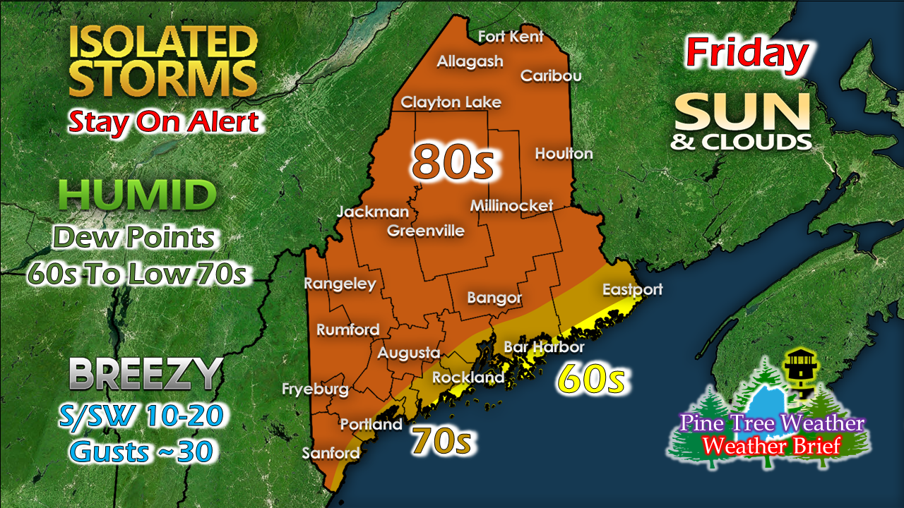 The day could be the most humid of the recent stretch. Heat indices could get into the 90s with dew points reaching the 70s. An outflow breeze from the south/southwest ahead of the storm increases into the afternoon. Kaitlyn will be back here this evening with an update on what to expect for Saturday with another round of showers and storms, a cooler outlook, and frost potential to start the week. 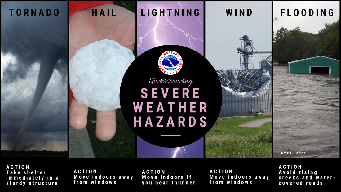 Stay on alert - make sure you have ways to receive alerts. Stay informed!
For more information, please follow Pine Tree Weather on Facebook and Twitter.
Thank you for supporting this community based weather information source that is funded by your financial contributions. Stay on alert, stay updated, and stay safe! - Mike |

Mike Haggett
|


