
Just a bad storm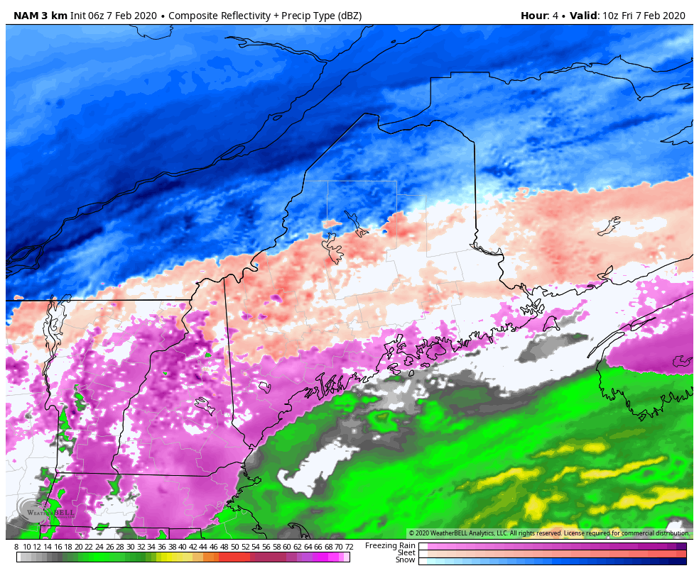 No real changes in forecast thinking at this point. Friday will be all about heavy precipitation in some form, whether it is snow in the north, or sleet and ice for the rest of the interior, and possibly rain within a handful of miles of the shorelines. The heaviest rolls through Friday afternoon, and begins to taper off from west to east Friday night into the wee hours of Saturday. 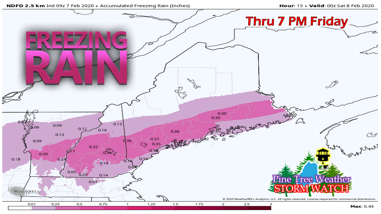 Ice continues to be the main concern for areas south and east of the mountains. As of 4:15 AM, I observed 0.25" of ice at my home in Kennebunk, which has already exceeded NWS estimates shown here all ready. Total amounts may reach close to a half inch in spots by the time this is over. 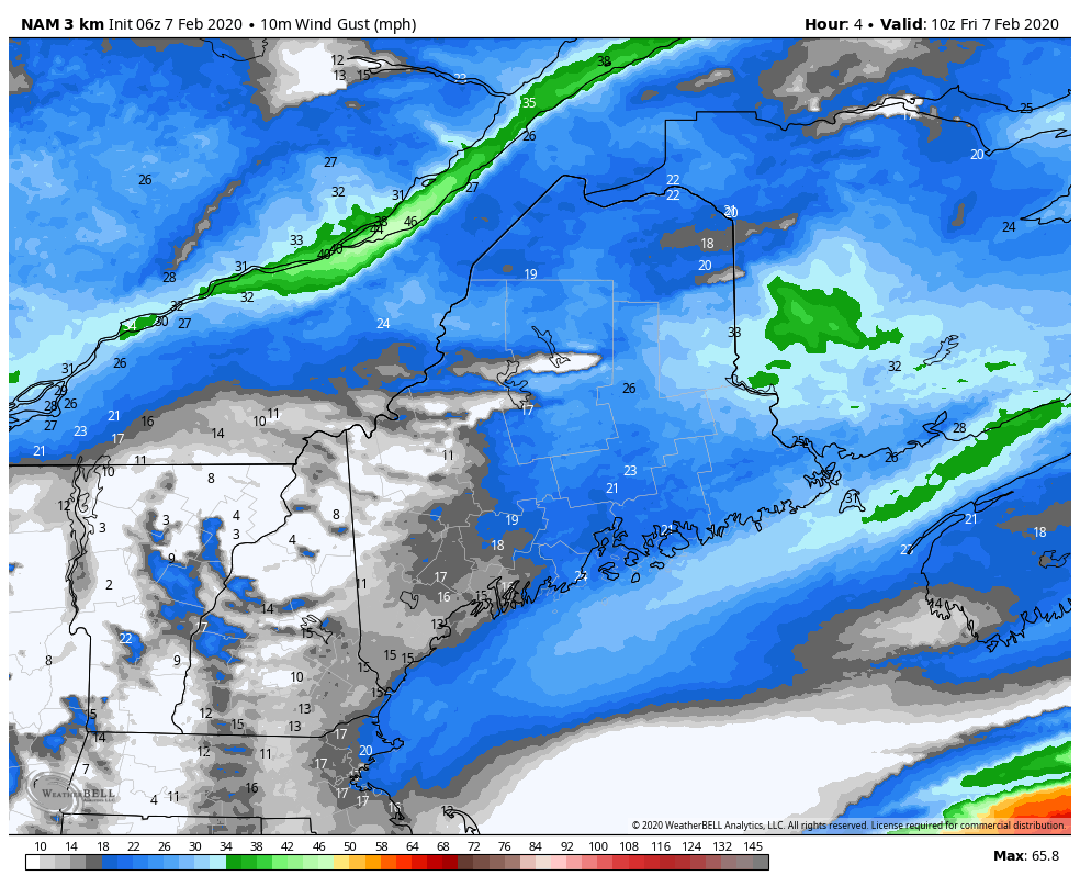 Anytime there is ice, there are concerns for wind. With the intensifying storm, there will some of that, and possibly enough to bring at least spotty power outages, Average gusts appear in the 20-30 mph range. DownEast areas may see a period of 30-40 mph. For northern areas, this brings whiteout conditions along with near blizzard conditions through the remainder of the day and into tonight. As the storm passes east, snow will continue to blow as northwest wind brings cold air in. Windchill values for most Saturday appear to be below zero in the north and mountains, to the single digits / low teens for the coast. 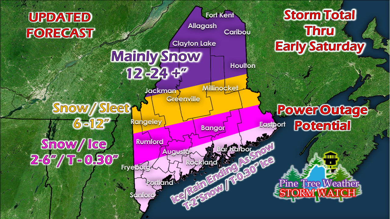 Only change here to this is the idea of upwards of a 1/2" of ice in areas. Other than that, the idea remains the same. Outlook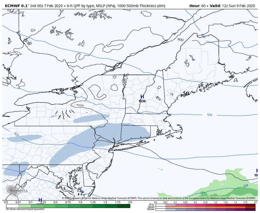 A cold and tranquil Sunday as arctic high pressure makes a brief visit. A ridge from the west drives a warm front into the region Monday and could bring a plowable snow to parts of the state. Another fast moving system may work through Tuesday night and bring another quick shot of snow going into Wednesday. Stay tuned for updates on that.
Don't get caught off guard.... stay on alert for surprises. ► ► For the latest official forecasts, bulletins and advisories, please check in with the National Weather Service in Gray for western and southern areas, or Caribou for northern and eastern parts of Maine. ► ► Due to a revised budget there is a $125 shortfall for the year ahead! You can help keep Pine Tree Weather going with a donation of ANY amount now through VENMO @PineTreeWeather, a monthly donation on Patreon or messaging me on Facebook or Twitter to send a check in the mail. Thank you for your support! For more information from me, please check the Pine Tree Weather Facebook page as well as my Twitter feed. Always stay weather aware! - Mike |

Mike Haggett
|


