Travel difficulties likely for both morning and evening commutes for Friday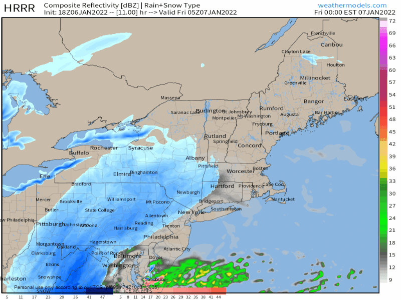 A low-pressure system is expected to track along the East Coast tonight, intensifying as it approaches New England. Its arrival in southwestern Maine appears to coincide with the morning commute, leading to difficult travel conditions. Snow spreads southwest to northeast throughout the day Friday, setting the stage for slick conditions during the evening commute as well. The snowfall should gradually taper off late Friday evening into the early hours of Saturday morning. Models appear to agree that the major impacts of the storm will be felt along the immediate coast, with the Downeast coastal region racking up the most inches. A sharp gradient in snow totals is likely to be seen as you head north, with the mountains and foothills only picking up a couple of inches. 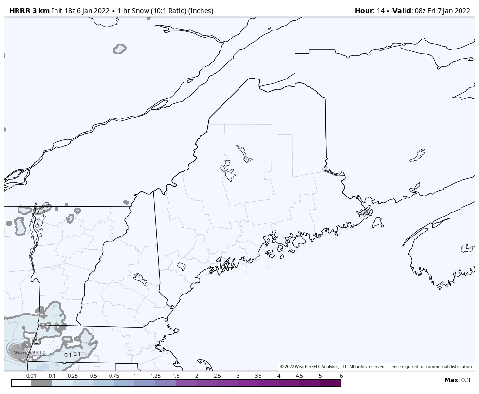 Friday 4 AM to Saturday 12 AM - This loop represents 1-hour snowfall totals. Heavier bands may bring rates of around 1" per hour and higher, as indicated by the purple color. Keep in mind that these periods of heavy snow are likely to occur during the morning commute for Portland south, and during the afternoon for Downeast areas. 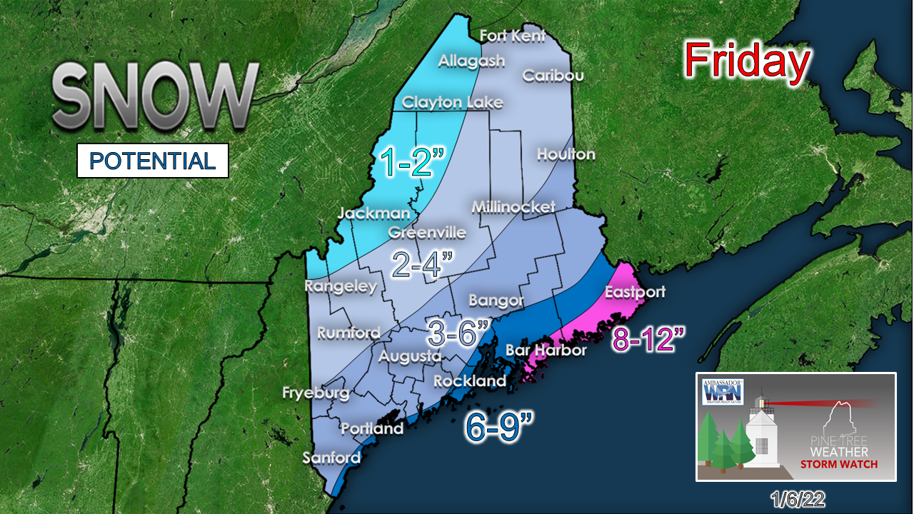 The heaviest snowfall is projected to occur along the coast, barring any late shifts to the storm track. A winter storm warning has been issued for interior Hancock as well as central and coastal Washington counties. Expect hazardous road conditions and potential power outages. As far as flooding goes, there is potential for some impacts. High tide at 2:35pm Friday may result in minor coastal flooding near Portland. Splash over across low-lying areas is possible across the southwest and MidCoast. There is also a winter storm warning posted for coastal York, Knox, and coastal Waldo counties. The remainder of southwest and south-central Maine, stretching to central and southern Penobscot, southeastern Aroostook, and northern Washington counties, are under a winter weather advisory. These areas are likely to pick up roughly 4-6 inches. Stay tuned for updates as these advisories may be changed to watches or warnings. 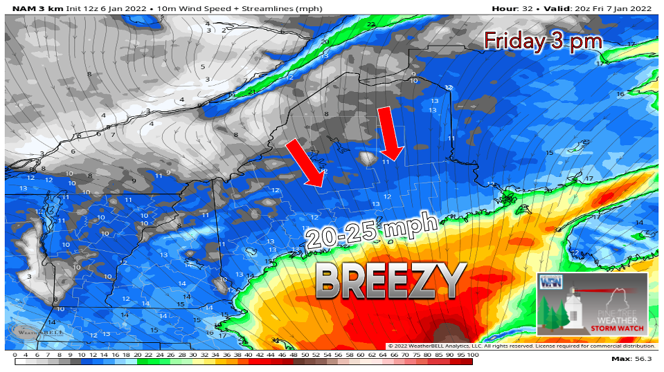 Breezy conditions are expected to kick in Friday afternoon as the low-pressure system spins off towards Nova Scotia. Northerly sustained winds of about 20-25 mph are likely around coastal areas, with gusts exceeding 35 mph possible. 20-25 mph gusts are possible inland. This may result in areas of blowing snow Friday evening into the early hours of Saturday, adding to the travel concerns. Clearing on Saturday with winds subsiding, another round of snow possible for Sunday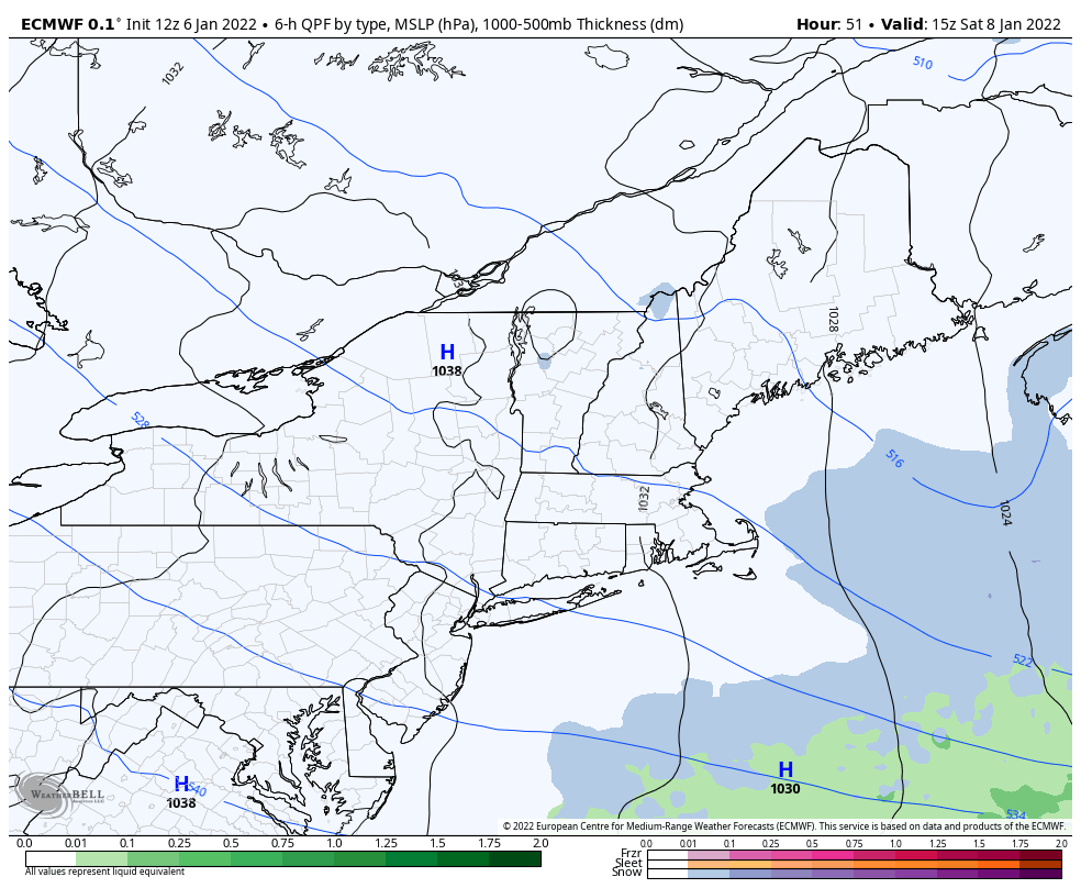 The sunshine returns on Saturday, coupled with cold air left behind from Friday's storm. Breezy conditions early on should begin to diminish as high pressure moves in and the gradient weakens. Scattered snow showers are possible Saturday night, primarily across the northern part of the state. A mixed bag of precipitation is possible on Sunday as a cold front approaches. Details on timing and precipitation types will be ironed out in the next couple of days. Sunday night brings in a secondary front, ushering an arctic air mass as we begin the work week. Dangerous cold expected Monday and Tuesday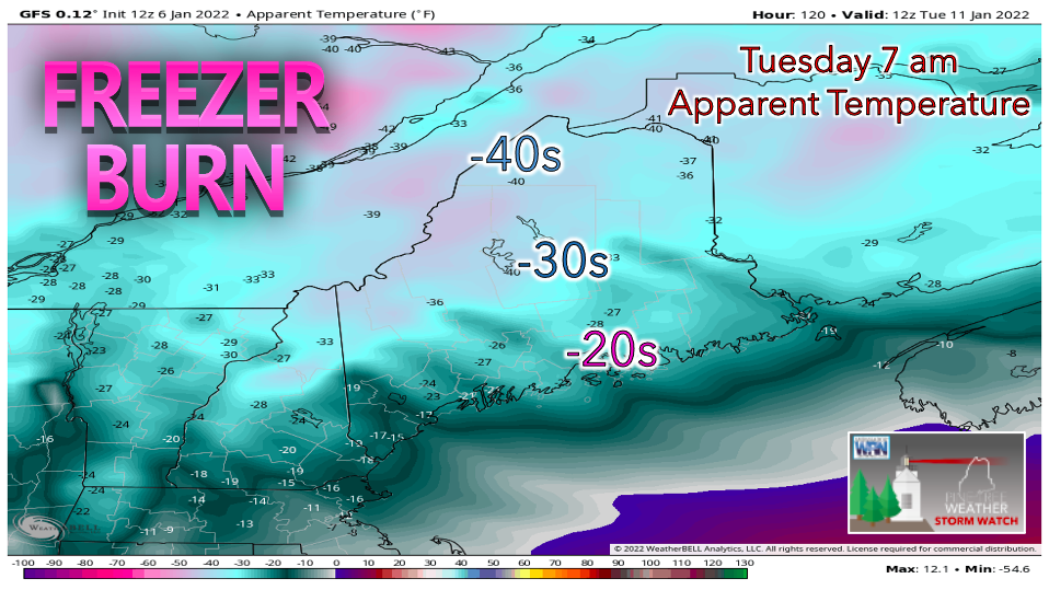 The coldest air so far this season is expected to arrive Monday, peaking around Tuesday. Factoring in gusty winds, wind chill values are likely to be well below zero statewide. Highs on Tuesday will struggle to climb above 0° in northern areas, with the interior and coast in the single digits and teens. Temperature outlook through TuesdayAfter Friday's storm makes its exit, cold air settles in on Saturday. A brief warm-up on Sunday is followed by an arctic front on Monday, sending temperatures plummeting throughout the region. 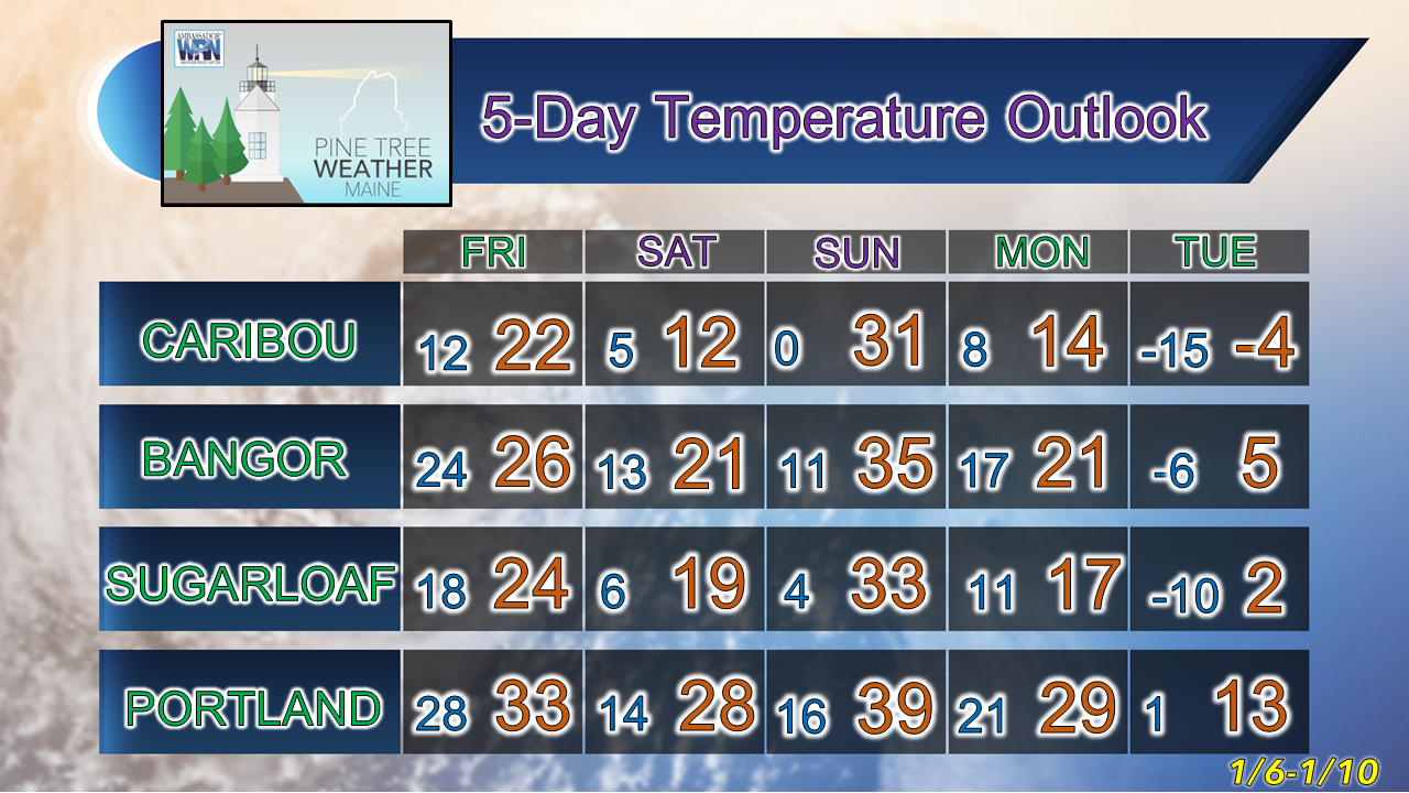  Winter Injuries and Fatalities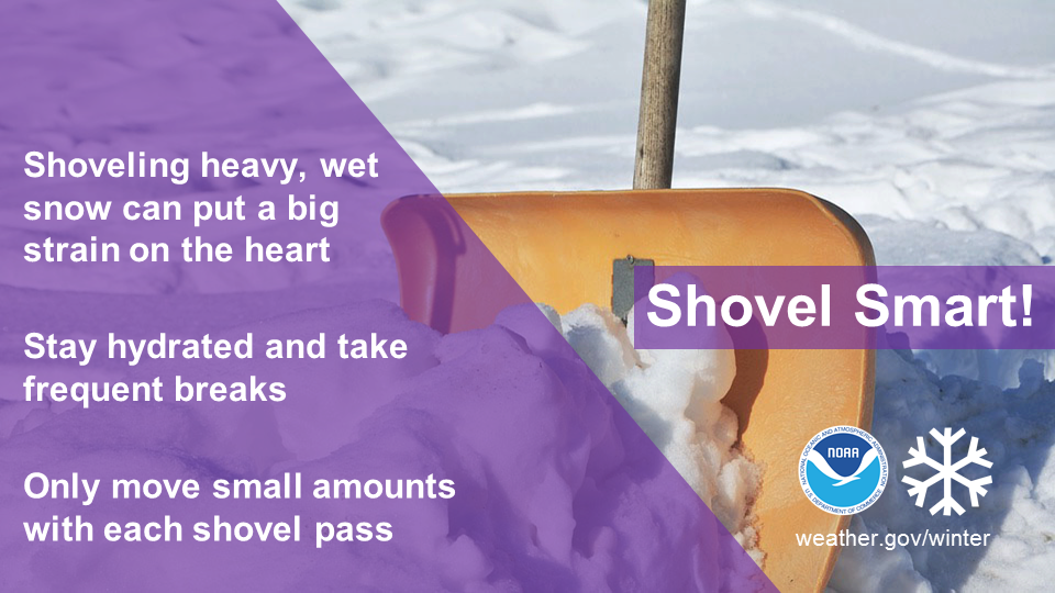 Shoveling snow can be a health risk, so remember to take it easy. Learn more at weather.gov/winter #WinterSafety Be prepared to receive alerts and stay updated!
 For more information in between posts, please follow Pine Tree Weather on Facebook and Twitter. Thank you for supporting this community-based weather information source which operates by reader supported financial contributions.
|

Mike Haggett
|