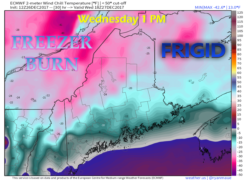
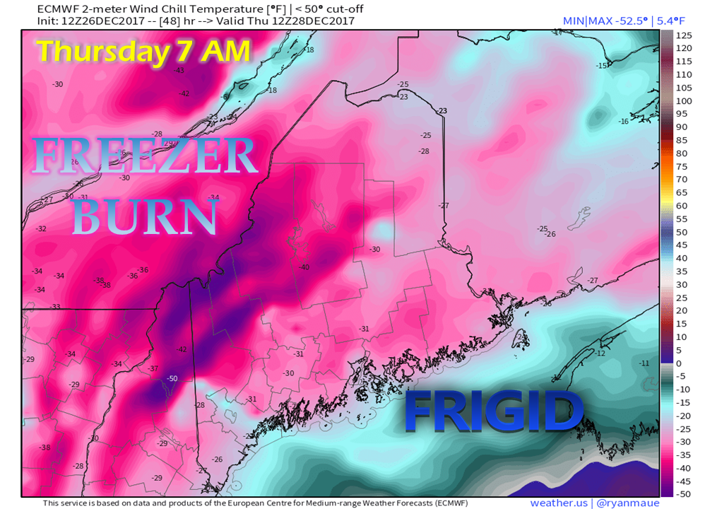
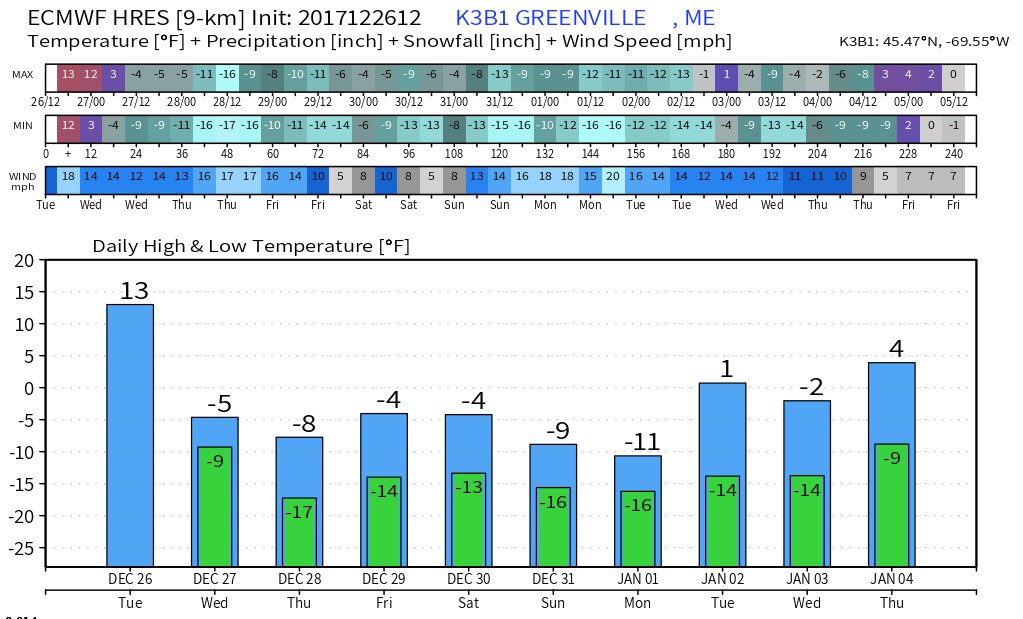
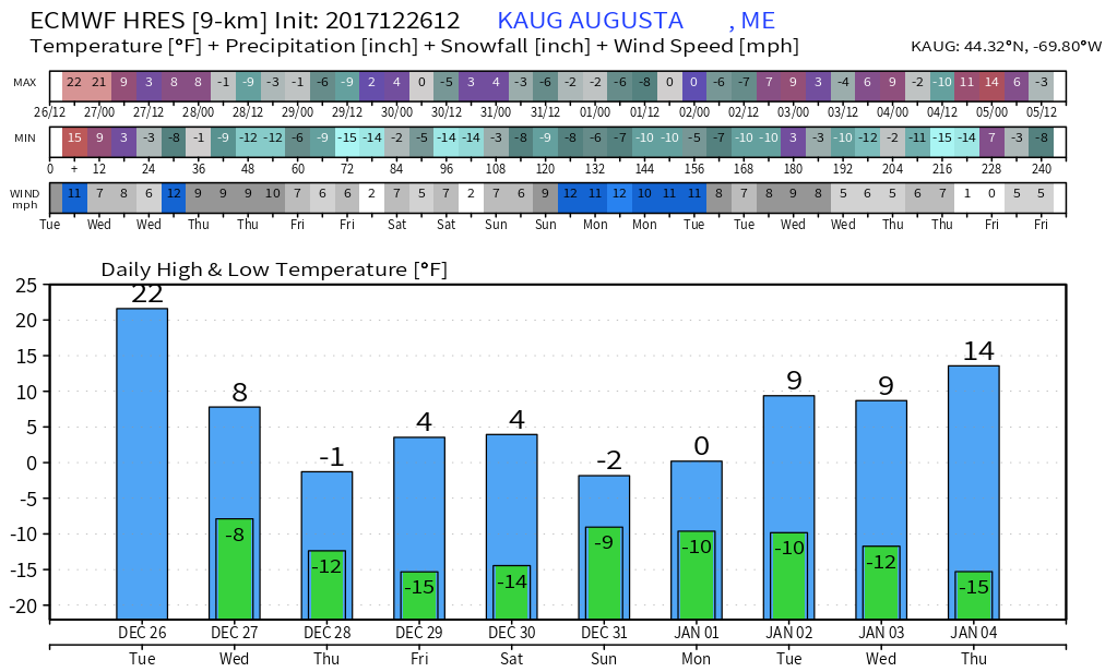
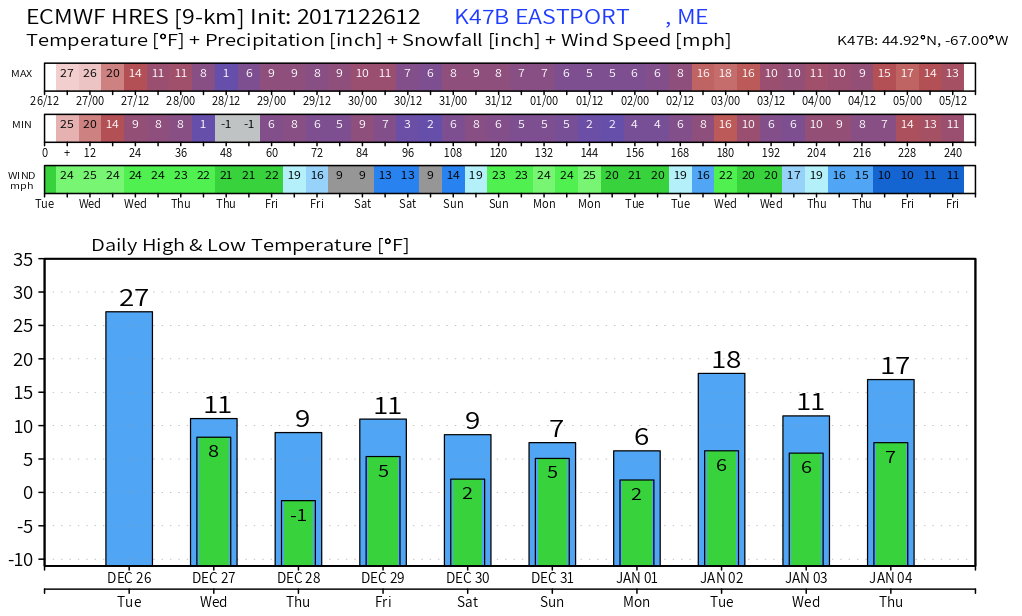
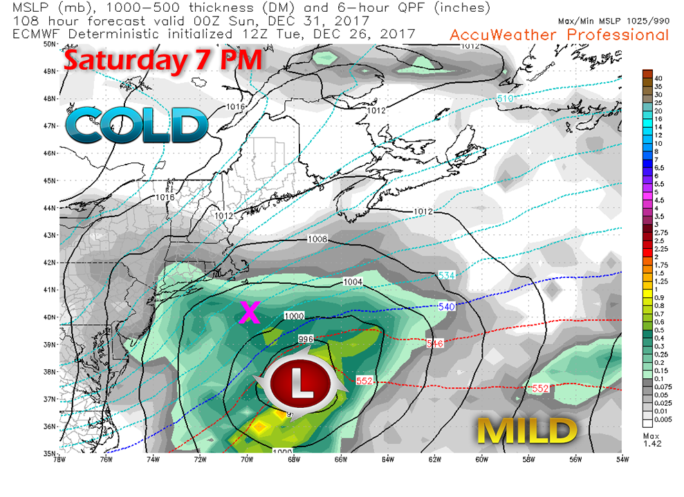
Freezer burn in the forecast for the near futureIn the wake of the Christmas storm comes the coldest air mass of the season thus far. This is only the beginning of the cold snap that will affect the region and much of the country. As guidance comes to grips with the cold, the forecast gets even colder. The deepest valley of the cold occurs on Thursday morning, with all areas likely to wake up to -20° to -40° or worse wind chill values. The polar air mass will modify a bit heading into the weekend, but it will hardly be noticeable to most. The mountains and north are likely to go roughly a week with double digit below zero actual temperatures, with highs struggling to get to zero. The Capital District is a bit "warmer" but overnight lows are very similar. Way DownEast may manage to stay above zero during the span, but with wind speeds in the teens to 20 mph range, it certainly will not feel like it. The year of 2018 will begin as 2017 ends... with temperatures firmly in the basement. With the frigid cold, a reminder to keep an eye on your senior neighbors, friends and relatives. With dew points in the cellar, drink plenty of water. Pets should not be outside for as long as necessary. These temperatures are likely to freeze pipes. It will also make weak car batteries fail to start vehicles, make diesel fuel coagulate and freeze any water content in gasoline. Expect tow trucks and AAA to be very busy assisting vehicles that are non-starters for the next week and beyond. Frost bite will occur in mere minutes. Dress accordingly. Snow covered roadways in low-salt areas around lakes, rivers and streams are likely to stay snow covered as it will be too cold for any melting to occur. Expect spotty slick areas while driving. New Year's Weekend Snow A Close CallFor now this storm appears to have impact for the Mid-Atlantic and Southern New England, but it is early to dismiss this storm for Maine. While this model idea indicates it passes well southeast of the benchmark location (40°N / 70°W... the pink "X"), there remains the possibility of the storm tracking closer to the coast. As we saw with the most recent Christmas storm, it "backed in" closer to the shorelines about 72 hours out. For now, I have put a chance for snow in the 5-Day Outlook (click on menu above) for Saturday for the south and east, and a chance for snow showers for the mountains and north. It is still early, and the forecast could change.
Bundle up, and stay tuned. - Mike |
Mike Haggett
|

