
A good start for ski country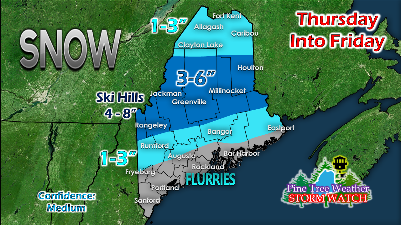 The guidance trend continues to flatten out the the upper level trough, so the results of that means less enhancement. I've only made a subtle adjustment to what was posted here Tuesday afternoon. Interior areas can expect some slick travel Thursday into early Friday. 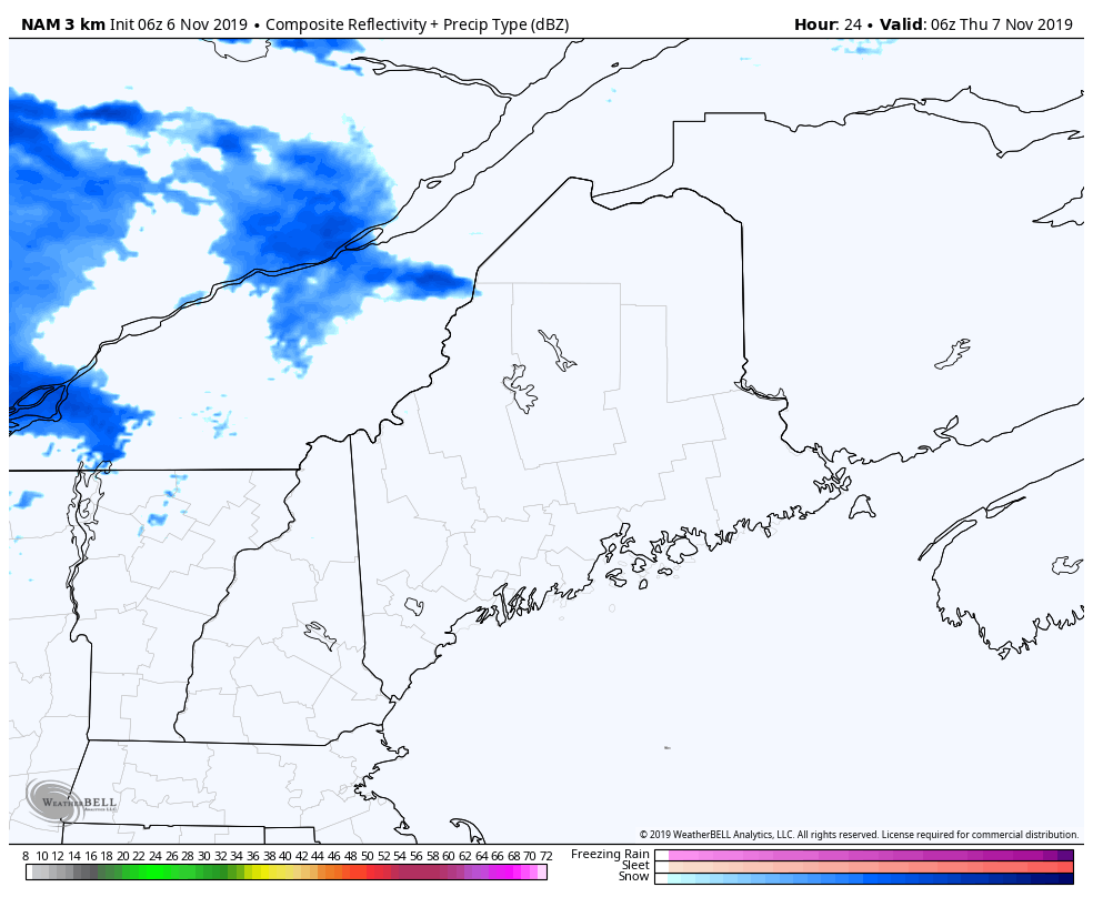 This loop from 1 AM Thursday to 1 PM Friday shows the duration of the event. Precipitation moves into western and northern areas Thursday morning, then slowly sags southeastward to the coastal plain Thursday afternoon. The snow exits most areas by around daylight Friday morning. Low pressure forms along the front over Atlantic Canada and spins snow showers through eastern areas through Friday afternoon, ending Friday night. 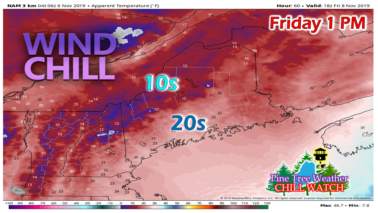 After the frontal boundary passes through, the wind picks up from the west-northwest and ushers cold air. Wind chills in the teens and 20s statewide through Friday afternoon, and get chillier heading into Friday night. The wind settles down heading into Saturday, when high pressure takes over the area. I will continue to track and update.  Get your snow tires on!
► ► For the latest official forecasts, bulletins and advisories, please check in with the National Weather Service in Gray for western and southern areas, or Caribou for northern and eastern parts of Maine. ► ► DONATION DRIVE UPDATE - $840 shortfall for the year ahead! You can help keep Pine Tree Weather going with a donation of any amount now through VENMO @PineTreeWeather, a monthly donation on Patreon or messaging me on Facebook or Twitter to send a check in the mail. Thank you for your support! For more information from me, please check the Pine Tree Weather Facebook page as well as my Twitter feed. Always stay weather aware! - Mike |

Mike Haggett
|


