
Status On Updates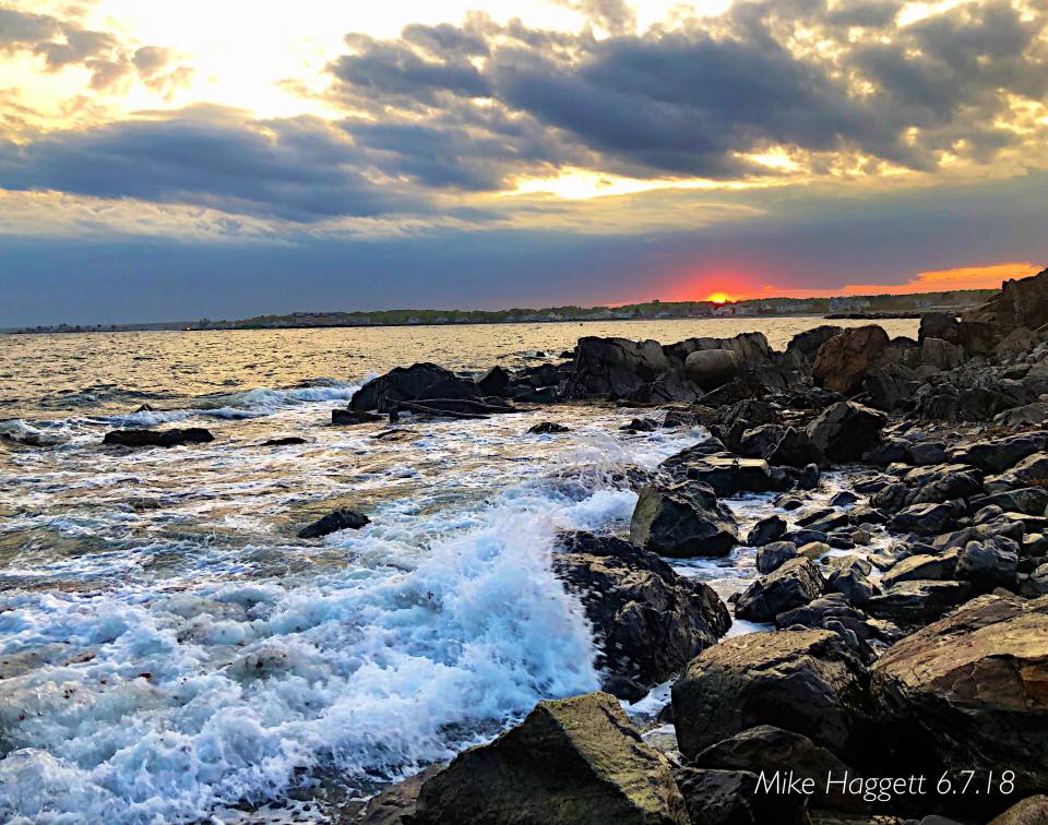 Between life and a rather mundane weather pattern, I have been a bit delinquent with updating frequency. Now that we are settled into our new home, we are dealing with numerous family matters, as well as enjoying the community and the surroundings. Another thing I have been lagging on is sharing my photography when I do update. I will work on correcting both. Our weather pattern hasn't changed much, and it doesn't appear to any time soon. The dry spring continues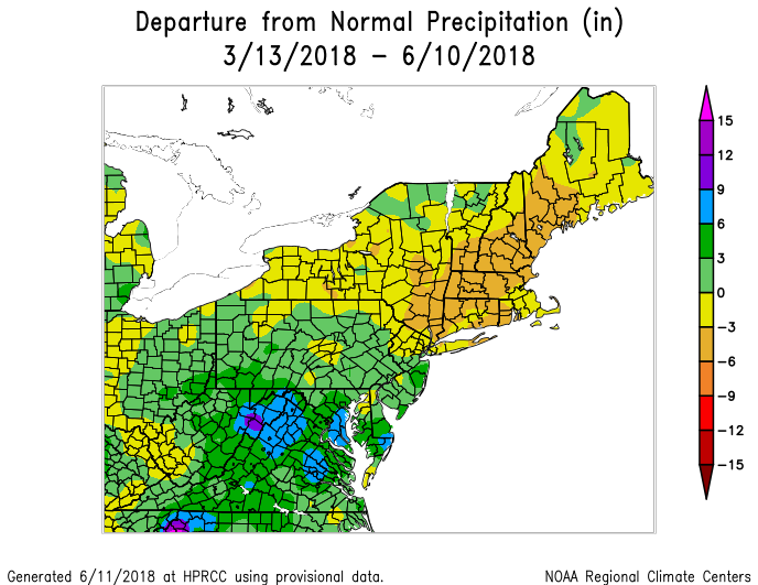 Even with the March snow events, most of the state is in a deficit as far as rain totals go for the spring. As I mentioned in my update last week, this stealth drought the region is in has been going on for four years at least at this point. 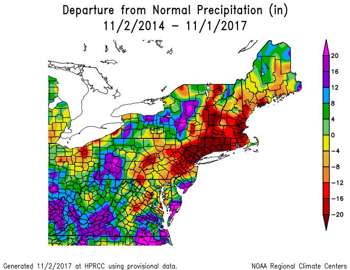 This is from the archives from last year when I was discussing the drought, and the deficit for much of western, southern, and eastern areas was well documented back to 2014 at that point. The High Plains Regional Climate Center (HRPCC) data only goes back 36 months, and I am working to find data older than that. 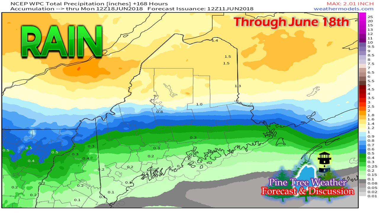 Model ideas look good for northern Maine to get a decent charge of rain, which will fall Wednesday and Thursday this week. This Weather Prediction Center idea posted Monday morning is fairly consistent with model guidance. This also shows the frontal boundary coming in, and the tricky set up along it. There is a stark difference between the haves and the have-nots. Any deviation north or south tips the scales as far as who gets beneficial rain and who escapes with light showers. Yeah, it's "thatclose". 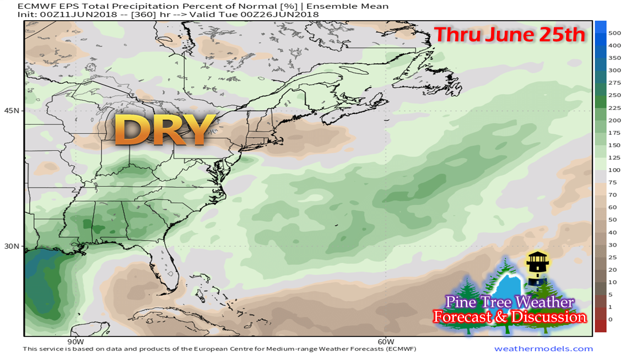 While the northern part of the state heads out of below normal rainfall, much of the southern part of the state continues with a dry pattern overall through much of the rest of the month. Since we are now in tropical storm season in the Northern Hemisphere, it will take some action in both the Pacific and Atlantic to throw a wrench into the upper air patterns to bring moisture to the region. Just my humble opinion... keep conserving groundwater resources until further notice. For folks using some sort of irrigation, bet on your pumps getting a long work out. Expect fire danger to be an ongoing concern. Campers, hikers, bonfire enthusiasts, and those doing brush clean ups need to stay in touch with the Maine Forest Service and local fire departments, as well as park rangers for burn regulations. Just because it may be alright in your region today, doesn't mean it will be that way tomorrow. The set up for rain midweek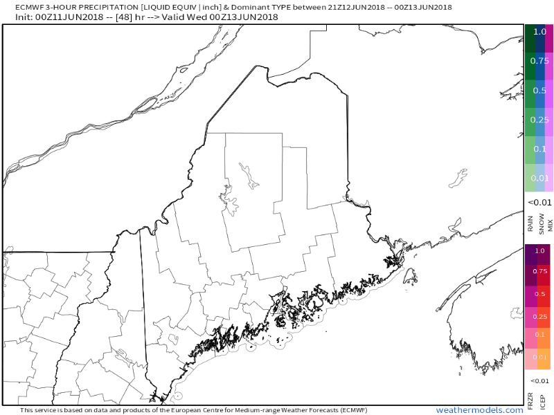 Tuesday sees high pressure move offshore and a southwest flow develops ahead of a frontal boundary approaching from the west. Clouds appear to gradually increase during the day, with showers breaking out late Tuesday / early Wednesday. The front more or less stalls over the state and precipitation rides along it through the wee hours of Friday. 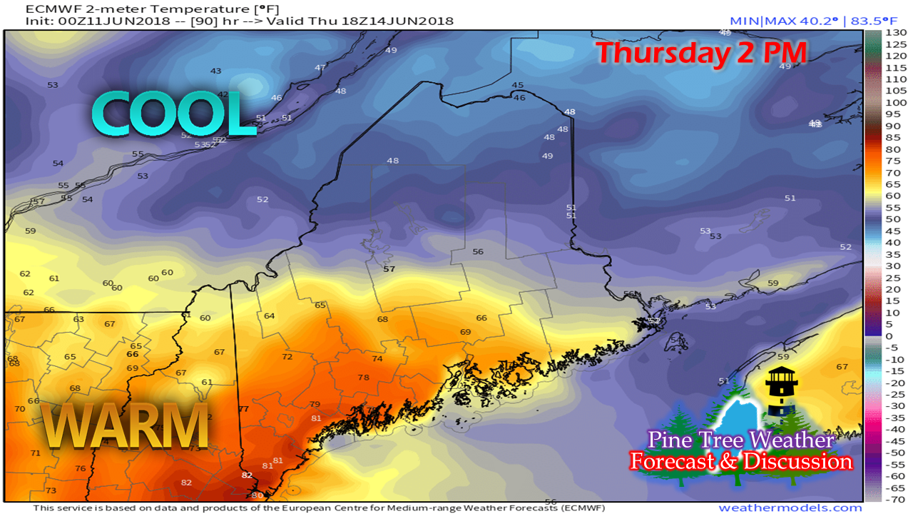 This temperature graphic shows the starkness in temperature between north and south, and also helps to explain the precipitation outlook posted above. There is a fine line in all of this. The north is likely to see the coolest of temperatures and the most rainfall from this event. How far south the beneficial rain falls is dependent upon where the front decides it wants to go. Like in winter, cold air will dictate what happens here, and also throws out the idea of a forecast bust. A bust in this case means more or less rainfall and with that, cooler or warmer temperatures. For those in western, eastern and southern areas cheering for rainfall, you'll want that bust. Once bit of hope for southern, western and eastern areas will be that there is a chance of thunderstorms to develop along the front. This may bring some heavier rain in areas, but the threat for now appears isolated due to cloud cover. The rule of thumb for summer remains the same: if the sun gets out for any period of time, expect thunderstorms to develop. When thunder roars, head indoors. Outlook Through Saturday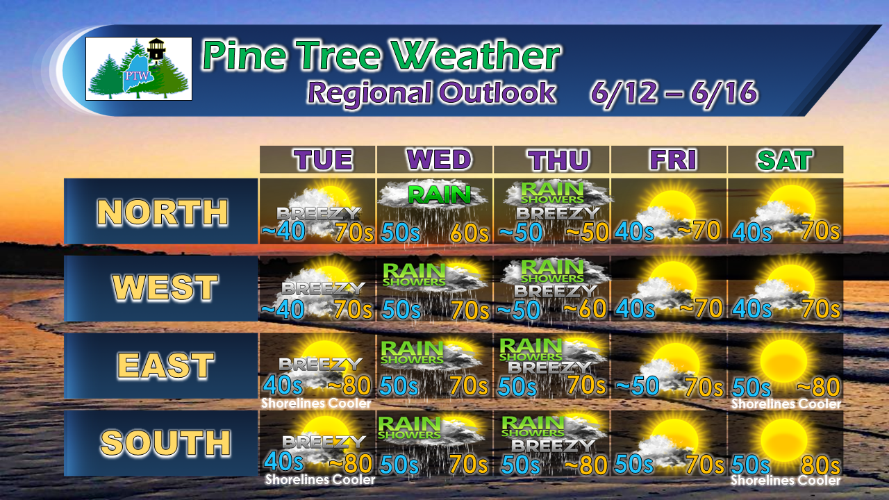 Folks in the north and west should continue to be aware of potential frost Monday night into Tuesday, and perhaps later in the week. Coastal areas can expect a sea breeze on Tuesday. Saturday appears to be a beach day for the shorelines, but the chilly ocean continues to keep the seaside areas on the cooler side. The extended outlook calls for another nice day for Sunday, with the next potential rain maker coming in early next week. As always, stay updated with the National Weather Service in Caribou for eastern and northern areas, and Gray for western and southern Maine for official forecasts and bulletins as necessary. Feel free to give a like on the Pine Tree Weather Facebook page and follow me on Twitter for tropical information and local weather bulletins.  Thank you as always for your support!
- Mike |

Mike Haggett
|


