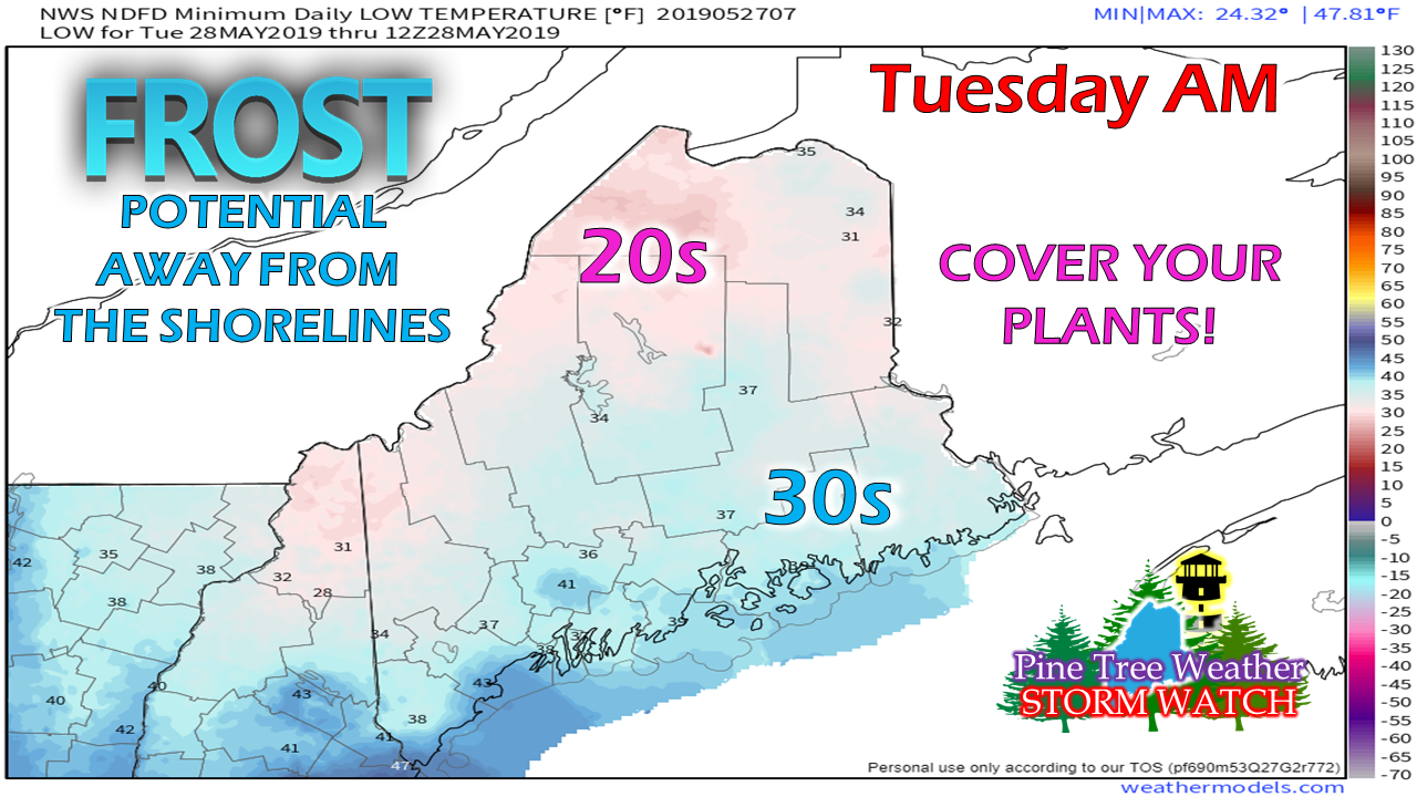
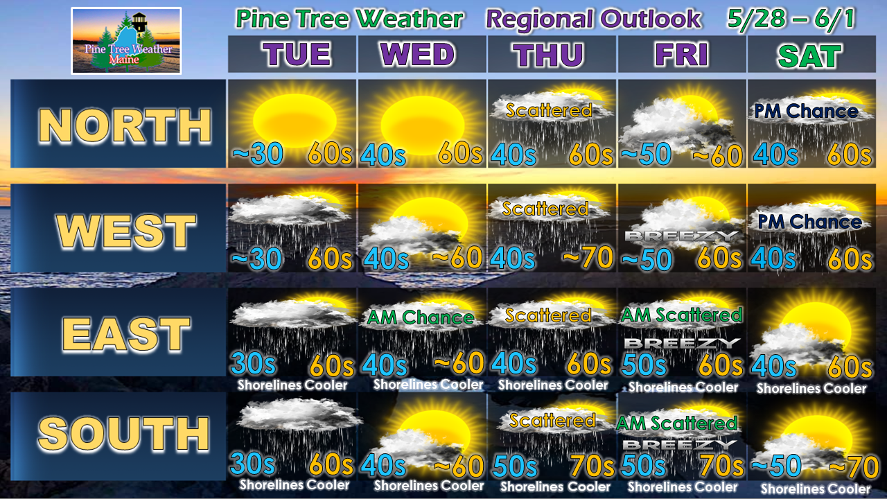
The Late May ChillAfter what will be a splendid Memorial Day statewide associated with high pressure moving into the region, it appears likely that it will cool down tonight. I've seen a lot of folks working on their gardens and landscaping over the past couple of weeks... it would be advised that if you have anything sensitive to frost, to cover it up away from the immediate shorelines. Note that additional areas may be added to the frost advisory areas later Monday. Outlook through SaturdayTuesday sees showers move in for all but northern areas as a weak disturbance rides along a ridge to the south. The next widespread rain event appears to be Thursday afternoon into Friday as a long wave front passes through the region. The weekend starts off dry, but a weak low passing through southern Quebec may bring a shower to the mountains and north.
► ► For the latest official forecasts, bulletins and advisories, please check in with the National Weather Service in Gray for western and southern areas, or Caribou for northern and eastern parts of Maine. ► ► Your financial donations are much appreciated to keep this site funded and for further development. I sincerely appreciate your support not only financially, but also in sharing my efforts with others. For more information from me, please check the Pine Tree Weather Facebook page as well as my Twitter feed. Always stay weather aware! - Mike |
Mike Haggett
|


